City of Mobile Launches Interactive Map Tracking Hurricane Sally Damage
The City of Mobile launched an interactive map showing Hurricane Sally damaged sites, including fallen trees and downed power lines.
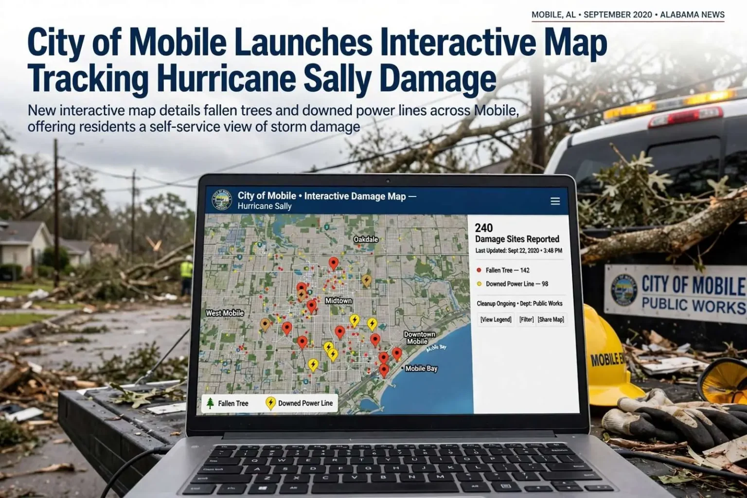
The City of Mobile has rolled out an interactive map documenting damage across the city from Hurricane Sally, giving residents a way to see which locations have been designated as damaged sites. The map, posted on the city’s website, plots reported damage locations so that homeowners, business owners, and curious neighbors can get a picture of the storm’s footprint without waiting on a phone call or a press release. City officials said the map is part of an effort to be transparent with residents about Sally’s toll on Mobile, and it reflects a broader shift among Gulf Coast municipalities toward publishing storm data directly to the public. For a city still working through cleanup, the map doubles as both an information resource and a planning tool.
Marked sites include areas hit by fallen trees and downed power lines, two of the storm’s most widespread impacts across the city. Anyone who rode out Sally in Mobile will not be surprised by those two categories. The city’s dense canopy of mature oaks and pines, one of its defining features, became one of its biggest liabilities when sustained tropical storm force winds and gusts swept through the area for hours. Weakened root systems in saturated soil gave way, sending large trees onto streets, roofs, fences, and power lines. Crews spent days and, in some neighborhoods, weeks simply clearing blocked roadways so utility and emergency vehicles could pass.
Downed lines carried their own dangers. Utility officials repeatedly warned residents in the days after the storm to treat every fallen wire as energized, a standard precaution that becomes especially important when lines are tangled in branches and hidden under debris. The interactive map consolidating these damage reports helps communicate that risk in a practical way, letting residents see which stretches of their neighborhoods were hit and adjust how they move around while repairs continue.
A tool for recovery
The online map allows residents to view affected areas without calling city departments, easing pressure on emergency management staff as cleanup continues. In the days immediately following a hurricane, municipal phone lines are typically flooded with calls asking the same basic questions: Is my street cleared? Has my block been assessed? When will crews reach my area? Each of those calls takes time from staff who are simultaneously coordinating debris contractors, utility repairs, and safety inspections. By moving that information to a public map, the city converts a stream of individual phone calls into a self-service resource.
That kind of efficiency matters in a community the size of Mobile, which serves as the county seat of Mobile County and the anchor of the Alabama Gulf Coast’s largest metropolitan area. Emergency management staff are responsible not just for responding to the storm’s aftermath but for documenting it, and public-facing maps help keep the whole process organized. When residents can check conditions themselves, staff can focus on the work that requires judgment and coordination rather than repeating status updates one caller at a time.
Similar tools have been used by Gulf Coast cities in past storms to coordinate debris removal and repair work. After major hurricanes along the Gulf, municipalities from Florida to Texas have adopted mapping platforms to plot damage, route debris haulers, and track recovery progress. The practice grew out of hard lessons from earlier storms along the northern Gulf Coast, when paper-based damage assessment slowed both local response and the documentation needed to qualify for federal reimbursement. Digital maps made the process faster, more accurate, and easier to audit.
What the map shows and how it works
The Mobile map functions as a record of designated damaged sites rather than a real-time outage tracker. It marks locations across the city that have been identified as damaged, with fallen trees and downed power lines featured among the most common entries. Residents can look up their own streets, check whether a nearby park or intersection has been flagged, and get a sense of which parts of town took the heaviest punishment. That neighborhood-level view is valuable for people returning to homes they evacuated, for commuters deciding which routes remain practical, and for contractors organizing cleanup work.
City officials have emphasized that the map is a transparency measure, and that framing matters. Publishing damage locations in an open format allows residents to see the same information the city is working from, which builds confidence that cleanup is proceeding according to need rather than guesswork. It also creates a shared reference point when residents call about specific properties or request follow-up services, reducing the back-and-forth that often slows post-storm communication.
Maps like this also serve a documentation purpose that extends well beyond public information. Damage assessments feed directly into the paperwork that determines whether a city qualifies for federal disaster assistance, including reimbursement for debris removal and emergency protective measures. A well-maintained record of damaged sites helps local officials substantiate costs to state and federal reviewers, turning everyday cleanup work into documented eligibility for recovery funding.
Sally’s path and landfall on the Alabama coast
Sally came ashore in September 2020 as a Category 2 hurricane near Gulf Shores, knocking out power to much of the Mobile area and toppling trees across the region. The storm’s landfall put the point of greatest impact squarely on the Alabama coast, with Gulf Shores and neighboring Orange Beach enduring the storm’s strongest winds and surge. Sally’s slow forward speed made it an especially punishing storm, prolonging the hours of wind loading on trees, signs, and structures and dropping extraordinary rainfall totals on communities in its path. Neighboring Pensacola, just across the state line, saw historic flooding as the storm crawled north.
The storm’s slow movement was one of its defining features and a major factor in the damage pattern that Mobile’s new map now documents. Hurricanes that move quickly tend to spread their destruction over a wide corridor in a short period; slow movers concentrate wind stress and rain on the same locations for many hours. For Mobile, that meant prolonged winds that shifted direction as the center passed nearby, working on the urban forest from multiple angles. Trees that might have survived a brief gust instead failed after hours of repeated stress in rain-softened ground.
Power outages spread across the Mobile area as lines fell, leaving large numbers of customers in the dark. Utility crews faced the dual challenge of removing tree limbs from lines before repairs could even begin, which stretched restoration timelines in the heaviest-hit neighborhoods. Some residents waited more than a week for power. Hospitals, water systems, and other critical facilities ran on generators while repairs proceeded, and traffic signals across the city were out for days, turning intersections into four-way stops and complicating an already disrupted cleanup.
Mobile’s geography magnified the tree problem. The city sits at the head of Mobile Bay, on flat to gently rolling terrain where deep-rooted live oaks, water oaks, and pines have grown for generations, often directly over the overhead lines that serve older neighborhoods. Many of the city’s residential streets were designed around that canopy, and residents prize it for shade and character. When a strong hurricane passes through, the same canopy that defines the streetscape becomes the leading cause of blocked roads and outages, and Sally was no exception.
What residents saw across the city
In the immediate aftermath, many Mobile neighborhoods looked like obstacle courses. Streets disappeared under tangled masses of limbs and trunks, and in some blocks a single fallen tree took down service lines to several homes at once. Crews from the city’s public works department worked alongside tree contractors and utility line personnel to cut and clear passages, prioritizing arterial roads and routes to hospitals before turning to residential streets. Debris piled along curbs grew into long ridges of vegetation that would take months of scheduled hauling to fully collect.
The damage extended well beyond trees. Signs were twisted or gone, awnings and roof coverings were peeled back, fences were flattened, and standing water lingered in low-lying areas near the bay and along creeks. Downtown Mobile, which sits close to the waterfront, dealt with wind-driven conditions and scattered damage, while neighborhoods farther inland reported the tree and power line failures that dominate the city’s damage map. Schools closed, many for more than a week, both because of damage and because buildings were left without power or air conditioning.
County and state parks, municipal facilities, and public rights-of-way all required assessment, and city teams systematically documented what they found. That assessment work is precisely what feeds a tool like the interactive map. Each designated damaged site represents a location where staff or contractors identified a specific problem that needs correction, whether that is a hanging limb, a downed line awaiting utility repair, or a road that remains partially obstructed. Seeing those sites laid out geographically helps managers spot clusters and allocate crews where the concentration of damage is highest.
Debris removal and the long cleanup ahead
The map arrives as Mobile enters the longest phase of any hurricane recovery: debris removal. Clearing downed vegetation is a massive logistical operation involving city crews, private contractors, monitored staging sites, and loads of vegetative debris hauled away by the truckload for weeks. Debris must be separated into categories, with vegetative material, construction waste, and household hazardous items handled differently. Mapping damaged sites helps route trucks efficiently and gives residents a realistic picture of why collection takes as long as it does after a storm with this many downed trees.
Utility restoration runs on a parallel track. Sites tied to downed power lines require crews to replace poles, string new wire, and reconnect individual services, and those repairs cannot safely begin until trees are cleared away. That interdependence is one reason recovery after a wind-heavy storm feels slow: the two work streams must be sequenced neighborhood by neighborhood. A public map showing where both trees and lines came down gives everyone a clearer sense of the work still to come.
Why transparency tools matter after a storm
The decision to publish damage data openly reflects lessons Gulf Coast cities have absorbed over two decades of active hurricane seasons. After a storm, information is as valuable as ice, fuel, or generators, and communities that distribute it well recover with less friction and less rumor. Public maps counter misinformation by giving residents a primary source, and they help neighborhoods that feel overlooked confirm their damage has been seen and logged. They also give journalists, neighborhood associations, and civic groups a common factual baseline for discussing recovery.
Transparency benefits the city itself as well. When residents can see how many damaged sites exist and where they cluster, requests for special attention are easier to prioritize on the merits, and expectations about timelines become more grounded. Storm recovery involves triage, and a shared map helps explain why one street is cleared before another. For a port city that has weathered major hurricanes repeatedly in recent memory, building that trust is a recovery resource in its own right.
What Mobile residents should know going forward
Residents using the map should keep a few practical points in mind. It shows designated damaged sites, but it does not replace official warnings about unsafe structures and does not capture every private property issue, since many residential damage reports never enter the city’s system. Fallen lines should be treated as live no matter how long they have been down, and any sparking or arcing should be reported immediately rather than assumed to be on a repair list. Residents with concerns about their own property can still contact city departments directly, using the map as a starting point for the conversation.
As cleanup progresses, the map stands as both a recovery tool and a reminder of what Sally demonstrated: that a September storm making landfall near Gulf Shores can leave a city of Mobile’s size working through tree damage and outages for weeks. The trees will be replanted, lines will be repaired or hardened, and the canopy will eventually return to define the streets again. In the meantime, letting residents watch the recovery unfold on a map turns a difficult season into a shared, visible project, and sets a template for how Mobile communicates through whatever storm comes next.