Clarke, Washington Counties Watch Severe Weather Threat Ahead of Saturday
Emergency managers in Clarke and Washington counties monitored a potential severe weather event approaching Alabama on Saturday, with tornadoes a.
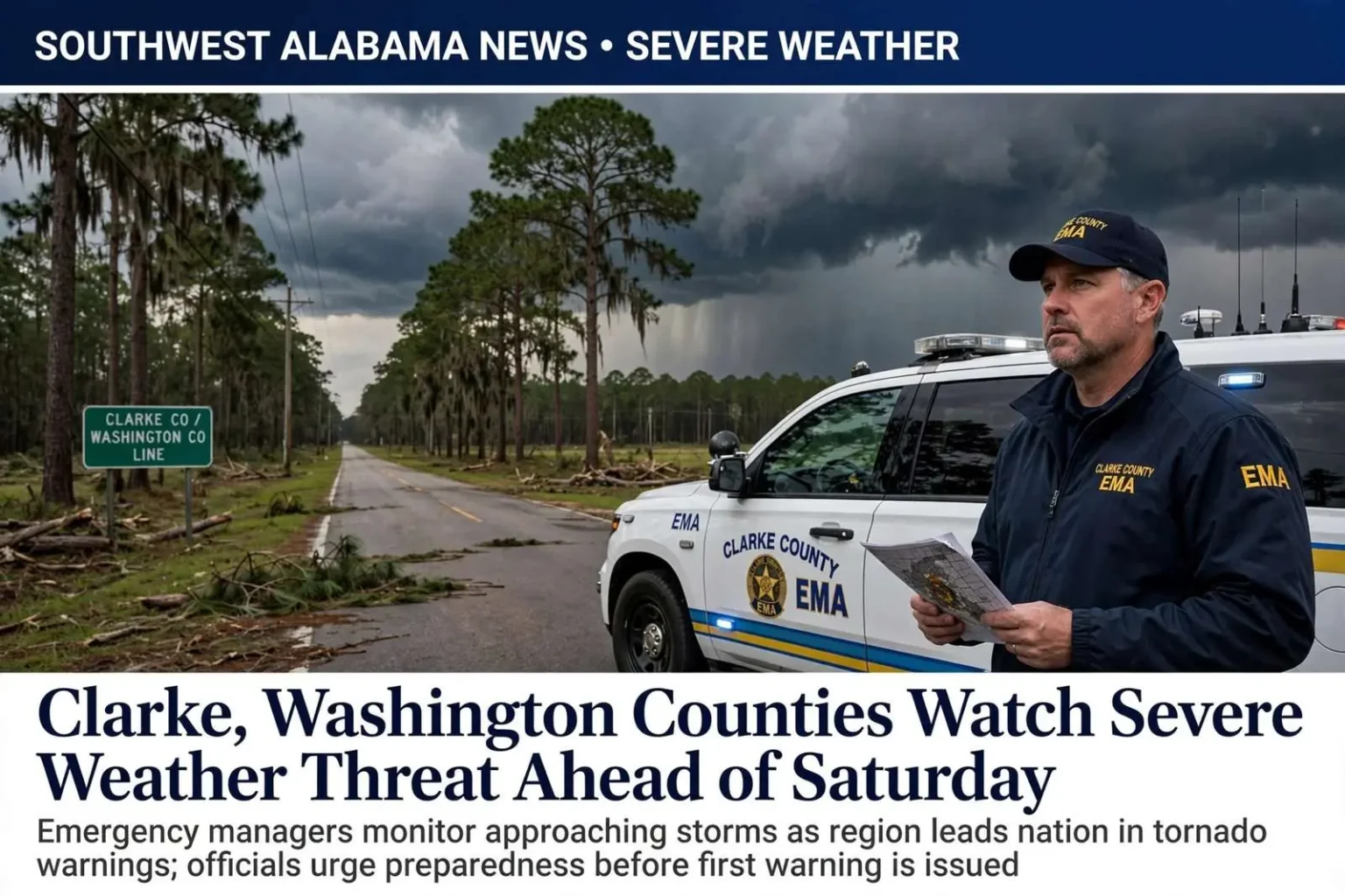
CLARKE COUNTY, Ala. — Emergency managers in Clarke and Washington counties kept a close watch on a potential severe weather event approaching the area Saturday. Forecasters had signaled the possibility of strong storms reaching southwest Alabama, and officials in the two rural counties spent the days ahead of the system reviewing response plans, checking warning systems and reminding residents that preparation matters most before the first warning is ever issued.
“If we start seeing damage back to our west, then we know we need to start watching them a little closer,” said Clarke County EMA Director Roy Waite. His approach reflects how experienced emergency managers in west Alabama track storms: not only by what the radar shows overhead, but by what is happening in the counties upwind. Storms that produce damage to the west are often the same cells that arrive locally, and that downstream awareness buys precious minutes for sirens, alerts and shelter preparations.
Clarke County is no stranger to rough weather: an EF-1 tornado touched down in Thomasville the previous October, and Waite said the region sees some of the highest numbers of tornado warnings in the nation. The Thomasville tornado was a reminder that even weaker rated tornadoes can tear roofs, down trees and cut power across small towns, and that rural counties must rely on their own readiness while mutual aid from larger cities is still hours away.
Waite pointed to a Washington Post analysis showing Washington County has logged more tornado warnings over the past decade than anywhere else in the country. The finding placed a small county of scattered communities and pine forests at the top of a national list, ahead of places with far larger populations, and it confirmed what residents of the region have long believed anecdotally: their corner of Alabama sits under more tornado warnings than almost anywhere in America.
He said both counties sit at higher elevation, and combined with their distance from the radar site in Mobile, tornadoes are not always easy to spot. Radar beams climb with distance, meaning that storms tens of miles from a radar site are sampled higher in the atmosphere — sometimes missing the low-level rotation that signals a tornado. For counties on the western edge of the Mobile radar’s coverage, that gap makes spotters, storm surveys and reports from neighboring counties even more important.
The Geography of Dixie Alley
The region Waite watches over lies at the heart of what meteorologists call Dixie Alley, the Gulf Coast and Tennessee Valley corridor where tornadoes strike with a frequency and deadliness that rivals the more famous plains of Oklahoma and Kansas. Dixie Alley tornadoes often form at night, move quickly and travel through wooded rural terrain where visibility is poor and warning times are short. The area’s long tornado season — with secondary peaks in late fall and winter, in addition to spring — means residents must stay ready for most of the year.
Clarke and Washington counties sit among the pine uplands west of the Alabama River, a landscape of small towns — Grove Hill, Jackson, Thomasville, Chatom, McIntosh — strung along U.S. highways and state routes. Mobile County and its bay lie to the south and east, and Mississippi’s state line to the west. That geography places the counties squarely in the path of storms that sweep northeast from the Gulf, and it leaves them at the far edge of the Mobile radar’s most useful range.
November holds a particular place in Alabama’s weather history. Deadly tornado outbreaks have struck the state in November repeatedly over the decades, a reminder that Alabama’s autumn storm season can be as dangerous as its spring one. Emergency managers across the state treat the late-fall months with the same seriousness as March and April, and Saturday’s watch fit squarely within that pattern.
For rural counties, tornado response begins long before a storm. Emergency management agencies maintain outdoor warning sirens, coordinate with the National Weather Service’s Mobile office, train volunteer spotters and work with volunteer fire departments that serve as the first set of eyes and hands in scattered communities. When warnings come in the night, it is often a volunteer firefighter who radios in the damage report that confirms what radar could only suggest.
How Residents Can Prepare
Emergency officials across southwest Alabama repeat a consistent message before severe weather: know where you will shelter before you need to. In rural homes, that often means a storm shelter, a basement or an interior room on the lowest floor away from windows. Mobile homes and manufactured housing, common across the region’s rural areas, offer little protection in tornado conditions, and residents of those homes are urged to identify sturdier shelter nearby in advance.
Multiple ways of receiving warnings are equally important. Sirens are designed for people outdoors and can fail exactly when power does; weather radios, smartphone alerts and local media fill the gaps. Families are encouraged to write out a communication plan — where to meet, who checks on elderly neighbors — and to keep shoes, helmets and medications within reach of the shelter space. Simple preparations made on a calm Friday can save lives on a stormy Saturday.
After storms pass, the work of emergency managers continues with damage assessment, road clearing and coordination with the Alabama Emergency Management Agency if state assistance becomes necessary. Damage surveys by the National Weather Service determine a tornado’s rating and its track, information that feeds back into the region’s understanding of its extraordinary storm climatology — the same data behind the national rankings that put Washington County at the top of the tornado warning list.
For now, officials in Clarke and Washington counties said the best defense is the region’s hard-earned familiarity with severe weather. Residents here have lived through outbreaks that made national headlines and countless smaller storms that never did, and that experience has produced a culture of watchfulness. As Saturday’s threat approached, Waite’s advice amounted to a summary of that culture: watch what is happening to the west, know where to go, and take every warning seriously — because in this part of Alabama, the next warning is never far away.
Warnings That Arrive With Little Room to React
The warning statistics that place Washington County at the top of the national list tell a story about both climatology and geography. Storms rotating out of the Gulf frequently track across southeast Mississippi and into the Alabama counties just east of the line, and the region’s terrain — ridges, river bottoms and dense pine forest — hides tornadoes from view until they are close. The National Weather Service issues warnings based on radar evidence and spotter reports, and in these counties the radar evidence is often the only early clue available.
Local emergency managers have learned to work around those limits. Waite’s practice of watching storms to the west — using reports from Mississippi counties and from the Mobile radar — effectively extends his county’s warning time by borrowing the observations of communities upwind. Coordination between county EMAs, the weather service and Alabama’s state EMA forms a chain of communication that compensates for what the terrain and radar coverage cannot provide.
Schools, churches and employers across the two counties drill on tornado procedures, and many rural congregations open their buildings as informal shelters during warnings. Volunteer fire departments and rescue squads stage equipment ahead of known threats, and public works crews pre-position around downed trees and power lines — the most common damage left behind by tornadoes in heavily wooded areas.
Residents who lived through the Thomasville tornado saw the full sequence play out: the warning, the strike, the damage surveys that rated the storm EF-1, and the cleanup that followed. Even at that rating, the storm demonstrated how a tornado crossing a small Alabama town can damage roofs and outbuildings, snap trees into power lines and interrupt daily life for days. Recovery after smaller tornadoes rarely makes statewide news, but it consumes the same local effort — chainsaws, insurance claims, utility repairs — as better-known disasters.
As the Saturday threat passed through its cycle of watches and warnings, officials said the outcome depended on the same ingredients as always: forecasts from the weather service, coordination among emergency agencies, and residents who took the threat seriously before it arrived. In the counties that lead the nation in tornado warnings, that preparation has become routine — a fact of life in a region where the sky demands attention more often than almost anywhere else in the country.
Weather service offices across the Gulf Coast have also expanded their outreach in recent years, holding storm spotter training sessions that teach residents how to recognize wall clouds, funnel clouds and hail signatures — and, just as important, how to report them safely. Each trained spotter in a rural county adds another pair of eyes to the warning network, and officials in Clarke and Washington counties have long encouraged residents to attend. In a place where radar alone cannot always confirm a tornado, the community itself becomes part of the warning system.