
Crews Test Mobile, Baldwin Waterways Weekly for Bacteria
Mobile Baykeeper tests 14 waterways across Mobile and Baldwin Counties each week for bacteria, notifying swimmers through its SWIM program when levels are.
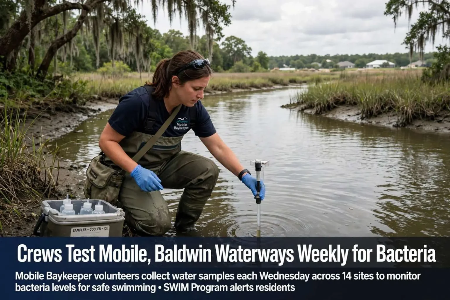
MOBILE, Ala. — Every Wednesday starting in April, a team with Mobile Baykeeper suits up and heads to one of 14 waterways across Mobile and Baldwin Counties to test the water. The weekly sampling program, which runs through the height of the summer recreation season, has become one of the most trusted sources of information about where it is safe to swim along coastal Alabama’s creeks, rivers and bays.
The work is methodical and unglamorous. Volunteers and staff pull on waders or wade in from the banks at each site, collect water samples in sterile containers, and deliver them for laboratory analysis that measures the presence of bacteria that can sicken swimmers. By the time families are planning weekend trips to their favorite swimming holes, the results from Wednesday’s run are ready to tell them whether the water is clean or whether they should steer clear.
“They’ll read the samples. Anything that’s over the EPA’s safe to swim threshold they’ll go out again, resample just to double check and be sure,” said Cassie Bates, a staff scientist with Mobile Baykeeper. The double-check protocol matters: a single high reading can result from a momentary spike caused by recent rain or a sampling anomaly, so the organization confirms elevated results before sounding the alarm about a popular swimming spot.
The environmental watchdog group keeps a close eye on coastal Alabama’s waterways year-round, but during summer the team’s work takes on added urgency as residents and tourists flock to the water. Popular spots like Fish River at Bohemian Park draw crowds of swimmers, kayakers and tubers throughout the season, and the conditions at those sites can change dramatically from one week to the next depending on weather and upstream activity.
Why Bacteria Levels Spike in Summer
Frequent summer rain is the driving force behind most of the contamination the team documents. Stormwater rushes off roads, parking lots and lawns, carrying everything it picks up along the way — pet waste, fertilizer, oil, trash — into the creeks, rivers and bays that drain coastal Alabama. Sewage spills and overflows add human waste to the mix, particularly in areas where aging collection systems are overwhelmed by heavy rainfall. Together, these sources push bacteria levels higher, sometimes well beyond the thresholds that health authorities consider safe for recreation.
The problem is compounded by growth. Bates said some rapid development in Baldwin County without proper filtration has made the problem worse. Baldwin County has been among the fastest-growing counties in Alabama for years, and the pace of construction — new subdivisions, retail centers and roads — has steadily increased the amount of impervious surface across the county’s watersheds. When rain cannot soak into the ground, it runs off quickly, and the natural filtration that forests and wetlands once provided disappears with each cleared acre.
The effects show up in the sampling data. Sites that drain rapidly developing areas tend to show more frequent elevated readings than those surrounded by protected land, a pattern that water-quality monitors have documented in coastal regions across the country. For the people who live in those watersheds, the connection between upstream development and downstream water quality is not an abstraction — it is visible every time a favorite swimming spot is posted unsafe after a rain.
Testing, Notification and the SWIM Program
Water samples collected each week are tested for E. coli and other bacteria that indicate the presence of fecal contamination. E. coli itself is a familiar organism — most strains are harmless, but its presence in water signals that waste from warm-blooded animals, and potentially harmful pathogens along with it, has entered the waterway. Federal and state health authorities use E. coli concentrations as the standard gauge for whether water is safe for swimming and other full-contact recreation.
The results are shared through the group’s “Swim Where It’s Monitored” program, or SWIM. Subscribers receive notifications when bacteria levels at monitored sites are unsafe, giving families timely, site-specific information instead of general assumptions about water quality. For parents deciding whether to take children tubing down Fish River or swimming in a bayou, that notification can be the difference between a fun weekend and a stomach-churning illness.
Mobile Baykeeper’s monitoring effort does not operate in isolation. Working with the Alabama Department of Environmental Management, the City of Daphne and the Alabama Department of Public Health, the group compiles the data into a color-coded map so residents can decide where to swim. Green indicates sites where the latest samples came back within safe limits, while other colors flag elevated results, allowing anyone with an internet connection to check conditions at a specific site before heading out.
The partnership reflects the shared responsibility for water quality along the coast. State environmental regulators rely on monitoring data to identify problem areas and pursue enforcement where violations are found; municipal governments use it to target infrastructure improvements; and public health officials use it to advise residents. Mobile Baykeeper’s role as an independent monitor complements the official agencies, adding coverage, frequency and a citizen-driven watchfulness that government programs alone do not always provide.
The Waters at Stake Across Two Counties
The 14 monitoring sites span a cross-section of coastal Alabama’s watersheds, from creek crossings in Mobile County to the rapidly suburbanizing drainage basins of Baldwin County. Fish River, which flows through rural and growing parts of eastern Baldwin County toward Weeks Bay, is one of the region’s most popular recreation waterways, and the sampling site at Bohemian Park is a favorite access point for swimmers and paddlers during the warm months.
The waters these teams monitor ultimately drain into Mobile Bay and the Gulf of Mexico, meaning that what enters a creek in Bay Minette or Foley travels through the estuary system that anchors the region’s environment and economy. Mobile Bay’s seafood industry, its recreational fishing, and the quality of life that draws new residents to the coast all depend on the health of the tributaries that feed it. Water quality is not simply a swimming issue; it is a barometer for the entire coastal ecosystem.
Coastal Alabama’s network of rivers, bays, bayous and tidal creeks is among the most extensive and ecologically productive in the northern Gulf of Mexico. The Weeks Bay National Estuarine Research Reserve, which encompasses portions of Fish River and the Weeks Bay watershed, exists in part to protect and study these systems. When bacteria levels rise in the tributaries, the impacts ripple outward to the oyster reefs, seagrass beds and marshes that make the estuary productive.
What Residents Can Do
For residents of Mobile and Baldwin Counties, the monitoring program offers both information and a call to engagement. Checking the color-coded map before a weekend on the water is the simplest step, and subscribing to SWIM alerts ensures that posted advisories reach swimmers directly rather than relying on word of mouth. The organization encourages anyone who observes sewage spills, illegal dumping or fish kills to report them, since citizen reports frequently trigger the investigations that identify and fix pollution sources.
Pet waste is one of the most tractable contributors to the bacteria problem, and one that individual households can address directly. Waste left on lawns and sidewalks washes directly into storm drains during rain, and the cumulative effect of thousands of pets across a watershed is significant. Pet-waste ordinances in many local municipalities exist for exactly this reason, and compliance costs nothing but a bag and a few seconds.
Development practices are the larger lever. Residents and local officials in fast-growing areas of Baldwin County continue to weigh how the region accommodates new growth while protecting the waterways that make the area attractive in the first place. Erosion controls at construction sites, preserved buffers along streams, and modern stormwater infrastructure all reduce the runoff that drives bacteria spikes, and the monitoring data gives communities objective evidence of which approaches are working.
As long as the Gulf Coast summer brings heat, rain and crowds to the water, the Wednesday sampling runs will continue. The work of suiting up, wading in and reading samples week after week is what turns a vague sense that “the water is probably fine” into real, verifiable information that families can act on. For the organization, the scientists and the volunteers who do it, that weekly ritual is the practical expression of a simple mission: making sure the people of coastal Alabama know what is in the water where they swim.
The program’s value grows with each season of data. Patterns emerge across years — which sites chronically struggle, which respond to rain events, which have improved after infrastructure work — and those patterns inform advocacy, enforcement and investment across the two counties. For a region whose identity is inseparable from its waters, knowing where it is safe to swim is a small service with an outsized importance.