
From Bulkheads to Living Shorelines: How Coastal Alabama Is Fighting to Save Its Marshes
The third installment of the 'A Thousand Cuts' series examines the living shorelines, public land restoration and funding challenges shaping the fight to save Alabama's disappearing coastal marshes.
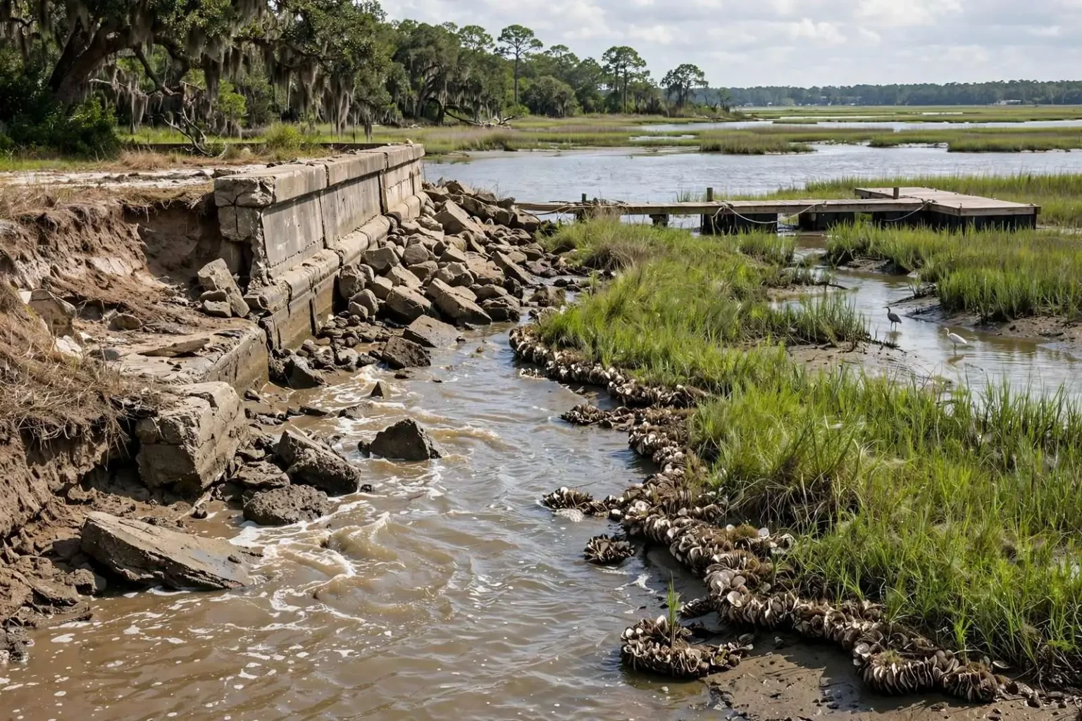
Coastal Alabama has been losing marshland for years, a slow erosion that scientists describe as death by a thousand cuts. Now, landowners, conservation groups and government agencies are testing a range of solutions meant to both restore what has been lost and protect the waterfront property standing behind it.
Andy Depaola knows the stakes firsthand. In 2012, the retired U.S. Food and Drug Administration scientist built his first pier off his property on Mon Louis Island, on the western side of Mobile Bay. Twelve days later, a hurricane washed it away.
“I built it like traditional piers, one plank at a time,” Depaola said. “And in those 12 days, I couldn’t believe that I had lived here 32 years without a pier. And I became addicted.”
An architect friend helped him design a removable pier built from modular sections that could be carted to and from the shore ahead of a storm. Depaola built the new version in 2013. He eventually stopped physically removing the sections before storms, instead tying them to the seafloor with rope. He said the system was 90% effective during Tropical Storm Bertha in July, even though the pier still sustained some damage.
A Widespread and Accelerating Problem
Depaola’s pier troubles reflect a much larger regional challenge. Since 2009, nearly all of coastal Alabama has lost acres of marsh, a critical habitat for fish, shrimp and other marine life that residents rely on for both recreation and food. Between 2009 and 2021, marsh loss across the region ranged from 13.2 acres on the northeast side of Dauphin Island to 210 acres in nearby Portersville and Heron bays, according to the 2025 “State of Alabama’s Estuaries and Coast” report from the Mobile Bay National Estuary Program. Over that same period, shorelines retreated anywhere from 9.8 feet near Point Clear to 97.1 feet on the northern side of the Fort Morgan Peninsula.
“A lot of these ecosystems, I like to say they’re being impacted by a thousand cuts,” said Blair Morrison, science and monitoring program lead with the Mobile Bay National Estuary Program.
Getting Private Landowners on Board
Because private landowners hold the vast majority of waterfront property in coastal Alabama, getting them to adopt marsh-friendly protections is one of the biggest hurdles facing conservation advocates, said Christian Miller, public-sector program lead with the national estuary program.
Miller’s team promotes “living shorelines,” a catchall term for using natural materials such as plants, sand, shells and rock along a shoreline to prevent erosion, according to the National Oceanic and Atmospheric Administration. The design varies depending on conditions at each property. But many landowners default to hiring a contractor to build a bulkhead, a hard retaining wall, because it is a more familiar and straightforward permitting process than a living shoreline.
“Changing paradigms is a hard thing to do, but it’s something worth pursuing, and I think [the national estuary program] and others are willing to give it a try,” Miller said.
The national estuary program first partnered with private property owners on a living shoreline project on Mon Louis Island in 2013 and now has two more such projects lined up with private landowners. Miller noted there is no dedicated public funding source for these projects, so landowners are largely responsible for designing and paying for a living shoreline themselves, at a cost that can run into the thousands or tens of thousands of dollars.
Depaola took his own path after Hurricane Katrina pushed floodwaters up to his home. His property sits on a 20-foot bluff without marshland, so in 2006 he began replacing lost soil with rubble from a neighbor, layering sand and topsoil on top, then planting pampas grass, oleander and four live oak trees. Over the following two decades he added fig trees, sweet potatoes and scuppernong grapes, creating what he calls his “jungle,” now home to birds, snakes and raccoons.
“It’s a photosynthesis zone, it’s ornamental, it’s food, it’s habitat,” Depaola said. “And most of all, it’s an integrated system with vines and trees and shrubs and ground cover where their root systems are integrated with a mixture of rubble and soil. And it’s withstood the last 20 years.”
Investing in Public Lands
Much of the marsh that remains on public land in coastal Alabama has been protected or restored thanks to a substantial financial boost from settlements tied to the 2010 Deepwater Horizon oil spill. Mobile County used settlement funds to create tidal marsh habitat protecting 300 acres of salt marsh on the west side of the Dauphin Island Causeway, along with the road itself. The national estuary program used similar funding to restore marsh spits in Fowl River, and earlier this year, Mississippi and Alabama officials announced a project to restore Grand Batture Island along the state line.
Alabama’s Department of Conservation and Natural Resources has conserved roughly 13,000 acres of intertidal saltwater marsh in south Mobile County, according to Amy Hunter, the department’s Deepwater Horizon restoration coordinator. In total, more than $1 billion in settlement funds has already been spent on restoration in coastal Alabama, and another $1 billion is expected by the time the funds are fully distributed in 2031.
When Good Intentions Cause Harm
Traditional “gray” infrastructure, like bulkheads and seawalls, can unintentionally worsen the very erosion it is meant to stop. These hard, vertical structures reflect wave energy outward, pushing water into nearby marshes and eroding the natural habitat around them. One study in North Carolina found that net marsh loss was, on average, 180% greater in areas with bulkheads than in areas without them.
Depaola said he has watched the number of armored shorelines increase dramatically on Mon Louis Island, particularly since 2010; he estimates about 90% of the property along his half-mile stretch of hillside now has some form of armoring, up from an estimated one-third of Mobile Bay’s shoreline in 2008.
“The neighbors have all kind of taken independent and disparate ways of arming their shorelines. And with very poor results there,” Depaola said. “It’s been a boon for the dock building industry, sea wall industry. They’re out here continuously.”
Still, researchers at the national estuary program are reluctant to condemn bulkheads outright. “We never tell people they’re right or wrong for putting in bulkheads and armoring shoreline,” said Jason Kudulis, the program’s executive director. “You want to protect that investment.” Instead, his team looks for solutions that can work alongside existing shoreline armoring rather than against it.
The Limits of Piecemeal Fixes
Even with strong effort from officials, conservation groups and private landowners, restoring coastal marshes remains complicated, and there is no perfect fix. Increasing development has fragmented much of the remaining habitat into small pockets rather than long, continuous stretches, Morrison said. Fragmented marsh cannot support juvenile fish the way intact marsh can, since it limits their range of travel, and it filters water less effectively. For people, a long, unbroken stretch of marsh offers far better hurricane protection than scattered patches.
“Really it just interferes with the kind of continuous delivery of ecosystem services,” Morrison said. “If you just have pockets of habitat, it’s not going to function the same way as if you had a big block of that same habitat.”
Morrison said the national estuary program increasingly hears from residents who want to help protect coastal Alabama’s waters and are interested in living shorelines. “Let’s make a more continuous stretch of habitat rather than just one-off projects,” she said, “because those one-off projects are still valuable, still provide a lot of help to the ecosystem. But again, having a more continuous habitat is going to provide more continuous ecosystem services.”
A Rare Bright Spot on the Eastern Shore
Amid the losses, researchers point to one notable exception: the Eastern Shore in Baldwin County, the only area in south Alabama where marsh area has actually increased. From 2009 to 2021, the coastline stretching from the Causeway through the southern edge of Fairhope gained 50 acres of marsh, according to the State of the Estuaries report. Researchers attribute the gain to wild rice beds re-establishing in D’Olive Bay in Daphne, though they still don’t know exactly why the beds came back to life several years ago.
“No one exactly knows why,” Kudulis said. “We don’t have a recipe for seagrasses, they’re almost transient.”
The turnaround follows years of targeted work upstream. In 2010, the Mobile Bay National Estuary Program established a watershed management plan for D’Olive Creek, which had significantly degraded over previous decades. Water quality in the creek has since improved substantially, reducing the amount of eroded sediment entering the water by 4,670 tons, according to the program.
Dottie Byron, a botanist who studies submerged aquatic vegetation such as seagrasses, tracks the wild rice beds closely and describes a boom-and-bust pattern. A few years ago, a large push of sediment into the bay coincided with wild rice growing so thick it was difficult to move through; this year, growth was comparatively sparse. Byron said whether wild rice seeds coming from upstream germinate depends on water salinity, drought conditions and several other factors that are still not fully understood.
Researchers say there is still much to learn about the long-term effects of marsh loss and how best to reverse it. “I think that a lot of those answers are things we’re still trying to figure out,” Morrison said of the impact on local fisheries. “It’s definitely still an evolving question.”
For Kudulis, the responsibility ultimately falls on people to manage the changes they set in motion. “[Humans] and beavers are the only ones who can terraform … two of the only species that can change the ecosystem to suit our needs,” he said. “With great power comes great responsibility.”
How Shoreline Projects Are Permitted
Most shoreline stabilization work in Alabama’s coastal waters requires authorization from the U.S. Army Corps of Engineers’ Mobile District, along with state review under the Alabama Coastal Area Management Program administered by the Alabama Department of Environmental Management. In 2017 the Corps created Nationwide Permit 54, a general permit specifically for living shoreline projects.
The Mobile Bay National Estuary Program is one of 28 national estuary programs established under Section 320 of the federal Clean Water Act.