
‘Map for Mobile’ Puts Downtown’s Industrial Waterfront on the Planning Table
Mobile's Map for Mobile comprehensive plan proposes 'character areas' and opens a dedicated conversation about the city's largely industrial waterfront.
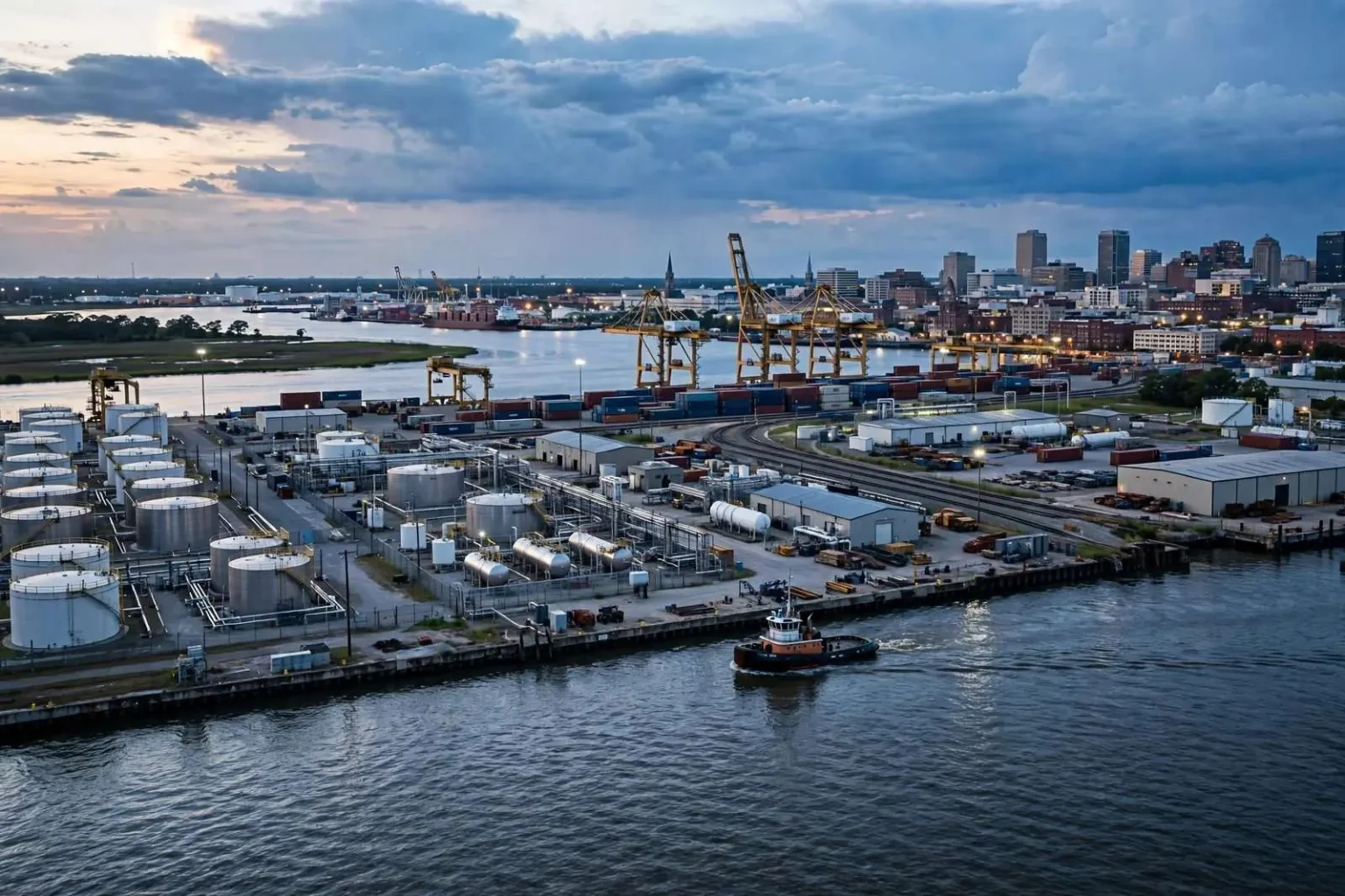
Mobile’s first comprehensive citywide plan in decades is taking shape, and one of its most consequential ideas is also one of its simplest: give the waterfront its own conversation. The city is working with a consulting firm on the plan, dubbed the “Map for Mobile,” and the way it treats the downtown riverfront could shape zoning, investment, and neighborhood protection for a generation.
The most recent milestone in the process was a four-day workshop at The Grounds, the event venue on the western side of the city, which wrapped with a two-hour public presentation on Thursday night. Consultants walked residents through early concepts for how different parts of the city should grow, gathering reactions that will feed into the drafting of the final plan. Workshops of that kind are the working heart of a comprehensive plan: rather than a document handed down from a shelf, the process depends on residents showing up, looking at maps, and saying what they want their neighborhoods and commercial districts to become.
A comprehensive plan is not a law, but it is the framework that future zoning decisions, capital projects, and development incentives are measured against. For a city that has grown and changed substantially since its last such plan, updating the map is the first step toward updating the rules that follow it. That is why the ideas presented at the workshop, preliminary as they are, matter to anyone who owns property, commutes across the city, or cares about how Mobile looks in twenty years.
A City Divided Into Character Areas
Among the central ideas floated: dividing Mobile into “character areas,” distinct parts of the city whose differing assets and challenges would each get tailored planning treatment rather than one-size-fits-all zoning. Under that approach, a dense downtown block, a mid-century neighborhood of ranch houses, a commercial strip, and an industrial district are treated as fundamentally different places with different futures, instead of all passing through the same regulatory filter. Planners use character areas to match expectations to reality, so that the goals for one part of the city do not accidentally smother the uses that make another part work.
The first such area identified in the plan is the waterfront, and the consultants were blunt about what they found there. Today, the land along the Mobile River downtown remains largely zoned industrial, and much of it is put to exactly that use. The working waterfront is real and significant: docks, terminals, warehouses, and support businesses line the river and tie the city’s economy to global shipping. Mobile’s port is one of the principal deepwater ports on the Gulf of Mexico, and the industrial activity downtown supports thousands of jobs across the region, from longshore labor to logistics to the industries that cluster near the water.
But planners also noted real friction points. Residents living near tank farms and other heavy industry have raised ongoing concerns about what sits next door, and those concerns are not new. The boundary between the port economy and the neighborhoods around it has shifted over the decades, and questions of health, safety, and quality of life follow wherever heavy industry and housing share ground. The character-area framework is designed to bring those tensions into the open rather than letting them be settled piecemeal, one zoning case at a time.
Why the Waterfront Gets Its Own Chapter
The comprehensive plan, consultants said, creates the waterfront distinction specifically to open a focused community conversation about the riverfront’s future. It is the first Mobile planning effort to recommend that this stretch of the city get dedicated attention of its own, treated not as leftover industrial land or as an afterthought to downtown but as a district with its own identity and its own set of decisions to make.
The stakes are visible in what the riverfront already is and what it might become. The State Docks and their shipping operations carry national significance, anchoring an economic engine that reaches far beyond the city limits. At the same time, other Gulf Coast and river cities have spent recent decades asking how much of their downtown waterfront should serve industry and how much should serve people — with outcomes ranging from expanded port capacity to riverwalks, parks, and mixed-use redevelopment. Where Mobile lands on that spectrum is exactly the conversation the plan is built to host, and nothing about the character-area designation predetermines the answer.
What the designation does change is the process. Instead of waterfront questions being decided in scattered pieces — a lease here, a rezoning there — they would be weighed together, with residents able to see the whole picture at once. That includes the relationships between the port and the neighborhoods that border it, the future of underused parcels along the river, and the way downtown connects or fails to connect to the water that gave the city its name and its start as a colonial port town more than three centuries ago.
How Residents Can Shape the Outcome
City officials are encouraging residents to follow the Map for Mobile process as it advances and to weigh in on what they want the waterfront to become. Public input sessions, presentations like the one at The Grounds, and online comment opportunities all feed the consultants’ drafting work, and the difference between a plan that gathers dust and one that guides real decisions usually comes down to how much genuine public engagement went into it.
For residents of neighborhoods near the tank farms and docks, the process is a rare structured opportunity to put long-standing concerns on the record in a citywide context. For port and industry stakeholders, it is a chance to document how essential the working waterfront is to the regional economy. For everyone else — downtown business owners, cyclists and walkers who dream of river access, developers eyeing the fringes of the industrial zone — the character-area conversation determines what tools the city will have to direct growth over the coming decades.
What Comes After the Workshop
The four-day workshop format is a standard technique in modern planning practice, compressing months of background study into an intensive stretch of public sessions, design exercises, and nightly debriefs. At The Grounds, consultants spent the week building on earlier rounds of community input, testing concepts on large maps and adjusting them based on what attendees said. The Thursday night presentation distills that work into a form residents can react to, and each reaction becomes another layer of data for the final document.
Between the workshop and a finished plan lie the harder steps: synthesizing input into draft text and maps, releasing those drafts for public review, revising in response, and ultimately adopting the plan through the city’s governing process. Adoption matters because the plan’s real power comes afterward, when planning staff and elected officials use it to justify or resist specific zoning changes, and when grant applications cite it to show that projects fit an adopted community vision. Funding agencies at the state and federal level consistently favor projects that trace back to an adopted comprehensive plan, which gives the Map for Mobile practical weight far beyond its pages.
The waterfront character area will be one of the earliest tests of whether the plan changes anything. Its questions are genuinely difficult: a deepwater port cannot be moved to accommodate a riverwalk, and neighborhoods cannot simply be relocated away from industry. But the first step in solving a decades-old tension is putting it on the table as a named, deliberate conversation — and that, more than any particular map line, is what the consultants’ framework accomplishes. As the process advances through further public sessions and draft releases, Mobile residents will get repeated chances to influence the outcome before anything is final, starting with the question the plan now poses formally for the first time: what should the downtown waterfront be?
Reading the Plan’s Signal on Industry
Nothing in the character-area approach signals a retreat from the port. If anything, the consultants’ blunt assessment of the industrial waterfront — nationally significant, economically central, and geographically fixed — is an acknowledgment that Mobile’s future includes a thriving working harbor. What the designation changes is the presumption of silence around it. For years, the land along the river has been zoned industrial almost by inertia, and decisions about it have tended to follow from that default. Asking the question again, in public, is itself a change.
The neighbors most affected by that reopening are the ones living closest to the tank farms and terminals. Their concerns about noise, truck traffic, lighting, and air quality have usually been aired in reaction to specific projects, after plans were already drawn. A character-area process flips that sequence: the community’s tolerances and priorities get documented first, and future proposals get measured against them. Industry also gains something in that arrangement, since a settled community understanding reduces the uncertainty that has shadowed waterfront projects in the past.
For now, the plan remains a draft in motion, and its authors have emphasized that the public presentation at The Grounds was a milestone, not a verdict. Residents who want a say in whether the riverfront grows more industrial, more accessible, or some careful mix of both will have their chances as the process continues. The first citywide plan in decades has officially put the waterfront on the table, and Mobile’s conversation about it is just beginning.