Several School Districts Announce Early Dismissal Ahead of Thursday Storms
University of South Alabama and Escambia County schools announce early dismissals and closures ahead of severe weather expected Thursday.
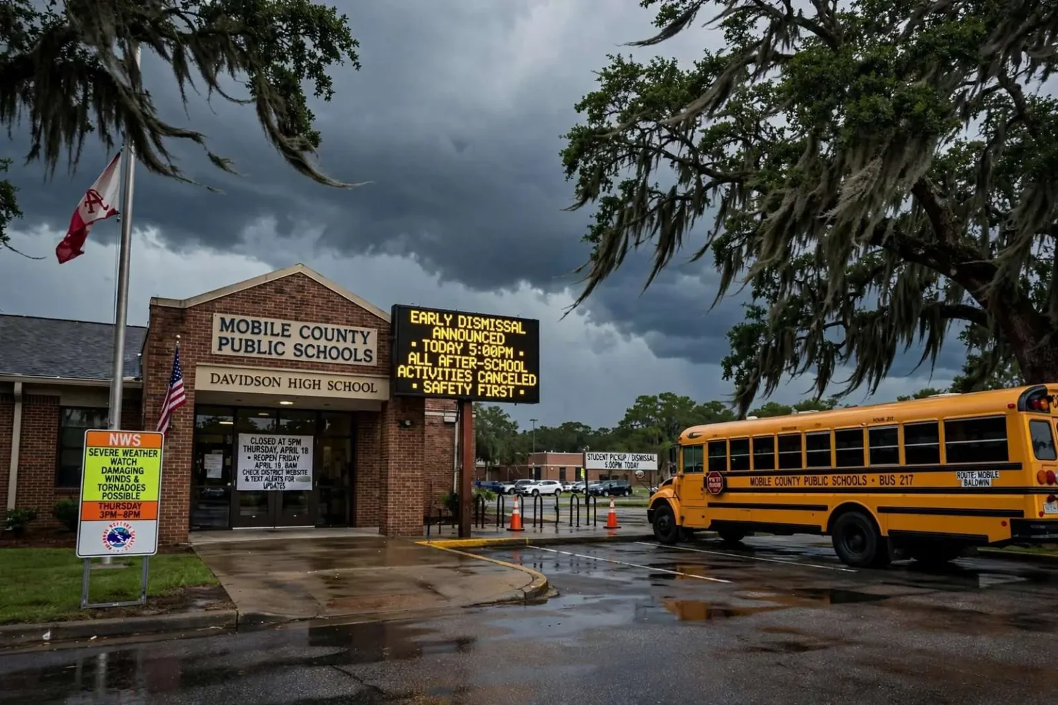
Several school districts in the Mobile area have announced early dismissals and schedule changes ahead of possible severe weather expected Thursday, joining a region-wide shuffle of calendars as Gulf Coast institutions move students and staff out of harm’s way before the storms arrive.
The announcements follow the standard Gulf Coast spring script: a strong system approaching, forecasters warning of severe weather capable of producing damaging winds and tornadoes, and school and university officials weighing dismissal timing against the certainty of afternoon travel in bad weather. Mobile-area families have been through this routine many times, and the districts’ decisions this week reflect the accumulated experience of a region that treats spring storm systems seriously.
South Alabama’s Schedule Changes
The University of South Alabama will close at 5 p.m. Thursday, April 18. All classes, activities and facility reservations scheduled after 5 p.m. on the main campus and the Baldwin County campus are canceled. The Marx Library, Student Center and Food Court, and Student Recreation Center also will close at 5 p.m.
The university’s plan effectively empties the campus of evening activity. Night classes, club meetings, gym sessions and reserved events — the usual content of a Thursday evening on a campus of South’s size — all stand down, and the facilities that anchor student life close along with the academic buildings. For a commuter-heavy university spread across a main campus in west Mobile and a satellite campus across the bay in Baldwin County, coordinating a single 5 p.m. shutdown is the simplest way to get everyone off the roads before the weather window opens.
Students who are Mississippi residents are permitted to leave campus at 3:30 p.m. Non-essential employees who are Mississippi residents also may leave at 3:30. The earlier release acknowledges the geography of the storm’s approach: students and staff heading west toward Mississippi face longer drives on highways that would be exposed to severe weather earlier in the afternoon than commuters staying in the Mobile area. Giving them a head start is a recognition that “dismiss at five” does not serve everyone equally when the threat moves across state lines.
The University is scheduled to reopen Friday, April 19, at 8 a.m. — a timeline that assumes the system clears overnight, and that gives officials the option to adjust if the forecast or the morning-after damage assessment says otherwise.
Escambia County, Florida
Across the state line, the Escambia County, Florida, school district canceled all outdoor after-school activities beginning after 6:30 p.m. The targeted approach — keeping the school day and indoor activities intact while clearing fields, stadiums and outdoor events — matches a threat expected to arrive in the evening hours rather than the afternoon.
A non-student day is already scheduled for Friday, April 19, so students will be home regardless of how the weather develops. All Escambia County public schools and offices will be open as scheduled Friday for administrators, teachers and staff — a reminder that the calendar pause applies to students, while the district’s workforce reports as usual to assess facilities and prepare for the return of classes.
The district’s decision to leave Friday’s existing non-student day in place, rather than converting it into a weather day, signals confidence that the storms will pass without school-day disruption — and it spares families the domino effect of rescheduling that a full closure would have triggered.
Why the Gulf Coast Runs This Playbook
April sits inside the Gulf Coast’s secondary severe weather season, when late-spring storm systems ride frontal boundaries into the region with the kind of wind energy that produces damaging straight-line gusts and tornadoes. School officials in South Alabama and the Florida Panhandle have learned from decades of events — some historically devastating — that the hours just before and after the school day are the most dangerous times to move students, and that early, clear announcements are the cheapest safety measure available.
The calculus behind an early dismissal is more subtle than “close if it might storm.” Districts weigh the forecast’s confidence and timing against the risk of releasing thousands of teen drivers into deteriorating weather, the burden on working parents of an unexpected early pickup, and the cost of a cancellation that turns out to be unnecessary. When officials stagger releases — as USA did with its 3:30 p.m. release for Mississippi-bound students and staff — they are managing travel exposure against the specific geography of the threat.
Universities face their own version of the problem. A campus population includes thousands of residents who live where they study, commuters spread across two counties, and out-of-state students whose homes lie in the storm’s path. South’s plan addressed each group: cancel everything after 5 p.m., close the buildings that keep students on campus late, and let those facing the longest drives leave before the weather arrives.
The Communication Chain
If there are any changes, the University says an additional update will be sent via email and posted to the USA website and social media. That commitment is the connective tissue of modern weather response: institutional decisions made once in the morning are amended in real time as the forecast sharpens, and families learn of the amendments through the channels they already check.
The multi-channel approach reflects hard lessons from past Gulf Coast storms. A single notification method fails in predictable ways — email goes unread, social media posts get buried — so institutions now push updates everywhere at once. For students and parents, the practical guidance is to watch for updates through the evening rather than assuming the 5 p.m. plan is final, especially if the storm’s timing shifts.
School districts follow the same logic. Escambia County’s announcement of canceled outdoor activities after 6:30 p.m. carries the same implicit caveat as the university’s: if the forecast tightens or the threat materializes differently than expected, follow-up messages will adjust the plan. Districts in the region have automated call and text systems for exactly this purpose, and a weather-decision cycle rarely ends with the first announcement.
What Residents Should Do With the Information
For families in the affected districts, the schedule changes are the beginning of preparation, not the end of it. Severe weather watches and warnings issued Thursday will carry the actionable detail — timing, threat types and shelter guidance — and households that know their evening is now free of school obligations can move through the standard Gulf Coast checklist: a way to receive warnings that works without the internet, a safe room identified, and a plan for the hours when damaging winds or a tornado warning put travel out of the question.
Parents of students in activities that were canceled — practices, rehearsals, games — should confirm directly with coaches and sponsors whether any makeups are scheduled, and students at South should check university channels before assuming Friday-morning operations. The reopening at 8 a.m. Friday is the current plan; weather systems that produce overnight damage can change even that timeline.
Commuters in both states should plan around the evening window. The decisions announced — USA emptying by 5 p.m., Escambia clearing outdoor events after 6:30 p.m. — sketch the period of greatest concern, and travelers who can complete their movement before it or after it passes will stay out of the worst conditions.
The Regional Picture
The coordinated announcements across Mobile-area districts, the University of South Alabama and Escambia County’s schools illustrate how the central Gulf Coast handles a shared threat. Storm systems do not respect county or state lines, but each institution sets its own schedule based on its population and geography — which is why a single weather event produces a patchwork of dismissal times, canceled activities and reopening plans across the region.
South Alabama’s main campus and Baldwin County campus closing together shows the two-campus coordination required for a university system spanning Mobile Bay. Escambia County’s decision to protect outdoor activities while leaving Friday’s non-student day intact shows a district managing a threat window that begins after the school day ends. The Mobile-area districts that announced early dismissals made their calls on the same forecast but their own operational needs.
The common thread is caution about evening travel. Every measure announced this week — earlier releases, canceled night classes, dark stadiums and fields — is designed to keep students, staff and families off roads and out of exposed venues during the hours the severe weather is expected to move through the region.
Looking Past Thursday
By Friday morning, the region should know how the event unfolded. If the storms stay within forecast bounds, the University of South Alabama resumes operations at 8 a.m., Escambia County’s staffed schools open on schedule, and the week’s disruption amounts to a reshuffled calendar. If the system overperforms, follow-up announcements — the ones officials have already promised via email, the USA website and social media — will handle the changes.
Either way, the week’s decisions will be evaluated by the same standard Gulf Coast families always apply: did the institutions move people to safety before the weather arrived, and did they tell everyone what was happening while it changed? The early dismissals announced across the Mobile area and beyond are this week’s answer — proactive, layered and built on the region’s long experience with April storms.
Residents are encouraged to monitor local forecasts and official channels through Thursday evening, and to treat the announced schedule changes as part of a broader readiness for weather that Gulf Coast springs reliably deliver.
School Weather Decisions: How They Get Made
Behind each announcement is a decision process that starts long before Thursday. District superintendents and university emergency managers confer with National Weather Service offices — in this region, the Mobile forecast office — tracking the storm’s expected timeline against bell schedules and campus operations. The questions are practical: when does the threat window open, how long does it take to move the student population, and where will those students be when conditions turn?
The answers produced this week’s mix of responses. Universities can clear a campus faster than a district can dismiss a county’s worth of schools, which is why South could set a single 5 p.m. closure while districts made more granular choices. Escambia County’s evening-activities cancellation reflects a threat arriving after most students are already home; a district facing an afternoon threat would have dismissed early instead.
These decisions also carry financial and logistical weight. Canceled days must sometimes be made up, events must be rescheduled, and parents must rearrange work — costs that officials accept deliberately when safety requires it. The Gulf Coast’s long record of spring and hurricane-season events has made that trade familiar: the region’s schools treat a forecast-driven schedule change not as an overreaction but as routine risk management.
For now, the guidance from every institution involved is the same: watch for updates, plan around the announced closure windows, and be ready for changes if the forecast shifts. The schedule changes announced Thursday — South Alabama’s 5 p.m. closure and 3:30 p.m. release for Mississippi residents, Escambia County’s 6:30 p.m. cutoff for outdoor activities — remain the operating plan unless officials say otherwise.