Weather Service Confirms EF-0 Tornado in Chickasaw as Storms Sweep the Coast
The National Weather Service confirmed an EF-0 tornado with 75 mph winds in Chickasaw as severe storms swept Mobile and Baldwin counties.
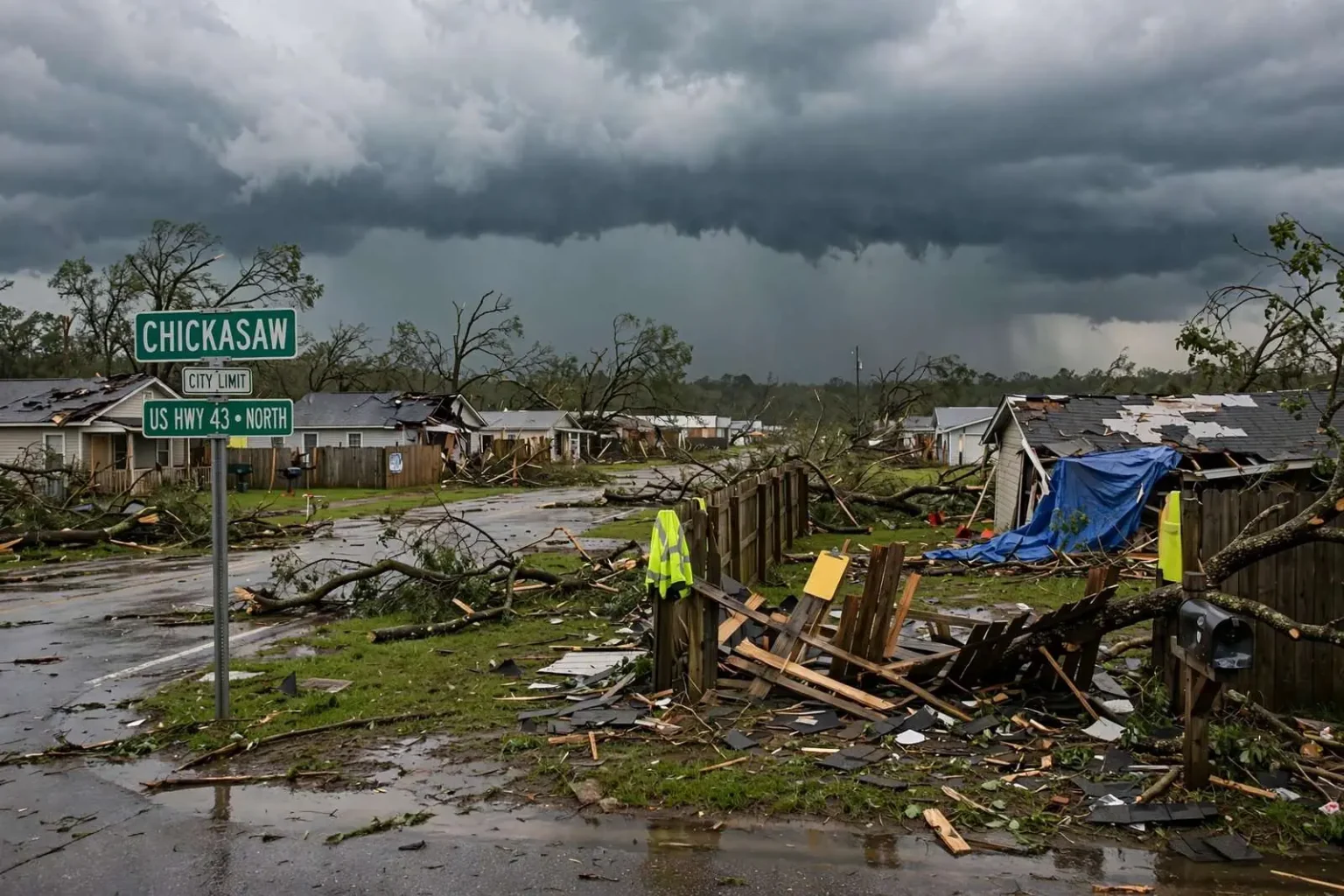
The National Weather Service has confirmed that a tornado touched down in Chickasaw during a round of severe weather that moved across Mobile and Baldwin counties on Friday. Surveyors with the agency rated the tornado an EF-0, the weakest category on the Enhanced Fujita damage scale, with maximum winds estimated at 75 mph. The confirmation came after weather service personnel examined reports and damage indicators from the Chickasaw area, where the brief twister was caught up in a larger line of thunderstorms sweeping toward the coast.
The rating places Friday’s event at the lowest end of the tornado spectrum, but officials emphasize that even weak tornadoes can cause localized damage and danger, particularly when they develop quickly inside fast-moving storm lines. No injuries were reported in connection with the Friday storms, a fact that residents and emergency officials in both counties were grateful for as cleanup got underway.
A Funnel Cloud and Airborne Debris
Before the confirmation was issued, a funnel cloud was reported in the Chickasaw area, and observers saw debris being lifted by the circulation. That combination — a visible funnel and debris being pulled from the ground — is one of the clearest signs that a tornado has made contact with the surface rather than remaining aloft as a rotating cloud. Reports of that kind from trained spotters, law enforcement, and residents are exactly what prompt the National Weather Service to send surveyors out once the storms clear.
Chickasaw, a small city in Mobile County just north of Prichard and Saraland along the U.S. Highway 43 corridor, sits squarely in the part of the Gulf Coast where summer thunderstorms can intensify with little warning. The community has seen its share of severe weather over the years, and Friday’s event was a reminder that tornado season along the upper Gulf Coast is not confined to the spring. Summer storm cells and squall lines routinely spin up brief, weak tornadoes that are on the ground for only a few minutes.
Storms Pushed Across Two Counties
The damage was not limited to Chickasaw. Severe weather also hit Silverhill on the Eastern Shore side of Mobile Bay, where strong storms moved through the Baldwin County community during the same outbreak. Baldwin County has grown rapidly in recent decades, and communities like Silverhill along the U.S. Highway corridor east of the bay have more homes, businesses, and vehicles in the path of any storm than they did a generation ago — which makes even short-lived severe weather a bigger cleanup and insurance event than it once would have been.
Farther west, hail was reported in Leakesville, Mississippi, in neighboring Greene County, showing that the storm complex producing the Chickasaw tornado was a broad one, stretching across state lines as it pushed toward the Gulf. Hail reports of that kind typically accompany strong updrafts within thunderstorms, the same vertical motion that can tilt and stretch a storm’s rotation into the brief tornadoes the Gulf Coast sees so often in the warm months.
Why EF-0 Tornadoes Are Common Along the Gulf Coast
EF-0 tornadoes are the most common type recorded along the Gulf Coast, and Friday’s event fits a well-established regional pattern. The Enhanced Fujita scale, which replaced the original Fujita scale in the United States in 2007, rates tornadoes from EF-0 to EF-5 based on the damage they produce rather than on wind measurements taken inside the storm. An EF-0 corresponds to estimated winds of 65 to 85 mph, which is why surveyors pegged the Chickasaw tornado at 75 mph — near the middle of that lowest band.
These weak tornadoes often develop quickly within lines of strong summer thunderstorms, giving little lead time for warnings. Along the Gulf Coast in summer, the daily collision of sea breezes from Mobile Bay and the Gulf of Mexico with the hot, humid air over land can touch off lines of thunderstorms by mid-afternoon. Those lines carry an enormous amount of moisture and instability, and embedded cells can briefly spin up rotation at low levels before collapsing just as fast as it formed.
Because the tornadoes are so short-lived, radar often shows only a fleeting velocity signature, and warnings may arrive only minutes ahead of the storm — if at all. That is why weather officials repeatedly stress that residents should treat any severe thunderstorm warning during the summer months seriously, since a tornado can form inside a warned storm without a separate tornado warning ever being issued before it touches down.
Damage at the Lowest End of the Scale
Damage at EF-0 intensity is usually limited to tree limbs, fencing, roof shingles and outbuildings rather than structural failure. At 75 mph, winds are comparable to the upper range of a strong tropical storm, strong enough to snap small limbs, peel loose shingles, flatten sections of wooden privacy fencing, and shift or overturn poorly anchored sheds and carports. The debris lifted by the Chickasaw circulation was consistent with that kind of damage profile — yard debris and light material rather than structural components.
For homeowners, the aftermath of an EF-0 is typically measured in chain-saw work and insurance claims rather than displacement. Property owners in the affected areas are advised to photograph damage before making temporary repairs, watch for downed or hanging limbs that may fall later, and be cautious around any power lines that may have been weakened by falling branches. Utility crews generally respond quickly to lines pulled down by tree damage, but hanging limbs can remain a hazard for days after the storm itself has passed.
Outbuildings deserve particular attention after an event like Friday’s. Sheds, carports, and detached garages are rarely engineered to the same standards as homes, and even winds in the 75 mph range can shift them on their foundations or peel back roofing that will then fail in the next heavy rain. A tarp and a prompt claim are usually the difference between a minor repair and a slow water-damage problem that surfaces weeks later.
How Storm Surveys Work
When damaging storms cross the region, the National Weather Service office responsible for the area — in this case the office serving the central Gulf Coast — decides whether to conduct a storm survey based on the volume and credibility of damage reports coming in. Surveyors visit the affected areas, map the path of any confirmed tornado, examine the type and severity of damage to trees, homes, and other structures, and use damage indicators to assign a rating on the Enhanced Fujita scale. The survey is what turns scattered reports of a funnel cloud and flying debris into an official confirmation like Friday’s.
Surveys also serve a practical forecasting purpose. Each confirmed tornado, hail report, and wind damage report becomes part of the long-term severe weather record for the region, and that record shapes how forecasters interpret radar signatures on future days. Along the Gulf Coast, where many tornadoes are brief and weak, the written record built by these surveys is one of the main tools available for understanding how often the region experiences tornadoes and in what circumstances.
Residents who experienced damage but have not yet reported it can still contribute. Damage reports submitted after the fact help surveyors refine the path and rating of a tornado, and they help local emergency management agencies document the overall impact of an outbreak when seeking state or federal assistance for larger disasters.
No Injuries, and a Reminder to Stay Weather-Aware
No injuries were reported in connection with Friday’s storms, and the quick confirmation process means residents across Mobile and Baldwin counties now have a clear picture of what happened. The outcome could easily have been worse: a tornado with lifting debris in a populated area is dangerous regardless of its rating, and summer storms that strike in the late afternoon or evening can catch people outdoors, on the road, or asleep.
Local officials use events like this to repeat familiar but important advice. Know where you will take shelter before a warning is issued — an interior room on the lowest floor, away from windows. Have more than one way to receive warnings, since sirens are not designed to be heard indoors in every neighborhood. Keep phones charged and emergency alerts enabled, especially during the summer when storms can develop between the afternoon commute and bedtime with very little notice.
For the coastal counties, the pattern that produced Friday’s storms is one that repeats all summer. Hot, humid afternoons, sea-breeze collisions, and fast-building thunderstorm lines will remain a near-daily possibility for weeks, and most will pass without a tornado. But the ingredients for another brief spin-up will be present on many of those afternoons, which is why forecasters encourage residents to check the forecast before outdoor plans and to know what a severe thunderstorm warning means for their neighborhood.
Friday’s storms also underscore the value of the region’s spotter network. The reports of a funnel cloud and lifted debris in Chickasaw, along with the severe weather reports from Silverhill and the hail observed in Leakesville, gave forecasters and surveyors the raw information they needed to confirm the tornado quickly and accurately. Those observations, gathered from ordinary residents and trained volunteers alike, remain one of the most important parts of severe weather response along the Gulf Coast, where so much of what happens in a summer storm line happens faster than radar alone can capture.
As cleanup continues in Chickasaw and repairs get underway in Silverhill, the confirmed EF-0 stands as a routine but useful reminder of how Gulf Coast summer weather works: storms that arrive fast, hit briefly, and are best met with preparation rather than surprise.