ALDOT Works Out Kinks in $3.2 Million U.S. 98 Smart Traffic Signal System, Eyes Memorial Day Finish
State transportation officials say lingering equipment glitches are delaying full activation of a $3.2 million adaptive traffic signal system along U.S. 98 on the Eastern Shore, though they expect it to be running at full strength by Memorial Day.
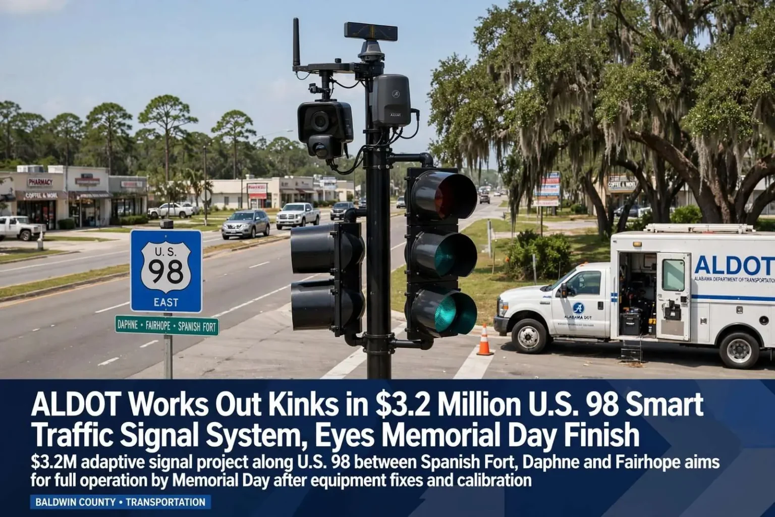
A $3.2 million project to modernize traffic signals along U.S. 98 between Spanish Fort, Daphne and Fairhope is still working through equipment problems more than a year after installation began, but state transportation officials say they expect the system to be fully operational by Memorial Day.
The Alabama Department of Transportation gave an update on the adaptive signal system to the Eastern Shore Metropolitan Planning Organization recently, reporting that some of the roadside electronics meant to detect approaching traffic have not worked as designed, and the software that is supposed to adjust signal timing to real-time conditions has not yet collected enough reliable data to run at peak efficiency.
ALDOT engineer Brian Aaron told the MPO that the setbacks are typical for this kind of technology rollout. “[The problems] aren’t unique to this project,” he said. “With any lighting or signaling project, you have a burn-in or a test period to make sure they are up and working, but we found a couple of components that were not functioning, so we’re working with our contractor to replace those with new components.”
The project spans approximately 12 miles of U.S. 98, covering more than 20 signalized intersections across the three municipalities. Each intersection has been upgraded with new controller cabinets, communication radios, and detection hardware designed to feed real-time data to a central traffic management center operated by ALDOT’s Southwest Region office in Mobile.
Construction began in early 2023 with an original completion target of late 2023. Supply chain delays for specialized controller hardware pushed the initial installation timeline back by several months. By the time all physical infrastructure was in place, the project had moved into the software integration and calibration phase, where the current equipment issues emerged.
Technology Modeled on Gulf Shores Success
The Eastern Shore system is modeled on a similar adaptive signal network already running along Alabama 59 in Gulf Shores, where it has been credited with extending green lights for beachbound and outbound traffic during peak travel periods and helping vehicles move through several intersections without stopping by syncing signal timing to actual traffic speed.
Aaron said the Gulf Shores system has shown just how responsive the technology can be. During a recent rainy day, when thousands of visitors left the beach at once to shop or visit attractions farther north near Foley, the system automatically shifted into a hurricane evacuation mode, holding north-south lights green at some intersections for as long as ten minutes before allowing cross traffic through.
Both adaptive systems can be manually overridden if needed, but they are built to operate autonomously once calibrated. The Gulf Shores installation along Alabama 59 serves as the proof of concept for the Eastern Shore corridor, demonstrating how adaptive signals can reduce congestion during seasonal traffic surges that are common along Alabama’s Gulf Coast.
The Gulf Shores system, which went live in 2019, covers a 7-mile stretch of Alabama 59 from the Intracoastal Waterway bridge north to County Road 6. It uses the same vendor platform — the Sydney Coordinated Adaptive Traffic System, or SCATS — that has been deployed in cities worldwide. ALDOT selected SCATS after evaluating multiple adaptive platforms, citing its track record in mixed urban and recreational corridors similar to the Eastern Shore.
Performance data from the Gulf Shores deployment showed a 15 to 20 percent reduction in average travel time during peak summer weekends compared to the previous fixed-time operation. The system also reduced stop-and-go events by approximately 30 percent, a metric that correlates directly with reduced fuel consumption and lower emissions.
How Adaptive Signal Technology Works
Unlike traditional traffic signals that operate on fixed timing cycles regardless of actual traffic conditions, adaptive signal systems use a network of sensors — including video detection cameras, radar units, and inductive loop detectors embedded in the pavement — to continuously monitor vehicle volumes, speeds, and queue lengths at each intersection.
This real-time data feeds into a central control system that runs optimization algorithms to adjust signal phasing and timing dynamically. The goal is to create “green waves” that allow platoons of vehicles to progress through multiple intersections without stopping, reducing delay, fuel consumption, and emissions.
On the Eastern Shore, U.S. 98 serves as the primary east-west artery connecting Spanish Fort, Daphne, and Fairhope, carrying a mix of local commuter traffic, commercial vehicles, and seasonal tourism traffic. The corridor’s traffic patterns shift dramatically between weekday rush hours, weekend beach traffic, and hurricane evacuation scenarios, making it an ideal candidate for adaptive control.
The system operates on a hierarchical basis: local intersection controllers make second-by-second adjustments based on immediate detector inputs, while the central system coordinates cycle lengths and offsets across the corridor to maintain progression. This two-level approach allows the system to respond to local anomalies — a turning truck, a pedestrian crossing — without disrupting the broader corridor rhythm.
Each intersection in the Eastern Shore deployment includes four-approach video detection capable of tracking vehicles, bicycles, and pedestrians in all lanes. The system also integrates with ALDOT’s existing statewide traffic signal management software, allowing operators in Mobile and Montgomery to monitor performance, upload timing plans, and manually override operations during special events or incidents.
Installation Challenges and Equipment Replacement
The project has encountered specific hardware issues with roadside detection units that failed to reliably communicate with the central controller. These components, typically mounted on signal poles or span wires, use a combination of video imaging and radar to detect approaching vehicles and classify them by type — passenger cars, trucks, motorcycles, bicycles.
When detection units malfunction, the system loses its “eyes” on traffic flow, forcing it to fall back on default timing plans that do not reflect real-time conditions. ALDOT’s contractor has been replacing the faulty units with updated hardware that includes improved weather sealing and enhanced communication protocols designed for the Gulf Coast’s humid, salt-air environment.
The software side of the system also requires a learning period. Adaptive algorithms need several weeks of clean, consistent detector data to build accurate traffic pattern models before they can optimize effectively. With some detectors offline during the initial months, the data stream was incomplete, extending the calibration timeline.
Communication reliability has been another challenge. The system relies on a wireless mesh network linking each intersection to the central server. In several locations, heavy foliage and building interference degraded signal strength, requiring the installation of additional repeater nodes and, in two cases, fiber-optic drops to ensure consistent connectivity.
Power quality issues at several intersections also caused intermittent controller resets, which disrupted the adaptive learning process. ALDOT has since installed uninterruptible power supply units at all locations, providing battery backup that maintains operation during brief outages and conditions the power supply to prevent voltage spikes from damaging sensitive electronics.
Regional Context and Metropolitan Planning
The Eastern Shore Metropolitan Planning Organization, which covers the urbanized areas of Baldwin County east of Mobile Bay, has identified the U.S. 98 corridor as a critical mobility spine for the region. The MPO’s long-range transportation plan highlights the corridor’s role in connecting residential communities to employment centers in Mobile, as well as its function as a hurricane evacuation route.
Baldwin County has been among the fastest-growing counties in Alabama for the past decade, with Daphne and Fairhope seeing particularly rapid population growth. This growth has increased peak-hour traffic volumes on U.S. 98 beyond what the original fixed-time signal system was designed to handle.
The adaptive signal project is funded through a combination of federal Surface Transportation Block Grant funds and state matching funds administered by ALDOT. The $3.2 million investment covers equipment, installation, software licensing, and the first year of system operations and maintenance.
The MPO’s 2045 Long-Range Transportation Plan projects that daily traffic on U.S. 98 east of I-10 will exceed 45,000 vehicles by 2035, up from approximately 32,000 today. Without adaptive control, the corridor would require costly widening — a solution constrained by limited right-of-way through established commercial and residential areas.
Spanish Fort, Daphne, and Fairhope each contributed local matching funds and coordinated permitting to expedite the project. The three municipalities also agreed to standardize their signal timing policies and share traffic count data, creating a unified corridor management approach that crosses jurisdictional boundaries.
Memorial Day Target and Seasonal Urgency
The Memorial Day target for full operational status carries practical significance beyond a calendar deadline. Memorial Day weekend marks the traditional start of the summer tourism season on the Eastern Shore, when traffic volumes on U.S. 98 can increase by 30 to 50 percent compared to off-peak months.
Having the adaptive system fully calibrated and operational before this surge allows it to learn and adapt to the seasonal pattern from the outset, rather than playing catch-up during the busiest weeks of the year. The system’s hurricane evacuation mode — demonstrated in Gulf Shores — is also a critical capability for a coastal corridor that serves as a primary evacuation route.
ALDOT officials have indicated that once the Eastern Shore system is fully operational, they will evaluate additional corridors in the Mobile metropolitan area for similar upgrades, including sections of U.S. 90, Airport Boulevard, and the Cody Road corridor.
The Eastern Shore project also positions Baldwin County to compete for future federal discretionary grants under the Infrastructure Investment and Jobs Act, which prioritizes intelligent transportation systems and corridor-level technology deployments. A successful U.S. 98 deployment would serve as a reference project for the region’s broader smart mobility strategy.
For daily commuters, the promise is simpler: fewer red lights, shorter trips, and a corridor that adjusts to them rather than forcing them to adjust to it. If the system performs as its Gulf Shores counterpart has, the Eastern Shore’s most congested artery could become a model for how mid-sized coastal communities manage growth without endless road widening.