ALEA Reports Lane Closure Cleared After Two-Vehicle Crash on Alabama 21 Near Atmore
All lanes have reopened on Alabama 21 near Atmore after a two-vehicle crash prompted a lane closure, according to ALEA.
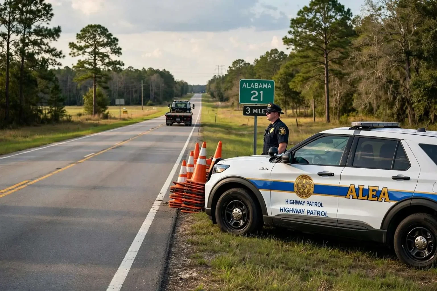
All lanes have reopened on Alabama 21 near Atmore after a two-vehicle crash forced a lane closure on the highway, according to the Alabama Law Enforcement Agency. The agency’s Highway Patrol Division responded to the crash, which occurred at approximately 1:29 p.m. Sunday, Aug. 30, and worked the scene until the roadway could be safely reopened to traffic.
What ALEA Reported
According to ALEA, the crash blocked the northbound travel lanes of Alabama 21 near the three-mile marker in the Atmore area for an undetermined amount of time while troopers investigated and coordinated the response. The agency said troopers with the Highway Patrol Division were on scene investigating the crash and continued to monitor the situation, providing updates as conditions changed before ultimately confirming that all lanes had been cleared.
ALEA’s public updates on significant crashes typically follow that same pattern: an initial report describing the incident and the resulting closure, followed by periodic status updates, and a final confirmation once the roadway has been fully reopened. That structure gives the traveling public actionable, real-time information without requiring troopers to divert their attention from the scene itself to field individual inquiries about conditions.
Alabama 21’s Role in the Region
Alabama 21 serves as a key transportation corridor connecting communities across southwest Alabama, running through the Atmore area and linking smaller towns to larger regional hubs. The highway sees significant daily traffic from both local residents and travelers passing through the region, making prompt incident response and lane clearance essential to minimizing disruption when a crash occurs.
For a community like Atmore, which serves as an important hub for both local and through traffic in Escambia County, maintaining safe and accessible roadways is closely tied to everyday economic activity. Businesses along and near the highway depend on a steady flow of traffic, and extended closures can create ripple effects that reach well beyond the immediate scene of a crash, affecting delivery schedules, commutes, and access to the area’s retail and service businesses.
How ALEA Responds to Highway Crashes
The Alabama Law Enforcement Agency’s Highway Patrol Division is responsible for monitoring and responding to crashes across the state’s highway system, including rural corridors like Alabama 21 where a dedicated municipal traffic unit may not be immediately available. In many rural stretches of Alabama highway, ALEA troopers serve as the primary law enforcement presence for both routine traffic enforcement and crash response, a role that becomes especially important when a crash blocks a heavily traveled route with limited nearby alternate roads.
When a two-vehicle crash occurs on a highway like Alabama 21, troopers typically need to secure the scene, direct traffic around the affected lanes, document the crash for investigative and insurance purposes, and coordinate with towing services to clear any disabled vehicles before the roadway can reopen. The amount of time that process takes can vary considerably depending on the severity of the crash, the extent of vehicle damage, and whether any injuries require additional medical response at the scene.
Two-Vehicle Crashes and Rural Highway Safety
Crashes involving two vehicles on rural highways can stem from a range of contributing factors, including speed, following distance, road conditions, and driver distraction, though ALEA’s public statements on this particular incident did not specify a cause. Highway safety officials have long emphasized that rural two-lane highways like sections of Alabama 21 present different risk factors than urban roadways, including higher average travel speeds and, in some cases, fewer traffic control measures at intersections and access points.
State transportation and public safety officials routinely use crash data from incidents like this one to help prioritize future safety improvements along Alabama’s highway network, including potential additions like turn lanes, improved signage, or traffic signals at high-crash locations. Whether this particular stretch of Alabama 21 near the three-mile marker has been previously identified as a location of concern was not addressed in ALEA’s public statements on the crash.
What Comes Next
ALEA has not indicated whether any citations or charges resulted from the crash, and the agency’s Highway Patrol Division typically completes a fuller investigative review in the days following an incident, well after the roadway itself has reopened to traffic. Officials have not released additional details about the extent of any vehicle damage or whether either driver involved in the crash sustained injuries.
Motorists traveling through the Atmore area are reminded that conditions on rural highway corridors can change quickly following a crash, and drivers are encouraged to follow ALEA’s public safety updates for the latest information on any active roadway incidents in Escambia County and the surrounding region. The agency continues to post real-time crash and closure information through its official communications channels as incidents occur across the state.
Escambia County’s Highway Network
Escambia County, where Atmore is located, sits along Alabama’s southern border with Florida and relies heavily on a network of state highways to connect its communities to each other and to larger metropolitan areas like Mobile and Pensacola. Alabama 21 is one of several key north-south and east-west routes that crisscross the county, carrying everything from daily commuter traffic to commercial freight moving between agricultural and industrial areas. Because the county’s population is spread across a mix of small towns and rural areas rather than concentrated in a single dense urban core, residents often have fewer alternate route options when a primary highway like Alabama 21 experiences a closure, making even a temporary lane blockage more disruptive than it might be in a more urbanized area with a denser street grid.
That reliance on a limited number of key corridors is part of why ALEA’s rapid response and clear public communication matter so much for communities like Atmore. A crash that closes even a single lane can create backups that affect not just immediate through-traffic, but also emergency response times for other calls in the area, school bus routes, and the daily commutes of residents who work in neighboring towns or in Mobile and Pensacola.
The Broader Pattern of Highway Crashes in Rural Alabama
Rural highway crashes like the one reported on Alabama 21 are a recurring feature of ALEA’s daily incident reporting across the state, reflecting the reality that a significant share of Alabama’s roadway miles run through rural areas with two-lane highways, higher average speeds, and, in some stretches, limited passing lanes or shoulder space. Traffic safety researchers have consistently found that rural highways, despite carrying less overall traffic volume than urban interstates, often see disproportionately severe crash outcomes when collisions do occur, a pattern attributed in part to higher travel speeds and longer emergency response times in less densely populated areas.
State and local officials have periodically explored a range of countermeasures aimed at reducing crash severity on corridors like Alabama 21, including targeted resurfacing, improved signage, and, in some cases, corridor studies examining whether specific stretches would benefit from additional turn lanes or other engineering changes. Whether any such review is planned for the section of Alabama 21 near Atmore where this crash occurred was not addressed in ALEA’s public statements.
How Residents Can Stay Informed
ALEA maintains active public communication channels, including social media updates, that residents and travelers can monitor for real-time information about crashes, closures, and other roadway incidents across the state. For a rural corridor like Alabama 21, where alternate routes may require lengthy detours, staying informed about active incidents can help drivers plan around a closure rather than encountering it unexpectedly and being forced to turn around or wait for the roadway to clear.
The agency’s Highway Patrol Division covers a large geographic area with a limited number of troopers relative to the highway miles under its jurisdiction, meaning that public reporting of hazards or suspicious activity — such as debris in the roadway or a vehicle stopped in an unsafe location — can also play a meaningful role in helping troopers respond more quickly to developing situations before they escalate into more serious crashes.
Atmore’s Position Along the Alabama-Florida Border
Atmore sits close to the Alabama-Florida state line, and its location has historically made it an important waypoint for travelers moving between the two states along Alabama 21 and nearby corridors. The city is also home to the Poarch Band of Creek Indians’ reservation lands and associated economic developments, which draw additional visitor and commuter traffic through the area beyond what a community of Atmore’s size might otherwise generate. That mix of through-traffic, tribal economic activity, and local commuting means that Alabama 21 functions as more than a simple connector between small towns — it is a corridor that a wide range of different travelers rely on for different purposes, from daily work commutes to visits tied to the area’s gaming and entertainment venues.
Given that layered traffic pattern, even a temporary lane closure on Alabama 21 near Atmore can affect a broader and more diverse set of drivers than a similar closure might on a highway serving a more homogeneous commuter base. ALEA’s coordination with local response resources during incidents like this one reflects an awareness of just how many different kinds of trips — commercial, tribal, tourist, and residential — depend on this stretch of highway remaining open and predictable for those who use it every day.