Eastern Shore Planning Panel Set to Get Update This Week on Mobile River Bridge
The Eastern Shore Metropolitan Planning Commission's Policy Board will get an ALDOT update this week on the Mobile River Bridge and Bayway project, along with several other Baldwin County road and bridge initiatives.
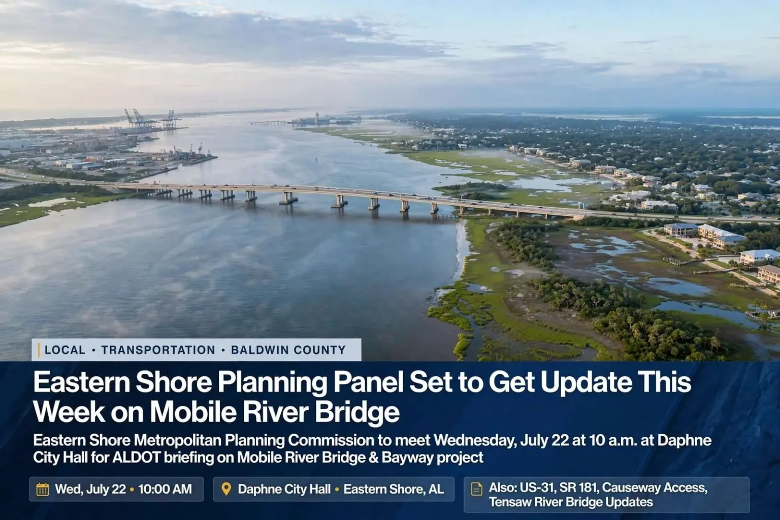
The Eastern Shore Metropolitan Planning Commission’s Policy Board will meet Wednesday, July 22, with an update on the Mobile River Bridge and Bayway project among the items on its agenda. The board is scheduled to gather at 10 a.m. at Daphne City Hall for its regular session. Representatives from the Alabama Department of Transportation are expected to brief the board on several ongoing projects across the Eastern Shore, according to the meeting agenda, making the session a broad snapshot of how the region’s road network is being studied, maintained and rebuilt.
The Eastern Shore Metropolitan Planning Commission is the regional body that plans transportation improvements for the Baldwin County cities along Mobile Bay — Daphne, Fairhope, Spanish Fort and their neighbors — in coordination with state and federal requirements. Metropolitan planning organizations exist across the country wherever urbanized areas receive federal transportation dollars, and their policy boards, made up of local elected officials, set the priorities that determine which projects move ahead. A regular session like Wednesday’s gives ALDOT a standing opportunity to report directly to those officials, and it gives the public a window into projects that will shape the area for decades. The meeting is open to anyone who wants to attend.
Daphne City Hall has long served as the venue for the board’s regular sessions, placing the meeting in the middle of the corridor most affected by the work on the agenda. The format is familiar to regional watchers: an agenda of studies and construction updates, presentations from state engineers and planners, and questions from board members whose constituents drive the affected roads daily. On the Eastern Shore, where population growth has outpaced infrastructure for years, those conversations carry real weight with local governments and residents alike.
The Mobile River Bridge and Bayway at the Center
In addition to the Mobile River Bridge and Bayway project, ALDOT’s update is set to cover Causeway Access Management, the US-31 Corridor Study, the US-98 project over Fly Creek, the SR 181 Corridor Study, the SR 181 signal project at Corte-Austin, and the Tensaw River Bridge. The list spans everything from long-range corridor studies to a single signal installation, illustrating the range of work the department juggles in the region at any given time. Each item affects a different piece of the Eastern Shore’s daily travel, and together they show how the area’s transportation future is being assembled piece by piece.
The Mobile River Bridge and Bayway project has been years in the making and remains one of the largest infrastructure undertakings on the Gulf Coast, with construction expected to reshape how traffic moves between Mobile and Baldwin counties. The concept calls for a new bridge spanning the Mobile River to carry Interstate 10 traffic, paired with improvements and widening along the Bayway — the elevated stretch of I-10 that crosses Mobile Bay itself. The current crossing funnels one of the region’s heaviest traffic flows through the George Wallace Tunnel, a bottleneck where vehicles descend into a tunnel under the river and emerge into some of the most congested miles on the Gulf Coast. Regular updates to regional planning bodies like the Eastern Shore Metropolitan Planning Commission are part of the ongoing coordination between ALDOT and local governments as the project advances.
For commuters and freight carriers alike, the project’s stakes are straightforward. Thousands of vehicles make the Mobile Bay crossing every day, and the demand keeps growing as Baldwin County adds residents faster than nearly any county in Alabama. A new bridge and a widened Bayway would add capacity that the existing crossing cannot, rerouting through traffic around the tunnel and changing travel patterns on both sides of the bay. The project has also drawn scrutiny over its costs and how the work would be paid for, which is part of why its progress is tracked closely at every planning meeting where it appears.
The Rest of the Regional Agenda
The Causeway Access Management study addresses the other critical link between the counties — the Battleship Parkway, the low-lying causeway that runs the length of Mobile Bay north of the Bayway. Lined with businesses, boat launches and access points, the Causeway serves local traffic and offers the alternative route when the interstate backs up, but its many driveways and turns make it both economically vibrant and hazardous. Access management — the practice of consolidating and controlling where vehicles can enter and exit a road — aims to cut crashes and improve traffic flow without closing businesses off from their customers, and any changes to the Causeway’s access points matter to the communities along it.
The US-31 Corridor Study and the SR 181 Corridor Study look at two north-south routes that carry growing volumes of Baldwin County traffic. US-31 runs through the older towns of the Eastern Shore, while SR 181 has become a faster parallel route farther east, and both have absorbed development that their original designs never anticipated. Corridor studies examine capacity, safety, signal timing and future needs along the full length of a route, producing the analysis that later construction projects are built on. The SR 181 signal project at Corte-Austin, by contrast, is the kind of targeted improvement that answers an immediate safety concern at a specific intersection, where growth along the highway has made the crossing busier and more dangerous than when it was built.
The US-98 project over Fly Creek addresses a different kind of problem entirely. US-98 crosses Fly Creek on its route through Fairhope, and work on the bridge there deals with the condition of a structure carrying daily traffic over one of the waterways that drains the Eastern Shore into the bay. Bridge maintenance projects rarely make headlines, but they are the unglamorous work that keeps a road network functioning, and they often come with lane restrictions and detours that residents notice long before they notice the engineering behind them. The Tensaw River Bridge item covers the bridge that carries traffic across the Tensaw on the northern edge of the bay system, another piece of the region’s aging infrastructure receiving state attention.
Why the Board’s Role Matters
Meetings like Wednesday’s are where regional transportation priorities are actually set. The policy board’s members vote on which projects enter the area’s transportation improvement program, which federal funding follows, and how local concerns are communicated back to ALDOT. A briefing on the Mobile River Bridge and Bayway is not just informational — it is part of the ongoing coordination between the state and the cities that will live with the project’s effects, from construction detours to the long-term changes in how traffic moves through Daphne, Spanish Fort and Point Clear.
For residents of the Eastern Shore, the value of attending or following along is practical. The agenda items touch the routes used every day: the drive to Mobile for work over the Bayway, the trip down SR 181 to the schools and shops along it, the crawl through the US-98 corridor in Fairhope. Decisions made in rooms like the one at Daphne City Hall determine when those roads are widened, when signals are installed and how the region braces for the growth still coming. The Wednesday, July 22 session begins at 10 a.m., and the public is invited to be there for it.
Baldwin County’s growth is the backdrop for every item on the agenda. The county has ranked among the fastest-growing in Alabama for years, adding new subdivisions, schools and commercial centers that push more vehicles onto the same roads, and the Eastern Shore communities feel that pressure most acutely because every trip south of the delta funnels toward a handful of crossings. A family moving into Spanish Fort or Daphne adds demand not just to local streets but to the Bayway, the Causeway and the corridors under study this week. Planning bodies exist precisely because that growth cannot be accommodated piecemeal — roads and bridges take years to design and build, so the work has to start long before the traffic arrives.
The corridor studies on the agenda illustrate that long view. A study like the ones underway on US-31 and SR 181 typically takes a year or more, gathering traffic counts, crash data and public input before recommending improvements, and its recommendations then wait for funding and design before anything is built. The signal project at Corte-Austin and the bridge work at Fly Creek and the Tensaw River sit at the other end of that pipeline, where analysis has already been done and construction is the remaining step. Watching the agenda across successive board meetings shows projects moving through those stages, and it is how residents and local officials gauge whether the region’s planning is keeping up with its growth.
Public participation in the process is straightforward. Metropolitan planning organization meetings are open by design, agendas are published in advance, and many boards include a period for public comments where residents can raise concerns directly. For an issue as consequential as the Mobile River Bridge and Bayway — which will affect tolls, travel times and traffic patterns for a generation — showing up and asking questions remains the most direct way for the public to influence the outcome. The board’s regular session Wednesday, July 22, at 10 a.m. at Daphne City Hall offers exactly that opportunity, with ALDOT representatives on hand to present the latest on the region’s most significant projects and answer for their progress.