Excessive Heat Warnings Grip South Alabama as Dangerous Heat Dome Lingers
A stubborn heat dome is keeping South Alabama under excessive heat warnings, with heat index values approaching 115 degrees, though forecasters expect relief and a return to a normal summer pattern by early next week.
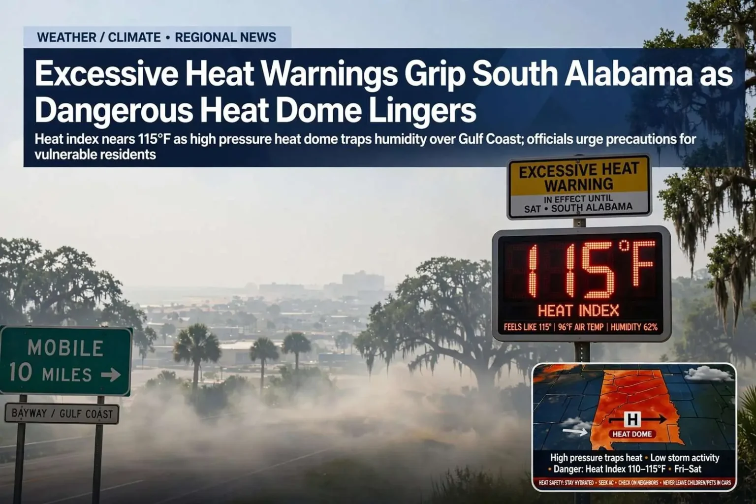
South Alabama remains locked in a dangerous heat wave this week, driven by a strong upper-level high pressure system parked over the region. The system, often referred to as a heat dome, traps sinking air beneath it, which suppresses the thunderstorms that typically bring afternoon relief and allows temperatures to build day after day.
Excessive heat watches and warnings are expected to remain in effect for at least another day or two across the area. Heat index values — a measure of how hot it actually feels when humidity is factored in alongside air temperature — could reach as high as 115 degrees on Friday, with similar conditions possible into Saturday.
A heat index at that level is not merely uncomfortable; it approaches the threshold at which the body’s ability to cool itself through sweating begins to fail, especially in direct sun and for anyone exerting themselves outdoors. Meteorologists describe that level of heat index as potentially dangerous, particularly for children, older adults, outdoor workers and anyone with underlying health conditions.
The dome’s mechanics are straightforward even when its effects are miserable. High pressure aloft compresses and warms the air beneath it, pushing temperatures toward record levels, while the same sinking motion acts as a lid that keeps pop-up storms from forming. What relief does arrive tends to be brief and localized, which is why forecasters emphasize duration — day after day of accumulating heat — as the real danger of a dome pattern.
Along the Gulf Coast, the humidity that makes Mobile summers famous is what turns a hot day into a dangerous one. Air arriving off the Gulf of Mexico carries moisture inland, and when that moisture combines with temperatures in the mid and upper 90s, the heat index climbs well past the actual air temperature — the difference between a warm afternoon and a medical threat.
Health officials are urging residents to check in on friends, neighbors and relatives who may be especially vulnerable during the stretch of extreme heat.
Heat safety basics
The basics of heat safety remain the most effective defense: drink plenty of fluids, stay in air-conditioned spaces when possible, avoid prolonged sun exposure, and never leave children or pets unattended in a parked vehicle, where interior temperatures can climb to lethal levels within minutes even on a mild day.
Public health officials repeat the vehicle warning every summer because the statistics never improve: a car parked in the sun can heat by 20 degrees or more in the first 10 minutes, and a child’s body temperature rises three to five times faster than an adult’s. Cracked windows slow the warming only marginally, and most heat deaths of children in vehicles happen when a caregiver forgets a child is in the back seat.
Residents without reliable air conditioning are encouraged to spend the hottest hours in public spaces that offer it — shopping centers, libraries and other cooling options around the region — rather than trying to endure the peak afternoon indoors. Ceiling fans help people feel cooler but do nothing to lower body temperature once the air itself is hotter than skin, which is why officials stress air conditioning over fans alone during heat advisories.
For those who must be outside
Anyone who works or spends significant time outdoors is being advised to take extra precautions during this stretch. Rescheduling strenuous activity for the early morning or evening hours, when temperatures are comparatively lower, can reduce the risk of heat-related illness.
For those who cannot avoid working in the heat, frequent breaks in shaded or air-conditioned areas are recommended to allow the body to recover.
Utility demand also spikes during heat domes, and power providers across the region ask customers to conserve during peak afternoon hours to reduce strain on the grid. Setting thermostats a few degrees higher while away from home and running large appliances in the evening are small steps that add up when every air conditioner in the region is running at once.
Construction crews, road workers, landscapers and agricultural laborers face the greatest exposure, and employers are reminded that hydration must begin before the workday starts — thirst is a late signal of dehydration, not an early one. Lightweight, light-colored clothing, hats with wide brims and buddy systems that let coworkers spot the first signs of illness all reduce the risk of a heat emergency on a job site.
Athletes and marching bands practicing for the fall season face similar exposure, and school systems across the region follow heat guidelines that mandate water breaks and limit practice intensity when the heat index crosses defined thresholds. Parents with questions about outdoor practice schedules are encouraged to check with their schools.
Recognizing a medical emergency
Heat stroke is a life-threatening medical emergency, not something to try to treat at home. If someone shows signs of being overcome by the heat — confusion, hot and dry skin, a rapid pulse or loss of consciousness — they should be moved to a cool, shaded location immediately and 911 should be called right away.
The distinction between heat exhaustion and heat stroke matters for anyone responding to a victim. Heat exhaustion brings heavy sweating, weakness and nausea and can usually be reversed with rest, fluids and cooling. Heat stroke, in which the body’s temperature regulation fails altogether, is marked by skin that is hot and often dry, confusion and possible collapse — a condition that can cause permanent injury or death within minutes and requires emergency medical care, not home remedies.
Emergency rooms along the Gulf Coast typically see a spike in heat-related visits during stretches like this one, with the most serious cases involving older residents in un-air-conditioned homes and outdoor workers who pushed through the hottest hours of the day.
When the pattern breaks
There is a light at the end of the forecast. Rain chances will stay low for the next day or so, but as the high pressure system gradually weakens, a low chance of rain is expected to return by the weekend.
Forecasters expect a more typical summertime pattern to reassert itself next week, with afternoon thunderstorms developing after midday and fading after sunset — a pattern familiar to anyone who has spent a Gulf Coast summer in South Alabama. Not every location will see rain on a given day, but the chance of a quick downpour will be more widespread than it has been during the peak of the heat wave.
Relief from a dome usually comes gradually rather than all at once. As the high weakens and drifts, moisture works back into the atmosphere, afternoon clouds build higher each day, and finally the first storms punch through — often producing brief heavy downpours and lightning before the more typical scattered pattern settles in.
By July 4th, forecasters expect a more typical afternoon thunderstorm chance that fades by evening — a forecast that matters for holiday plans across the region, when parks, beaches and backyard cookouts will be in full use.
The return of afternoon storms will do more than water lawns. Cloud cover and rain-cooled air knock the heat index down several degrees, and the sea-breeze collisions that trigger Gulf Coast thunderstorms help break the stagnation that lets pollution and haze build under a persistent dome.
At the beach
For beachgoers, the rip current risk is currently low, but conditions can change quickly along the Gulf Coast, which is why officials continue to stress paying attention to posted beach flags and signs before entering the water.
Rip currents remain one of the most significant threats to swimmers along Alabama’s coastline, and checking the local beach forecast before a trip to the sand is a simple step that can prevent a life-threatening situation.
The flag system used at Alabama’s beaches — green for low hazard, yellow for medium, red for high and double-red for closed waters — is updated each morning by lifeguards and beach safety officials, and visitors unfamiliar with it can ask at any staffed beach. Swimmers caught in a rip current are urged to stay calm, signal for help and swim parallel to shore until free of the current rather than fighting it directly.
Even in a low-risk window, thunderstorms developing over the Gulf can change beach conditions with little notice, and lightning remains a separate hazard that prompts beach evacuations whenever storms approach.
The sun itself is a hazard
The UV index remains in the extreme range through this stretch of weather, meaning sunburn can occur in a matter of minutes on exposed skin. Sunscreen, shade and protective clothing remain the best defenses for anyone spending time outside while the heat dome holds over the region.
Dermatologists recommend a broad-spectrum sunscreen of SPF 30 or higher applied 30 minutes before exposure and reapplied every two hours — more often after swimming or sweating — along with sunglasses and hats, since the sun’s cumulative damage is as much a long-term health risk as the heat is an acute one.
Until the dome breaks and the daily storms return, the region’s routine changes only at the margins: more water, more shade, more indoor hours, and more attention to the neighbors and coworkers who depend on someone noticing when the heat has become too much.