Five Facts About the Bridges and Tunnels That Connect Mobile to the Eastern Shore
A look back at how the Cochrane Bridge, the Causeway and two underwater river tunnels transformed travel across Mobile Bay over the last century.
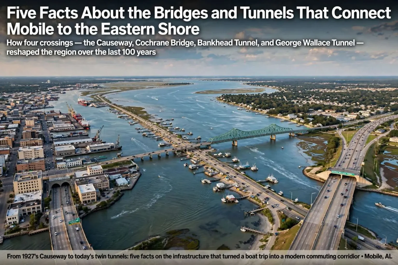
Long before commuters could cross Mobile Bay in minutes, getting from Mobile to the Eastern Shore meant boarding a boat. Today the route is carried by the Cochrane Bridge, the Causeway, the Bankhead Tunnel and the George Wallace Tunnel, four pieces of infrastructure built over the last hundred years that reshaped how people move around the region. Together they turned a costly, weather-dependent boat trip into a highway network that ties Mobile and Baldwin County into a single commuting region.
Fact one: bay boats were expensive
Before the Cochrane Bridge and Causeway opened on June 14, 1927, crossing the bay required a ride on a bay boat. Fares ran between $3.50 and $6 for the roughly ten-mile trip, a price that would translate to somewhere between $45 and $78 in today’s dollars. That cost alone made a land route an attractive proposition for anyone traveling regularly between Mobile and Baldwin County.
At those prices, a daily commute across the bay was out of reach for ordinary workers, and crossings were the kind of trip taken for business, family visits or special occasions. Weather mattered, too: boats crossed on the bay’s schedule, not the traveler’s, and storms could strand plans on either shore. The Causeway changed that equation by putting the crossing under a traveler’s own control — drive across whenever you like, for the price of gasoline — and its opening effectively created the Eastern Shore as an extension of Mobile’s everyday world.
The Causeway itself, running low across the water just north of the bay’s head, became more than a road. Lined over the years with fishing camps, restaurants and communities that grew up at its edges, the route embedded itself in local life in a way no ferry schedule ever could.
Fact two: a downtown bridge almost happened
A downtown bridge connection was floated as early as the 1930s as planners looked for a more direct route between Mobile and the Eastern Shore. The idea drew pushback from residents and business owners who worried a bridge through the heart of the city would disrupt commerce along the Mobile River, damage the waterfront’s scenic character and displace existing businesses along the banks.
The objections tell their own story about Mobile in that era. The riverfront was a working waterfront, lined with wharves, warehouses and the businesses that served them, and a high-rise bridge with its long approach ramps would have cut through the heart of that economy. The resistance stalled the idea, and the region’s crossings took a different path — under the river rather than over it, and along the bay’s edge rather than through downtown.
Fact three: the tunnels were built by floating concrete tubes
The Bankhead Tunnel and the later George Wallace Tunnel were both built using the same unusual method. Concrete tubes were constructed on land in Mobile, then floated out into the river. Workers climbed into the submerged sections through a hatch in the ceiling to complete work inside, while barges kept the tubes buoyant as concrete was added and the structures gradually settled into place on the riverbed.
The technique, known as immersed-tube construction, solved the problem of digging beneath an active shipping river. Rather than trenching down from the surface and interrupting the port’s traffic, engineers built the tunnel in pieces where they could, floated each piece into position, and sank it into a prepared trench on the river bottom. The method has been used for underwater crossings around the world, but watching it happen on the Mobile River — factory-sized tubes drifting past the skyline — made it a spectacle for the city each time.
The Bankhead Tunnel, the earlier of the two, carries traffic beneath the river at the foot of downtown, its portals emerging into the street grid at either end. Its low clearance and single-bore design have made it a distinctive — and occasionally temperamental — piece of the city’s street system, famous to generations of Mobile drivers for flooding during heavy rain and for the disorienting curve of its approach.
Fact four: the second tunnel was predicted years in advance
By 1951, engineers with the Mobile firm Palmer & Baker Inc., who had consulted on the Bankhead Tunnel, were already predicting the region would need a second underwater crossing within five years to keep pace with growing traffic. Their early proposal called for the new tunnel to run south of the Bankhead and to be dedicated to eastbound traffic, while the original tunnel would continue handling traffic headed west into Mobile.
That basic east-west split between the two tunnels is largely how the crossings still function today. The George Wallace Tunnel, built decades after the Bankhead, took the eastbound role the engineers described, carrying I-10 traffic out of downtown toward the Eastern Shore while the Bankhead continues to receive westbound drivers into the city. The prediction proved accurate in its timing, too: postwar growth in car ownership and the arrival of the interstate system swamped the single-tunnel arrangement faster than planners of the 1930s could have imagined.
Palmer & Baker’s foresight also shaped the region’s long-term debate over how to expand the crossings — a discussion that continues today as planners study a replacement or supplement for the tunnels and the I-10 crossing of the bay. The east-west tunnel division established in the middle of the last century remains the baseline from which every modern proposal starts.
Fact five: the four crossings remade the region
Together, the four crossings replaced what was once a slow and costly boat trip with a network capable of moving thousands of vehicles a day, a change that helped knit Mobile and Baldwin County’s Eastern Shore into the single commuting region residents know now. Without them, the explosive growth of Daphne, Fairhope, Spanish Fort and the rest of the shore — communities that fill each morning with commuters bound for Mobile jobs — would have been impossible on the scale that actually occurred.
The pattern is visible in the development history of both counties. Baldwin’s population growth tracks closely with the capacity of its bay crossings, from the 1927 Causeway opening to the tunnel expansions of the postwar era, and each improvement in the crossing has been followed by building booms on the eastern side. Real estate along the Eastern Shore has long commanded a premium for the same reason the bay boats once charged their fares: proximity to Mobile, made cheap by asphalt and concrete rather than expensive by distance and water.
Each crossing also carries its own character in local memory. The Causeway remains the scenic route, a low drive across open water that many travelers choose over the interstate for the view alone. The Cochrane Bridge, carrying the Causeway traffic over the Blakeley River and its tributaries, offers one of the region’s most photographed vistas. The tunnels, by contrast, are remembered in stories — first trips through as children, white-knuckle merges at the portals, the June rainstorms that pool at the Bankhead’s low point.
Looking forward, the four crossings are also the reference point for the region’s next big infrastructure decision. With I-10’s tunnel bore capacity long since stretched to its limits, planners have spent years studying how to add crossing capacity across the bay — whether a new bridge, a larger tunnel, or some combination — and every proposal is measured against the hundred-year story of how Mobile and the Eastern Shore got connected in the first place. The lesson of that story is consistent: when the crossing improves, the region grows, and the demand for the next crossing follows.
The bay boat era left its own traces for anyone who looks for them. Photographs from the early twentieth century show the boats that linked Mobile with the shore communities, carrying everything from daily workers to automobiles in their later years, and the landings on both sides grew into neighborhoods precisely because the boats made regular crossing possible. When the Causeway opened in 1927, the boats lost their reason for being almost overnight — the same pattern that has repeated every time a faster crossing has opened since.
Understanding the tunnel construction also explains a quirk of downtown geography. Because the tubes were floated and sunk rather than bored deep beneath the city, the tunnels sit relatively close to the surface, their approaches carved into the street grid. That is why the Bankhead’s entrance sits between buildings at the foot of Government Street and why the Wallace Tunnel’s portal interrupts the interstate at the river’s edge — the crossings had to fit into a downtown that was already built, and the floating-tube method was the only way to thread that needle without closing the river to shipping.
The original 1930s bridge debate, meanwhile, reads differently a century later. The objections that stopped a downtown bridge — protecting the riverfront economy and the waterfront’s appearance — helped preserve the district that Mobile now markets to visitors, and they pushed the region’s crossing capacity underwater and along the shoreline instead of over it. Every subsequent proposal to bridge the river downtown has run into the same questions, answered by the same instincts, with the result that the region’s crossings still follow the pattern set in 1927.