Mobile Crews Clear Downed Trees, Flooded Roads After Tropical Storm Arthur’s Remnants Pass Through
Mobile road crews worked to clear flooding and storm debris after the remnants of Tropical Storm Arthur left several roadways closed or impassable, with the city urging drivers to stick to major thoroughfares.
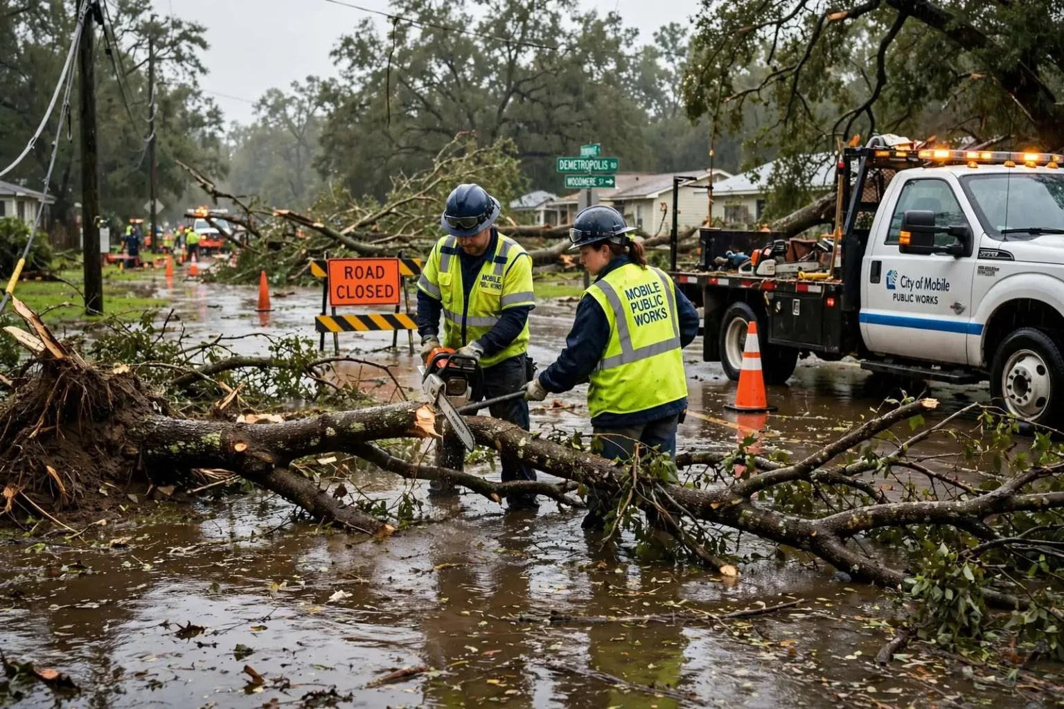
Mobile road crews spent the day clearing downed trees and addressing flooded streets after the remnants of Tropical Storm Arthur swept through the area, leaving several roadways closed or difficult to pass and prompting the city to urge drivers to use extra caution while getting around town.
Roads Affected by the Storm
City officials identified several specific roadways experiencing closures or significant traffic impacts as a result of the storm. Westbound Bay Bridge Road was closed due to flooding, while the Highway 90 Service Road experienced a washout severe enough to affect travel. Florida Street at Irvine Road was closed after a downed power line came to rest across the roadway, and two lanes of Demetropolis Road near Woodmere Street were closed due to a downed tree blocking part of the road.
With those and other localized impacts scattered across the city, officials advised drivers to stick to major thoroughfares, which largely remained clear and passable even as secondary streets in low-lying or tree-lined areas bore the brunt of the storm’s impact. That kind of uneven impact is typical after strong rain and wind events: major arterial roads are generally built with better drainage and fewer overhanging trees than smaller residential streets, making them more reliable options when a storm has left isolated trouble spots scattered across a city’s secondary road network.
Ongoing Cleanup Efforts
City crews worked throughout the day to clear downed trees and address flooded and washed-out sections of roadway, a process that typically requires coordinating public works crews, and in some cases utility companies, when downed power lines are involved, as was the case on Florida Street. Removing a downed tree from a roadway is usually a faster fix than repairing a washout like the one reported on the Highway 90 Service Road, which can require more extensive assessment and repair work to the road surface itself before a lane can safely reopen to traffic.
The city also prepared for the possibility of continued inclement weather, including additional rain, thunderstorms, and gusty winds later in the day, as the broader weather system continued to move through the region. According to the National Weather Service, the area remained under a flood watch until 8 p.m., reflecting continued concern about the potential for further rainfall on ground already saturated from the storm’s initial passage.
Why Tropical Storm Remnants Still Pack a Punch
Even after a tropical system weakens below hurricane or named tropical storm strength, its remnant moisture and circulation can continue to produce significant rainfall, gusty winds, and localized flooding well after the system’s formal classification has changed. That’s particularly true along the Gulf Coast, where remnant tropical moisture often interacts with existing frontal boundaries or sea-breeze patterns to produce training bands of heavy rain that repeatedly move over the same areas, a mechanism that frequently produces the kind of flash flooding and washouts reported on Mobile’s roadways.
For a city built largely on flat coastal terrain with limited natural drainage gradient, even moderate rainfall totals delivered over a short period can overwhelm stormwater systems in low-lying areas, producing street flooding well before rainfall totals approach hurricane-level accumulations.
How Residents Could Get Help
Residents encountering storm-related issues, including flooding, downed trees, or damaged roadways not already identified by the city, were asked to report those issues to Mobile 311 through the city’s citizen reporting portal. That reporting system allows the city’s public works department to prioritize response across a large number of storm-related reports rather than relying solely on crews discovering problems during routine patrols.
City officials continued to monitor conditions as the broader storm system moved through the region, with public safety messaging focused on encouraging drivers to avoid unnecessary travel on smaller side streets until cleanup crews could complete their work and city inspectors could confirm which roadways remained safe for normal traffic.
A Reminder of Gulf Coast Storm Season Realities
Tropical Storm Arthur’s remnants and their impact on Mobile’s roadways serve as a seasonal reminder of the flooding risk that comes with living along the Gulf Coast during the peak of hurricane season, which typically runs from June through November with activity often peaking in late summer and early fall. Even systems that have weakened well below hurricane strength by the time they reach land can produce localized flash flooding capable of closing roads, felling trees weakened by saturated soil, and knocking down power lines — the same combination of impacts reported across several Mobile streets following Arthur’s remnants.
City and county emergency management officials across coastal Alabama routinely use storms of this scale, even those that fall short of a formal hurricane designation, as opportunities to reinforce public messaging about flood safety, including standard guidance to never drive through flooded roadways, since floodwater depth and road conditions underneath can be difficult to judge from behind the wheel and a relatively small amount of moving water can be enough to sweep a vehicle off the road.
\n
The 311 System’s Role in Storm Response
\n
Mobile’s 311 citizen reporting system plays a central role in the city’s post-storm response process, allowing public works crews to prioritize which reports of downed trees, flooding, or damaged infrastructure to address first based on the volume and location of citizen reports coming in, rather than relying solely on crews discovering problems during scheduled patrols. That kind of crowd-sourced reporting has become an increasingly standard tool for municipal governments managing storm cleanup across a large geographic area with limited crew resources, helping ensure that reports from residential side streets receive the same visibility as more obvious impacts on major roadways that crews might notice without any resident report at all.
Flood Watches Versus Flood Warnings
The National Weather Service’s decision to keep Mobile under a flood watch rather than escalate to a flood warning reflects a specific and deliberate distinction in how the agency communicates flood risk to the public. A flood watch means conditions are favorable for flooding to develop, essentially telling residents and city officials to stay alert and be prepared, while a flood warning is issued once flooding is either occurring or considered imminent based on observed rainfall, river gauge readings, or reports from the field. That distinction matters practically for how a city times its response: officials can begin pre-positioning crews and equipment once a watch is issued, without necessarily activating the full emergency response that a warning would trigger, allowing public works departments to strike a balance between readiness and the practical limits of keeping road crews staged for a flood that may or may not fully materialize. In Mobile’s case, the fact that road crews were already responding to specific closures well before the watch’s 8 p.m. expiration suggests the city treated the watch as sufficient justification to mobilize resources proactively rather than waiting for conditions to escalate further.
How Tropical Storm Names Track a System’s Life Cycle
Arthur, like all Atlantic tropical cyclone names, comes from a rotating set of lists maintained by the World Meteorological Organization, with names reused every six years unless a storm is retired due to the severity of the damage it caused. A storm’s name and classification typically persist even after it weakens well below tropical storm strength, which is why meteorologists and local officials continued referring to “Arthur’s remnants” even once the system’s sustained winds and organized structure had diminished to the point where it no longer met the technical definition of a named tropical storm. That naming continuity serves a practical communication purpose: it allows forecasters, emergency managers, and the public to track a single weather system’s full life cycle and continued rainfall threat under one consistent reference, even as the storm itself transitions from a tropical cyclone into what meteorologists typically classify as a remnant low pressure area or a broader area of tropical moisture no longer displaying the organized circulation that defines a tropical storm.
Coastal Drainage Systems and Their Limits
Mobile’s vulnerability to street flooding from tropical remnants reflects broader engineering realities common to Gulf Coast cities built on low, flat terrain. Stormwater drainage systems in cities like Mobile are generally designed around a specific rainfall-intensity threshold, meaning pipes, culverts, and drainage ditches are sized to handle a defined amount of rainfall over a given period rather than an unlimited volume. When rainfall rates exceed that design threshold, even for a relatively short period, water can pool faster than a drainage system can move it away, producing street flooding in low-lying areas well before any nearby river or bayou has risen enough to cause more conventional overbank flooding. Older sections of a city’s stormwater infrastructure, much like aging water and sewer mains, were often engineered decades ago to standards that did not anticipate the increasingly intense short-duration rainfall events that meteorologists have documented becoming more frequent along the Gulf Coast in recent decades, a mismatch that city planners and engineers in coastal communities across the region have increasingly had to reckon with when prioritizing stormwater infrastructure upgrades.
Why Saturated Soil Makes Trees More Likely to Fall
The downed trees reported alongside Mobile’s flooding point to a related hazard that frequently accompanies heavy tropical rainfall: saturated soil dramatically reduces the ability of tree root systems to hold a tree upright, even in relatively modest wind conditions that a tree could easily withstand under normal soil conditions. As soil becomes waterlogged, it loses the structural cohesion that normally anchors root systems, effectively turning the ground around a tree’s base into a much weaker foundation than it would be during drier conditions. That’s part of why tree-related hazards, including the downed tree that closed lanes of Demetropolis Road and the downed power line on Florida Street, often cluster in the aftermath of heavy rain events even when peak wind speeds during the storm itself were not especially extreme. Utility companies and public works crews responding to storms like Arthur’s remnants typically treat downed trees resting on or near power lines as a priority hazard requiring coordinated response, since a tree that has already fallen against a still-energized line poses an ongoing electrical hazard beyond the simple traffic obstruction a fallen tree alone would present.