National Weather Service in Mobile Tracked Ida in 2009
A 2009 WKRG report documented National Weather Service preparations in Mobile as Ida approached the Gulf Coast.
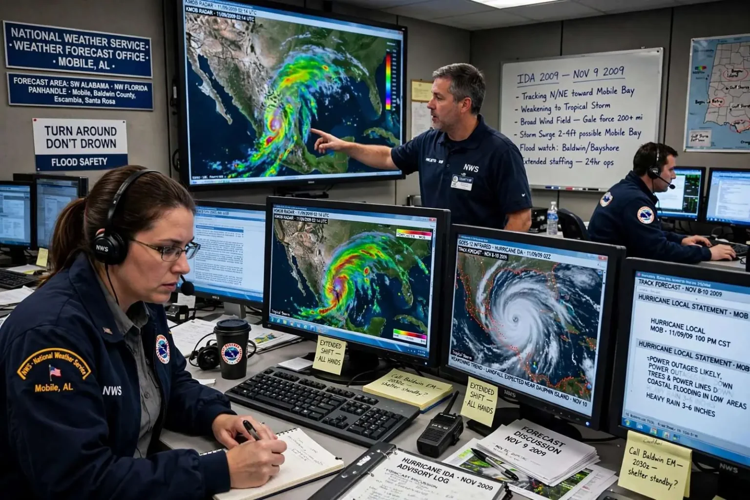
National Weather Service staff in Mobile were closely tracking Hurricane Ida in November 2009, according to a local news report from the time. The office, responsible for forecasts across southwest Alabama and northwest Florida, increased staffing as the late-season storm churned north through the Gulf of Mexico, and forecasters warned that Ida could bring strong winds, power outages and flooding in low-lying areas even if it did not retain hurricane strength at landfall. It was a familiar Gulf Coast drill executed with the urgency of a system that refused to fit the calendar.
November hurricanes are rare but not unheard of along the northern Gulf Coast, and Ida’s approach put residents of Mobile, Baldwin County, and the Florida Panhandle on alert during the week before Thanksgiving. The National Weather Service’s Mobile office, located at the Mobile Regional Airport, serves an area that stretches from the Mississippi line east through the western Florida Panhandle, including the barrier islands of Dauphin Island and the resort beaches of Gulf Shores and Orange Beach. Forecasters there worked extended shifts, issuing updated advisories and coordinating with county emergency management agencies as Ida’s track came into sharper focus.
Ida’s Unusual Path Through the Gulf
Ida began as a hurricane in the western Caribbean, making landfall in Nicaragua before reemerging over the Caribbean Sea and strengthening again as it moved north of Mexico’s Yucatan Peninsula into the Gulf of Mexico. By the time it was tracking toward the northern Gulf Coast, it had weakened from its peak intensity, but it remained a significant system with a broad wind field. Its very late-season timing was noteworthy: only a handful of hurricanes on record have threatened the northern Gulf in November, a month when water temperatures have usually cooled below the threshold that sustains tropical cyclones.
The storm’s structure posed a particular forecasting challenge. An unusual weather feature accompanied Ida into the Gulf — an area of severe weather and severe winds far larger than the tropical core itself. That meant the impacts were expected to spread well beyond the point of landfall, with gale-force winds and heavy rain possible hundreds of miles from the center. Offshore, the system generated dangerous marine conditions, and the Coast Guard and offshore energy companies began evacuating and securing platforms in the central and eastern Gulf as a precaution.
What Forecasters Warned Local Residents to Expect
The Mobile office’s messaging emphasized the point that a weakening storm is not a harmless storm. Even if Ida came ashore as a tropical storm rather than a hurricane, forecasters warned, its winds could still bring down trees and power lines across south Alabama and the western Panhandle, leaving thousands of customers in the dark. Power outages were highlighted as a near-certainty in the hardest-hit areas, and residents were urged to prepare for outages lasting more than a day by stocking flashlights, batteries, drinking water, and shelf-stable food, and by charging phones in advance of the first rain bands.
Flooding was the second major concern, particularly in low-lying areas. Late-season storms arriving on high tide can push storm surge into coastal communities along Mobile Bay, and heavy rain bands can flood poorly drained neighborhoods well inland. Forecasters also cautioned about the potential for tornadoes in outer rain bands, a hazard that accompanies landfalling tropical systems regardless of their peak strength. Schools, government offices, and event organizers across the region monitored the updates, ready to close or postpone as the system approached.
The National Weather Service in Mobile
The Mobile forecast office is one of 122 Weather Forecast Offices operated by the National Weather Service across the country, staffed around the clock by meteorologists, hydrologists, and electronic technicians. Its forecast area covers roughly southwest Alabama, including Mobile, Baldwin, and surrounding counties, and portions of northwest Florida, including Pensacola and the Panhandle beaches. During significant weather events the office increases staffing to maintain continuous coverage, and during hurricane threats it coordinates closely with the National Hurricane Center in Miami, which owns the official track and intensity forecast.
That division of labor matters during a landfall threat. The Hurricane Center issues the advisories, watches, and warnings for the storm as a whole, while the local office translates those forecasts into county-level impacts: expected wind gusts, rainfall totals, tornado risk, and marine conditions for specific waters. In the days before Ida’s approach, Mobile’s meteorologists produced briefings for emergency managers in Mobile and Baldwin counties and the Florida counties to the east, keeping sheriffs, mayors, and school superintendents informed as decisions about evacuations and closures loomed.
A Region That Knows the Drill
Gulf Coast residents live with a hurricane preparation culture built over decades of storms, from Frederic in 1979 through Georges, Ivan, and Katrina. In the days before Ida’s expected approach, the familiar steps played out across south Alabama: residents topping off fuel tanks and buying water and batteries, boat owners securing vessels at marinas along Mobile Bay, and coastal residents from Bayou La Batre to Gulf Shores reviewing their evacuation plans. Mobile County and Baldwin County emergency management agencies opened their operations and monitored the forecasts, prepared to open shelters if conditions warranted.
The 2009 season itself had been relatively quiet for the United States before Ida, which made the November system stand out even more. Ida’s remnants would ultimately move across the southeastern United States, spreading heavy rain into the Florida Panhandle and beyond and contributing to significant flooding in some areas. For the forecasters in Mobile, the storm served as a late-season reminder that hurricane season runs through November 30, and that the Gulf can still produce a threat when residents have long since stopped thinking about it.
Mariners and offshore interests faced their own decisions in those final days. Small craft were urged to remain in port, bridges over Mobile Bay and the Intracoastal Waterway were subject to wind restrictions once gusts reached operational thresholds, and crews working the state’s coastal construction and dredging projects secured equipment and waited out the weather. Ferry service between Dauphin Island and Fort Morgan, a link that suspends whenever seas build in the bay’s main channel, was another visible piece of coastal life that bent to the forecast as the storm approached.
This article is a historical summary of a 2009 forecast report. It is not current weather guidance, and anyone seeking present-day weather information for the Gulf Coast should consult the National Weather Service and local emergency management for current conditions and official forecasts.
How the Forecast Played Out
Ida made its final landfall near Dauphin Island in the early hours of November 10, 2009, as a tropical storm, having weakened below hurricane strength as it crossed the cooler shelf waters of the northern Gulf. Sustained winds at landfall were well below hurricane threshold, but the storm’s broad wind field still produced gusty, damaging conditions along the coast, and its remnants combined with a frontal system to spread drenching rain across the region for days afterward.
The forecast verification in Mobile Bay was mixed in the way late-season storms often are. Coastal flooding from surge was modest compared with what a stronger hurricane would have produced, but the wind and wave impacts were serious enough offshore that several vessels ran into trouble in the Gulf, including a drilling rig and cargo vessels that were caught in the severe seas. The Coast Guard conducted rescues in the region as the storm passed, underscoring the marine threat that forecasters had emphasized alongside the land-based concerns.
The Broader Lesson of a November Storm
Ida’s 2009 run became a case study that emergency managers across the northern Gulf would reference for years. It demonstrated that even a decaying tropical system can produce widespread power outages, scattered wind damage, and serious marine emergencies across a broad area, and that the absence of a major hurricane landfall does not mean the absence of significant local impacts. It also reinforced the value of the local forecast office’s role in translating a regional advisory into street-level warnings about which neighborhoods flood, which roads are vulnerable, and when conditions will deteriorate.
For residents of Mobile, Baldwin County, and the Panhandle, the 2009 episode was a dress rehearsal for later storms and a reminder of how the region’s warning system fits together: the National Hurricane Center tracking the storm, the Mobile office refining local impacts, emergency managers making closure and shelter decisions, and the public acting on watches and warnings. In November 2009, with forecasters in Mobile staffing up and watching Ida’s every move, that system worked exactly as designed — converting an uncertain late-season threat into clear, local guidance that let residents prepare for strong winds, outages, and flooding before the first rain band came ashore along the Alabama coast.