Sunny Skies Across South Alabama Today, but Severe Storm Threat Looms Thursday
Mild, sunny weather is giving way to a potential severe storm threat across South Alabama on Thursday, with the Storm Prediction Center placing the region in a slight risk zone.
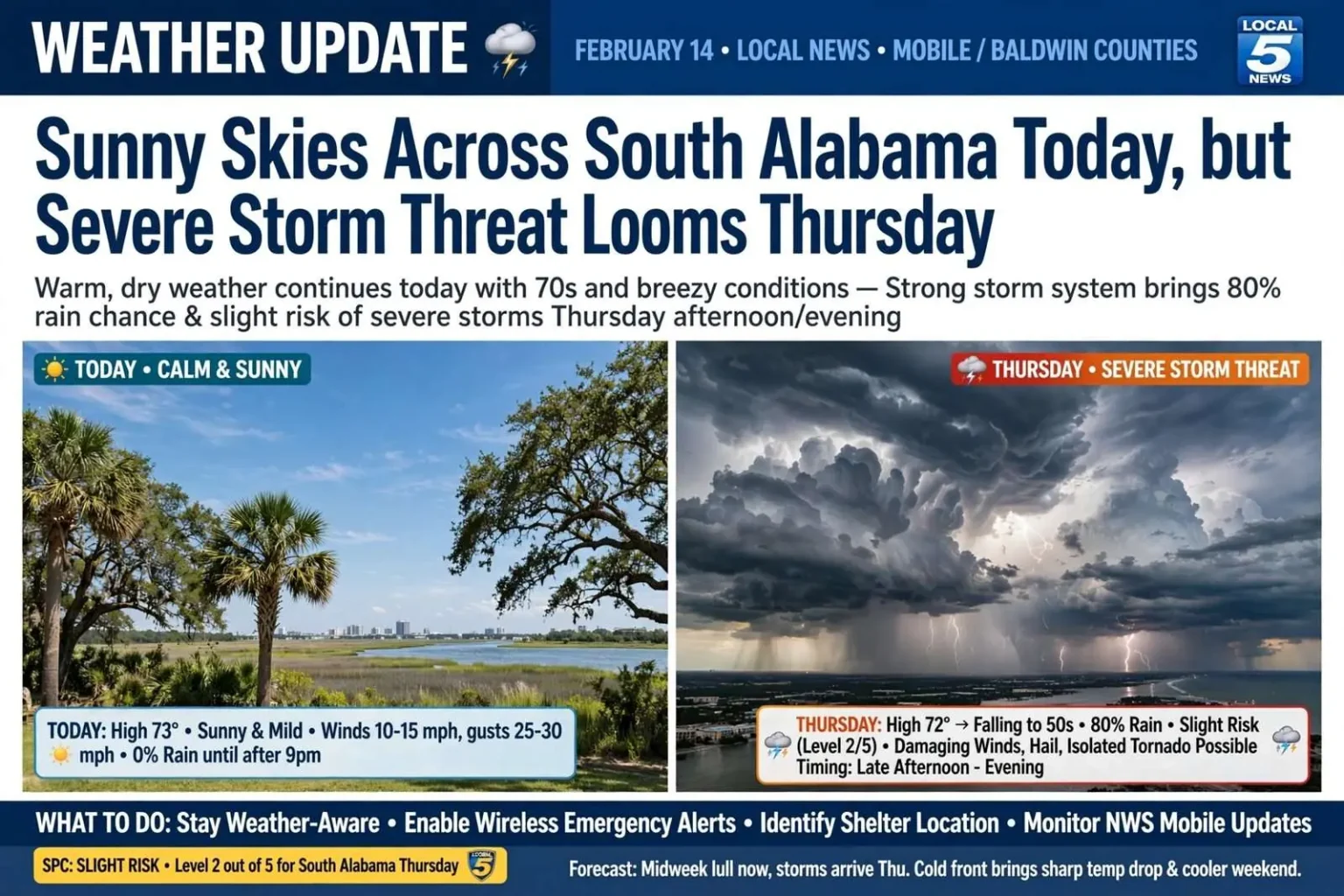
South Alabama enjoyed a mild, sun-filled start to the week after a chilly morning gave way to spring-like afternoon warmth in the 70s, forecasters said, though a stronger weather system later in the week is expected to bring the possibility of severe storms to the region.
The contrast between the two halves of the week made for a classic Gulf Coast forecast: a tranquil stretch of blue skies and warm afternoons, then an approaching storm system with enough energy to demand attention. Forecasters urged residents to enjoy the calm days but to keep an eye on the calendar, because the pattern behind the sunshine was about to change.
After the last chilly morning of the stretch, breezy conditions took hold through the afternoon, with sustained winds of 10 to 15 mph and gusts reaching 25 to 30 mph across the Mobile area. Rain chances were expected to hold off until after 9 p.m., meaning outdoor Valentine’s Day plans were largely unaffected by the incoming system.
The timing was welcome news for the restaurants and venues that count Valentine’s Day among their busiest evenings of the winter. Dinner reservations, downtown strolls and the area’s usual February date nights went forward under dry skies, with the breeze the only reminder that a system was working its way toward the Gulf Coast from the west.
The following morning was forecast to start on the mild side, in the mid-to-upper 60s, with scattered showers possible before clearing by afternoon. Rain chances for that day were pegged at only about 30 percent, with highs again reaching into the 70s.
That midweek lull was the transition period. Behind the first weak disturbance, skies cleared and temperatures rebounded, but forecasters watched the much stronger system lined up behind it — one carrying a deeper supply of Gulf moisture, a sharpening dry line and enough wind energy aloft to raise the possibility of severe weather when it arrived on Thursday.
Thursday’s severe threat takes shape
The bigger concern for the region centers on Thursday, when rain chances jump to around 80 percent alongside a potential severe weather threat. The Storm Prediction Center placed South Alabama in a level 2 out of 5, or a slight risk zone, with gusty straight-line winds along the front identified as the primary hazard.
The Storm Prediction Center in Norman, Oklahoma, issues its categorical risk outlooks on a five-level scale, from level 1’s marginal risk through level 5’s high risk. A level 2 — slight risk — is the most common category for organized severe weather along the Gulf Coast, signaling that forecasters expect scattered severe storms capable of damaging winds, hail or a tornado, without the widespread outbreak conditions implied by the higher categories.
Straight-line winds are the workhorse hazard of Gulf Coast storm systems. When thunderstorms organize into lines ahead of a cold front, their downdrafts can spread out at the ground as damaging gusts that flatten trees, peel roofs and knock out power across wide swaths of a county — damage that is sometimes mistaken for tornado damage in the aftermath but can be just as disruptive.
Forecasters cautioned that an isolated tornado could not be ruled out, with the highest-risk window arriving in the late afternoon and evening hours.
That timing matters for schools, employers and commuters. Late-afternoon and evening storms coincide with dismissal times, the drive home and youth sports and evening events, and emergency managers used the run-up to Thursday to remind residents that severe weather plans need to account for where family members will be when warnings are issued — not just where everyone sleeps.
Temperatures were expected to fall sharply behind the front, ushering in sunshine and chilly conditions to close out the week.
The pattern is a familiar one for February on the Gulf Coast: a warm, moist southerly flow ahead of the front pulls temperatures well above seasonal norms, and the passage of the front swings winds around to the north and drops readings by twenty degrees or more within hours. The same air mass that fuels the storms is followed almost immediately by the kind of crisp, clear days that make late winter along the Gulf so changeable.
What residents should do before Thursday
Local residents are encouraged to stay weather-aware as the system approaches and to have a plan in place in case severe warnings are issued for Mobile and Baldwin counties.
Staying weather-aware starts with the sources of information. A NOAA Weather Radio with battery backup remains the standard recommendation because it sounds an alarm when a warning is issued for the listener’s county, working through the night and during power outages when television and cell service may not. Wireless emergency alerts on smartphones serve the same function for most residents, and meteorologists advise checking that those alerts are enabled rather than silenced.
Plans for the afternoon and evening should include a shelter location: the lowest floor of a sturdy building, an interior room away from windows, a hallway or bathroom, or — for residents of manufactured homes, which are numerous across south Alabama — a pre-identified sturdier structure to reach before the storm arrives. Manufactured home residents are consistently urged to plan on leaving their homes for shelter during any tornado warning rather than sheltering in place.
Households are also advised to prepare for the wind hazard’s side effects. Power outages are likely wherever straight-line winds bring trees and limbs down onto lines, so charged phones, flashlights, medications and a supply of water are the standard checklist items. Drivers should be ready to pull off the roadway if they encounter blinding rain or debris rather than pressing through a squall line.
Why February systems matter on the Gulf Coast
Winter and early spring are peak severe weather seasons for south Alabama, even though the public tends to associate tornadoes with spring and summer farther north. The Gulf supplies deep moisture year round, and the strong jet stream patterns of the cold season — like the one driving this week’s system — provide the wind shear that organizes storms into lines and occasionally rotates updrafts into tornadoes.
The region’s tornado climatology reflects that: Mobile and Baldwin counties have recorded destructive tornadoes in every month of the year, and some of the area’s worst outbreaks have come in the cool season, when nocturnal storms catch residents asleep and unaware. Nighttime tornadoes are disproportionately deadly, which is why evening warnings and functioning alert systems receive so much emphasis in Gulf Coast preparedness messaging.
Local meteorologists and emergency managers routinely point to past cool-season events in the area’s record when urging residents not to discount a slight risk because it arrives in winter, and this week’s setup — a sharp front, a moist Gulf flow and strong winds aloft — is the same basic recipe behind many of them.
How the forecast comes together
Forecasters building the Thursday outlook were tracking several ingredients typical of Gulf Coast severe weather events. The returning southerly flow pulls warm, humid air off the Gulf and loads the atmosphere with instability through Wednesday night and Thursday morning. Aloft, a strengthening jet stream and an approaching upper-level disturbance provide the lift and directional wind shear that organize scattered showers into a squall line ahead of the front.
The slight risk category reflects confidence in that organization — enough to expect a few severe storms — without signaling the extreme parameters associated with higher-end days. Forecast uncertainty in these setups usually centers on details: exactly when the line crosses Mobile Bay, how much instability survives the morning clouds, and whether any storm along the line can briefly rotate. Those questions are why residents are told to monitor updated forecasts rather than treat the risk level as fixed.
Local National Weather Service offices serving south Alabama — the Mobile office covers both coastal counties — issue weather story graphics, briefing packages and updated watches and warnings as the system approaches, and they coordinate with county emergency management agencies on pre-positioning and public messaging.
After the front passes
Once the line clears the coast Thursday night, the forecast flips quickly to the quiet pattern that closes the week. Temperatures were expected to fall sharply behind the front, ushering in sunshine and chilly conditions, with winds shifting to the north and drying out the atmosphere almost immediately after the storms exit.
That post-frontal sunshine is usually welcome, but residents are advised to check for storm damage before assuming all is well. Downed limbs, scattered power outages and local street flooding can linger after a squall line passes even when the afternoon turns bright, and utility crews typically spend the day after a wind event clearing lines across the hardest-hit neighborhoods.
For the week overall, the sequence — warm and dry, a midweek lull, a Thursday severe threat and a chilly finish — is about as compact a demonstration of Gulf Coast winter variability as the calendar offers. The same Gulf that gives the coast its mild, sunny February afternoons supplies the moisture that makes its storm systems dangerous, and south Alabamians live with both sides of that bargain.
The practical guidance remains unchanged from what forecasters have repeated all week: enjoy the sunshine while it lasts, make sure alerts are turned on, know where you will shelter if a warning is issued for Mobile or Baldwin County, and keep watch on updated forecasts as Thursday’s system draws closer.