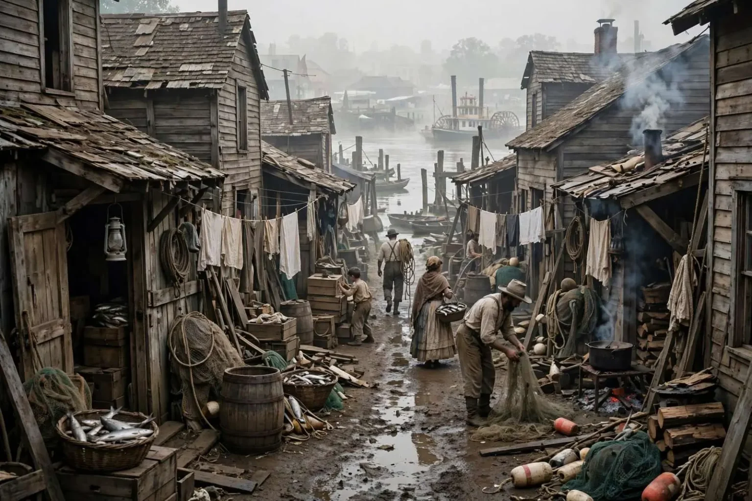
Long before the docks and rails remade Mobile’s riverfront, a cramped, hard-lived district known as Spanish Alley sat in the shadow of the city’s old waterfront. Set between Monroe and Eslava streets, running east from Royal Street toward the river, the neighborhood earned a reputation that lingered in Mobile’s memory long after the last shanty was gone.
Where the alley actually stood is a question collectors of old Mobile lore have wrestled with for generations. Joseph A. Marques, who studied the city’s old streets, described it as an alley connecting Water and Commerce streets, within the block between Eslava and Monroe. Old maps show Monroe Street once reaching the river before being cut off at Water Street; that would place the alley roughly 150 feet north of what is now Eslava Street. However it is mapped, the name gradually spread, over the course of the late nineteenth century, to cover the whole district.
That uncertainty is itself a lesson in how Mobile’s oldest places disappear. Streets were truncated, blocks were regraded, and the riverfront was extended outward over the decades, so the landmarks that once anchored a neighborhood — a street ending at the water, a pier, a row of leaning buildings — were erased one by one. What survived was the name, passed along in reminiscences and newspaper columns by writers who remembered the place or had heard about it from parents and grandparents who did.
A Quarter of Shanties and Workingmen
The alley was about 40 feet wide, lined with shanties, some two stories tall, leaning against each other like two drunks going home. They were dingy and unpainted, home to numerous families of Spanish fishermen and longshoremen, often a family to a room. It was, by all accounts, no place for an afternoon stroll.
The residents who gave the district its name were part of a broader Spanish presence on the northern Gulf Coast. Spain had ruled the Mobile region from the early 1780s until 1813, and Spanish surnames and Spanish-speaking fishing families remained rooted along the coast long after the flags changed. Along the Mobile waterfront, as in the fishing villages down the bay, Spanish families worked the water and the docks, and districts like the alley grew up around them where cheap housing sat closest to the work.
Life there was hard in ways the rest of the city only glimpsed. Fishing families rose before dawn and sold their catch within earshot of their own front doors; longshoremen took whatever cargo work the cotton trade and the steamboat landings offered. The shanties held enormous crowds by any modern standard, a family to a room, with laundry lines and cook fires crammed into whatever space remained. Sanitation was rudimentary, fires were a constant danger in closely packed wooden buildings, and the river itself brought its own hazards with every flood tide.
Anyone traveling the alley at night carried a club or a revolver; even years after it was demolished, the reputation of the place hung like a cloud over the district. The stories that survived — saloons, fights, disappearances — grew with every retelling, the way such stories do, until the alley became less a place on a map than a byword for the rough edge of old Mobile.
Every port city had its version of such a quarter, and Mobile was no exception. The combination of cheap lodging, transient labor, cash wages and saloons produced volatile streets in nearly every waterfront district on the Gulf, and respectable opinion of the era kept its distance while depending on the labor all the same. The men who unloaded the cotton and the boats that fed the city came home to places like the alley, and the city’s commerce was built on their backs even as the city wrote the district off.
How the Name Spread
The exact boundaries mattered less over time than the label. What began as one alley between Water and Commerce streets became, in everyday speech, the name for the whole district between Monroe and Eslava east of Royal Street. Cartographers and chroniclers of the era disagreed about what to include, which is one reason later students of old Mobile, Marques among them, had to sort through conflicting descriptions to pin the place down.
Mobile’s street grid along the river preserves the trace of that argument today. Royal Street, one of the city’s oldest thoroughfares, once marked the high ground above the working waterfront; Water and Commerce streets, as their names suggest, sat where the water and the trade actually were in the nineteenth century. Eslava and Monroe bounded the alley district to the south and north, and the block between them held the shanty rows long after more fashionable neighborhoods had moved up the hill and westward.
The demographic story behind the name repeated itself across the Gulf Coast. Spanish fishing families clustered in Mobile, in Bayou La Batre, and in the coastal villages of Mississippi and the Florida panhandle, keeping family boats and family recipes while their children moved in and out of the trade. In Mobile, the alley district was the urban expression of that community — dense, poor, close to the water, and largely invisible to the parts of the city that bought the fish and shipped the cargo.
The End of the District
Accounts collected by Mobile’s historians — including the writing of Caldewell Delaney in “Craighead’s Mobile” — tell how the district’s history ended: a fire razed the block, according to the tradition, and not long after, the steel rails of a railroad were laid across the ground, and the river piers gradually swallowed the point where the alley once met the water.
Fire was the recurring terror of nineteenth-century shanty districts, and closely packed wooden buildings burned quickly and completely. When the block burned, there was little to rebuild with and, by the accounts that survived, little will to rebuild it. The land along the river was simply worth more for other uses, and the city’s expanding transportation network was ready to claim it.
The railroad’s arrival along the waterfront marked a larger transformation of Mobile’s riverfront in the late nineteenth and early twentieth centuries. Tracks laid along the water’s edge made the wharves an extension of the national rail network, accelerating the port’s cotton and lumber trade but requiring an unbroken corridor of land that no shanty district could be allowed to interrupt. Where families had lived a family to a room, the rails ran straight, and where the alley had met the water, the piers reached farther out into the river than ever before.
By the early twentieth century the alley proper was gone, its name surviving only in the fading legends of old Mobile and in the pages of the histories that tried — and sometimes disagreed — to pin down exactly where it had stood.
Remembering a Vanished Quarter
The alley’s afterlife in memory says as much about Mobile as the place itself did. Old districts that vanish from the map tend to survive as cautionary tales, and the alley was remembered less for the families who lived there than for the danger it supposedly posed to anyone who wandered in. The people who actually built their lives there — the Spanish fishermen who worked the bay, the longshoremen who unloaded the steamboats — left few written records of their own, and their story reached the twentieth century mainly through the reminiscences of outsiders.
That is a familiar fate for working-class waterfront neighborhoods everywhere, but it is worth remembering what the alley actually was: housing, however rough, for the labor that made the port run. The fishermen and longshoremen of the district were part of the same Gulf Coast Spanish community whose descendants still work the water from Mobile Bay down to the fishing towns south of the city. Their quarter disappeared into fire and rails and piers, but their trade never left the coast.
The chroniclers who preserved the alley’s story — Delaney writing in “Craighead’s Mobile,” Marques sorting out the old streets decades later — were doing the work of rescuers. Without their columns and notes, assembled from the memories of aging Mobilians, the district would have vanished without a trace, one more block swallowed by the port’s expansion. Instead, the name survived to be argued over, mapped, and set down in the city’s history books.
Today the ground where the alley stood lies under a century and a half of rebuilt waterfront, far from any street sign that remembers the people who lived there. The riverfront that modern Mobile knows — the paved wharves, the industrial corridors, the stretches where rails once met the water — was built over the old quarters like this one, and the port’s growth required their removal. The alley’s story survives as a reminder that the city’s handsome commercial history rests on neighborhoods that were never commemorated, only remembered by those who knew where to look.
In the end, Spanish Alley belongs to that long list of Gulf Coast places that existed mostly in the memories of working people and the notebooks of local historians. A 40-foot-wide lane of leaning shanties between Monroe and Eslava, home to fishing families a family to a room, dangerous after dark and gone by the early twentieth century — it was never more than a few blocks of the city’s geography, and it turned out to occupy a much larger piece of the city’s memory.