
Volunteers Track Gulf Coast River Health for Alabama Water Watch
Trained volunteers with Alabama Water Watch monitor water quality on Gulf Coast rivers in Mobile and Baldwin counties, supported by the Mobile Bay National Estuary Program.
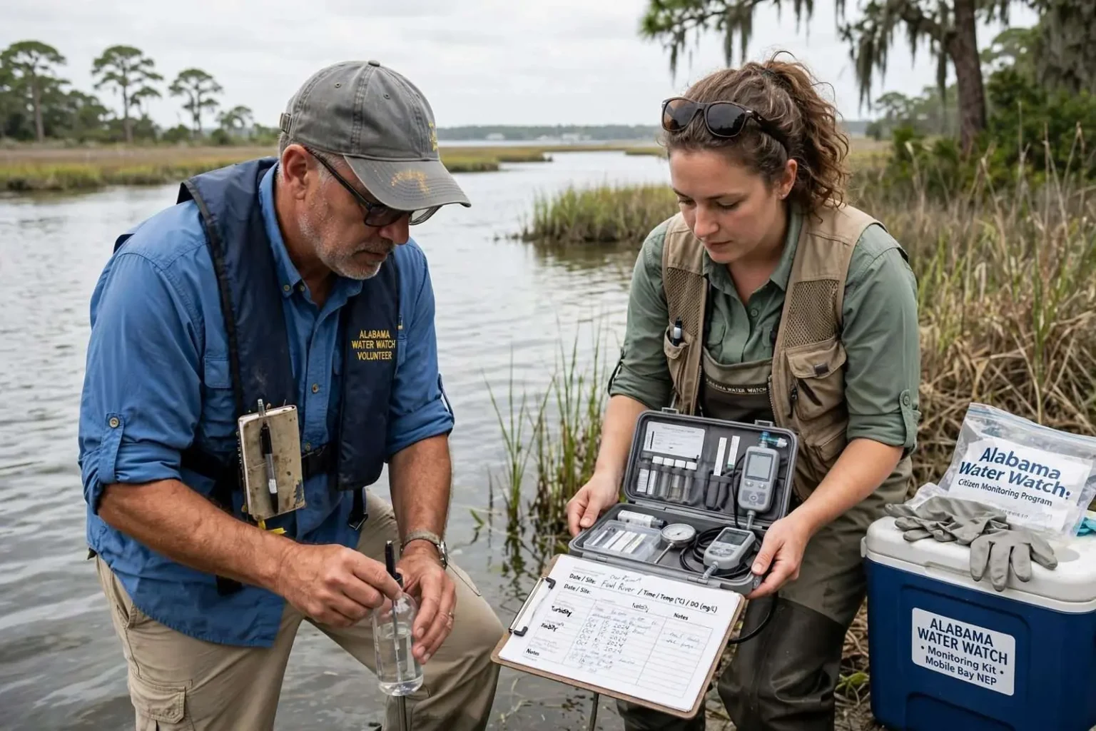
Along the Gulf Coast, some residents are doing more than enjoying the water around them. They are helping study it. Through the Alabama Water Watch program, volunteers are trained to monitor water quality and collect data about the health of their local waterways, and their efforts span creeks, rivers and bays across Mobile and Baldwin counties, including Dog River, Fowl River and Magnolia River, with research and education also taking place through the Weeks Bay Research Reserve.
The program turns ordinary residents into trained monitors who take regular readings from the same sites month after month, building long-term records that no single agency could gather on its own. For the coastal communities of southwest Alabama, where property values, commercial fishing, recreation and tourism all depend on clean water, those volunteer-collected records have become part of how the region understands its own environment.
Starting at Square One
“That’s one of the great things about the Alabama Water Watch program — you don’t have to be a scientist. You don’t have to have scientific training to be a volunteer water quality monitor. Really, all of the training starts you off at square one,” said Blair Morrison, lead monitoring scientist for the Mobile Bay National Estuary Program.
The volunteers watch for patterns over time rather than reacting to any single reading. “Well, we look for trends. Look for anything that’s out of normal. And if we find something that’s out of normal, we report it in to either the Department of Health or Environmental Quality,” said Ted Henken, a water quality monitor volunteer at the Fowl River.
That routine discipline is what gives the data its value. A single cloudy sample on a single afternoon means little; the same site trending worse over successive months can signal erosion upstream, failing septic systems, or runoff from new development. By standardizing how samples are taken and recorded, Alabama Water Watch makes it possible to compare readings across seasons and across watersheds, which is exactly what state agencies need when they decide where to direct attention and resources.
Data That Drives Action
The goal is more than simply collecting numbers. Volunteer monitoring groups have used their data to identify problems, work with local and state agencies, and advocate for stronger protections for waterways.
“It’s important to have residents collecting the data themselves because, again, they’re folks that live here along these water bodies. They’re the first ones who would notice if something is off. And they’re the people that interact with these resources on a daily basis,” Morrison said.
For those doing the work, the connection goes beyond science. “I think I’m making a difference because I can feel comfortable that my grandchildren can swim in the river and it not be unsafe for them. And that was probably the most important point to me,” Henken said.
That personal stake is a defining feature of the program. Volunteers monitor the creeks and rivers that run behind their own homes and through their own neighborhoods, which makes them both the first to notice a change and the most persistent advocates for fixing it. A fish kill, an oily sheen after a storm, or a stretch of bank collapsing into the water is noticed by the people who live beside it long before it appears in any official report.
The Program Behind the Volunteers
The Mobile Bay National Estuary Program helps provide the resources and training residents need to take part. “We support, providing all of the supplies and the kits, for over 100 coastal volunteer water quality monitors throughout Mobile and Baldwin County, and I believe our latest numbers is that this past quarter, they submitted a cumulative number of over 500 data records just in the last three months,” Morrison said.
The scale of that effort matters. More than a hundred monitors working simultaneously across two counties produces a picture of coastal water health that would be prohibitively expensive to assemble with paid staff alone. Each of those 500 quarterly records represents a trained volunteer visiting a fixed site, running standardized tests, and logging results that agencies and researchers can draw on when they evaluate the condition of a bayou, a river or a bay.
The Mobile Bay National Estuary Program itself exists to coordinate exactly this kind of work. As one of the National Estuary Programs established under the Clean Water Act, it brings together government agencies, conservation groups, businesses and residents around a shared management plan for the Mobile Bay watershed, one of the largest estuarine systems in the United States. Supporting a trained corps of volunteer monitors fits squarely within that mission, extending the program’s reach into coves and creek heads that agency staff could never sample regularly on their own.
From Dog River to Weeks Bay
The monitoring effort spans waterways across Mobile and Baldwin counties, including Dog River, Fowl River and Magnolia River, with research and education also taking place through the Weeks Bay Research Reserve. Each of those waterways tells a different story about the coast. Dog River drains a heavily developed urban watershed in Mobile, where stormwater runoff is a persistent concern. Fowl River winds through a mix of suburban and still-rural land south of the city before reaching Mobile Bay. The Magnolia River flows into Weeks Bay, one of the state’s most studied bodies of water.
At Weeks Bay, the reserve serves as both a living laboratory and an education center, hosting long-term research on the estuary’s water quality, habitats and wildlife while offering programs that introduce students and adults to the science of coastal ecosystems. Pairing reserve-based research with the volunteer network creates a bridge between formal science and community observation, and it means that when something unusual shows up in a volunteer’s data, there are professionals nearby with the tools to investigate it further.
Why Volunteer Data Carries Weight
State and county agencies have come to rely on citizen monitoring data for reasons that go beyond cost. Volunteers are on the water year-round, including in the quiet months when agency staff are stretched thin, and they are often the first to document a problem while it is still small and traceable. When a volunteer flags an abnormal reading to the Alabama Department of Public Health or the Alabama Department of Environmental Management, it can trigger follow-up sampling, a pollution source investigation, or a public advisory before the situation worsens.
The training requirement is what separates a program like Alabama Water Watch from casual observation. Volunteers learn calibrated procedures for testing water chemistry, standard methods for measuring clarity and dissolved oxygen, and consistent formats for recording what they find. Because every monitor follows the same protocols, their results can be compared with confidence, and the program’s certified data has been used in watershed management plans, restoration projects and water quality studies across the state.
What Residents Can Do
For coastal residents interested in joining, the path is straightforward: sign up for a training workshop, get certified in the standard monitoring methods, and adopt a monitoring site on a waterway near home. Supplies and support come through partner organizations such as the Mobile Bay National Estuary Program, which coordinates the coastal network and supplies kits for more than a hundred active monitors. Training sessions are held regularly, and no scientific background is required to begin.
Even for those who never take a sample, the program’s findings filter into daily life along the coast. The health of Dog River, Fowl River, Magnolia River and the streams feeding Weeks Bay shapes whether it is safe to swim, whether fish populations stay strong, and whether the marshes and seagrass beds that buffer the shoreline against storms keep functioning. Protecting the Gulf Coast does not always start in a laboratory or a government office. Sometimes it starts with a resident, a water sample and a willingness to get involved.
A Model With Deep Roots in Alabama
Alabama Water Watch has been building this network for decades, training thousands of monitors across the state since its founding through Auburn University. The program’s longevity is part of why its data carries credibility: some coastal sites now have monitoring records stretching back further than many agency sampling efforts, giving researchers a rare long-term view of how urbanization, hurricanes and restoration work have changed individual waterways.
That history also created a culture around the program. Many of the coastal monitors have been testing the same sites for years, and several learned the craft from neighbors or family members who trained before them. The result is a community of residents who know their rivers intimately — where the current slows, where erosion bites the bank after heavy rain, and what the water usually looks like in a given season — and who can spot an anomaly that a rotating roster of agency staff might never catch.
The program also feeds into larger regional efforts. Data from coastal monitors supports watershed planning, helps track recovery after tropical storms, and contributes to the ongoing work of restoring the Mobile Bay estuary, where freshwater from the nation’s fourth-largest river system by flow meets the Gulf of Mexico. Every certified volunteer who adopts a site adds another permanent observation post to that effort, and another resident with the knowledge to explain to neighbors exactly what the data means for the water at the end of their street.