Bayou La Batre Police: Multiple Roads Impassable as Hurricane Ida Nears
Bayou La Batre police reported multiple roads impassable from rising water as Hurricane Ida approached the Gulf Coast on Aug. 29, 2021.
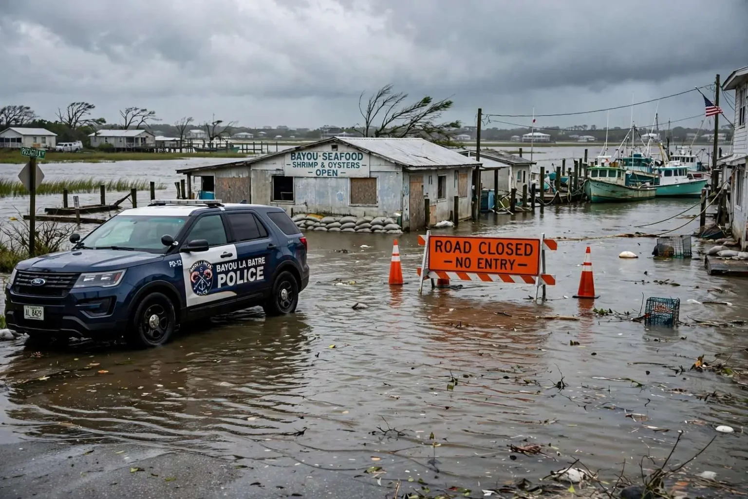
BAYOU LA BATRE, Ala. — The Bayou La Batre Police Department reported Sunday morning, Aug. 29, 2021, that multiple roads in the waterfront community were impassable because of rising water as Hurricane Ida churned north through the Gulf of Mexico toward the northern Gulf Coast. The advisory put one of Mobile County’s most flood-prone towns on the map of Ida’s growing emergency, hours before the storm even made landfall.
Police said water had moved over roadways across the city as winds out of the south pushed Gulf water into Mississippi Sound and up against the shoreline. The geometry of the event was straightforward: a powerful storm to the southwest, sustained south winds stacking water against the coast, and a town that sits barely above the tide line with nowhere for the water to go except across its streets.
Water covering low-lying streets
Bayou La Batre, a working seafood town of roughly 2,000 residents on the western shore of Mobile County, sits at low elevation along the Sound, making its streets especially vulnerable to storm surge even from storms that make landfall well to the west. The town’s location at the head of its namesake bayou, ringed by water on the seaward side, means that surge events arrive not as a distant threat but as water in the yards and across the roads of neighborhoods where fishing boats and seafood houses line the waterfront.
That vulnerability does not require a direct hit. A storm making landfall far to the west still pushes its surge bands eastward, and the onshore flow ahead of the storm raises water levels for hours before the worst weather arrives. By the time Ida’s center came ashore, Bayou La Batre had already spent a morning with impassable roads — flooded under water that residents could see rising but could do nothing about except stay off it.
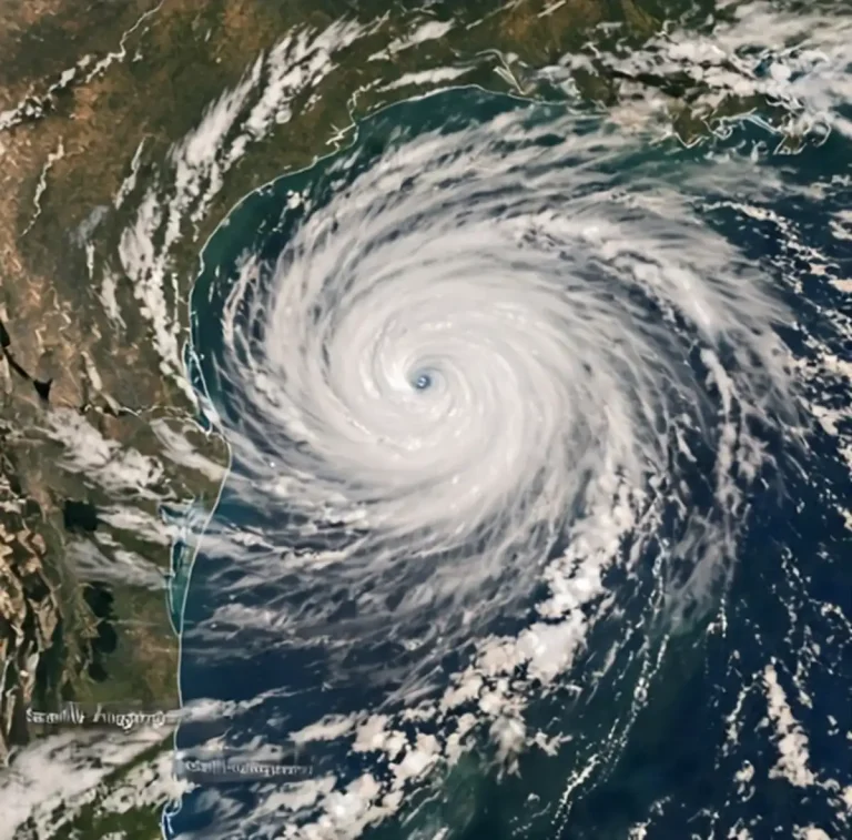
Ida comes ashore as a Category 4
Ida strengthened rapidly overnight before coming ashore that afternoon near Port Fourchon, Louisiana, as a Category 4 hurricane. The storm’s rapid intensification — from a gathering system in the Gulf to a major hurricane aimed at the Louisiana coast inside a day — left little slack in preparation timelines for communities across the entire northern Gulf, including Alabama’s coastline, which sat on the storm’s weaker but still dangerous eastern side.
Even with the center aimed at southeast Louisiana, eastward-extended surge bands and onshore winds flooded coastal roads across Mobile County’s bayou communities. The pattern is a familiar one for Gulf Coast emergency managers: the most destructive winds go where the eyewall lands, but the water spreads far beyond it, and communities dozens of miles from landfall can see their roads go under while the skies above them are merely gray and gusty.
Officials urged residents to stay off flooded roads
Emergency officials repeated their standing advice during the event: never drive through water covering a roadway, where the depth and condition of the pavement beneath cannot be seen. Just a foot of moving water can carry away a passenger vehicle, and floodwater routinely hides washed-out road shoulders, open drains and debris that can disable a car in inches of water. The deaths in coastal flooding events skew heavily toward drivers who misjudge a covered road, which is why the warning is repeated in every surge advisory.
Residents were asked to shelter in place until water receded and crews could assess damage. With streets impassable, sheltering in place was not merely advice but the only practical option for many households — the flooded roads that kept residents home also kept emergency vehicles out, a reality that shapes how bayou communities ride out every coastal storm.
A seafood town that lives with the water
Bayou La Batre’s economy and its geography are the same story. The city has long been one of Alabama’s centers of commercial seafood, home to a fleet of shrimp boats, oyster boats and processing houses, and its shipyards have built and repaired vessels for generations. That livelihood puts the community directly on the waterfront — the same waterfront that surge turns hostile whenever a Gulf storm approaches, from whichever direction.
Residents of the bayou measure storms by water marks, and the town’s history with them stretches back decades: Frederic, Georges, Katrina, and most recently Sally. Each event follows the same script in miniature — water rises with the south wind, streets flood first, the fleet seeks shelter, and the community waits for the Sound to give the streets back. Ida’s flooding fit the pattern precisely, arriving on south winds before the storm had even made its Louisiana landfall.
Nearly a year after Sally
The flooding came nearly a year to the week after Hurricane Sally pushed record surge into the same stretch of coastline in September 2020, an event still fresh for Bayou La Batre families repairing homes and boats along the bayou. Sally had struck the coast as a slow-moving Category 2 with catastrophic surge and rainfall, and its damage was still being repaired in places when Ida’s approach sent water over the same streets again.
For households still working insurance claims or contractor lists from Sally, an advisory of impassable roads was more than an inconvenience — it was a test of unfinished recovery. Storm-tired roofs, repaired seawalls and replaced flooring faced another round of surge within a single year, a one-two sequence that has become a defining feature of life on the northern Gulf Coast, where the interval between damaging storms has repeatedly been measured in months rather than decades.
How surge advisories work
The Bayou La Batre police advisory, issued as Ida approached, followed the standard choreography of a Gulf Coast surge event. National Weather Service forecasts project surge heights by coastal zone; county and municipal emergency agencies translate those projections into road closures and shelter decisions; and local police departments — often the closest voice to the community — push out street-level warnings about which routes are under water. In a town the size of Bayou La Batre, that local reporting travels fast, by social media and word of mouth, to households deciding whether to move cars to higher ground and hunker down.
Residents of low-lying coastal communities are encouraged to plan for surge before any storm enters the Gulf: knowing which routes out of the neighborhood flood first, moving vehicles to elevated ground, securing boats and gear, and keeping supplies on hand for a night or more of sheltering in place. When the advisory comes — as it did the Sunday morning of Aug. 29, 2021 — the preparation is already done or it is too late.
Waiting for the water to fall
Surge flooding from a distant landfall typically recedes within a day or two of the wind shift, leaving behind debris lines, soaked floors and the damage assessment that follows every event. Police and public works crews reopen roads only after checking them for washouts and hazards, and residents return to the slow arithmetic of cleanup — drying out, filing claims, counting what the water took.
Ida’s Sunday-morning flooding in Bayou La Batre ended as those events do, but the episode added another entry to the town’s record of surge events and another argument for the resilience work coastal Alabama continues to pursue. For a community of 2,000 people whose streets sit at the mercy of the Mississippi Sound, every storm in the Gulf is a local event — and on the last Sunday of August 2021, Ida proved it without ever coming within a hundred miles of the bayou.
Mississippi Sound and the mechanics of surge
The body of water that drives Bayou La Batre’s flooding is Mississippi Sound, the shallow, sheltered lagoon running behind the barrier islands from Dauphin Island west toward the Mississippi coast. Shallow water stacks higher than deep water under the same wind, which is why Sound-side communities flood from storms that would barely ruffle a town on a deep harbor. South winds have an unobstructed run down the axis of the Sound, gathering water and pushing it into the bayous and rivers that drain the coastal marsh — including the bayou that gives the city its name.
That geography explains a fact that surprises newcomers: the severity of a flood in Bayou La Batre is set less by how close the storm’s center comes than by how long the south wind blows ahead of it. A large, slow storm hundreds of miles away can raise the Sound higher than a small hurricane passing quickly to the east, and the worst flooding often arrives hours before landfall, when the wind field is widest and the onshore flow strongest.
Preparedness in a town that floods first
Bayou La Batre’s repeated experience with surge has built a local culture of preparation that starts long before a storm enters the Gulf. Boat owners double their lines and move upbay; households know which neighbors’ driveways sit on the town’s few rises of higher ground; and the seafood houses that anchor the economy stage their equipment with an eye on the water gauge. The police department’s morning advisory — plain-spoken, street-specific — is the public face of that preparation, telling residents not that a storm is coming but that their roads are already going under.
The town has also been the focus of repeated recovery and resilience efforts in the years since Katrina, from elevated construction in rebuild programs to drainage and mitigation projects aimed at shortening the flooding cycle. Each project buys back a little margin against the Sound, but no project changes the essential fact: the town exists because of the water, and the water will keep visiting the streets.
The Gulf Coast’s new storm rhythm
The back-to-back sequence of Sally in 2020 and Ida in 2021 compressed into a single year what coastal Alabama once measured in generations. Sally’s record surge damaged the same bayou communities that Ida’s outer bands flooded a year later, and the interval between the two left little time for recovery to finish. Families repairing a roof in the spring of 2021 heard a storm named Ida entering the Gulf that August, and knew exactly what the south wind would do to their streets.
That rhythm — prepare early, heed the road advisories, shelter in place while the water crosses the streets, and rebuild after — is now simply the operating manual for life on the Sound. On Aug. 29, 2021, as Ida came ashore in Louisiana as a Category 4, Bayou La Batre’s police department gave the town its usual early warning, the water did what the geography said it would, and the community once again waited out a storm that never came close — and never had to.