Dry, Sunny Pattern Persists Across South Alabama as Drought Deepens
A mostly sunny, warm week is ahead for the Mobile area, but no rain is in sight as the Gulf Coast drought worsens and forecasters track Hurricane Tammy and a Caribbean disturbance.
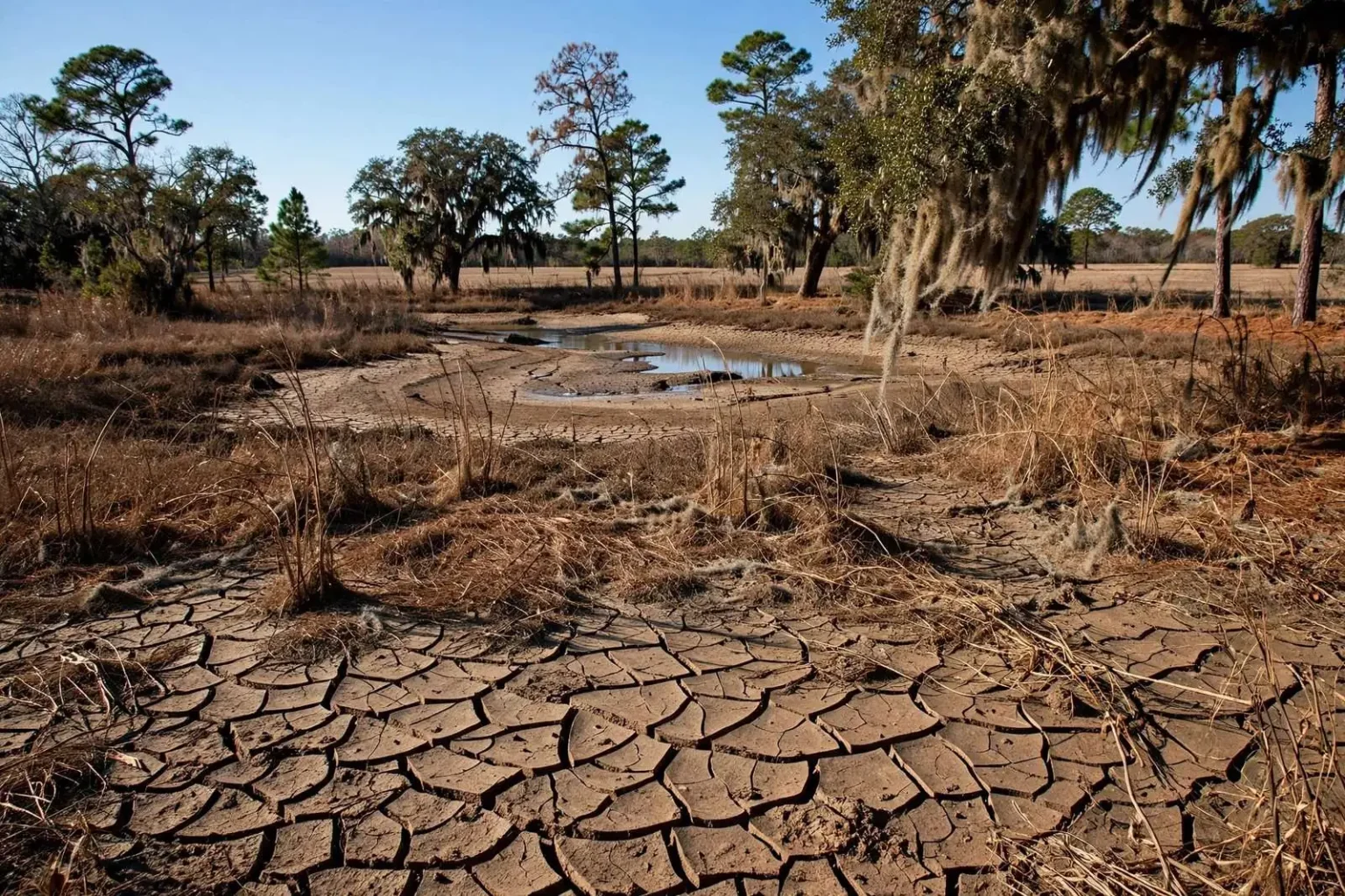
South Alabama residents can expect a stretch of warm, dry weather to open the week, with little relief in sight for a drought that has tightened its grip on the Gulf Coast in recent months. Monday is shaping up to be mostly sunny with highs climbing into the mid-80s, well above what is typical for late October. The fair skies are good news for outdoor plans, but they underscore a deepening moisture shortfall across the region.
Mobile has crept close to a 10-inch rainfall deficit for the year, while Pensacola is not far behind at nearly 7 inches below normal. Both areas remain classified in the extreme-to-severe drought category, and forecasters say no meaningful rain is expected through the coming week. The numbers place the central Gulf Coast among the driest stretches of the Southeast, and each additional rain-free day pushes the deficit deeper.
A Drought That Keeps Building
Drought classifications used by forecasters and water managers come from the U.S. Drought Monitor, a weekly product assembled by federal agencies that blends rainfall totals, soil moisture, streamflow and vegetation health. A place can land in severe drought or extreme drought after months of below-normal rain, and recovery typically requires not one big storm but a sustained stretch of above-average rainfall. That is why a single passing shower does little to change the picture across Mobile, Baldwin, Escambia and neighboring counties.
The current pattern is being held in place by persistent high pressure aloft, which suppresses cloud formation and blocks the kind of organized storm systems that deliver widespread soaking rain. Without a strong front to sweep the moisture back in, forecasters see little to break the dry stretch through the next seven days. Long-range guidance offers only a modest chance of improvement, meaning the region could carry a significant rainfall deficit into the start of the new season.
Prolonged dry stretches like this one raise concerns for area farmers, increase the risk of brush and wildfires, and can strain water systems that depend on steady rainfall to recharge. For agricultural producers across south Alabama, a shortfall this late in the growing season affects winter grazing, the planting of cool-season forages and the moisture available in the soil heading into spring. Hay supplies can tighten as pastures stop producing, which pushes up feed costs for cattle operations.
Fire Weather Concerns Rise
The wildfire risk is one of the most immediate practical concerns tied to a dry October. The Alabama Forestry Commission tracks burn conditions across the state, and extended rain-free periods combined with low humidity and breezy afternoons can turn pine straw, fallen leaves and cut fields into ready fuel. Residents are typically urged to delay outdoor burning until conditions ease, and landowners who do burn are asked to obtain the required permits and keep firefighting equipment close at hand.
Brush fires under drought conditions can also smolder deep in organic soils and reignite days later, which makes suppression harder and more expensive. Fire officials across the region generally ask residents to be careful with anything that throws sparks, from yard equipment to backyard fire pits, and to keep a water source nearby whenever burning is allowed at all.
Temperatures will stay mild overnight through the rest of the week, with morning lows generally in the low to mid 60s. Daytime highs are expected to hold in the low 80s Tuesday through Thursday before climbing back into the mid-80s by Friday and into the weekend. The pattern points to a warmer-than-average finish to October across South Alabama, extending a stretch of unseasonably high temperatures that has coincided with the ongoing dry spell.
The warmth is notable for late October, a month when the Mobile area normally transitions toward milder autumn weather. Afternoon readings running several degrees above seasonal norms, combined with the lack of rain, mean evaporation continues to pull moisture from soils even as none arrives to replace it. That feedback loop is part of why droughts that begin in late summer often intensify through the fall if the upper-level pattern stays stuck.
Beach Forecast: Rip Current Risk Climbs
Beachgoers should keep an eye on changing surf conditions this week. The rip current risk is expected to remain low at area beaches on Monday, but forecasters say that risk will climb to high on Tuesday and Wednesday, meaning swimmers should use extra caution and heed posted flags and lifeguard guidance.
The jump in the risk level is tied to onshore winds and shifting surf conditions along the coast, which can concentrate water flow through channels between sandbars. Rip currents are narrow, fast-moving channels of water that pull swimmers away from shore, and they do not drag people under; the danger comes from exhaustion for anyone trying to swim directly against the current. Safety guidance from the National Weather Service and beach patrol officials is consistent: stay calm, float or tread water, and swim parallel to the beach until free of the current, then angle back toward shore.
Lifeguards and flag systems at Gulf Shores, Orange Beach and the Florida panhandle beaches use a color code to communicate daily conditions, and a high rip current risk generally corresponds to the most serious flags short of a beach closure. Visitors arriving midweek should check the flag status at their particular beach before entering the water, since conditions can vary from one stretch of coastline to another. Weaker swimmers and children are advised to stay in shallow, guarded areas, and no one should swim alone or at unguarded beaches when the risk is elevated.
The elevated rip current risk comes at a time when many visitors are drawn to the coast by the warm, dry weather that dominates the inland forecast. Sunny skies and mid-80s temperatures make the beach attractive even in late October, so officials emphasize that pleasant conditions on the sand can coexist with hazardous conditions in the surf.
Tropical Systems Stay Well Away
Out in the Atlantic, Hurricane Tammy continues to churn well offshore, tracking on a path that could bring it close to Bermuda by the end of the week. The storm is not expected to have any direct impact on the Gulf Coast.
While the Gulf of Mexico remains quiet for coastal Alabama interests, the late-October calendar is a reminder that the Atlantic hurricane season runs through the end of November, and systems can still form in the Caribbean and the western Atlantic even as frontal passages become more common along the northern Gulf Coast. Local emergency managers generally encourage residents to keep basic preparedness plans current through the end of the season rather than packing preparedness away early.
Meteorologists are also monitoring a separate tropical disturbance in the southwestern Caribbean Sea, which has a medium chance of organizing before it is forecast to move inland over Nicaragua as early as Tuesday, keeping it well away from Alabama’s coastline. Any development in that part of the Caribbean would pose a concern mainly for Central America, not the northern Gulf, but forecasters will continue tracking the disturbance until it moves ashore.
Water Conservation in Focus
With no rain in the forecast and above-normal temperatures expected to linger, water conservation remains a priority for communities across the Mobile-area region as the drought shows no signs of easing in the near term. Water systems across south Alabama rely on a mix of surface water and groundwater, and both sources depend on steady rainfall to stay replenished. When weeks pass without significant precipitation, usage for lawn irrigation and outdoor washing tends to climb at exactly the moment supply is under the most pressure.
Utilities typically respond to prolonged dry spells by asking customers to limit lawn watering to certain days, to water early in the morning when evaporation losses are lowest, and to fix leaking faucets and irrigation heads. Simple measures such as shorter showers, full dishwasher and laundry loads, and shutting off sprinkler systems during rainy weeks all add up across a service area the size of Mobile County. Residents on private wells face their own considerations, since declining water tables can force wells to work harder and can affect neighbors drawing from the same aquifer.
Municipal suppliers watch reservoir levels, stream gauges and well depths closely during drought periods, and voluntary conservation requests can graduate to mandatory restrictions if conditions deteriorate. Officials generally stress that responding early to voluntary requests helps keep more aggressive measures from becoming necessary.
What the Rest of the Week Looks Like
The day-by-day forecast is remarkably stable. After Monday’s sunshine and mid-80s highs, look for low 80s from Tuesday through Thursday, with morning lows in the low to mid 60s and light winds. Friday and the weekend bring a modest warm-up back to the mid-80s under continued mostly sunny skies. No organized rain chance appears anywhere in the seven-day window, which is a forecast with two sides: excellent conditions for outdoor work, sports and events, and another week of deepening drought.
Residents with outdoor plans this week face essentially no weather obstacles inland, but the combination of dry air, warm afternoons and elevated fire danger means caution with any open flame. Along the coast, the midweek rip current risk is the main hazard to track, and anyone planning a beach day Tuesday or Wednesday should plan around the flags rather than assume the calm conditions of Monday will hold.
The bottom line for South Alabama: a warm, dry, quiet stretch of late October weather is ahead, but it comes at the cost of a drought that continues to deepen. Until a wetter pattern arrives, farmers, firefighters and water managers across the region will be watching the sky and asking residents to do their part, one saved gallon and one avoided spark at a time.