Sheriff’s Office Crime Map Logs Saturday Afternoon Shooting in Mount Vernon
The Mobile County Sheriff's Office crime map logged a shooting reported in Mount Vernon at 4:17 p.m. Saturday. No further details were released.
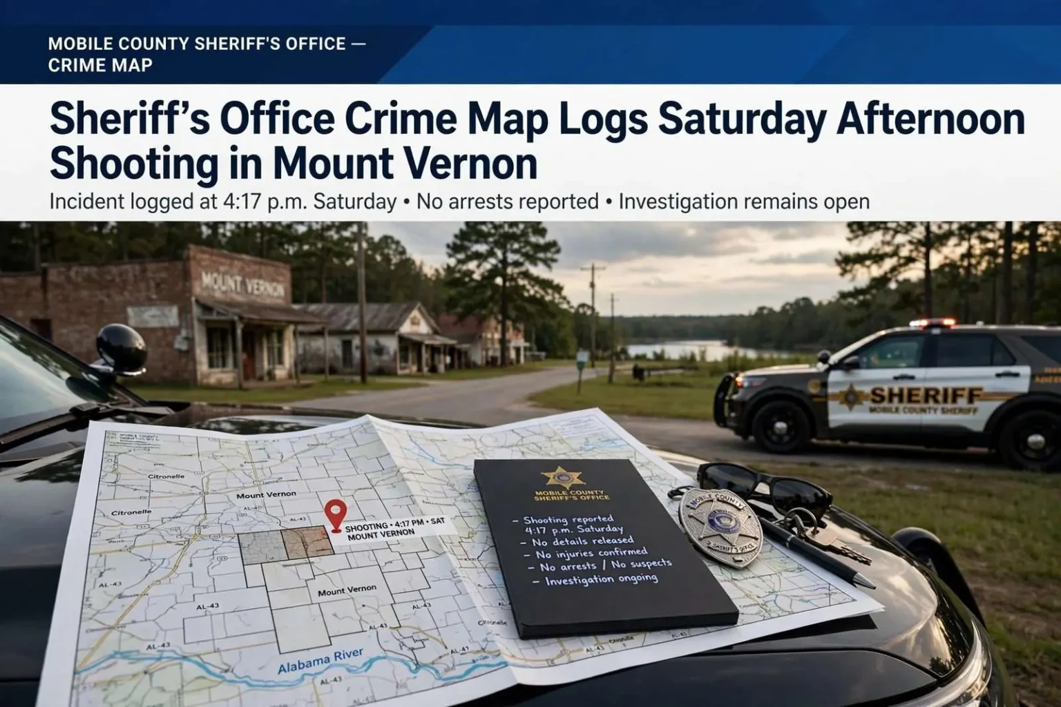
MOUNT VERNON — A shooting was reported in Mount Vernon on Saturday afternoon, according to an entry on the Mobile County Sheriff’s Office crime map. The incident was logged at 4:17 p.m.
The sheriff’s office did not release further details, including the exact location, how many people were involved, or whether anyone was injured. The entry itself carried only the basic classification and time stamp that the public mapping system records when a call for service comes in, leaving the circumstances of the report unknown to anyone monitoring the map from outside the investigation.
Investigators had not announced any arrests or named any suspects in connection with the report, and no additional information was made available by the agency at the time. That silence is common in the hours and days after a rural shooting report, when detectives are still sorting out what happened, who was involved, and whether the account that produced the original call holds up as evidence accumulates.
Mount Vernon is a small community in northern Mobile County along the Alabama River corridor, roughly 30 miles north of downtown Mobile. Incidents in the unincorporated and small-town parts of the county fall under the jurisdiction of the Mobile County Sheriff’s Office, which publishes reported calls to a public crime map so residents can see what deputies are responding to across the county’s vast territory outside the city limits of Mobile and the other incorporated municipalities.
Anyone with information about a crime in Mobile County can contact the sheriff’s office directly, and investigators typically lean on tips from residents in cases that begin with a thin public record like this one. In a community the size of Mount Vernon, where deputies and residents often know one another, that flow of information can determine whether a case moves quickly or stalls.
How the Sheriff’s Office Crime Map Works
The Mobile County Sheriff’s Office crime map is a public-facing tool that plots calls for service and reported incidents across the county’s unincorporated areas and small towns. Entries typically include the type of call, the general location, and the time it was logged, giving residents a running picture of what deputies are handling from Citronelle and Mount Vernon in the north down through the communities south of the city.
Mapping systems of this kind have become standard equipment for sheriff’s offices nationwide, part of a broader push toward transparency in agencies whose jurisdictions sprawl across hundreds of square miles. For a county like Mobile, where the sheriff’s patrol area includes everything from suburban fringes to isolated river communities, the map is one of the few windows residents have into activity that never generates a press release.
The tradeoff is that map entries are preliminary by design. A logged report reflects the call as it came in, not the verified outcome of an investigation, and agencies caution that entries can change classification, be canceled as unfounded, or lead to arrests that are announced separately. A shooting entry with no injury information may resolve as anything from a shot fired with no victim to a serious wounding, and the map alone does not distinguish between them.
That preliminary quality is why law enforcement agencies pairing maps with public appeals urge residents to treat them as starting points for awareness, not conclusions. The sheriff’s office publishes the data so people can see patterns near their homes and roads, and investigators count on the same audience to supply the context that turns a log entry into a case.
Mount Vernon: A Small Town With a Long History
Mount Vernon occupies a distinctive place in the history of northern Mobile County. The community grew around a military post established on the Alabama River in the early 19th century, and the old Mount Vernon Barracks site remains one of the area’s historical landmarks. The town later became known for the public institutions located there, and its scale has always been modest: a compact community surrounded by the piney woods and river bottoms of the county’s northern end.
Geography shapes policing there. The Alabama River corridor and the surrounding rural stretches mean long response distances for deputies, and the town’s location along the routes connecting Mobile to the northern county places it along paths that carry both ordinary commuter traffic and, at times, activity that draws law enforcement attention. Small towns in that position report crime at rates that ebb and flow, and a single serious incident can register as a significant share of a small community’s annual total.
Sheriff’s coverage of the area reflects that rural reality. Deputies patrolling the county’s northern tier cover territory measured in dozens of miles between communities, with mutual aid arrangements tying together the sheriff’s office, municipal police departments where they exist, and neighboring county agencies. When something serious happens in a town the size of Mount Vernon, the investigative capacity that arrives is typically the sheriff’s office detective bureau, supported by whatever forensic resources the case requires.
Shootings in Rural Communities: What the Record Shows
Shootings logged without immediate detail are a familiar pattern in rural law enforcement across Alabama. The initial call often captures little more than the sound of gunfire reported by a neighbor, a victim or witness who drives to safety before deputies arrive, or a scene that has emptied out by the time the first unit rolls in. Building a case from that starting point means canvassing for witnesses, collecting shell casings and other physical evidence, and waiting on hospital reports if an injured person turns up at a medical facility later.
It is also common for the understanding of an incident to shift as investigators work. A report logged as a shooting may become a case of reckless discharge, an altercation that never involved live fire at all, or a homicide investigation if a victim dies. Until the sheriff’s office confirms what the evidence shows, the only reliable facts are the ones in the log: the classification, the time, and the general location.
Gun violence in small Alabama towns mirrors many of the dynamics seen in larger cities, scaled down: disputes between people who know each other, firearms close at hand, and investigations that succeed or fail on whether the community cooperates. Rural agencies report that clearance in such cases depends heavily on witnesses coming forward, since physical evidence alone rarely identifies a shooter in an incident with no surveillance cameras nearby.
The sheriff’s office has historically encouraged residents to report not just crimes but suspicious activity, from unfamiliar vehicles lingering at vacant houses to the sound of gunfire in areas where target practice is not expected. That stream of calls is what populates the crime map in the first place, and it is the raw material from which investigations like Saturday’s report are built.
As of the latest available information, the Mount Vernon entry remained unchanged: a shooting reported at 4:17 p.m. on Saturday afternoon, with no confirmed injuries, no named suspects, and no arrests announced. Residents with any knowledge of the incident were urged to contact the Mobile County Sheriff’s Office, and updates would come from the agency itself as investigators establish what happened.
Why Public Crime Data Matters in a Big Rural County
Mobile County is one of the largest counties in Alabama by both population and land area, and the sheriff’s office’s responsibility for everything outside its incorporated cities makes public crime data more consequential there than in places where a single police department covers a compact jurisdiction. Residents in communities like Mount Vernon, Citronelle, Grand Bay, and Wilmer are often miles from the nearest patrol station, and the crime map is one of the few regularly updated sources showing what is happening in their immediate surroundings.
Transparency tools of this sort also shape how communities perceive safety. Research on public crime mapping has found mixed but real effects: residents generally value the visibility, while criminologists caution that raw call data can exaggerate some kinds of crime and miss others, since many incidents are never reported at all. In small towns, where a handful of serious incidents in a year can feel like a wave, that context matters when reading the map.
The sheriff’s office’s decision to publish the data also creates accountability in both directions. Residents can see whether calls in their area receive follow-up, and the agency can demonstrate the breadth of its workload across a territory where patrol demands range from domestic disputes on isolated roads to commercial burglaries along the highway corridors. For the northern communities in particular, the map is a periodic reminder that they share a sheriff’s office with the entire rest of the county outside Mobile’s city limits.
For now, the public record of the Mount Vernon shooting consists of that single logged entry, and the next developments will come from the sheriff’s office itself. The pattern in such cases is familiar: investigators work the scene and the witnesses, the log entry eventually acquires an outcome or quietly drops from view, and the community learns what happened only if the agency announces it or word travels the way news always has in small Alabama towns.