Volunteers Push to Build 550-Mile Hiking Trail Stretching From Gulf Shores to North Alabama Mountains
The Alabama Hiking Trail Society is working to create a 550-mile hiking trail from Fort Morgan to north Alabama's Walls of Jericho.
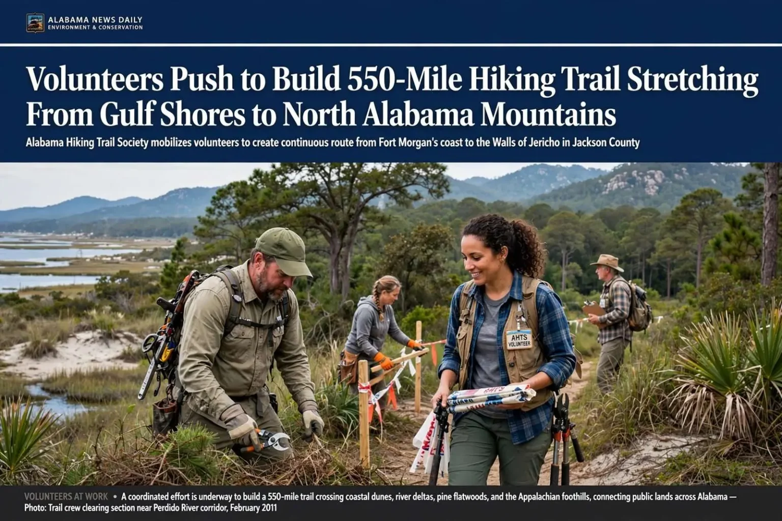
A group of dedicated volunteers is working to create an ambitious 550-mile hiking trail that would stretch from the white sand beaches of Fort Morgan all the way to the mountains of north Alabama, offering hikers a chance to experience the full range of the state’s diverse natural landscapes. The Alabama Hiking Trail Society is collaborating with state and federal agencies to bring the vision to life.
The trail’s northern terminus would be the Walls of Jericho, a dramatic bowl canyon and waterfall located in Jackson County along the Alabama-Tennessee state line. The site, part of the state’s Forever Wild land preservation trust, features a canyon bordered by 250-foot-high sheer cliffs and surrounded by hardwood forest that is home to rare animal and plant species.
If completed as envisioned, the route would give Alabama something few states its size can claim: a single continuous footpath crossing coastal dunes, river deltas, pine flatwoods, the Black Belt prairie and the southern Appalachians. Hikers would start among the dunes and shorebirds of the coast and end in a canyon a five-hour drive to the north, all without leaving the state.
Gulf Coast Chapter Rallies Support
The AHTS Gulf Coast chapter announced plans to hold a public meeting on February 12, 2011, from 1 to 3 p.m. at the 5 Rivers Delta Resource Center on the Causeway in Spanish Fort. The meeting was designed to recruit additional volunteers and discuss progress on the project.
Chapter President Joe Cuhaj, a Daphne resident and author of Hiking Alabama, said the southernmost section of the trail was closer to reality than many might expect. A 60-mile corridor along the Perdido River already sits on 18,000 acres of state property and simply needs to be marked and developed.
“We have a huge corridor that can be completed in a relatively short period of time,” Cuhaj said. “We’re not only looking for the path of least resistance, but we want to make a unique and interesting trail to walk.”
The Perdido corridor is the kind of head start trail builders rarely get. Because the land along the river’s Alabama side is already in public hands, the society does not face the slow, expensive work of negotiating easements or purchases with dozens of private landowners. The challenge is simply routing, clearing and maintaining a path through it — labor-intensive, but far faster than assembling the corridor itself.
The 5 Rivers Delta Resource Center, where the recruitment meeting was scheduled, sits where the Mobile, Tensaw, Apalachee, Blakeley and Spanish rivers meet Mobile Bay — an apt setting for an organization trying to stitch together a trail that would eventually cross those same waterways. The center hosts state conservation offices and serves as a hub for outdoor education on the Eastern Shore.
Manual Labor and Careful Planning
Building the trail is painstaking work. Cuhaj explained that volunteers do nearly everything by hand, with the only motorized equipment being a mower used to chop brush. The rest involves trimming trees and constructing bridges manually.
Trail designers must balance a range of factors, including selecting the most interesting features to include, ensuring water sources are accessible along the route, and creating grades manageable for backpackers carrying heavy packs. Proper switchbacks on steep terrain are essential to keep hikers safe and comfortable.
Those considerations shape every mile. A route that climbs straight up a slope will erode into a gully after the first heavy rain; a route that wanders too far from water becomes punishing for long-distance hikers. Volunteers walk candidate paths repeatedly, flag the line that best balances scenery, sustainability and grade, and only then begin cutting. Bridges over creek crossings are built by hand from treated lumber and native materials, and every stream crossing must be engineered to survive the flash floods that sweep south Alabama’s rivers after Gulf storms.
Maintenance is a permanent obligation as well. A trail through coastal pine forest and hardwood coves grows over quickly in Alabama’s climate, and blowdowns from thunderstorms and hurricanes can block a path within days. That is why chapters like the Gulf Coast group recruit continuously — a 550-mile trail is never finished, only maintained by the people who use it.
A Southern Anchor Already in Place
The proposed southern terminus at the Bon Secour National Wildlife Refuge already had six miles of trails in place. Refuge Manager Jereme Phillips expressed support for the project, comparing the vision to an Alabama version of the Appalachian Trail.
“This could be an Alabama version of the Appalachian Trail, as continuous as possible, which is a difficult thing to accomplish these days with urbanization and development,” Phillips said.
The Bon Secour refuge, on the Fort Morgan peninsula, protects some of the last undeveloped coastal habitat in Alabama and provides critical nesting ground for sea turtles and habitat for migratory birds. Its existing trail network winds through dunes, maritime forest and freshwater sloughs, giving southbound hikers a memorable opening act and giving the refuge a new audience of low-impact visitors.
Phillips’ point about development cuts to the heart of the challenge. Every year, more of the land between Mobile Bay and the Tennessee line is subdivided, paved or fenced, and corridors that exist today may not exist in a decade. Trail organizations across the country have learned that the hardest part of a long-distance route is not building it but keeping a continuous line of protected or permitted land ahead of the bulldozers.
Connecting to a National Trail Network
Trail developers envisioned the Alabama Trail eventually linking up with the Pinhoti Trail in north Alabama and potentially connecting to the Appalachian Trail, which stretches 2,181 miles from Georgia to Maine. The project could also tie into the Eastern Continental Trail, running from south Florida to Quebec, Canada.
Those connections matter more than they might first appear. The Pinhoti Trail already runs through the Talladega National Forest and crosses the highest point in Alabama, and hike.org-style routing through the Southeast has long treated Alabama as the missing link between Florida’s trails and the Appalachian spine. A completed Alabama Trail would let a thru-hiker walk, at least on paper, from the Gulf of Mexico to the Canadian border.
For Alabama, the branding value of that geography is considerable. Long-distance trails attract travelers who spend nights in gateway towns, buy food and gear locally, and return with families for shorter trips. Communities from Gulf Shores to Gadsden have watched the economic footprint of trails elsewhere in the country and see the same potential here.
Eco-Tourism and the Long Haul
Beyond recreation, organizers said the trail could fuel eco-tourism, bringing new economic activity and positive exposure to communities along the route. Towns near trailheads stand to benefit first — from Fort Morgan, Gulf Shores and Spanish Fort on the coast to the small communities scattered along the route’s middle miles — as hikers look for lodging, meals and shuttles.
Eco-tourism has been a growing piece of Alabama’s coastal economy, layered on top of the beach traffic that dominates the region’s image. Kayak outfitters on the Mobile-Tensaw Delta, birding festivals on the coast and the state’s growing network of paddling trails have all shown that visitors will come for natural experiences, not just amusement parks and condominium beaches. A 550-mile hiking trail would extend that story inland.
With just 62 members in the Gulf Coast chapter at the time, the group faced a significant challenge but remained optimistic about completing the coastal corridor within five to six years. The recruitment meeting at 5 Rivers was part of that push — every additional volunteer meant another crew able to flag, clear and maintain the southern sections while state and federal partners worked on corridor acquisitions farther north.
Trail organizations elsewhere have shown that modest membership numbers do not preclude large results. What the Alabama Hiking Trail Society has going for it is a string of public lands — the Perdido River corridor, the Mobile-Tensaw Delta, Forever Wild tracts, national forest land in the north — that can carry a continuous route across most of the state without new acquisitions on the scale a fully private route would require.
‘Something We Currently Do Not Have’
“This project will give something, especially to the Gulf Coast, that we currently do not have — a wilderness area where individuals and families can go out and explore nature,” Cuhaj said. “It will also protect a greenway so wildlife can roam free as they should, something we are rapidly losing here on the coast.”
Cuhaj’s second point speaks to the conservation argument that runs beneath the recreation one. A trail corridor, once established and maintained, functions as a protected greenway — a linear habitat that lets deer, turkey, black bear and other wildlife move between larger blocks of public land without crossing dense development. On the rapidly suburbanizing coast, where parcels between Gulf Shores and Fairhope turn into subdivisions every year, that function grows more valuable annually.
The society’s leaders have long argued that Alabama trails are underbuilt for a state with this much public land and this much biodiversity. From the longleaf pine ecosystems of the coastal plain to the canyon country of Jackson County, the state holds natural attractions that neighboring states have monetized through trail networks, while Alabama’s remain largely known only to locals.
How to Get Involved
Volunteers interested in the Alabama Trail, or in the Gulf Coast chapter’s local trail projects, were invited to the February 12 meeting at the 5 Rivers Delta Resource Center on the Causeway in Spanish Fort. No trail-building experience is required; the society trains volunteers on tool use, safe clearing techniques and trail design, and many of its most dedicated workers began as hikers who simply wanted to give something back.
For more information on the Alabama Hiking Trail Society and its chapters statewide, prospective volunteers can contact the society directly. The society’s officers note that donations of time are the currency the project runs on — a trail built by hand, mile by mile, by the people who hope to walk it.