$28 Million RESTORE Act Grant Could Fund 11,000-Acre Wildlife Corridor in Southeast Baldwin County
A $28 million RESTORE Act grant could help Alabama acquire up to 12,000 acres in southeast Baldwin County for a wildlife and recreation corridor.
A Baldwin County land conservation project is in line to receive $28 million after being placed on the Gulf Coast Ecosystem Restoration Council’s “Funded Priorities List,” money that state officials say would be used to acquire between 10,000 and 12,000 acres in southeast Baldwin County for a new wildlife and recreation corridor. The listing places the project among the first large-scale conservation efforts funded with penalties paid over the 2010 Deepwater Horizon oil spill, and it would rank among the largest land acquisitions in Baldwin County’s history if it comes to completion.
Alabama Department of Conservation and Natural Resources Commissioner Chris Blankenship is helping coordinate the project, which would use the RESTORE Act funding both to purchase the land and to manage it for the following 10 years. The RESTORE Act, passed by Congress in 2012, directs the bulk of the Clean Water Act penalties from the spill to the five Gulf states, with the federal restoration council — chaired by the U.S. Department of Commerce and including governors and federal agency heads — approving projects that restore the Gulf’s ecosystem and economy.
“This is a project to acquire between 10,000 and 12,000 acres along the Perdido River Watershed,” Blankenship said. “It’s part of a broader vision that we have to create a wildlife and recreational use corridor that goes from the Perdido [River] Wildlife Management Area above Interstate 10 all the way down through the Lillian Swamp, Forever Wild property that’s right there in Perdido Bay almost down to Lillian.”
The new acreage would connect with roughly 17,000 acres of land Alabama already owns along the watershed, plus about 12,000 acres across the state line in Florida. Blankenship said the goal is to eventually link those areas through a network of waterways and trails. Together the protected lands would form an unbroken conservation belt running the length of the Perdido, the blackwater river that forms the boundary between the two states for much of its course and feeds Perdido Bay on the Gulf.
A corridor for trails and wildlife
“In the Perdido River Wildlife Management Area now we have the Bartram Canoe Trail and a hiking trail that follows all the way through that management area,” Blankenship said. “Our goal would be to continue those two trails all the way down through eastern Baldwin County. It is part of a really ambitious project that we’ve been working on for the last couple of years. It would give a big chunk kind of in the middle of that whole area that we’re looking to acquire to start piecing it all together.”
The Bartram Canoe Trail, named for the naturalist whose 1770s travels through the Southeast were recorded in his book Travels, already gives paddlers a marked route along the Perdido’s slow bends and sandbars, and extending the trail network southward would create one of the longest continuous paddling routes on the Gulf Coast. For eastern Baldwin County, whose population growth has been among the fastest in Alabama, the corridor would also preserve public access to a river landscape that is otherwise rapidly being subdivided — a working compromise between the region’s development boom and the unspoiled watershed that long predates it.
Conservation planners prize connections of this kind because fragmented habitat supports far fewer species than continuous landscape. A linked corridor from Interstate 10 to Perdido Bay would give wide-ranging animals room to move, protect the river’s water quality from runoff along its entire length, and buffer the wetlands that shelter the bay’s fisheries — benefits that reach well beyond the property lines being purchased.
Public comment period and next steps
The project was open for public comment through Jan. 10. Residents could review the proposal at restorethegulf.gov and submit comments by email to the federal Restore Council. “It’s out for public comment now and then, after that, the federal Restore Council will be replying to comments,” Blankenship said. “We hope that plan will be approved in mid-February at a work session of the steering committee.”
The comment period is a required step for every project on the council’s funded priorities list, giving residents, local governments and advocacy groups a formal opportunity to weigh in before federal money is committed. Approval by the council’s steering committee would move the project from planning into the acquisition phase, with title work, appraisals and negotiations to follow. State conservation officials have emphasized that the timeline for actual land purchases would stretch over multiple years even after approval, as parcels become available from willing sellers.
The Magnolia South priority
Of the acreage under consideration, Blankenship said one large tract known as the Magnolia South property is the state’s top target, and negotiations with the owner are already underway. “There’s one really large parcel that we’ve kind of identified as a priority target,” he said. “We call that the Magnolia South property. There are many other parcels along the river and in that same area that we could also acquire if the target property doesn’t work out. We will strive to acquire that parcel which is on the river, has a lot of river frontage on the Perdido River and has a lot of uplands as well.”
The tract’s mix of river frontage and uplands is what makes it central to the corridor vision. Riverfront lands protect the water quality and the paddling route, while adjacent uplands provide the dry ground that many species need and the acreage that gives a preserve its ecological scale. Acquiring a single large tract also delivers more conservation value per dollar than assembling dozens of small parcels, which is why the state has made it the centerpiece of the negotiation strategy even as it keeps alternatives in play.
Restoration work to follow
If the acquisition goes through, the state plans to work with the U.S. Department of Agriculture, the Environmental Protection Agency and the Department of the Interior on restoration work throughout the watershed, including rebuilding riparian stream buffers. “A longleaf pine habitat management, and converting some of that over to longleaf pine will help with the gopher tortoises and indigo snakes and some of those threatened and endangered species,” Blankenship said.
Longleaf pine forest once covered tens of millions of acres across the Southeast, but only a small fraction of the original forest survives today, and the Perdido watershed holds some of the best remaining examples in Alabama. Restoring the fire-dependent ecosystem — which requires prescribed burning to thrive — supports the gopher tortoise, whose burrows shelter hundreds of other species, and the Eastern indigo snake, a federally protected predator that has vanished from much of its historic range. The ten years of management funding built into the grant would pay for that careful work: replanting, burning, monitoring and the stream-buffer restoration that filters runoff before it reaches the river’s tributaries.
For residents of southeastern Baldwin County, the project promises public hunting, fishing, paddling and hiking opportunities on land that would otherwise be closed to access, and a permanent greenbelt along the county’s eastern edge. For the state, it represents the most significant use yet of oil-spill restoration money to protect the Perdido, and a template for connecting Alabama’s existing conservation holdings into landscapes large enough to sustain them. The council’s mid-February decision will determine whether that vision moves from the planning maps to the ground.
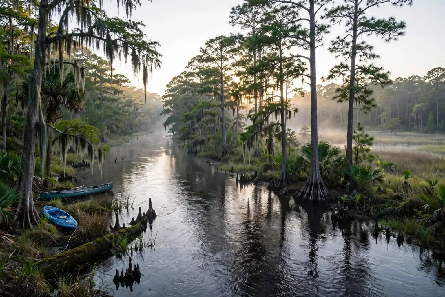
The Perdido River itself is one of the more unusual waterways on the Gulf Coast. Rising in southern Alabama and meandering roughly 60 miles to Perdido Bay, it remains largely undeveloped along its banks, its tea-colored blackwater stretching beneath tupelo gums and cypress in a way that few Gulf Coast rivers still do. The name “Perdido” — Spanish for “lost” — dates to the colonial-era boundary disputes between Spain and the United States, and the river served as an international boundary line long before it became the dividing line between Baldwin County and Florida’s Escambia County. That history of border status is part of what left its corridor so lightly touched: neither state built heavily along a river that marked a frontier.
The acquisition strategy also reflects lessons learned from other large-scale conservation efforts along the Gulf. Land purchases made quickly after restoration funding became available have, in other watersheds, preserved tracts that were within years of residential subdivision, while stalled projects watched their target acreage disappear street by street. Baldwin County’s growth makes that urgency real: the county has regularly ranked among the fastest-growing in Alabama, with rooftops spreading east from the bay toward the river corridor, and land prices in the county have climbed accordingly.
State officials have said the corridor would be managed as public land open for traditional outdoor uses, including hunting and fishing under state regulations, alongside the paddling and hiking trails. Combined with the existing wildlife management area above Interstate 10 and the Forever Wild properties near the bay, the restored and protected tract would complete a public landscape stretching nearly the full length of eastern Baldwin County — a rare continuous conservation corridor on the developing Gulf Coast, funded by the disaster that touched every corner of the region.