Baldwin County Will Lay Out a Decade of Road, Intersection and Bridge Plans at a Robertsdale Public Meeting
The Baldwin County Commission will present a proposed 10-year roadway connectivity plan, a 45-intersection improvement program, bridge replacement schedules and land use revisions at a public Road and Bridge Meeting in Robertsdale.
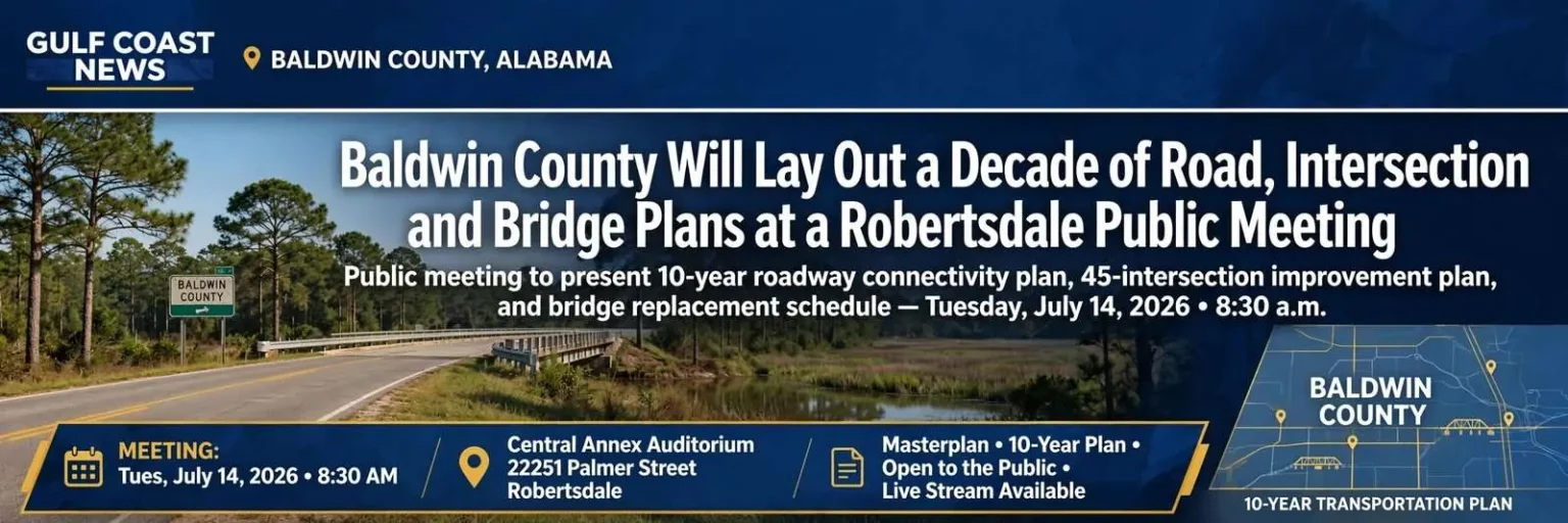
Baldwin County residents who have spent the last decade watching two-lane roads fill with subdivision traffic will have a rare opportunity on a single Tuesday morning to see what county government proposes to do about it. The Baldwin County Commission has scheduled a Road and Bridge Meeting open to the public, and the agenda amounts to a decade-long blueprint for the county’s transportation network. The session is unusual in its scope, stacking Masterplan revisions, a 10-year roadway connectivity plan, a 45-intersection improvement plan, and a bridge replacement schedule into a single sitting.
Meeting Details: Date: Tuesday, July 14, 2026. Time: 8:30 a.m. Location: Central Annex Auditorium, 22251 Palmer Street, Robertsdale. Access: Open to the public; the session will be recorded and the full video posted on the county website afterward. County officials have described the gathering as a significant infrastructure-focused session, and residents, local leaders, and community stakeholders are all encouraged to attend.
Masterplan and Future Land Use Map Revisions
Commissioners plan to discuss proposed changes to the county’s Masterplan and to its Future Land Use Map, commonly abbreviated FLUM. A future land use map is not a zoning ordinance, but it is the document that guides zoning decisions. It expresses where the county expects and intends growth to occur. Revising it is one of the most consequential things a county government does, because developers, utilities, and school planners all read it as a signal of where the next decade of construction is likely to land.
The Baldwin County Planning and Zoning Department, which staffs the commission on land use matters, treats the FLUM as the bridge between the long-range Masterplan and the day-to-day zoning decisions made on individual parcels. When the map is amended, the language of those decisions shifts. A property shown as low-density residential on the FLUM tends to receive different treatment at the zoning board than a property shown as mixed-use or commercial, even when the underlying zoning ordinance has not changed.
A Proposed 10-Year Roadway Connectivity Plan
Connectivity planning addresses a problem familiar to anyone who has tried to get from one Baldwin County subdivision to a neighboring one and found that the only route runs back out to a state highway. A connectivity plan identifies where new links, extensions, and parallel routes should be built so that local trips stay off major corridors. Baldwin County’s road network grew up around a handful of farm-to-market highways, and the rapid residential build-out of the past 20 years has repeatedly produced subdivisions that are physically close to one another but functionally isolated because no local road connects them.
County engineers describe the resulting pattern as leapfrog development, and they argue that the only way to break it is to plan connections before the next phase of subdivisions is platted. A connectivity plan that is adopted alongside the FLUM sends a clear signal to developers that interior road extensions will be expected as part of future approvals, not negotiated in after the fact.
A 10-Year Intersection Improvement Plan Covering 45 Intersections
This is the item likely to draw the most direct public interest. Forty-five specific intersections across the county have been identified for potential upgrades. Intersections are where the overwhelming majority of serious crashes occur, and they are also where congestion is most visible to drivers. Improvements can range from added turn lanes and signal upgrades to full roundabout conversions.
The Baldwin County Highway Department, working with the Alabama Department of Transportation’s local district office, has been assembling the intersection list for several years. Crash data, peak-hour turning movement counts, and projected traffic from approved but unbuilt developments all feed into the prioritization. The list will not commit the county to building any particular improvement in any particular year; rather, it is a ranked pipeline that determines which projects are ready to move when funding becomes available.
Bridge Status and Replacement Schedules
Officials will cover the current condition of county bridges and when they are slated for replacement. Bridge work is expensive, disruptive, and unglamorous, and it tends to be invisible to the public until a structure is posted with a weight limit or closed outright. Baldwin County maintains hundreds of bridges, many of them on quiet rural roads that predate the modern county road system, and a steady share of them are nearing the end of their design life.
Federal Highway Administration bridge inspection ratings drive much of the schedule. Bridges rated structurally deficient under the old classification, or that fall into poor condition under the newer metrics, move to the top of the replacement list. The commission will be asked to consider the funding mix for those projects, which typically combines county dollars with state aid and occasional federal bridge program grants.
Costs and Long-Term Funding
Infrastructure cost considerations and funding discussions are on the agenda as well, giving residents a look at how the county intends to pay for what it is proposing. Baldwin County has historically relied on a mix of gasoline tax allocations, state transportation grants, county general fund transfers, and developer contributions for road work. The scale of the proposed plan, measured in hundreds of millions of dollars over a decade, will almost certainly require either new revenue, a larger share of county general fund capacity, or a more aggressive posture toward state and federal grant applications.
County staff are expected to walk through the assumptions behind each funding source, including the recent volatility of fuel-tax receipts and the increasing competition among Alabama counties for a limited pool of state Industrial Access Road and ATRIP funding. The commission’s decisions about how aggressively to pursue grants will shape which projects on the list actually advance and which sit on paper for another decade.
Why This Meeting Is Worth a Morning
Baldwin County has been among the fastest-growing counties in Alabama for years, and growth of that kind arrives on the roads before it arrives anywhere else. Rooftops go up, driveways connect to county roads that were designed for farm trucks, and the capacity problem becomes everyone’s problem at 7:30 in the morning and again at 5 in the afternoon. The commission’s choice to put the entire decade of planning in a single public meeting is an acknowledgment that the county cannot fix what it does not first show its residents.
Long-range plans are the mechanism by which a county gets ahead of that curve rather than perpetually chasing it. Once adopted, a 10-year plan shapes which projects receive engineering funds, which corridors get right-of-way acquisition, and which grant applications the county is positioned to file when state and federal money becomes available. A project that is not in the plan is, functionally, a project that is not going to happen for a very long time.
How to Participate
The meeting begins early, at 8:30 a.m. on a Tuesday, which will make in-person attendance difficult for many working residents. For those who cannot make it to Robertsdale, the county has committed to recording the session and posting the video afterward, so that the presentations, maps, and cost figures remain available for review. Residents with a specific intersection, road, or bridge in mind would do well to attend, or at least to watch the recording and follow up with their district commissioner. Plans of this scale are amended most easily before they are adopted.
The Baldwin County Commission meets in the Central Annex Auditorium at 22251 Palmer Street in Robertsdale, the county seat. The Central Annex is a familiar venue for public hearings on infrastructure and land use, and parking is generally available on site. The session is also expected to be live-streamed through the county’s official channels for residents who prefer to follow along from home or work.
Growth Pressure on the Alabama Gulf Coast
The meeting arrives as Baldwin County, the largest county by area in Alabama and one of the fastest-growing in the state, continues to absorb new residents drawn to the beaches, the schools and the relative affordability of the Gulf Coast. Communities from Robertsdale to Foley, from Spanish Fort to Gulf Shores, have watched once-quiet two-lane roads become daily commuter corridors. The county’s transportation planning is, in effect, an attempt to keep the physical network from being overtaken by the pace of development.
The 45 intersections singled out for study are a useful illustration of the problem. As subdivisions fill in behind them, intersections originally designed for light rural traffic now handle volumes that were never anticipated, and the result is congestion and, too often, crashes. A long-range plan that addresses those intersections with turn lanes, signal timing or roundabouts is one of the few tools county government has to keep the roads safe as the population climbs.
For residents who cannot attend in person, the posted recording will preserve not only the maps but the reasoning behind them. Infrastructure decisions made in July 2026 will shape how Baldwin County moves for the next decade, and the commission’s choice to record and publish the session reflects a recognition that a meeting held at 8:30 on a weekday reaches only a fraction of the people it affects.
Understanding the Planning Documents
For residents new to the county, the distinction between the Masterplan, the Future Land Use Map and the zoning ordinance is worth understanding. The Masterplan sets the long-term vision; the FLUM translates that vision into a map of intended growth; and the zoning ordinance, adopted separately by the commission, gives the map the force of law. Changes to the first two, on the July 14 agenda, ripple outward to everything that follows, which is precisely why the county is presenting them in a single, decade-spanning view.
That presentation style is itself a shift. In earlier years, the commission considered FLUM amendments and road plans as separate conversations, often months apart, which made it harder for residents to see how a growth designation in one document translated into a road project in another. Bundling them into a single July morning is, in part, a transparency measure, and it gives the public a clearer picture of the trade-offs the commission is willing to make between accommodating growth and preserving the rural character that many newcomers say drew them to Baldwin County in the first place.