159 Football Fields of Marsh, Gone: Inside Coastal Alabama’s Slow-Motion Erosion Crisis
Between 2009 and 2021, the Mississippi Sound and Portersville and Heron bays lost 210 acres of marsh — about 159 football fields. Scientists, landowners and boaters explain what is driving coastal Alabama's erosion and what it would take to reverse it.
Andrew Saunders has spent 50 years cruising the coastal estuaries of Alabama, and he can tell you where the beaches used to be. He remembers when the Lower Perdido Islands were thick with vegetation and loud with birds. Saunders is emeritus chairman and former president of Saunders Yachtworks in Gulf Shores. He has watched Baldwin County's commercial development boom firsthand — and has done commercial development himself, which makes his assessment harder to dismiss as an outsider's complaint. "Everywhere that I've traveled from Apalachicola to Pearl River. I mean, everywhere," Saunders said. "Everywhere there's estuary, there's degradation. And much of it's avoidable, or could be moderated or modulated, but it's not.
It's ravenous." The Numbers Coastal erosion is happening nearly everywhere in lower Alabama, but the losses are not evenly distributed. The Mississippi Sound and Portersville and Heron bays lost 210 acres of marsh between 2009 and 2021 — the equivalent of about 159 football fields, and more than any other area in coastal Alabama, according to the Mobile Bay National Estuary Program's "State of Alabama's Estuaries and Coast" report. It is not only habitat disappearing. Shorelines themselves have been retreating inland. Landward shifts measured in the report ranged from 9.8 feet near Point Clear to 97.1 feet along the northern Fort Morgan Peninsula. Why It Matters Beyond the Wildlife Losing marshland means losing habitat for countless species.
It also means putting pressure on marine life that people in Alabama actually eat — oysters, crabs, and finfish including red snapper. And it means losing one of the coast's most effective defenses against hurricanes, and potentially the property standing behind it. "Our beaches, our quality of life, our cultural heritage, it's a way of life," said Jason Kudulis, executive director of the Mobile Bay National Estuary Program. "It's a responsibility of ours to take care of [the marshes] for what they provide for us, spiritually, culturally, economically." The Stakes: Death by a Thousand Cuts Erosion itself is natural. Shorelines shift. Marshes are resilient systems that can adapt to a stressor, Kudulis said. The problem now is how many stressors are arriving at once.
"Our resources are resilient, fine-tuned machines developed over millions and millions of years," Kudulis said. "It's the rapid changes. If it was just one thing, it would be different." Sea level rise, severe weather and wave energy from boat traffic have all contributed to the loss of marsh habitat and shoreline. When conditions change for intertidal marshes — those flooded and drained by tides — the marsh begins migrating inland. Eventually it runs out of room and starts drowning in place, said Blair Morrison, science and monitoring program lead at the national estuary program. "Once they're gone, they're gone, unless there's a really intensive effort to rebuild that," Morrison said.
"If you think about our coastal communities, if you think of Bayou La Batre or Coden or Alabama Port, Mon Louis Island, there's only so much space you can let those marshes migrate in before you're talking about people's houses." Global Causes, Local Consequences Some threats to Alabama's coastline are within local control. Others are not, Morrison said. "A lot of these ecosystems, I like to say they're being impacted by a thousand cuts," she said. "There are some things that we have more local influence over than others, but these are ecosystems that are under a variety of different stresses." Global sea-level rise cannot be solved at the county level.
In the western Gulf of Mexico, sea level is expected to rise 16 to 18 inches from 2020 levels by 2050 — well above the national projected average, according to NOAA. Rising seas push more saltwater into coastal marshes that depend on brackish conditions, part saltwater and part fresh. Disrupting that salinity balance stresses the vegetation and can kill it, according to Christian Miller, public-sector program lead with the national estuary program. The marsh grasses are not only shelter for marine life. Their root systems are what hold the shoreline together. When the grass goes, so does the structure, and the shoreline retreats. Saltwater in the Delta Salty water has begun moving into the Mobile-Tensaw River Delta, a system of forested swamps, Morrison said.
Marsh grasses are likely to follow the brackish line inland, which could constrict a delta habitat widely recognized as holding some of the richest biodiversity in the United States. The "E.O. Wilson Land Between the Rivers" nature preserve was purchased by The Nature Conservancy in 2024 specifically to protect delta habitat and give it room to migrate upward. Some marshes are also sinking through subsidence, when sediment compacts beneath the grasses, Morrison said — a loss that compounds rising water from the opposite direction. Storm Impacts on the Western Shore On the western side of Mobile Bay, more frequent tropical storms and hurricanes have taken a visible toll.
Research cited in the state of the coast report shows severe storms occurring more frequently in the region, and flash flooding from those storms can rework a shoreline in hours. Andy Depaola has lived on Mon Louis Island, south of Mobile, since 1980. He moved into his current house in 2004, a year before Hurricane Katrina. During Katrina, storm surge reached roughly 10 feet at his house. It scoured away sand and dirt, and the 20-foot bluff separating his property from the water caved in. "When you are on a bluff, when the waves hit at the bottom, it tunnels it out at the toe and it just caves in," Depaola said.
"It washed back to my stairs, which was probably 25 feet of property, 20 feet high that I lost." Smaller storms do damage too. During Tropical Storm Bertha in July, he said surge took pieces from his pier and damaged a set of stairs running down to his small beach on Mobile Bay. The Gulf is warming at twice the rate of the global ocean, according to Yale Climate Connections. Warmer water can raise the wind speeds of hurricanes forming there, delivering stronger storms to the same shoreline. Marshes are built to absorb storms — they calm wave energy and shield the land behind them from surge — but episodic events still inflict a great deal of damage very quickly, Kudulis said.
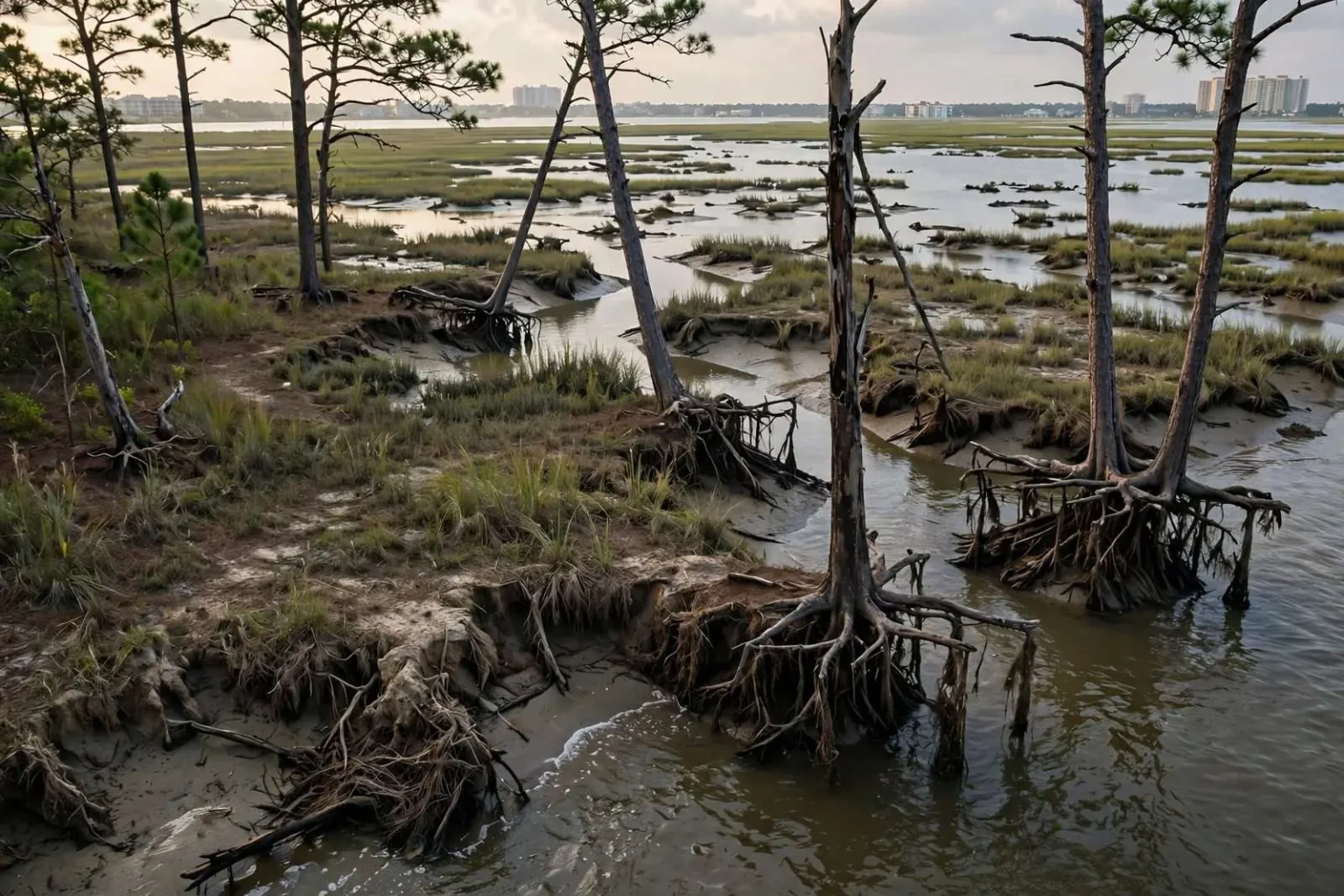
Combined with the slower stressors, the system cannot keep pace. Natural Causes, Too Ten years ago Saunders bought the property he nicknamed "Sweet Bay Point" from a friend's family. It sits at the headwaters of Wolf Bay in Elberta. From his pier — which extends over the marsh grasses and out into the water, disturbing the estuary as little as he could manage — you can see the high-rise resorts of Orange Beach. That clear southern view is exactly the problem. Wind coming off the water with nothing to break it pushes water into the marsh and eats away the sediment. Saunders has lost about 120 feet of marsh to erosion. Pine tree roots now hang exposed over the water, holding onto nothing. "The erosion is quite natural," Saunders said.
"No humans are making that happen. That's entirely natural. So I'm not all fighting up against it. I'm just modifying it a little bit." Working With It, Not Against It Saunders said he is working with an engineer on a design that would rebuild the marsh he has lost and protect what remains. The plan is not final, but he expects it to include some measure to dampen wave energy before it reaches the grass line. His philosophy is restraint. He has left the back of his property undeveloped down to the water's edge, cutting only a few paths and clearing them minimally — closer to "pruning," as he put it. "My sensibility has for many years been in the direction of environmental conservation and naturalism," Saunders said. "That's the broad focus. So any land I approach, I would approach it with that respect and sensibility."
About the Estuary Program
The Mobile Bay National Estuary Program, whose “State of Alabama’s Estuaries and Coast” report supplied the marsh-loss figures above, is one of 28 national estuary programs established under Section 320 of the federal Clean Water Act and supported by the U.S. Environmental Protection Agency. Each program works with local governments, scientists, businesses and residents to carry out a long-term management plan for its estuary; Mobile Bay’s covers Mobile and Baldwin counties.