Small Earthquake Shook Coffeeville Area in 2008
Archived WKRG coverage reported that a small earthquake shook homes near Coffeeville in 2008 but caused no reported damage.
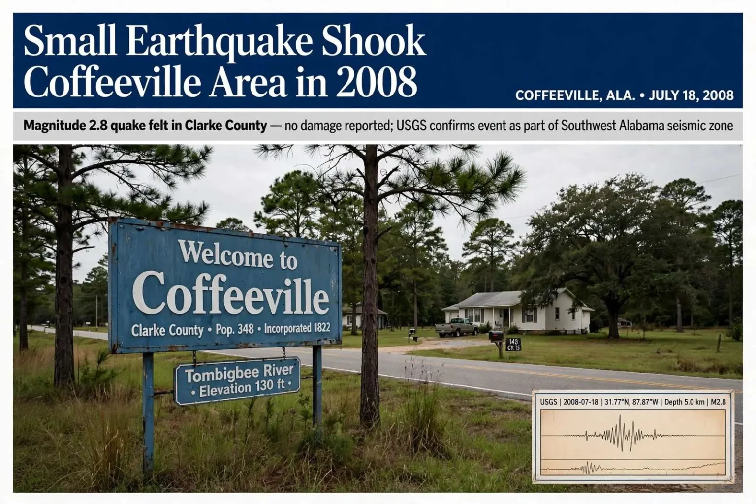
COFFEEVILLE, Ala. — A small earthquake shook some homes near Coffeeville in 2008, according to an archived local news report documenting an event that surprised residents in a part of Alabama not widely known for seismic activity. The quake was felt in the area but had not caused reported damage, according to Clarke County Emergency Management Director Roy Waite, who addressed the reports as calls came in from residents.
The event drew enough attention that the local station reporting it also linked to the U.S. Geological Survey’s official record of the earthquake, giving residents a way to confirm that what they had felt was real. For a community where earthquakes are a rarity rather than a routine hazard, the arrival of a felt quake — even a small one — was enough to prompt questions about whether the region could expect more.
This is a historical account of a past earthquake, not a current earthquake alert or emergency notice. The 2008 event remains part of the documented seismic history of southwest Alabama, a region that sits within one of the state’s known seismic zones even though damaging earthquakes there are uncommon.
Earthquakes in Alabama: the bigger picture
Alabama is not California, but it is not seismically silent either. The state sits near two significant seismic zones. The most famous is the New Madrid Seismic Zone, centered where Missouri, Kentucky, Arkansas, and Tennessee meet, whose earthquakes in 1811 and 1812 were strong enough to ring church bells as far away as the East Coast and to temporarily reverse the flow of the Mississippi River. West Alabama and northwest Alabama feel the effects of that zone on occasion, particularly during the larger quakes the zone produces.
Closer to home is the Southwest Alabama seismic zone, a band of earthquake activity that runs through the southern part of the state, from around the Montgomery area southwest toward Mobile and the Mississippi line. That zone has produced small to moderate earthquakes over the decades, most of them too weak to cause damage but strong enough to be felt by residents nearby. Clarke County, where Coffeeville sits along the Tombigbee River, lies within the general reach of that activity, which is why a felt quake in 2008 — while unusual — was not without precedent.
The U.S. Geological Survey maintains the authoritative record of earthquakes across the country, logging each detected event with its location, depth, and estimated magnitude. When residents feel shaking in an area unaccustomed to earthquakes, the USGS database is where the event can be verified, and its “Did You Feel It?” reporting system allows members of the public to contribute their own observations, which helps scientists map how widely a quake was felt and how strongly.
Most earthquakes in Alabama are small — in the magnitude 2 to 3 range — and cause no damage at all. A quake that rattles homes without breaking anything fits squarely within that pattern. Damage generally begins to occur in earthquakes of magnitude 4 and above in regions where buildings are not constructed to seismic codes, and earthquakes that strong remain rare in the state’s recorded history.
Coffeeville sits in Clarke County, a rural county in southwest Alabama defined by the Tombigbee and Alabama rivers, which meet to the south of the county before flowing toward Mobile Bay. The town of Coffeeville itself is perched on a ridge above the Tombigbee, and the surrounding area is a mix of river bottomland and pine uplands. When shaking occurred there in 2008, residents’ first reactions ranged from curiosity to concern, and reports to local officials and media outlets followed quickly — the standard pattern when an unfamiliar natural event touches a small community.
Emergency management directors like Clarke County’s are the local point of contact when unusual events raise public concern. Part of that role is communication: confirming what happened, explaining what it means, and telling residents whether any action is needed. In the case of the 2008 quake, the message from Roy Waite was straightforward — the earthquake had been felt in the area, but no damage had been reported. That combination, a felt but harmless quake, is the most common kind of earthquake experienced in the southeastern United States.
Small earthquakes can still be unsettling precisely because they are unfamiliar. Unlike a thunderstorm, an earthquake arrives without weather radar images, without warning sirens, and without any buildup. Residents describe a low rumble or a sharp jolt, a rattling of windows and dishes, and a moment of confusion about the source. In south Alabama, first guesses often involve blasting at a quarry, a large truck, or a problem with a nearby industrial facility, and only the USGS confirmation settles the question.
What residents should know about quake preparedness
Although damaging earthquakes are rare in Alabama, emergency managers include them among the hazards the state prepares for, alongside hurricanes, tornadoes, and floods. The standard guidance is simple: during shaking, drop to the ground, take cover under a sturdy table or desk, and hold on until the movement stops. Running outside during a quake exposes a person to falling debris near the building’s edges, which is where injuries most often occur in moderate earthquakes.
Preparedness at home mirrors the steps recommended for other hazards. Securing tall bookcases and water heaters to wall studs, keeping shoes and a flashlight by the bed, and knowing how to shut off gas and water service are the basic measures. Those steps serve double duty in a hurricane-prone state, where the same preparations support recovery from storms.
The 2008 Coffeeville earthquake remains a footnote in the seismic record of southwest Alabama, notable mainly because residents felt it in a region where they rarely do. The USGS continues to monitor the region’s seismic stations, and any future quake in Clarke County will be recorded and publicly reported the same way the 2008 event was. For residents, the lesson of the event was measured: earthquakes do happen here, they are almost always small, and the appropriate response — check on neighbors, report what you felt, and take no unnecessary risks — is well established.
Archived reports like the one documenting the 2008 quake serve a lasting purpose. They preserve the local record of events that might otherwise be forgotten, and they give researchers and residents alike a baseline for understanding the natural hazards of southwest Alabama. The Coffeeville quake of 2008 — felt, reported, and recorded by the USGS — stands as a reminder that the ground under even the quietest corners of the state occasionally moves.
The geology beneath southwest Alabama helps explain why the region has any earthquake activity at all. The Gulf Coastal Plain is underlain by thick layers of sediment resting on older basement rock, and ancient faults buried deep below the surface can occasionally slip, releasing small amounts of energy. Scientists believe some of the activity in the Southwest Alabama seismic zone relates to these buried structures, which date to geologic eras long before the Gulf of Mexico took its present shape. Because the faults are deep and the sediment layers above them are thick, even quakes that are widely felt often produce little shaking intensity at the surface.
That combination — small magnitude, deep source, and soft sediment — produces the typical Alabama earthquake experience: a rumble, some rattled nerves, and essentially no damage. It also means magnitude figures reported by the USGS can be misleading to residents who expect East Coast and Gulf Coast quakes to “feel” like their western counterparts. Earthquakes in the eastern United States are felt over larger areas than quakes of the same size in the West, because the crust here is older, colder, and more efficient at transmitting seismic waves. A modest quake in Clarke County can therefore be noticed by residents several miles away, even though it would barely register as an event in a more seismically active region.
Emergency managers across the region also point to the indirect hazards that even small events can create. A quake that damages nothing can still rupture a gas line weakened by corrosion, knock a chimney loose, or shift a propane tank in a rural yard. That is why the standard post-earthquake advice includes checking for the smell of gas and inspecting utility connections after any felt event, even one that leaves the house visibly undamaged. In river counties like Clarke, where many homes rely on propane and well systems, those checks are a practical part of the routine.
The 2008 Coffeeville event also illustrates how local news and federal science agencies work together in documenting natural events. The archived news report preserved the community’s experience — who felt it, what they described, and what the county’s emergency management director said — while the USGS record preserved the technical facts: the quake’s size, its epicenter, and the time it occurred. Together, the two records give a fuller picture than either could alone, and both remain available to anyone researching the seismic history of southwest Alabama today.
Two decades on, no resident of Coffeeville needs to treat the 2008 quake as anything more than what it was: an unusual day, a rattling of windows, and a story told since. But the archived account continues to serve the community as a reference point — proof that the region’s occasional tremors are real, documented, and, in this case, harmless. Any future shaking in Clarke County can be checked against the USGS database within minutes, and the same local channels that spread word of the 2008 quake remain ready to do the same the next time the ground moves under the Tombigbee bluffs.