Dauphin Island Officials Begin Assessing Hurricane Sally Damage
After Hurricane Sally, Dauphin Island reopened its causeway within hours as officials found flooding on Bienville Boulevard and west-end home damage.
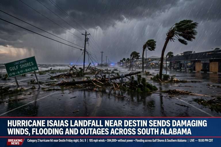
Hours after Hurricane Sally cleared the Alabama coast, the causeway to Dauphin Island was back open — an unusually quick reopening for a barrier island after a major tropical event — and town officials immediately turned to the hard work of assessing the damage left behind. Sally had come ashore near Gulf Shores on the morning of September 16, 2020, as a Category 2 hurricane with winds near 105 mph, but the storm’s slow crawl toward the northeast proved far more destructive than its wind category suggested. Because the system lingered over the northern Gulf Coast for much of the day, it pushed a prolonged surge of Gulf water into Mobile Bay and against the low-lying communities that ring it, and no community sits lower or more exposed than Dauphin Island.
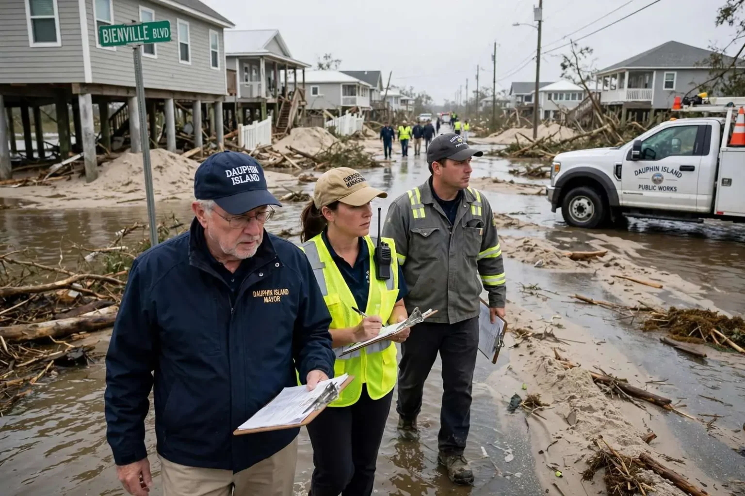
The first look at the island on the morning after the storm showed the extent of the flooding in stark terms. Bienville Boulevard, the main east-west thoroughfare that runs the length of the island, was transformed into what one reporter described as a virtual river, with stormwater still coursing down the roadway and across lots on either side long after Sally’s center had moved inland. Photographs and video from the island showed sand, debris and standing water covering wide stretches of the street, a familiar image for a town that has repeatedly watched the Gulf wash over its roads in past storms.
A Mayor’s Morning-By-Morning Account
Mayor Jeff Collier provided updates through the morning as conditions allowed, giving residents and the wider public a steady stream of information about what the island was facing. He reported that numerous west-end homes had sustained varying degrees of structural damage, an outcome that surprised few people who know the geography of the island. The west end of Dauphin Island is its most vulnerable section — a narrow, low-lying strip of land that bears the brunt of Gulf surge moving into the bay — and in major storm events it is routinely cut off from the rest of the community.
Collier’s updates made clear that some stretches of the west end were impassable without a four-wheel-drive vehicle, with sand and water blocking the road surface and leaving ordinary passenger cars unable to reach the westernmost homes. That reality shaped the first hours of the response: emergency crews, utility workers and town staff had to prioritize where they could safely go, while residents who rode out the storm in elevated west-end houses waited for conditions to improve before they could move around freely.
Why the Causeway Mattered
The rapid reopening of the causeway was itself a significant piece of good news. Dauphin Island is connected to the mainland by a single road link across the water, and when that connection is knocked out, the island’s recovery stalls before it can even begin. A functioning causeway in the hours after a major tropical event meant that damage assessment teams, utility crews and supply vehicles could begin moving almost immediately. For a barrier island community that has seen storm surge sever its link to the mainland in previous hurricanes, having the road passable the same day Sally’s winds died down was an unusually favorable start to what everyone understood would be a long recovery.
The speed of that reopening also reflected the nature of the storm’s impact. Sally’s damage to the island was driven overwhelmingly by water rather than wind, and while flooding along Bienville Boulevard and across the west end was severe, the road link to the mainland had survived. That combination — heavy local flooding but an intact connection — set the stage for the methodical island-wide assessment that town officials launched as soon as it was safe to fan out.
The Island Reopens to Residents
The island reopened Wednesday morning to people holding reentry passes, a system that coastal communities across the Gulf use to control who returns to a storm-damaged area and when. Reentry passes are typically issued to residents, property owners and essential workers before hurricane season begins, and they allow law enforcement at the access points to distinguish between people who have a legitimate reason to return and those who do not. On a barrier island like Dauphin Island, where the only road in crosses open water and where downed lines, washed-out pavement and debris can make early return dangerous, the pass system is a critical tool for keeping the first wave of reentry orderly.
For residents who had evacuated ahead of the storm, the Wednesday reopening offered the first chance to see their property in person. For those who had stayed, it marked the moment the island began functioning again on something like a normal footing — mail, utilities, insurance adjusters and contractors all following the same road back across the bay. Town officials urged patience, noting that assessment work on the west end and other hard-hit areas would continue for days.
A Barrier Island’s Long Memory of Storms
Longtime residents of Dauphin Island understood immediately that the Sally recovery would be measured in months and years, not days. The island has been reshaped repeatedly by Gulf hurricanes: Hurricane Frederic in 1979 devastated the community; Hurricane Georges in 1998 pushed surge across much of the town; Hurricane Ivan in 2004 and Hurricane Katrina in 2005 each carved new inlets through parts of the island and destroyed dozens of homes. More recently, repeated overwash events have dumped sand across Bienville Boulevard and rebuilt the shoreline in ways that permanently alter lots and streets.
That history informs how the town builds and rebuilds. Many west-end homes sit on tall pilings designed to let surge pass beneath the structure, and the town has long participated in federal programs that help elevate or relocate repeatedly damaged properties. Still, every significant landfall tests the limits of those measures, and Sally’s prolonged surge flooding was no exception. The structural damage Collier reported across the west end fell on a section of the island where homeowners have, in many cases, already rebuilt once or twice in the past two decades.
What the Assessment Involved
The work officials began in the hours after the storm followed a pattern familiar to Gulf Coast communities. Assessment teams move street by street, checking structures for damage, marking homes that are unsafe to enter, documenting the condition of public infrastructure — roads, water and sewer lines, and the utility system — and clearing hazards where they can. On Dauphin Island, where a single road serves the entire community, documenting the condition of Bienville Boulevard and the west-end streets was itself a priority, because those roads control access for every phase of recovery that follows.
Utility restoration ran in parallel. Power crews worked to restore electricity to areas that could safely receive it, while water and sewer service was checked for storm-related problems that flooding can cause. Residents returning Wednesday morning were advised to treat any damaged structure with caution until it had been evaluated, and to photograph damage for insurance purposes before beginning cleanup.
Mayor Collier’s morning-after assessment, delivered while water still ran down the island’s main street, set the stage for what would become a long, island-wide recovery from Sally — a recovery that would continue to unfold across the west end and beyond in the weeks and months after the storm moved on.
Life on a Sandbar: The Geography Behind the Risk
Understanding Sally’s impact on Dauphin Island requires understanding what the island is. It is a classic Gulf Coast barrier island — a narrow ribbon of sand at the mouth of Mobile Bay, separating the bay’s waters from the open Gulf. The town occupies the sheltered side of that ribbon, but in a major storm the distinction largely disappears. Surge enters Mobile Bay through the wide pass between Dauphin Island and Fort Morgan, and water moving across the low island from the Gulf side meets water pushed up from the bay side, flooding properties from both directions at once.
The island’s eastern end is anchored by higher ground around Fort Gaines and the Audubon bird sanctuary, but the town itself sits on ground only a few feet above sea level. Bienville Boulevard — named for the French colonial founder of nearby Mobile — runs the length of the community and serves as its civic spine, fronted by homes whose views of the Gulf come with a well-known price in every hurricane. When surge tops the beach, the boulevard is the first public roadway to flood, which is why the post-storm image of it running like a river resonated so strongly with people who follow the island’s fortunes.
The Regional Picture After Sally
Dauphin Island’s experience fit into a much larger regional disaster. Sally’s slow track dropped torrential rainfall across coastal Alabama and the western Florida Panhandle, flooding neighborhoods in Gulf Shores, Orange Beach and Pensacola and knocking out power to hundreds of thousands of customers across the two states. Bridges and causeways across the region were closed during the storm and reopened as inspectors cleared them, one by one. Within days, President Trump issued a federal disaster declaration for parts of Alabama, opening the door to federal assistance for affected communities.
For Mobile County’s coastal communities, the days after Sally’s landfall were consumed by the same sequence Dauphin Island began that morning: search for the injured, clear the roads, restore utilities, assess damage and begin the paperwork that connects residents to insurance and disaster aid. The island’s quick causeway reopening meant its assessment could start early, while some neighboring communities were still contending with closed roads and flooded neighborhoods.
Recovery, and What Comes Next
In the weeks that followed, the island’s recovery proceeded in familiar stages. Debris contractors collected storm wreckage from roadsides; building officials worked through inspections; residents met with insurance adjusters and applied for assistance; and the town evaluated the condition of its beaches, streets and public facilities. West-end owners whose homes had been damaged faced the questions that follow every significant storm there: repair, elevate or rebuild — and whether to remain on a piece of the island that the Gulf reclaims a little at a time.
Nobody on Dauphin Island needed to be told that a hurricane’s departure is only the beginning. The town’s modern history is, in many respects, a continuous cycle of storm, assessment, rebuilding and preparation for the next storm. What Sally’s aftermath demonstrated once again was both the island’s vulnerability — nowhere more so than in the flooded stretches of Bienville Boulevard and the battered west end — and the community’s capacity to organize a response quickly. Within hours of the storm’s exit, the causeway was open, the mayor was providing updates, reentry passes were being honored, and the long work of recovery had begun.