Hurricane Isaias Landfall Near Destin Sends Damaging Winds, Flooding and Outages Across South Alabama
Hurricane Isaias made landfall near Destin, Florida, Friday night as a Category 2 storm with 105 mph winds, then weakened to Category 1 as it raced north into southern Alabama with damaging gusts, flooding rain and widespread outages.
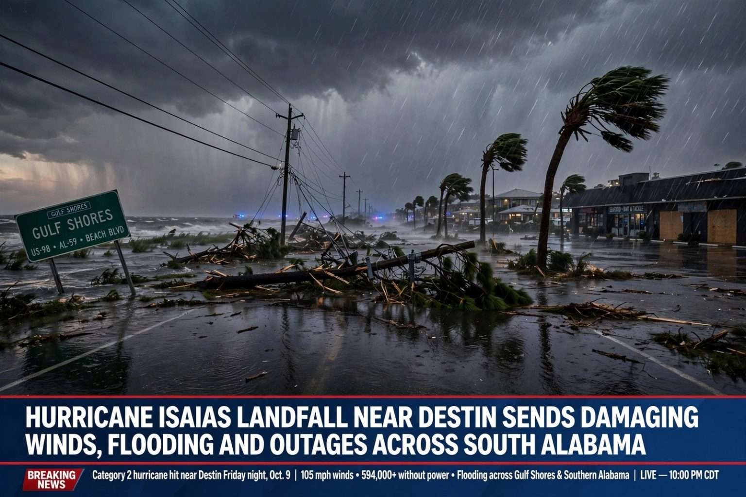
GULF SHORES, Ala. — Hurricane Isaias landfall came Friday night, Oct. 9, near Destin, Florida, where the storm crossed the coast as a Category 2 hurricane with maximum sustained winds of 105 mph, then raced north toward southern Alabama with damaging gusts, flooding rain and the threat of tornadoes. By 10 p.m. CDT, the storm had weakened to a Category 1 hurricane with 90 mph winds, but forecasters warned it remained dangerous as its center moved inland at 20 mph.
The National Hurricane Center said Isaias came ashore around 8:30 p.m. CDT (0130 UTC). National Weather Service Doppler radar data put the estimated minimum central pressure at landfall at 971 millibars, or 28.67 inches. The storm had weakened to just below major hurricane strength before it reached the coast.
More than 594,000 customers in Florida and Alabama were without power Friday evening, and officials in Mobile reported downed trees and power lines.
From major hurricane to landfall
Isaias became the first hurricane of the 2026 Atlantic hurricane season on Wednesday night, Oct. 7, and strengthened into a major hurricane on Friday morning. As of 4 p.m. Friday, its maximum sustained winds were 115 mph, and Hurricane Hunter aircraft found that its central pressure had leveled off near 959 millibars. Coastal radar began tracking the eye as it closed in on the northern Gulf Coast.
Wind shear increased during the day, but because it was aligned with the storm’s forward motion its weakening effect was limited, and the hurricane center had said Isaias could hold major-hurricane strength until landfall.
On the Saffir-Simpson scale, Category 2 covers sustained winds of 96 to 110 mph; major hurricanes, Category 3 and up, begin at 111 mph.
The forecast track shifted farther east during the day Friday, pointing toward a landfall along the western Florida Panhandle rather than the Alabama coast. That eastward shift placed Gulf Shores and Orange Beach on the western side of the eye, where winds were strong but the worst surge and the heaviest weather were concentrated to the east. As skies briefly cleared on that western edge Friday evening, the Alabama coast was treated to a rainbow and a vivid sunset.
Where Isaias was late Friday
As of 10 p.m. CDT, the center of Isaias was about 45 miles east-northeast of Pensacola and about 65 miles northwest of Panama City, moving quickly north at 20 mph. Hurricane-force winds extended up to 35 miles from the center, and tropical-storm-force winds reached outward up to 160 miles.
That track was expected to carry the center across Alabama Friday night and Saturday and into the Tennessee Valley by Sunday. Forecasters said Isaias would continue to weaken, becoming a tropical storm by Saturday afternoon and eventually transitioning into a post-tropical cyclone over Alabama on Saturday.
Because the storm was moving so fast, damaging wind gusts and heavy rain were expected to spread well inland across southern Alabama, including Escambia, Conecuh, Covington and Butler counties, even as the system weakened. Sustained hurricane-force winds were possible near and along the track up to 100 miles inland into southern Alabama, and hurricane-force gusts could reach even farther north into central Alabama.
Wind gusts and water levels
The strongest measured winds were reported in northwest Florida. The National Weather Service in Mobile reported a 116 mph gust in Florida’s Santa Rosa Sound just after 8 p.m. A NOAA National Ocean Service station in Panama City Beach reported a gust of 83 mph and sustained winds of 72 mph.
A NOAA water level gauge in Panama City Beach also reported a water level of 5.6 feet above mean higher high water, a measure that approximates how deep the water was over normally dry ground in that area.
Warnings for Alabama
The hurricane center trimmed some of its coastal warnings late Friday as Isaias moved inland, while the National Weather Service in Mobile extended hurricane warnings to several inland Alabama counties as of 7 p.m. Tropical storm warnings were expanded inland as far north as the Birmingham metro area.
As of the 10 p.m. CDT advisory, coastal warnings were:
- Storm Surge Warning: Dauphin Island to the Suwannee River in Florida. The warning was discontinued west of Dauphin Island.
- Hurricane Warning: The Mississippi/Alabama border to the Bay/Gulf County line in Florida. The warning was discontinued west of the Mississippi/Alabama border.
- Tropical Storm Warning: East of the Bay/Gulf County line to the Aucilla River in Florida. The warning was discontinued west of Ocean Springs, Mississippi.
- Storm Surge Watch: Discontinued east of the Suwannee River.
Across Alabama, the alerts in effect late Friday included:
- Hurricane Warning: Mobile, Baldwin, Conecuh, Covington, Escambia, Monroe, Butler and Crenshaw counties.
- Storm Surge Warning: Mobile and Baldwin counties, including Mobile Bay.
- Tropical Storm Warning: Autauga, Barbour, Bibb, Bullock, Butler, Chambers, Chilton, Choctaw, Clarke, Clay, Coffee, Coosa, Crenshaw, Dale, Dallas, Elmore, Fayette, Geneva, Greene, Hale, Henry, Houston, Jefferson, Lamar, Lee, Lowndes, Macon, Marengo, Marion, Monroe, Montgomery, Pickens, Pike, Randolph, Russell, Shelby, St. Clair, Sumter, Talladega, Tallapoosa, Tuscaloosa, Walker, Washington, Wilcox and Winston counties.
- High Wind Warning: Blount, Calhoun, Cherokee, Cleburne, Cullman, DeKalb, Etowah, Jackson, Madison, Marshall and Morgan counties.
- Wind Advisory: Colbert, Franklin, Lauderdale, Lawrence and Limestone counties.
- Flood Watch: All southwest Alabama and northwest Florida counties served by the National Weather Service in Mobile, until 1 p.m. Saturday.
A hurricane warning means hurricane conditions are expected within the warning area. A storm surge warning means there is a danger of life-threatening flooding from rising water moving inland from the coast. Hurricane-force gusts remained possible through early Saturday in the hurricane warning areas.
Storm surge on Mobile Bay and the Alabama coast
Earlier Friday, before Isaias made landfall, the Storm Surge Warning stretched from the mouth of the Mississippi River to the Suwannee River. At that time, forecasters said peak surge could reach 6 to 9 feet along the northwest Florida coast and 4 to 6 feet along the southwest Alabama coast, including Mobile Bay, with large and dangerous waves. Florida’s Pensacola Beach and the Gulf Islands National Seashore were among the places considered most at risk.
In its late Friday update, the hurricane center said 3 to 5 feet of storm surge would be possible in the surge warning areas. Surge is typically highest near and east of where a hurricane’s center comes ashore.
Rain, flooding and tornadoes
Rainfall totals of 4 to 8 inches are expected across southern Alabama, the Florida Panhandle and southwestern Georgia through the weekend, with localized totals of up to 15 inches possible in heavier bands. Considerable flash and urban flooding is possible, along with significant river flooding in the days after the storm passes.
The tornado threat was expected to continue through Saturday. The greatest risk lies east of the storm’s center, especially across the Florida Panhandle into southern Georgia, before spreading north-northeast across parts of the Southeast on Saturday.
Isaias is also expected to bring heavy rain to much of the Southeast over the weekend and to parts of the Midwest and Northeast into Monday.
Damage reports across the region
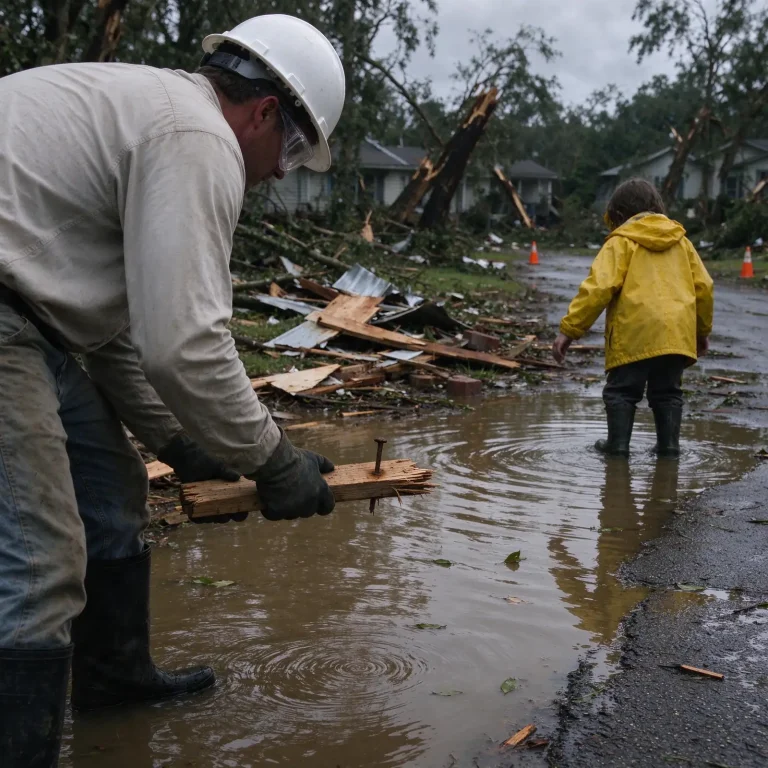
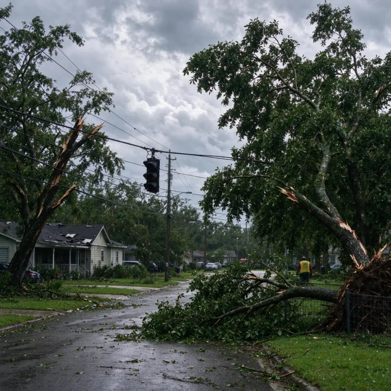
In Destin, roads were flooded. In nearby Pensacola, police warned residents to stay off the streets because of debris on roadways. Many residents posted pictures online of downed trees and power lines, and one video posted to social media showed the roof being torn off an inn in Pensacola. Some Florida Panhandle counties temporarily suspended emergency response Friday night because conditions were too dangerous for crews.
Florida Gov. Ron DeSantis urged residents to stay put once the storm arrived.
“The storm is here. Buckle down at this point. Don’t be getting out on the roads,” DeSantis said at a news conference, adding that flash flooding would be a hazard “throughout the region.”
DeSantis also warned residents to expect power outages, gasoline shortages and closures of bridges and highways. Florida’s National Guard deployed about 5,000 soldiers and airmen to help with the response, search and rescue teams were ready to respond, and some prisons evacuated inmates.
President Donald Trump told reporters at the White House late Friday, as he returned from a rally in upstate New York, that he was watching the hurricane closely and that it was “under control.” Trump also canceled plans to attend Saturday’s football game between the University of Georgia and the University of Alabama in Tuscaloosa, saying he did not want to disrupt the emergency response.
In Mobile and Baldwin counties
Several counties announced mandatory evacuations ahead of the storm, and the city of Mobile imposed a curfew through Saturday morning. Parts of southern Alabama were flooded. In Baldwin County, where more than 40,000 customers had lost power, strong winds continued to threaten the area into the night, and residents were urged to stay sheltered and vigilant.
On Dauphin Island, the barrier island at the mouth of Mobile Bay, Mayor Jeff Collier had said before landfall that he did not expect major damage, while cautioning that storms can change quickly.
“These things are very fickle and a little jog here or there, or some last-minute increase in strength — we just have to be prepared for the worst,” Collier said.
Police on the island said they had been in contact earlier in the day with a local man who chose to remain aboard his boat off the island’s east end during the storm. Officials said the man was aware of the dangers and was willing to take the risk.
Riding it out at home
Many residents along the coast chose to ride out the storm at home. Anne Petzold, who lives with her husband in the Florida beach community of Gulf Breeze, said everyone in their neighborhood planned to stay. The couple installed hurricane shutters and picked up anything in their yard that could become a projectile.
“Everybody does what they can do, everybody asks if they need help — they ask for help, they offer help. All good,” she said. “It’s just another adventure.”
One informal measure of the storm’s seriousness came from Waffle House, the Southern breakfast chain known for staying open through severe weather. Dozens of its restaurants in the Florida Panhandle were closed Friday, according to the company’s website. Kelsei Frazier, a Florida native living in Pace, said the closures got her attention.
“We joke because if Waffle House is still open, then you know it’s not a bad hurricane, but all the Waffle Houses that I know of within at least a normal range from us are closed,” Frazier said.
Travel and energy
The storm grounded most Friday flights at several Panhandle airports, including all flights into and out of Destin-Fort Walton Beach Airport. Isaias was expected to miss the oil industry’s biggest hubs along the Gulf Coast, though industry experts said fuel prices could rise if power outages shut down refineries that process crude.
A late-season first hurricane
Isaias is the first hurricane to strike the eastern United States since Hurricane Milton tore across Florida’s Gulf Coast in 2024. Its arrival in October also made it an unusually late first hurricane for an Atlantic season.
The storm’s landfall strength is comparable to recent hurricanes that have hit the Alabama-northwest Florida coast. Hurricane Sally came ashore near Gulf Shores in September 2020 as a Category 2 storm with 105 mph winds, and Hurricane Ivan made landfall near Gulf Shores in September 2004 as a Category 3.
In the Pacific, Hurricane Simon became a Category 2 storm Friday ahead of an expected weekend landfall in Mexico, and Tropical Storm Rachel was forecast to bring wind and rain to northern Mexico and Southern California.
What residents should do now
Forecasters and emergency managers urged people across northwest Florida and southern Alabama to stay sheltered Friday night and into Saturday as rain bands, localized flash flooding, strong gusts and embedded tornadoes continue. Residents under evacuation orders were told to follow instructions from local officials. Other guidance included:
- Do not drive through flooded roads.
- Stay away from downed power lines and assume every line is energized. Report outages and downed lines to your utility.
- Never run a generator indoors, in a garage or near open windows and doors because of the risk of carbon monoxide poisoning.
The latest advisories are available from the National Hurricane Center at nhc.noaa.gov and from the National Weather Service office in Mobile at weather.gov/mob. County emergency management agencies will post updates on curfews and road closures.