Double Red Flags Keep Alabama Beaches Closed to Swimmers as Dry, Warm Week Follows Isaias
Double red flags close the Gulf at Gulf Shores and Orange Beach through Sunday's high rip current risk, while sunny, dry and warm weather settles in until a late-week cold front.
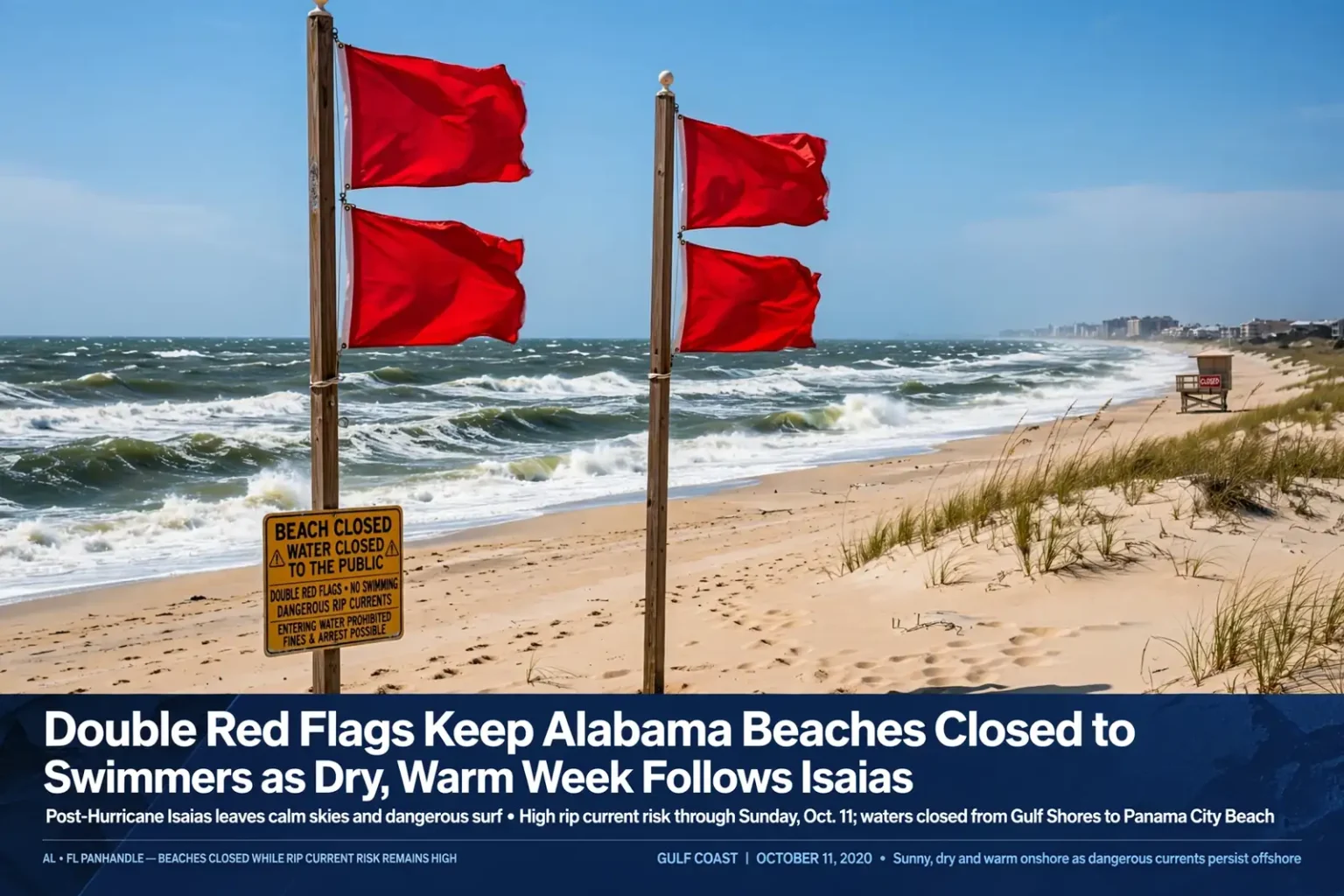
Double red flags are flying on Alabama’s beaches this weekend, keeping swimmers out of a Gulf still churned up by Hurricane Isaias, even as the weather onshore turns sunny, dry and warm. Forecasters expect the high risk of rip currents to last through Sunday, Oct. 11, before easing early in the week, while high pressure keeps rain chances near zero across south Alabama and northwest Florida until a cold front brings cooler air late in the week.
Isaias came ashore as a Category 2 hurricane Friday night, Oct. 9, near Destin, Fla., and has since moved well inland and lost its tropical characteristics. Its departure leaves behind a striking contrast: calm, clear skies over the coast and dangerous water just offshore.
Water closed from Gulf Shores to Panama City Beach
Double red flags, which mean the water is closed to the public, were posted Saturday at popular beaches along the northern Gulf Coast, including Gulf Shores and Orange Beach in Alabama and Pensacola Beach, Destin and Panama City Beach in Florida. Officials in Gulf Shores and Orange Beach cited “potentially life threatening rip currents and dangerous surf.”
Disobeying double red flags and entering the water can result in fines or arrest. Beach patrols use the closures to keep swimmers, surfers and waders out of the surf when conditions are so dangerous that rescuers themselves would be put at serious risk.
In Florida, Walton and Bay counties were flying double red flags, as were State Park Gulf Beaches, West Facing Gulf Beaches and South Facing Gulf Beaches.
Alabama beach conditions
Along the Alabama coast, conditions were expected to stay rough through Saturday, with waves of 3 to 5 feet and a strong westward-running current. Here is how forecasters expect the rip current threat to evolve at Dauphin Island, Fort Morgan, Gulf Shores and Orange Beach:
- Through Sunday: High risk of rip currents, with a warning in effect.
- Sunday night: Risk improving to moderate.
- Monday through Wednesday: Low risk of rip currents.
Even when the risk falls to low, forecasters stress that rip currents can still form, particularly near piers, jetties and sandbars. Swimmers should always check local beach conditions, follow posted flags and listen to lifeguards before entering the water.
Florida Panhandle surf
Conditions were even rougher to the east. The National Weather Service said dangerous beach conditions would continue along the Florida Gulf Coast through Saturday, with surf around 5 to 10 feet.
“It will be very dangerous to enter the surf, and residents and visitors should avoid entering the water,” the weather service said. “The high risk persists into Sunday before subsiding early next week.”
A High Surf Advisory for portions of the western Florida Panhandle was in effect until 3 p.m. Saturday for surf heights up to around 5 feet.
What a rip current is
Rip currents are narrow channels of fast-moving water that flow away from the beach. They can pull even strong swimmers out from shore surprisingly quickly. After a hurricane, the combination of lingering swells, reshaped sandbars and strong longshore currents makes rip currents especially likely and difficult to spot.
Forecasters noted that dangerous currents can pull swimmers away from shore even when the weather looks calm. That is the trap many beachgoers fall into in the days after a storm: bright sunshine and light winds onshore can mask hazardous water conditions that persist for days.
How to escape a rip current
The National Weather Service offers this advice for anyone caught in a rip current:
- Remain calm to conserve energy and think clearly.
- Never fight against the current.
- Think of it like a treadmill that cannot be turned off, which you need to step to the side of.
- Swim out of the current in a direction following the shoreline. Once out of the current, swim at an angle, away from the current, toward shore.
- If you are unable to swim out of the rip current, float or calmly tread water. When out of the current, swim toward shore.
- If you still cannot reach shore, draw attention to yourself by waving your arm and yelling for help.
If you see someone else caught in a rip current, standard safety guidance is to get help from a lifeguard or call 911 rather than going in after them, and to throw the person something that floats if possible. Many drownings involve would-be rescuers.
Know the beach flags
Alabama and northwest Florida beaches use a common color-coded warning flag system. A quick refresher:
- Double red: Water closed to the public.
- Red: High hazard, with high surf and/or strong currents.
- Yellow: Medium hazard, with moderate surf and/or currents.
- Green: Low hazard, calm conditions; exercise caution.
- Purple: Dangerous marine life, such as jellyfish, present.
Flags can change during the day as conditions shift, so check them every time you head to the water.
Forecast: Cooler Saturday night, sunny and warmer Sunday
Behind Post-Tropical Cyclone Isaias, drier air and clearer skies settled over the region Saturday night, allowing temperatures to fall into the 50s and 60s. Lows ranged from the mid-50s farther inland to the mid-60s near the immediate coast.
Sunday brings quieter weather across southern Alabama, northwest Florida and southeast Mississippi. Increasing sunshine and dry conditions will push afternoon highs into the mid to upper 80s, and rain chances will remain very limited as high pressure builds in behind the storm.
It will be a much calmer day, though storm cleanup will continue in some communities. Forecasters cautioned that anyone traveling through areas affected by Isaias should remain alert for lingering damage, debris and localized flooding.
Warm and dry through Thursday
High pressure is expected to keep the Gulf Coast warm and dry through much of the workweek. Afternoon highs will climb into the upper 80s to low 90s Monday through Thursday. Overnight lows will gradually warm, reaching the lower 60s inland and the upper 60s near the coast by midweek.
The dry stretch is good news for crews clearing debris and restoring power, and for residents making repairs. It also means the heat will be a factor for anyone doing strenuous cleanup work outdoors. Standard heat safety guidance applies: drink plenty of water, take frequent breaks in the shade or air conditioning, and work during the cooler morning hours when possible.
Cold front brings a cooldown late in the week
A weather system and cold front will approach late in the week, but rain chances are expected to remain very limited. Forecast guidance suggests there may not be enough moisture to produce meaningful rainfall as the front moves through Friday into Friday night.
Temperatures will fall behind the front. Friday’s highs will reach the mid to upper 80s, followed by highs around 80 degrees on Saturday, Oct. 17. Overnight lows will drop as well, reaching the lower 50s in some inland communities and near 60 degrees along the coast by Saturday night.
The front will bring a noticeable change in temperatures, but widespread rainfall is not expected at this time.
The bottom line for beachgoers
Visitors are allowed back on Alabama’s beaches now that the state has lifted its evacuation order, and the coming week’s weather will be about as pleasant as October gets on the Gulf Coast. But the water is another matter. Stay out of the Gulf while double red flags are flying, keep checking the flags as the rip current risk drops early in the week, and remember that a beautiful day on the sand does not guarantee safe conditions in the surf.