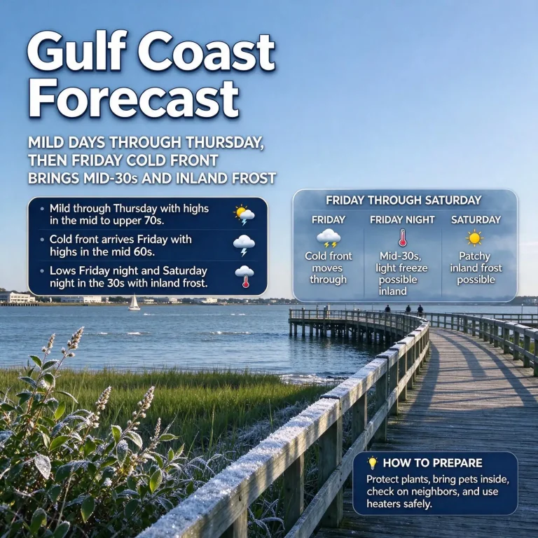
MOBILE, Ala. — The first frost and freeze of the fall season were forecast for the Gulf Coast this weekend, beginning Friday night, with a second cold night lined up for Saturday into Sunday morning. The National Weather Service placed inland portions of Mobile and Baldwin counties and the western Florida Panhandle under a Frost Advisory for Friday night into Saturday morning, Nov. 14, while freeze warnings covered a large part of Alabama farther north.
Update, Nov. 14: How Cold It Got Saturday Morning, and a Second Freeze Tonight
Saturday morning delivered the season’s first widespread freeze across much of Alabama, and forecasters expect a repeat overnight into Sunday before a slow warming trend takes hold next week.
Lowest readings between midnight and 6 a.m. Saturday
National Weather Service data showed temperatures in the 20s and 30s across the state. These are the coldest observations recorded during that window, not the official daily lows:
| Location | Low (°F) | Location | Low (°F) |
|---|---|---|---|
| Haleyville | 27 | Huntsville | 31 |
| Demopolis | 29 | Auburn | 32 |
| Anniston | 30 | Evergreen | 32 |
| Montgomery | 30 | Florala | 32 |
| Sylacauga | 30 | Greenville | 33 |
| Tuscaloosa | 30 | Mobile (regional airport) | 33 |
| Birmingham | 31 | Troy | 34 |
| Decatur | 31 | Dothan, Enterprise, Muscle Shoals | 35 |
| Andalusia, Eufaula | 36 |
Mobile came within a degree of freezing, while Haleyville in northwest Alabama was the coldest spot on the list.
Saturday night: warnings and advisories
- North and central Alabama: Freeze warnings from midnight to 8 a.m. Sunday, with upper-20s lows likely in many northern communities and lows from the upper 20s to lower 30s across central Alabama.
- Southwest and south-central Alabama: A freeze warning from midnight to 8 a.m. Sunday for Butler, Choctaw, Clarke, Conecuh, Crenshaw, Monroe, Washington and Wilcox counties.
- Wiregrass: A frost advisory from midnight to 8 a.m. Sunday for Geneva and Houston counties.
- Coastal counties: Frost remains possible inland, but forecasters trimmed the frost advisory to leave out southern Mobile and Baldwin counties, along with Stone and George counties in Mississippi, because thickening high clouds may keep temperatures from falling as far there. Overnight lows are expected in the lower 30s inland and the lower 40s near the coast.
The week ahead
- Sunday: Highs near 60 inland and in the lower to middle 60s elsewhere, with clouds increasing through the day. Sunday night should be slightly milder thanks to the cloud cover, though patchy interior frost is still possible.
- Monday: Cool and cloudy, highs in the upper 50s to lower 60s. A weak disturbance could bring a few showers or sprinkles, mainly in southeast Mississippi and possibly near the coast Monday evening. Forecast models disagree on whether measurable rain will fall in southern areas, and widespread rain is not expected.
- Tuesday through Friday: An upper-level ridge builds over the eastern United States, keeping conditions dry and allowing a gradual warm-up. Highs should reach the middle to upper 70s by Friday, with lows rebounding to the 40s inland and 50s near the coast. Statewide, highs in the 60s and 70s are expected by midweek, with no rain in the forecast for most of Alabama through at least the middle of the week.
Beach warning: rip currents return
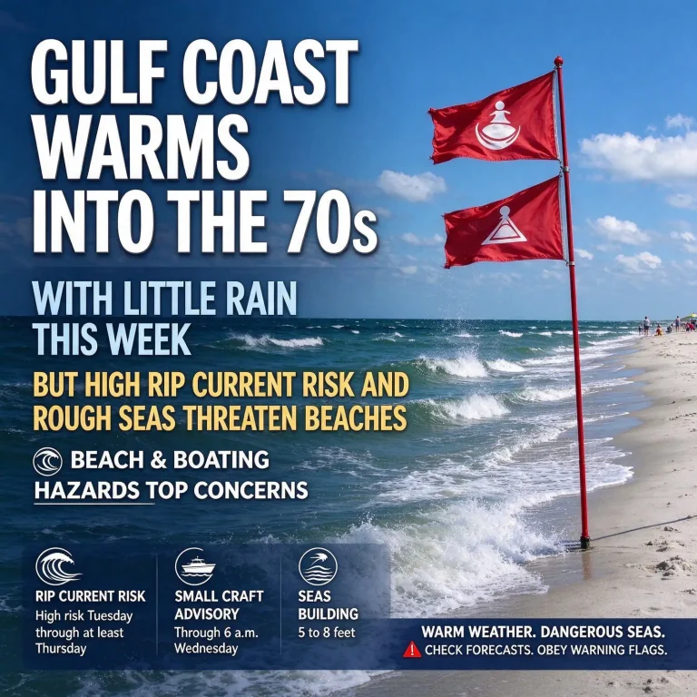
Even as temperatures climb, Gulf conditions are expected to turn dangerous. Strong high pressure to the north and low pressure developing over the Gulf will produce strong east-northeast winds beginning Monday. A high risk of life-threatening rip currents is expected to develop Monday or Monday night and continue through midweek, along with building surf and hazardous marine conditions. Beachgoers should check the flag warnings and stay out of the water when red flags are flying.
Lows across much of the region were forecast between 30 and 32 degrees, with frost possible as far south as roughly Interstate 10. Only the immediate coast and beach communities were expected to stay out of the frost zone, with readings in the upper 30s to low 40s.
Weekend Cold at a Glance
- Friday night into Saturday: Frost Advisory for inland sections of coastal counties, including Mobile, Baldwin and the Florida Panhandle; lows mainly 30 to 32 degrees inland
- Coldest local spots: Washington, Clarke, Monroe and Conecuh counties, with lows near freezing
- Beaches: Upper 30s to lower 40s
- Saturday: Mostly sunny and cool, with a high near 61
- Saturday night: Another cold night, with frost again possible down to near I-10 and another widespread freeze possible across Alabama
- Sunday: Highs returning to the mid-60s
Where the Cold Hits Hardest
Southwest Alabama and Northwest Florida
The advisory zone excludes the immediate coastline but covers the inland portions of the coastal counties. The interior counties of Southwest Alabama are expected to be colder still, with Washington, Clarke, Monroe and Conecuh counties forecast to hover near freezing early Saturday. Inland communities across Northwest Florida were also included in the advisory.
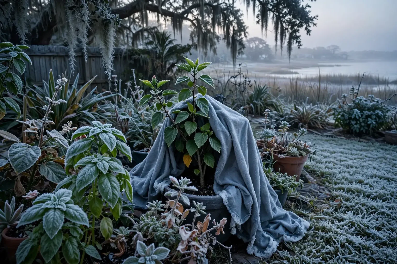
Forecasters noted that frost can form even when the official air temperature stays above 32 degrees. On clear nights with light wind, grass, rooftops and car windshields can lose heat faster than the surrounding air and drop below freezing, allowing ice crystals to form on those surfaces.
Central and north Alabama
Freeze warnings covered a large portion of the state, where the weather service expected a widespread freeze across the northern half of Alabama. North Alabama could fall into the upper 20s, while central Alabama was forecast to bottom out in the low to mid-30s. Most of south Alabama was expected to see lows in the mid-30s, and only the southernmost counties in the state were left out of the freeze watches and warnings.
How the Cold Air Arrived
A cold front pushed through the state on Thursday, Nov. 12, ushering in a much cooler air mass. Friday turned out to be a chilly day statewide. Highs reached only the low 50s in north Alabama and the low to mid-50s in central Alabama. Along the Gulf Coast, afternoon temperatures topped out in the lower to middle 60s as a northwest breeze gusted to around 20 mph at times.
Once the wind eased and skies cleared Friday night, conditions were ideal for rapid cooling. Calm air and clear skies let heat escape from the ground into the atmosphere, which is why the coldest readings typically come around sunrise.
Why the Beaches Stay Warmer
The split between frosty inland lawns and milder beachfront readings is a familiar pattern on the northern Gulf Coast. Water holds heat far longer than land, so the Gulf, Mobile Bay and the region’s back bays release warmth overnight and keep nearby air from cooling as quickly. A few miles inland, away from that moderating influence, temperatures can fall several degrees lower on a clear night, which is why advisories often cover the northern parts of Mobile and Baldwin counties while leaving the immediate coast out.
Low-lying spots and open fields tend to be the coldest of all. Cold air is denser than warm air and drains into valleys, creek bottoms and other low ground on calm nights, so frost can appear in some yards while a neighbor on higher ground sees none.
A Second Cold Night
The chill does not end after one night. Saturday is expected to be mostly sunny but cool, with highs in the 50s across most of Alabama and near 61 on the Gulf Coast. Saturday night into Sunday morning brings another round of frost potential locally, again reaching as far south as about Interstate 10, with a light breeze in inland areas.
Across the rest of Alabama, another widespread freeze is possible Saturday night, and some locations could end up a degree or two colder than they were Friday night. Anyone who covered plants or brought in pets for the first night should plan to do the same again.
Frost Advisory vs. Freeze Warning
The National Weather Service uses several products to warn about cold nights during the growing season, and each means something different:
- Frost Advisory: Temperatures are expected to drop into the middle 30s or so on a clear, calm night, cold enough for frost to form and damage sensitive plants even without a hard freeze.
- Freeze Watch: Conditions could allow temperatures to reach freezing within the next day or two.
- Freeze Warning: Temperatures are expected to fall to 32 degrees or lower, which can kill tender vegetation and harm crops.
These alerts are issued only during the growing season. Once an area records its first freeze, the growing season is considered over and the weather service stops issuing freeze watches and warnings there until spring.
Protecting Plants, Pets and Pipes
Gardeners have the most at stake with a first frost. A few common precautions can reduce damage:
- Bring potted plants, hanging baskets and tropical plants indoors or into a garage.
- Cover tender plants in the ground with sheets, blankets or frost cloth, letting the cover reach the ground to trap heat from the soil. Remove covers once temperatures rise the next morning.
- Avoid using plastic directly against leaves, since it can transfer cold to the foliage.
- Bring pets inside, or make sure outdoor animals have dry, insulated shelter and unfrozen water.
- Disconnect garden hoses and cover outdoor faucets if temperatures are expected to reach freezing.
Which plants need help
Not everything in the yard is at equal risk. Warm-season vegetables such as tomatoes, peppers, squash and basil are easily damaged by frost, as are tropical ornamentals like hibiscus and bougainvillea that are popular along the coast. Cool-season crops that many south Alabama gardeners plant in the fall, including collards, cabbage, kale and turnips, generally tolerate a light frost and may even taste sweeter after one. Watering beds a day ahead can help, since moist soil holds and releases more heat overnight than dry soil.
Check on neighbors
Older adults, young children and people without reliable heat are more vulnerable when temperatures drop into the 30s. A quick call or visit to an elderly relative or neighbor can make sure their heat is working and that they have what they need for a second cold night.
Heating safety
Cold snaps often send people reaching for space heaters and fireplaces for the first time in months. Keep space heaters at least three feet away from anything that can burn, plug them directly into a wall outlet, and turn them off when leaving the room or going to sleep. Never use a gas oven, grill or generator to heat a home, and make sure smoke and carbon monoxide detectors are working.
Early-morning drivers
Drivers heading out at dawn should allow a few extra minutes to clear frost from windshields rather than driving with limited visibility. Bridges and overpasses cool faster than other roads because air flows above and below them, so those surfaces deserve extra caution on the coldest mornings.
Warmer Days Ahead
Temperatures will rebound gradually. Sunday afternoon should reach the mid-60s on the Gulf Coast, and Monday brings a chance of an isolated shower with highs in the low 60s. That shower is the only meaningful rain chance in the local seven-day outlook.
Statewide, the cool pattern is expected to linger into the early part of the week before temperatures warm by midweek, although nights should stay chilly. On the coast, daytime highs are forecast to climb back into the mid to upper 70s by late in the week under mostly sunny skies.
Looking further out, NOAA’s Climate Prediction Center gives north and east Alabama a 50 to 60 percent chance of above-normal temperatures from Nov. 20 to 26, and west and south Alabama a 40 to 50 percent chance, suggesting a milder stretch heading toward Thanksgiving.