Foley Flooding Closes Roads as Flash Flood Warnings and Waterspouts Hit Coastal Alabama
Heavy rain Sunday triggered Flash Flood Warnings for southeastern Baldwin and southern Mobile counties, closed roads in Foley and uprooted trees, while waterspouts prompted tornado warnings along the coast.
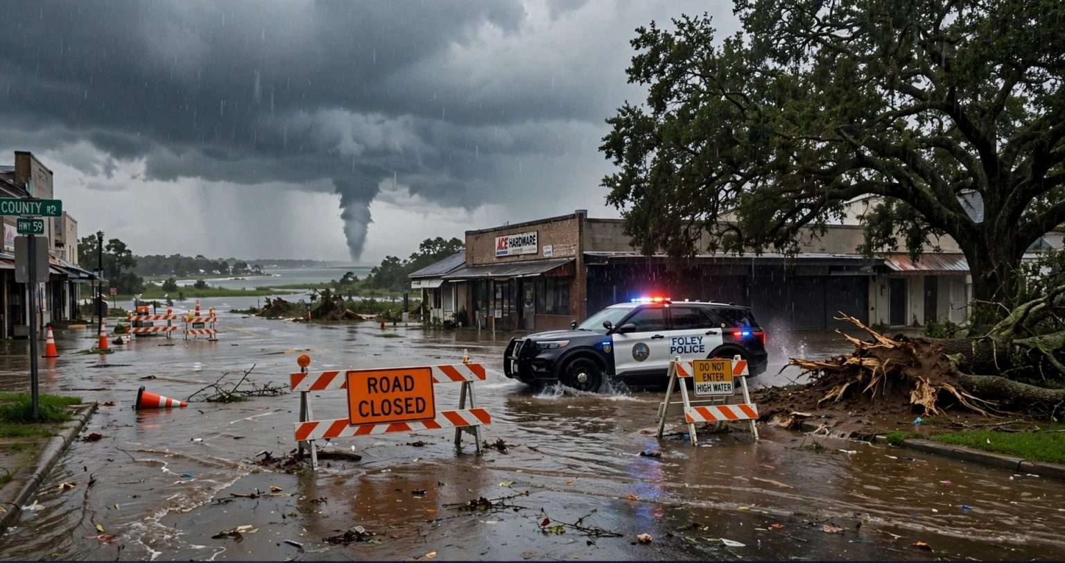
FOLEY, Ala. — Torrential rain hit coastal Alabama on Sunday, Oct. 4. Foley flooding closed several city roads, and firefighters answered calls for flooded streets and toppled trees. The National Weather Service also issued Flash Flood Warnings for southeastern Baldwin County and southern Mobile County.
Storms near the coast also produced waterspouts, and the weather service issued several tornado warnings during the day. Forecasters estimated that the heaviest storms were dropping rain at 2 to 5 inches per hour.
Nobody was reported hurt in the Foley flooding. Officials still urged residents to stay off the roads, and the weather service said more heavy rain was possible near the coast into early Monday.
Flash Flood Warning for Southeastern Baldwin County
The first warning came at 1:10 p.m. Sunday and covered southeastern Baldwin County until 4:15 p.m. Doppler radar showed thunderstorms with heavy rain over the area. By then, 2 to 3 inches of rain had already fallen.
Forecasters said another 1 to 2 inches was possible and that flash flooding was either underway or about to start. The communities named in the warning were Foley, Magnolia Springs, Summerdale, Elberta, Miflin, Marlow, RiverPark and Clay City.
The warning said small creeks and streams, urban areas, highways, streets, underpasses and other low-lying or poorly drained spots could flood. Those places tend to flood first when heavy rain sits over flat coastal ground.
Southern Mobile County and Dauphin Island Under Warning
At 2:30 p.m., the weather service issued a second Flash Flood Warning for southern Mobile County, in effect until 5:30 p.m. Radar showed 2 to 4 inches of rain had fallen there, and another 2 to 3 inches was possible.
Dauphin Island was the community named in that warning. Forecasters said flash flooding was ongoing or expected to begin shortly. The bulletin was flagged for activation of the Emergency Alert System, which sends urgent warnings out over broadcast radio and television.
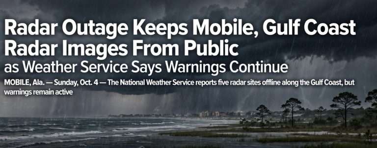
The weather service’s New Orleans office issued both warnings on behalf of the Mobile office. The weather service was also dealing with a regional radar communications outage that kept Mobile radar imagery from reaching the public over the weekend. Forecasters could still see the radar data internally and kept issuing warnings.
Foley Flooding Closes Roads as Police Urge Residents to Stay Home
The Foley Police Department posted a flood alert on social media shortly before 2 p.m. Sunday. Police said they had received many reports of road flooding around the city and had already closed several streets.
At 2:40 p.m., police posted an update listing these closures:
- East Michigan Avenue from Commercial Drive to Bay Street
- Westbound traffic at County Road 12 and James Road
- Eastbound traffic at County Road 12 and Highway 59
Police also asked drivers to use caution on U.S. 98 between Alston Street and Oak Street. With heavy rain expected to continue through the day, the department asked residents to skip unnecessary trips. Anyone who had to drive was told to stay out of flooded areas and away from standing water that hides the road surface.
The department acknowledged the weather might upset people’s Sunday plans and thanked residents for their patience. Police asked people to call the Foley Police Department to report severe flooding or road hazards.
Foley Fire Chief: ‘Conditions Really Started to Deteriorate’
Foley Fire Chief Joseph Darby said rain moved into the area Sunday morning and the roads got bad quickly after midday, starting on the south side of the city.
“Conditions really started to deteriorate with our roadways shortly after noon. We had some flooding conditions that began on the south end of town,” Darby said.
County Road 12 was closed from Highway 59 to James Road, and other roads with localized flooding were closed too. Darby said firefighters were also sent to trees pulled out of the soaked ground.
“We’ve had a couple of calls for trees that have fallen just due to saturation, and they’ve been uprooted,” he said.
Darby said one vehicle drove into deep water downtown. No one was hurt.
Concerns About Response Times and Darkness
Darby warned that flooded roads could slow emergency crews. He asked people to stay home unless they absolutely had to go out, especially after dark, when standing water, debris and downed trees are hard to see.
“We’re worried about the overnight hours where people, you know, visibility is an issue. People really can’t see some of these hazards, so that’s got us worried as it gets dark,” Darby said.
Sandbags Available for Foley Residents
City officials said Foley residents could pick up sandbags at the city’s old public works facility. Sandbags can steer shallow water away from doorways, garages and other low entry points, but they will not stop deep or fast-moving water.
Waterspouts, Tornado Warnings and Extreme Rain Rates
The weather service issued several tornado warnings for parts of coastal Alabama on Sunday as waterspouts threatened to come ashore. A waterspout is a rotating column of air over water. Forecasters issue a tornado warning when one could move onto land, because it can then do the same kind of damage as a small tornado.
The Storm Prediction Center kept a Level 1 of 5, or “marginal,” severe weather risk in place for areas near the coast. That level means isolated severe storms are possible, and the center said a low-end tornado threat came with it. The scale then goes to Level 2 (slight), Level 3 (enhanced), Level 4 (moderate) and Level 5 (high).
Rain was the biggest problem. The weather service estimated the strongest storms were producing 2 to 5 inches of rain per hour. At those rates, storm drains, ditches and small creeks fill faster than they can drain, and streets can flood within minutes, even in neighborhoods that seldom see high water.
The same coastal areas got rain over and over through the afternoon and evening. That pattern, often called “training,” piles up rainfall totals in the same spots and led to several flash flood warnings in the region.
Turn Around, Don’t Drown: Flood Safety Guidance
Both warnings carried the weather service’s standard advice: “Turn around, don’t drown.” The weather service says most flood deaths happen in vehicles, often when drivers try to get through water they think is shallow.
Floodwater is more dangerous than it looks. According to the weather service, 6 inches of fast-moving water can knock an adult off their feet, about 12 inches of moving water can carry away most cars, and 2 feet of rushing water can sweep away SUVs and pickup trucks.
Here are some safety steps for the next round of heavy rain:
- Never drive through flooded roads. If you can’t see the pavement, you can’t know how deep the water is or whether the road underneath has washed out.
- Be extra careful at night. As Darby pointed out, flooded roads and hazards are much harder to spot in the dark.
- Obey barricades. Driving around a road-closed sign puts you and the first responders who may have to rescue you at risk.
- Stay out of floodwater on foot. It can hide open storm drains, sharp debris and downed power lines, and it is often contaminated.
- Keep children away from ditches, culverts and drainage canals, which can fill and flow quickly during heavy rain.
- If your vehicle stalls in rising water, leave it and get to higher ground if you can do so safely.
- Watch for falling trees. Soaked ground, like the conditions Darby described, can let trees topple without strong wind.
- Have more than one way to get warnings, including phone alerts, a NOAA Weather Radio and local broadcasts.
Know the Difference Between a Watch and a Warning
A Flood Watch means conditions could lead to flooding, so it is time to get ready. A Flash Flood Warning means flash flooding is happening or about to happen, so act right away, especially if you are in a low-lying or flood-prone spot.
After the Water Recedes
When the water goes down, take photos of any damage before you start cleaning up, and call your insurance company. Standard homeowners and renters policies usually don’t cover flood damage. Flood coverage normally comes from a separate policy, such as one through the National Flood Insurance Program, and those policies usually have a 30-day waiting period before they take effect.
Throw away food, medicine and other items that touched floodwater. Have electrical systems and appliances that got wet checked before you use them again. Report downed power lines to your utility right away and stay well away from them.
What Comes Next for Coastal Alabama
The weather service in Mobile said rounds of heavy rain could continue through early Monday, “with flooding remaining possible, mainly along the coast.” Forecasters expected the region to begin drying out on Tuesday.
Forecasters were also watching an area of disturbed weather expected to form in the southern Gulf, which could become a tropical depression later in the week. They said it was too early to know whether it would affect Alabama. Residents should check the latest forecasts this week.
Foley residents can report severe flooding or road hazards to the Foley Police Department. In any life-threatening emergency, call 911.