Gulf Shores Trades 53 Acres for 30 — and Buys Itself a Way Out of the Neighborhood Detour
The Gulf Shores City Council has unanimously approved a land exchange with Gulf State Park, clearing the right-of-way for a bypass road that will finally connect the new Intracoastal Waterway bridge to Highway 59 and eliminate the Gulf Pines detour.
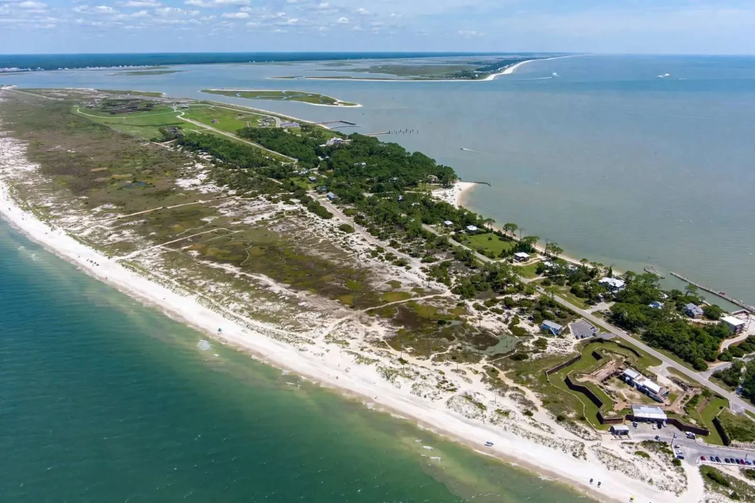
Gulf Shores has traded 53 acres of city-owned property for 30 acres of land in a deal that the city says will buy it a way out of a long-running impasse over how to manage public land on the Fort Morgan peninsula. The swap, approved by the city council, gives the city ownership of a smaller but more strategically located tract in exchange for a larger parcel that has been difficult to manage.
Why the Swap Makes Sense
The city’s larger parcel, totaling 53 acres, has been a challenge to manage because of its location and the limited infrastructure available to support it. The smaller 30-acre tract that the city is acquiring in the swap is in a more accessible area where the city can make more productive use of the land, according to city officials.
Land swaps of this kind are a common tool for municipalities that find themselves holding property that does not fit their long-term plans. By trading the larger parcel for a smaller but more strategically located one, the city is able to convert an asset that has been producing limited value into one that can support the city’s broader goals.
What the New Tract Allows
The 30-acre tract that Gulf Shores is acquiring in the swap gives the city more flexibility to plan for the area’s future. City officials have indicated that the new parcel may be used for public purposes, including potential recreational facilities, conservation or other uses that fit the city’s broader land-use strategy on the Fort Morgan peninsula.
The Fort Morgan peninsula, the narrow strip of land that runs west of Gulf Shores toward the historic Fort Morgan site, has been a focus of the city’s long-term planning efforts. The peninsula includes residential subdivisions, vacation rentals, the state historic site and a long stretch of public beach, and the city has worked to balance the competing interests of property owners, vacationers and the broader public in its planning decisions.
What Happens to the 53 Acres
The 53 acres that the city is giving up in the swap will be transferred to the other party in the transaction. The identity of that party and the specific terms of the deal have not been fully disclosed, but the city’s council approved the swap after a public discussion that included consideration of the long-term management challenges associated with the larger parcel.
City officials have indicated that the swap will allow the larger parcel to be put to a use that better matches its location and characteristics. The city’s role in managing the parcel under its previous ownership had been limited by the infrastructure and access challenges associated with the property, and the swap removes that burden from the city’s plate.
How the Deal Was Negotiated
Land swaps of this kind typically involve months of negotiation between the city and the other party, with both sides weighing the value of the properties being exchanged against the strategic value of acquiring different land. The negotiations are typically conducted in closed sessions under the state’s open meetings law, with the public discussion happening only when the deal is ready to be voted on.
The Gulf Shores council’s approval of the swap followed a public discussion that laid out the rationale for the deal and the expected benefits to the city. Council members voted to approve the swap after the discussion, and the city has signaled that the transaction will be completed in the coming weeks.
What the Public Sees
For Gulf Shores residents and visitors, the land swap is unlikely to produce immediate visible changes, but it represents a significant shift in how the city manages its property on the Fort Morgan peninsula. The smaller, more strategically located tract that the city is acquiring will give the city more options for the area’s future, while the larger parcel that the city is giving up will be managed by a private party that may be better positioned to make productive use of it.
The Fort Morgan peninsula has been the subject of long-running discussions about how to balance private property rights, public access and conservation. The land swap is one step in those discussions, and the city’s decision to focus its property holdings on the smaller, more accessible tract reflects the kind of strategic thinking that residents have been asking for.
Looking Ahead
City officials have indicated that the next steps will include working with the other party in the swap to finalize the transaction and beginning to plan for the future use of the 30-acre tract. Public input will likely be sought before any major decisions are made about the new property, and the city has signaled that it will keep residents informed about the planning process as it moves forward.
For Gulf Shores, the land swap is also a useful example of how municipal property decisions can produce positive outcomes when they are approached strategically. By trading a property that was producing limited value for one that the city can use more productively, the city has improved its long-term position without spending public funds on a new acquisition.
What the Fort Morgan Peninsula Is Known For
The Fort Morgan peninsula, which extends west from Gulf Shores toward the entrance of Mobile Bay, is one of the most distinctive stretches of land on the Alabama Gulf Coast. The peninsula is home to the historic Fort Morgan site, a Civil War-era fortification that has been preserved as a state historic site and that draws visitors interested in the area’s military history. The peninsula also includes miles of public beach, residential subdivisions that have grown up over the past several decades, and a mix of vacation rentals that accommodate the area’s seasonal tourism economy.
The peninsula’s geography, with a single road providing the only access in and out, has shaped how the area has developed and how the city has approached long-term planning. Residents and visitors who want to reach the peninsula must travel west from Gulf Shores along Fort Morgan Road, and that limited access has influenced everything from emergency response planning to the design of new subdivisions.
How Land Swaps Work in Alabama
Land swaps involving municipal property in Alabama typically follow a specific legal process. The city must determine that the swap serves a public purpose, and the council must vote to approve the transaction after a public discussion. Appraisals are typically required to ensure that the values of the properties being exchanged are reasonably comparable, although the strategic value of one property over another can justify a difference in acreage or appraised value.
The state’s open meetings law requires that the council’s discussion and vote on the swap happen in a public meeting, although the negotiations leading up to the deal can be conducted in closed session under the state’s existing legal framework for land transactions. The Gulf Shores council’s public discussion of the Fort Morgan swap followed that pattern, with the council voting to approve the deal after laying out the rationale in open session.
What It Means for Taxpayers
For Gulf Shores taxpayers, the land swap is essentially revenue-neutral, in the sense that the city is not spending cash to acquire the new property but is instead trading property it already owned. The transaction does shift the city’s property portfolio from one configuration to another, with the new configuration expected to produce more value for the city over time, but the immediate financial impact is minimal.
Longer-term, the swap positions the city to make more productive use of its property holdings on the Fort Morgan peninsula, which could translate into additional revenue or additional public benefits depending on how the new parcel is used. The city council’s decision to approve the swap reflects a judgment that the long-term value of the new configuration will exceed the long-term value of the existing one, and the council will have the opportunity to revisit that judgment as the planning process for the new tract moves forward.
What Residents Should Watch
Residents who want to follow the planning process for the new 30-acre tract can watch for council agendas that include discussions of the property, public hearings and other formal opportunities to weigh in. The city has indicated that it will seek public input before making major decisions about the future use of the property, and residents who want to influence those decisions should watch for those opportunities and participate when they arise.
How the City’s Property Strategy Is Evolving
The Fort Morgan swap is part of a broader effort by Gulf Shores to right-size its property portfolio on the peninsula. As the city has grown over the past several decades, it has accumulated land through a mix of purchases, donations and developer dedications, and not all of that land has turned out to fit the city’s long-term plans. Swaps like the one approved by the council give the city a way to convert properties that are no longer a good fit into properties that better match its current priorities.