Heat Indices Near 110 and Daily Storms: What the Gulf Coast Faces Through Midweek
Heat index values could approach 108 to 110 degrees Sunday and Labor Day across the Gulf Coast, with strong afternoon and evening storms possible, daily storm chances all week and a quiet Atlantic as hurricane season hits its Sept. 10 peak.
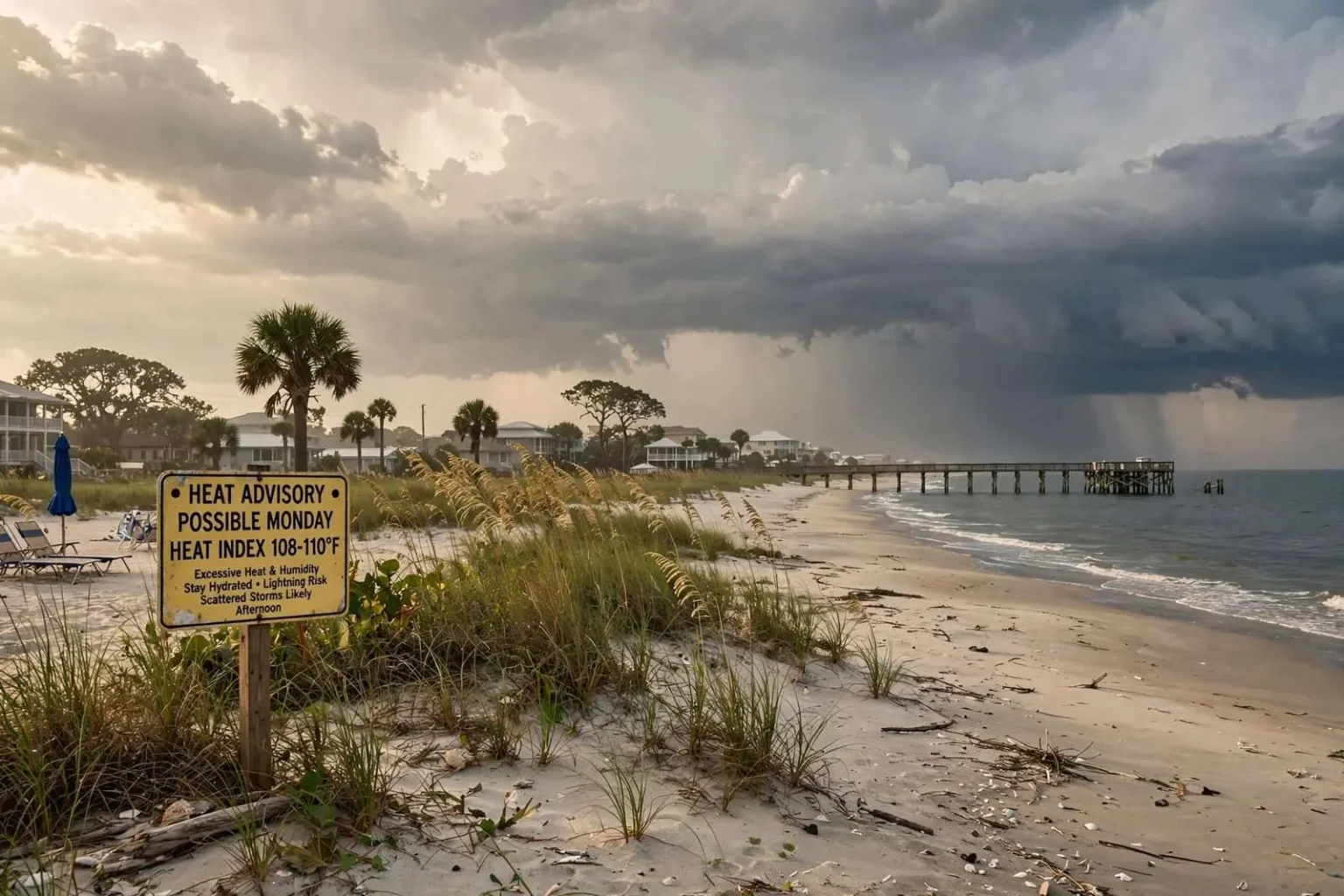
The Gulf Coast is heading into a stretch where both halves of the forecast are worth paying attention to. Scattered to numerous showers and storms are expected nearly every day through the coming week, and peak heat index values are forecast to run between 100 and 107 degrees — with some locations potentially approaching 108 to 110 Sunday and Monday.
The National Weather Service office in Mobile indicated a Heat Advisory may be needed for portions of the area Monday.
That Monday is Labor Day, which puts the holiday itself at the hottest point of the stretch. Forecasters expect much of the day to remain usable for outdoor plans — it does not look like a washout — but scattered thunderstorms are expected to develop during the afternoon and early evening, and a few of them could turn strong, with gusty winds, frequent lightning and heavy rainfall. Temperatures ease slightly later in the week, though daily storm chances continue.
The Setup
Forecasters describe the region as sitting on the periphery of upper-level ridging, with subtle shortwaves aloft moving across the area. That configuration is what keeps conditions both hot and stormy rather than one or the other.
Remnant moisture from Friday’s tropical wave remains in place across the region. The wave itself is becoming increasingly stretched out along the northern Gulf Coast and losing organization, but it has left behind a very moist environment that will continue fueling showers and thunderstorms into early next week. There is some possibility that a weak area of low pressure could develop over the eastern Gulf, though the main local impact remains increased moisture and storm activity rather than tropical development.
A developing backdoor cold front pushing south from the Tennessee Valley adds a second focus for storms Sunday and Monday.
Sunday
Afternoon highs will be quite hot over interior areas, topping out in the middle to upper 90s with heat indices warming into the 100 to 107 range. Nearer the coast, the atmosphere does not mix out as thoroughly, holding highs in the lower to middle 90s — with similar heat index values.
A shortwave crossing the area during the afternoon serves as a focus for thunderstorm development. Guidance varies significantly on how storms evolve, but forecasters expressed confidence that at least scattered coverage will exist areawide during the afternoon, lingering into the evening nearer the coast.
Storms will be capable of producing strong wind gusts alongside heavy rainfall. Isolated instances of flash flooding cannot be ruled out across urban areas where storms train repeatedly over the same locations.
Sunday Night: Storms Fade, Warm and Muggy
The scattered storms moving around the area Sunday evening are expected to weaken and fade gradually after dark. A stray shower or storm remains possible overnight, but most locations should stay dry.
The night will be warm and muggy, with temperatures settling into the middle 70s inland and the upper 70s closer to the coast. Those numbers are worth noting for reasons beyond comfort: an overnight low in the upper 70s at high humidity offers the body very little recovery from the previous day’s heat, which is the mechanism that turns a hot afternoon into a multi-day heat problem.
Monday
Monday carries a fair amount of uncertainty, and the reason is worth understanding: it depends on what happens upstream.
A complex of storms may form across Georgia and the Carolinas and roll across the area. If it does, morning storms would likely keep the region cooler through the day with a drier afternoon. If it does not, Monday will likely resemble Sunday — hot afternoon temperatures with scattered to numerous showers and storms developing.
That is a genuine fork rather than hedging. Morning convection stabilizes the atmosphere and shades the surface, suppressing afternoon development; its absence leaves the atmosphere free to destabilize.
Either way, storms through Monday carry the potential to be strong, with gusty winds and heavy rain the primary concerns, and localized flooding possible. A few storms could produce strong downdrafts or microbursts.
Heat becomes the larger concern Sunday and Monday, when heat index values could reach 108 to 110 degrees in some locations.
The holiday itself is expected to start with plenty of dry time, and the heat will build quickly through the morning. Afternoon temperatures should climb into the low to middle 90s across much of the area, with hotter readings possible farther inland, and the humidity will make it feel closer to 105 to 110 degrees in some locations during the hottest part of the day.
Scattered showers and thunderstorms are then expected to become more widespread during the afternoon and early evening, particularly across the southern half of the area. Anyone with outdoor holiday plans should stay hydrated, take breaks in the shade or air conditioning and keep an eye on radar, with a nearby indoor shelter available if storms approach. The standard rule applies: if you can hear thunder, you are close enough to be struck by lightning.
Monday Night: Storms Gradually Settle Down
Some showers and thunderstorms may continue into Monday evening before coverage gradually decreases overnight. Temperatures remain warm, with lows generally in the middle to upper 70s — a second consecutive night without much relief.
For a holiday, that evening timing is the awkward part of the forecast. Cookouts, boat returns and fireworks-adjacent gatherings tend to run right through the window when convection is still winding down, and a storm that has weakened is still capable of producing lightning well ahead of any rain reaching the ground.
Tuesday: Slightly Cooler, More Afternoon Storms
Temperatures come down a bit Tuesday, with most areas reaching the upper 80s to around 90 degrees. Scattered showers and thunderstorms are expected to develop again, with the greatest coverage during the afternoon.
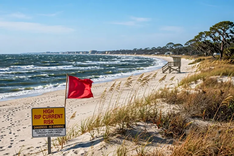
Beachgoers should note a change in the water as well: the rip current risk increases to Moderate on Tuesday along the Alabama and northwest Florida Gulf Coast. Swim near a lifeguard where possible, and check posted beach conditions before entering the water.
Midweek and Beyond
Upper ridging gradually spreads eastward with deep-layer easterly flow becoming established Tuesday into Wednesday. The ridge then breaks down late in the week as upper troughing sets up across the eastern United States.
The net effect keeps the pattern somewhat active. Expect scattered to locally numerous showers and storms each afternoon, with daily highs in the lower to middle 90s and overnight lows holding steady in the lower to middle 70s. Storms will continue to be capable of gusty winds and heavy rainfall.
As the front stalls and gradually weakens, the wetter pattern persists into Tuesday and midweek, particularly across the southern half of the area and near the sea breeze.
From Wednesday through the weekend, a familiar late-summer pattern settles in: sunshine mixed with scattered afternoon showers and thunderstorms each day, with some days seeing greater coverage than others. High temperatures generally stay in the upper 80s and lower 90s, and overnight lows remain in the 70s.
Most of those storms will be brief and scattered, but locally heavy rain, lightning and gusty winds remain possible with any of them. In practice that means outdoor plans through the week are best treated as movable by an hour or two rather than canceled — the typical afternoon storm in this pattern clears a given spot in well under an hour.
Why 108 Degrees Is Not Just an Uncomfortable Number
Heat index combines air temperature and humidity to express how heat actually stresses the body. The mechanism matters: the body cools primarily by evaporating sweat, and evaporation slows as humidity rises. At high humidity, sweating produces progressively less cooling for the same physiological cost in fluid and salt.
At heat index values approaching 108 to 110, heat exhaustion becomes likely with prolonged exposure or physical activity, and heat stroke — a medical emergency — becomes possible. Risk is elevated for outdoor workers, athletes, older adults, young children, people with chronic health conditions and anyone without reliable access to air conditioning.
Two Gulf Coast-specific factors compound it. Overnight lows in the mid-70s with high humidity provide limited recovery, so heat stress accumulates across consecutive days rather than resetting each night. And afternoon thunderstorms, while briefly cooling, pump additional moisture into the boundary layer — which can push heat index values higher once the sun returns.
At the Beach
Beachgoers face both hazards at once. Morning showers and thunderstorms will be possible near the coast, with storms becoming more likely inland during the afternoon. Waterspouts remain possible over coastal waters, particularly during morning hours.
The standard guidance applies without exception: if you hear thunder, head indoors and wait for the storm to pass. Open beaches and piers offer no protection, and lightning routinely strikes well ahead of visible rainfall.
Heat on the beach is worse than the forecast number suggests. Sunshine, humidity and hot sand combine to make conditions feel hotter than the ambient heat index. Stay hydrated and take frequent breaks from direct sun.
The rip current risk remains Low for Alabama and Florida beaches through the period, though it may try to reach Moderate Tuesday as stronger easterly flow becomes established.
Aviation and Marine
For aviation, the focus is developing thunderstorms and showers across coastal locations, potentially affecting Jack Edwards National Airport in Gulf Shores and Pensacola. Additional inland thunderstorms are expected during the afternoon, with a few strong or locally severe storms possibly drifting in from the north late in the day. Main impacts are gusty, erratic downdraft winds and reduced visibility and ceilings from heavy rain. VFR conditions prevail outside of convection.
On the water, generally light to occasionally moderate southwest-to-west flow prevails through Monday, shifting to light to moderate easterly flow Tuesday into Wednesday, then light to occasionally moderate onshore flow for the remainder of the week. Seas generally run 1 to 2 feet throughout. Scattered to numerous showers and thunderstorms remain possible during morning hours each day, with potential for gusty winds and waterspouts.
Point Forecasts
Preliminary temperatures and precipitation chances (high, low, high, low / percent chance of precipitation):
- Mobile: 92, 74, 94, 74 / 40, 20, 60, 40
- Pensacola: 91, 77, 92, 76 / 30, 20, 60, 60
- Destin: 89, 78, 90, 76 / 20, 30, 70, 60
- Evergreen: 95, 72, 95, 71 / 50, 40, 50, 40
- Waynesboro: 96, 73, 98, 72 / 40, 30, 20, 20
- Camden: 96, 73, 96, 72 / 50, 40, 20, 30
- Crestview: 94, 73, 94, 72 / 40, 20, 80, 50
Note the interior-versus-coastal split: Evergreen, Waynesboro and Camden run several degrees hotter than Mobile, Pensacola and Destin. Coastal locations benefit from marine influence and sea breeze; inland areas mix out more thoroughly and reach higher afternoon temperatures.
Advisories
As of the latest issuance, no watches, warnings or advisories were in effect for Alabama, Florida, Mississippi or the Gulf marine zones. A Heat Advisory may be needed for portions of the area Monday, and areas of dense fog were possible early Saturday morning along the Interstate 10 corridor across the Florida Panhandle and near the Alabama-Florida line.
The tropics remain worth monitoring, though the current local story is moisture and heat rather than development.
Tropical Update: The Atlantic Is Quiet at the Peak
As the Sept. 10 statistical peak of hurricane season approaches, the Atlantic basin remains unusually quiet. The National Hurricane Center is not expecting any new tropical development over the next seven days, and there are no tropical threats to the Gulf Coast over the next seven to 10 days.
The Pacific, by contrast, remains much more active, with multiple tropical systems ongoing.
Sept. 10 is not an arbitrary date. It is the climatological midpoint of Atlantic hurricane activity — the day on which, averaged across decades of records, the most storms have been active in the basin. Sea surface temperatures are near their annual maximum, wind shear across the tropical Atlantic is typically at its seasonal minimum, and the African easterly waves that seed most major hurricanes are coming off the continent at their highest frequency. A basin with nothing on the map at that point in the calendar is genuinely unusual.
It is also not a guarantee. Roughly a third of Atlantic activity in a normal season still occurs after Sept. 10, and the Gulf Coast has been struck by significant storms in October and even early November. A seven-day window with no expected development is a real and welcome piece of information for anyone with plans on the water; it is not the end of the season, and hurricane season does not close until Nov. 30.
Forecast information is drawn from the National Weather Service office in Mobile. Conditions change; check the latest official forecast and any active advisories before making plans.