Mobile Launches Redistricting Webpage With Interactive District Map
The City of Mobile launched a redistricting webpage with FAQs, meeting dates, public feedback forms and an interactive map of current and proposed.
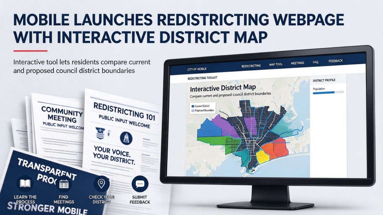
Mobile residents can now track the city’s redistricting effort in one place, thanks to a webpage the city launched to document the process underway between Mayor Sandy Stimpson and the Mobile City Council. The page gathers everything related to the once-a-decade redraw in a single spot: an explanation of how the redistricting process works, a list of frequently asked questions, dates for upcoming community meetings and a form where residents can submit feedback directly to city officials.
The launch signals how the city intends to run a process that will redraw the political map for every neighborhood in Mobile. Redistricting decisions determine which council district a resident votes in, which council member represents them at City Hall, and how resources and attention are balanced across the city’s seven districts. By putting the materials online as the process unfolds rather than after it ends, city officials are inviting the public to follow along — and to weigh in — while the map is still being drawn.
An interactive map at the center
The centerpiece is an interactive map that lets users compare the existing council district boundaries against the proposed ones. Built by the city’s GIS department, it also layers in population data and racial demographics for each district across Mobile, giving residents a level of detail that once would have required a public records request to obtain. Anyone with an internet connection can look up their own street, see which district it falls in today, check where it would fall under the proposed lines, and view the population figures driving the changes.
The demographic layer matters because population shifts are what force redistricting in the first place. Census results showed how Mobile’s population moved over the past decade, and the city must adjust district boundaries so that each of the seven districts contains roughly equal numbers of residents. Where growth concentrated, districts shrink in area; where population declined, districts expand to sweep in more residents.
The mayor’s pitch for transparency
“When we started this process a few weeks ago, our goal was to have a thorough and transparent process,” Stimpson said. “Thanks to input from all seven city councilors and the hard work of the City’s GIS department, we’ve put together a toolkit I believe will help us do that moving forward.”
The mayor’s framing emphasizes two things at once: collaboration with the council and technical accessibility for the public. Redistricting has historically been conducted with scattered public notices and paper maps at City Hall, which limited who could participate to the people who followed City Hall closely. A webpage with an interactive map, plain-language explanations and a direct feedback form lowers that barrier considerably.
Why redistricting happens every ten years
Redistricting follows each federal census and determines how Mobile’s seven council districts are drawn to reflect shifts in where residents live. The principle behind it is simple: districts should represent equal numbers of people so that each council member speaks for a comparable constituency. Over a decade, though, neighborhoods change — some parts of the city grow with new subdivisions and apartments, others lose population — and the once-equal districts drift out of balance. The census provides the updated counts, and the redraw brings the districts back into alignment.
For the City of Mobile, the process involves both the mayor’s administration and the seven-member council, and the final map must be adopted by the council. Along the way, the city must satisfy federal requirements, including those protecting minority voting rights under the Voting Rights Act, which is why the racial demographic data on the new map is not just informational — it is part of the legal analysis that any redraw must survive.
What the community meetings will do
The meeting dates posted on the webpage give residents a series of chances to respond to the proposed boundaries in person. Public meetings during redistricting serve a practical purpose beyond commentary: residents know their neighborhoods in ways demographic data cannot capture. They can point out that a proposed boundary splits a neighborhood association, separates a school attendance zone, or draws a line that residents on both sides consider artificial. City planners and council members use that local knowledge to refine draft maps before adoption.
Meetings also give the process its legitimacy. Boundary drawing is the kind of work that can look abstract — or worse, self-interested — when done behind closed doors, and cities that redraw maps with minimal public involvement often spend years absorbing the suspicion that followed. Mobile’s schedule of public meetings, advertised on the same page as the maps themselves, is the administration’s way of avoiding that outcome. Every comment made at a meeting becomes part of the record that the final map can point back to.
Public input gathered through the meetings and the feedback form will shape the final map the council considers. Residents who want to weigh in without attending a meeting can use the online form at any time, and the webpage’s FAQ addresses the questions city staff hear most often — including why a district line might move, what stays fixed, and how long the process takes.
What the law requires of the new map
The redraw is not a freehand exercise. Beyond the equal-population requirement, district lines must comply with federal protections for minority voting strength, follow traditional redistricting principles such as contiguity, and respect the geographic and neighborhood boundaries that make districts coherent. Population deviation between districts must be kept within accepted tolerances, which means a shift of a few thousand residents in one part of Mobile can ripple through boundary adjustments in every other district.
That ripple effect is one of the least understood parts of redistricting. Because all seven districts must remain roughly equal, moving one boundary line usually forces adjustments elsewhere — a change near the county line can ultimately reshape a district on the other side of the city. The interactive map lets residents trace those ripples across the whole city rather than just their own block.
What redistricting changes for residents
Most residents will see the effects of redistricting in three ways. First, representation: if your street moves into a different district, your council district seat — the official you call about potholes, zoning questions and neighborhood issues — changes at the next election. Second, elections: district boundaries determine where candidates must live and which voters they campaign before, so the redraw can reshape the field in every affected seat. Third, attention: council districts are the basic unit through which city services, infrastructure priorities and redevelopment focus are organized, and boundary lines influence how those decisions balance across the city.
The interactive map makes those stakes visible in a way spreadsheets cannot. A resident can see immediately whether the proposed lines move them, whether their neighbors remain in the same district, and what the population and demographic profile of each redrawn district looks like. For civic groups, neighborhood associations and prospective council candidates, that information is the raw material for the public debate to come.
A toolkit built in-house
The GIS department’s work deserves particular note. Interactive comparison maps with layered demographic data were once the province of expensive outside consultants; Mobile’s team produced this one in-house, in a process the mayor said began only weeks ago. Building it in the city’s own systems means updates can go live quickly as drafts evolve — residents will not be looking at a stale snapshot while negotiations move forward at City Hall.
The mayor’s acknowledgment of “input from all seven city councilors” is also a practical detail. Council members know their districts’ micro-geography better than anyone, and early input from the full council suggests the administration wants the eventual map to have the seven votes it needs for adoption — a map imposed without council buy-in rarely survives the process.
How to take part
For residents, the steps are straightforward. Visit the city’s redistricting webpage, find your address on the interactive map, and see how the proposed boundaries would affect your district. Read the FAQ for background on the rules, note the dates for the upcoming community meetings, and either attend or submit feedback through the online form. The window for public influence closes when the council adopts the final map, which means the period between the webpage’s launch and that vote is when residents’ comments carry the most weight.
Redistricting happens once a decade, quietly, and its consequences outlast the process by years. Mobile’s decision to open the books — map, data, meetings and all — gives the city’s neighborhoods a real opportunity to shape the lines that will represent them until the next census. The toolkit is there; the rest depends on who uses it.