Mobile Opens Redistricting Debate With Virtual Town Halls on New Council Maps
Mobile's first redistricting town halls take input on maps adding a fourth majority-Black district; Mayor Stimpson's final plan is due Feb. 12.
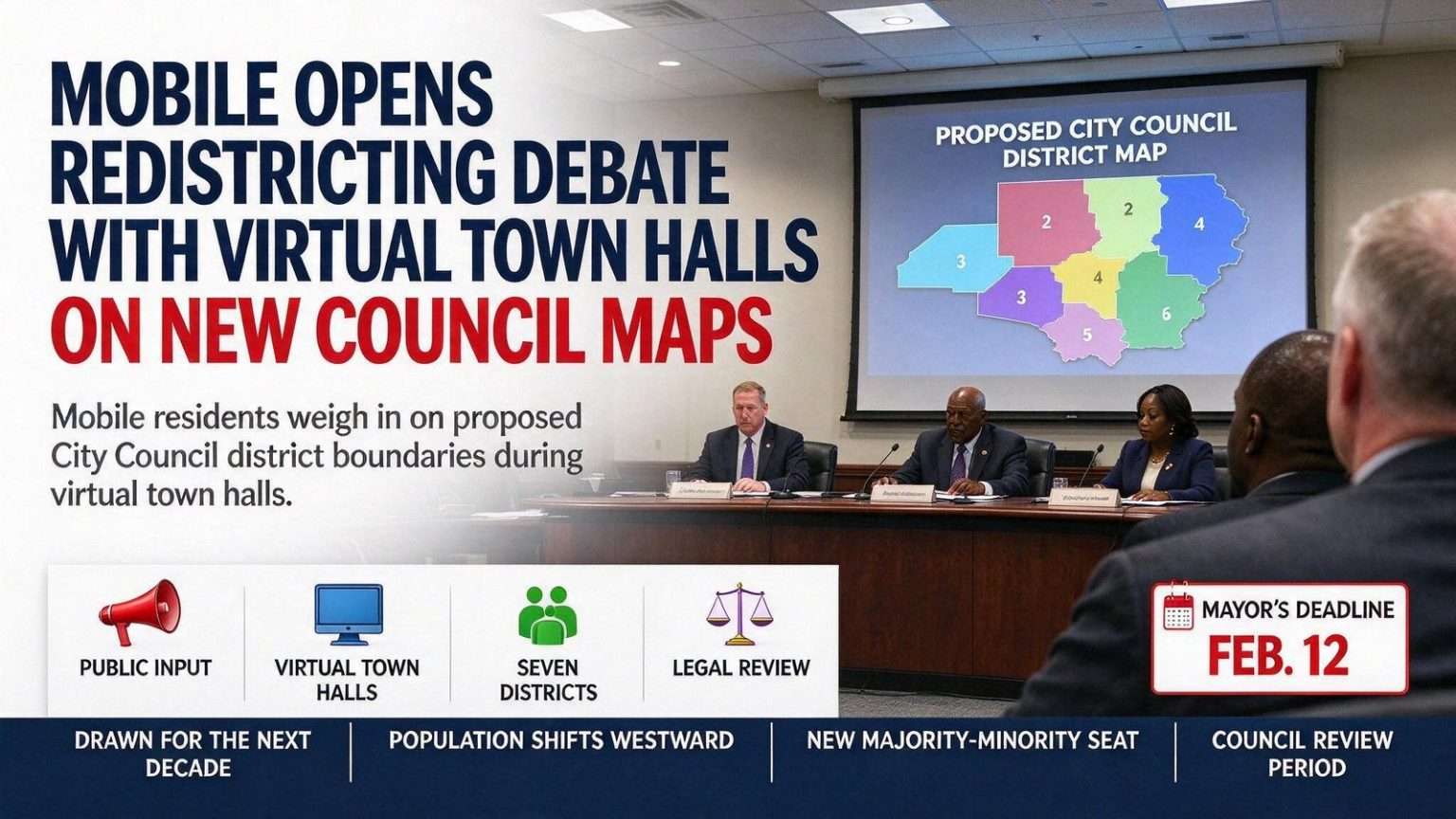
Mobile residents got their first chance to weigh in on proposed City Council district boundaries during two virtual town halls streamed on the city’s Facebook page — one at noon, another at 5 p.m. The dual sessions gave Mobilians who work different schedules a window into a process that will shape local elections for the next decade.
The proposal under discussion would create a fourth majority African American district, adding a majority-minority seat in District 7 on the city’s northwest side. The change stems directly from the population shifts recorded over the past decade, and it would mark the most significant reshaping of Mobile’s council map since the districts were last drawn.
Under the current draft, part of Spring Hill moves into District 1, while District 3 picks up areas west of Dog River now in District 4. Those adjustments trace the movement of people across the city: neighborhoods that once anchored one district’s population core now sit closer to another’s.
A Tight Timeline for a Final Map
The city council will offer input before Mayor Sandy Stimpson produces a final plan by Feb. 12. Once he does, council members will have six months to approve or reject it — a runway that gives the body time for deliberation but not for an open-ended stalemate.
In an email ahead of the meetings, Stimpson noted that “there have already been some suggested adjustments and there will be more moving forward.” The message signaled that the draft maps shown in the town halls are a starting point rather than a finished product, with feedback from council members and residents expected to refine the boundaries before the mayor’s deadline.
The maps divide Mobile’s roughly 187,000 residents into seven districts of more than 26,000 people each, drafted by a legal team working with the city’s mapping staff. The near-even split is not accidental: federal law requires districts to be substantially equal in population, and the legal team’s involvement reflects the compliance obligations that accompany every municipal redistricting.
Why the Map Must Change
The driving force behind the changes is demographic drift. Both the city’s overall population and its African American population have moved westward over the past decade, leaving some districts overpopulated relative to others and shifting where concentrations of voters live. A map drawn on the previous decade’s census cannot remain legally balanced when the people have moved.
Redistricting follows every census, and for cities the stakes are concrete: district boundaries determine which neighborhoods are grouped together for representation, which candidates can realistically compete, and how responsive each council seat is to its constituents. Mobile’s seven districts each elect one council member, so even modest line adjustments can change the character of a district’s electorate.
What the Proposed Lines Change
The move of part of Spring Hill into District 1 reallocates one of the city’s most recognizable neighborhoods, whose voters would shift from their current council representation to the district anchored nearer the city’s central and western core. District 3’s absorption of areas west of Dog River similarly pulls in territory that had belonged to District 4, reflecting how growth west of the river has outpaced the boundaries drawn a decade ago.
The most consequential proposed change is in northwest Mobile, where District 7 would become the city’s fourth majority African American district. The creation of a new majority-minority seat would give African American voters in that part of the city a district in which they make up the majority of the population — a shift with direct implications for who runs, who votes, and who wins the seat in future elections.
Under the Voting Rights Act, jurisdictions must ensure that their districting does not dilute the voting strength of minority communities, and where population concentrations support it, majority-minority districts are one of the standard tools for compliance. Mobile’s seven-district council structure, adopted decades ago after the city moved from at-large to district elections, is built around that framework.
How Residents Can Shape the Process
The virtual town hall format — streamed on the city’s Facebook page at noon and again at 5 p.m. — reflected the practical realities of public engagement. Streaming the sessions allowed residents to participate from home or work, ask questions, and see the proposed maps without traveling to a government building, and the two-session schedule made the process accessible to residents whose work hours fall across the middle of the day.
Public comment at this stage matters because the timeline leaves room for revision. Council input comes before the mayor’s Feb. 12 deadline for a final plan, and Stimpson’s acknowledgment that adjustments are already arriving suggests the draft lines will move before they are finalized.
Residents can follow the process through the city’s published map materials and council proceedings. Once the mayor produces his final plan, the six-month clock gives the council its constitutional window to act, and any approved map would take effect for subsequent council elections rather than immediately unseating current members.
The Decade Ahead
Whatever map ultimately emerges will define Mobile’s political geography through the next census. The districts being debated now will determine where neighborhood associations look for representation, which corridors candidates canvass, and how the city’s westward growth translates into political voice.
The westward drift that drove this round of redistricting is itself a story about the city: as population moved toward West Mobile and the areas beyond Dog River, the older core districts thinned relative to their 2010 boundaries. Maps that made sense ten years ago now split communities or concentrate uneven shares of the city’s 187,000 residents.
The process now underway — two town halls, council input, a mayoral deadline, and a council decision window — is the established mechanism for reconciling that change with the legal requirement that every district carry substantially equal weight. By Feb. 12, Mobile will have its answer, and by the next council elections, voters will cast ballots in districts drawn for the city as it is today.
Inside the Drafting Work
Drawing council districts is a technical exercise governed by strict rules. Districts must be nearly equal in population, must be compact and contiguous, and should respect natural and political boundaries where practical. Mobile’s draft maps, prepared by a legal team working with the city’s mapping staff, divide the city’s roughly 187,000 residents into seven districts of more than 26,000 people each — a balance that must hold against the latest federal census counts.
The legal team’s role is significant. Redistricting decisions are frequently tested in court, and the law surrounding minority voting rights, compactness, and population equality is detailed and evolving. Having counsel involved from the drafting stage — rather than after a map is adopted — is the standard approach for municipalities that want their plans to withstand scrutiny.
The mapping staff, meanwhile, translates legal requirements into actual lines on the ground, working with precinct data, census geography, and the city’s street grid. Small changes — moving a boundary from one street to the next — can shift thousands of residents between districts, which is why the draft maps presented at the town halls are reviewed block by block.
What District 7’s Change Would Mean
The proposal’s centerpiece — a fourth majority African American district in District 7 on the city’s northwest side — follows the migration patterns the census documented. As Mobile’s African American population drifted westward over the past decade, the concentrations that once defined the city’s existing majority-minority districts shifted with them, leaving the northwest side with the population to anchor a new one.
If adopted, the change would alter the makeup of the council’s electoral map without changing the council’s size. Mobile’s seven districts each elect one member, and the current draft keeps that structure intact while redistributing the population within it.
For residents of the neighborhoods involved — Spring Hill’s affected sections, the areas west of Dog River, and the northwest side communities in District 7 — the practical effect begins with representation questions: which council member answers their calls, sits on their committees, and carries their priorities into budget debates. Those relationships take shape after the first election under new lines.
The Council’s Decision Window
Once Mayor Stimpson delivers his final plan on or before Feb. 12, the council’s six-month window to approve or reject the plan is the last formal checkpoint. The body cannot redraw the mayor’s map at will under this process — its choice is approval or rejection — which concentrates the influence of both the council and the public in the input stage now underway.
That structure makes the town halls and the suggested adjustments Stimpson referenced especially important. The final plan will have been shaped by what arrives before the deadline: council feedback, resident comments from the virtual sessions, and the technical corrections the drafting team identifies as it tests the lines against census data.
Mobile has been through this process before, after each census, and the outcome each time has been a map that looked familiar to the previous one but reflected the city’s changed population. This round’s changes — westward line adjustments, a redrawn District 7, and rebalanced districts across the city — continue that pattern, converting ten years of movement in Mobile’s neighborhoods into the framework for its next ten years of representation.