Rare Snow Flurries Dust Parts of Mobile and Clarke Counties
Light snow flurries fell across parts of Mobile and Clarke Counties late Saturday night, the National Weather Service in Mobile reported.
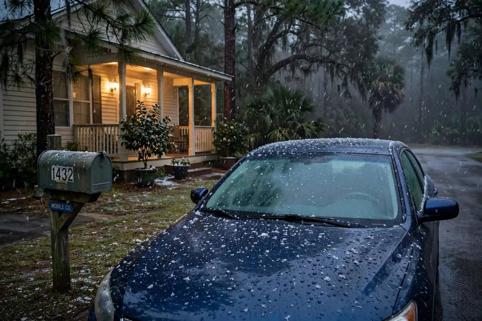
Parts of south Alabama got a brief taste of winter over the weekend when light snow flurries drifted across the region late Saturday night and into early Sunday morning. The National Weather Service office in Mobile received reports of flurries from both Mobile County and Clarke County, confirming that frozen precipitation reached the ground in communities that more commonly see plain cold rain, sleet or nothing at all during Gulf Coast cold snaps. Forecasters attributed the fleeting snowfall to a combination of lingering moisture in the atmosphere and well-below-normal cold temperatures in place across the region.
The timing mattered as much as the temperature. The flurries arrived after dark, when temperatures were at their lowest point of the night, and they moved through quickly enough that most residents who slept through the event woke to nothing more than a story told by neighbors. Those who were outside late Saturday or up before dawn Sunday described a brief scattering of white flakes against porch lights and windshields — a novelty along a stretch of coast where snow is the exception measured in decades rather than seasons.
No accumulation was reported anywhere in the affected counties, and the flurries did not create any travel problems. Roadway surfaces across Mobile and Clarke counties held whatever warmth they had absorbed during the day, which meant that even where flakes briefly clung to grassy spots or car hoods, they melted almost immediately. Law enforcement agencies reported no weather-related crashes tied to the snowfall, and utility providers saw no widespread outages linked to the cold.
Even so, the sight of snow falling anywhere along the upper Gulf Coast is unusual enough that residents took notice. Word of the flurries spread quickly through social media and neighborhood message boards, with people posting short videos and photographs as proof for skeptical friends and relatives living farther north. In a region where a hard freeze can close schools and burst pipes, actual snow falling from the sky is an event that people remember and talk about for years afterward.
Why snow is so rare near the Gulf
Snow flurries of this kind occasionally reach the coastal counties when Arctic air masses push far enough south while moisture remains available overhead. The recipe is a delicate one. Cold air dense enough to reach the Gulf Coast usually arrives on dry northerly winds that sweep the atmosphere clean of clouds, which is why so many severe cold snaps in south Alabama arrive under bright blue skies. For snow to fall, the cold air must arrive at the same time a lingering supply of moisture is still overhead, and the entire column of air from the cloud deck to the ground must remain below freezing so that flakes do not melt into raindrops or sleet on the way down.
Most events that manage that combination still melt on contact with the ground, as appears to have been the case with this weekend’s flurry activity. Gulf Coast soils, pavement and shallow water stay relatively warm even during Arctic outbreaks, and a surface temperature at or above freezing erases whatever reaches it within moments. That is why residents of Mobile and Baldwin counties can count on one hand the times in their lives when snow has actually stuck to the ground, while residents of the Midwest shrug at totals that would shut the entire Gulf Coast down for a week.
Proximity to the Gulf of Mexico is the other half of the equation. Mobile Bay and the shallow coastal waters moderate temperatures year-round, keeping winter nights milder than inland locations just a short drive north. Communities along and north of the U.S. 84 corridor typically see at least a chance of wintry precipitation most winters, while the immediate coast can go many years between events in which frozen precipitation of any kind is even observed, much less reported.
When snow has visited the Gulf Coast before
The Deep South’s recorded weather history includes a handful of genuinely memorable snow events, which is part of why each new flurry draws such attention. The Great Blizzard of 1899 brought snow and record-breaking cold across the Gulf states, reaching all the way to the coast and beyond, and remains a benchmark event in Southern weather lore more than a century later. In more recent decades, light snowfalls have occasionally dusted the region when the right combination of cold air and Gulf moisture came together, including a widely remembered December 2017 event that put a thin white coating on parts of the central Gulf Coast and delighted residents from Louisiana to the Florida line.
What those events share with this weekend’s flurries is rarity. Many lifelong residents of Mobile and Clarke counties have never seen measurable snow at home, and children in the region routinely grow up hearing older relatives describe the one snow of their childhood the way people elsewhere describe a famous hurricane. National Weather Service records for the Mobile area show that years can pass between reports of even trace amounts, and measurable accumulations are rarer still. Each event becomes a small piece of local history, recalled and compared whenever the next one arrives.
Clarke County’s experience mirrors that of the coast. The county sits inland enough that its temperatures run a few degrees colder on winter nights than downtown Mobile, which gives it a slightly better shot at seeing flurries when cold air floods the region. Groves of pine timber, pastures and the low ridges north of the Tombigbee and Alabama rivers give the landscape more of a wintry backdrop than the sandy coastal plain to the south, so even a brief flurry stands out against the scenery for residents in Grove Hill, Jackson and Thomasville.
What forecasters watch when cold air arrives
The National Weather Service office in Mobile, located at the regional airport, covers southwest Alabama, northwest Florida and southeast Mississippi, and its forecasters track a well-defined checklist whenever Arctic air threatens the Gulf Coast. The first question is the depth of the cold air — whether the sub-freezing layer reaches from the ground up through the cloud deck or only sits in a thin layer near the surface. The second is moisture, since the same dry winds that transport Arctic air southward usually wipe out clouds along the way. The third is timing, because the coldest readings arrive in the pre-dawn hours when flurries are least likely to be seen.
When those ingredients line up, forecasters begin mentioning the possibility of flurries or light wintry mix in public forecasts, and spotter networks along the coast are asked to report anything that falls. That is essentially what happened over the weekend: the reports that reached the Mobile office from Mobile and Clarke counties came from residents and trained observers who happened to be awake and watching as the brief band moved through. Without those reports, an event this short and this light could easily pass undocumented, since radar signatures for flurries are faint and often indistinguishable from light rain or noise.
The weekend event also served as a reminder of how the region’s infrastructure is built for heat rather than cold. South Alabama roads are not treated for ice, few homes have heat pumps rated for prolonged sub-freezing weather, and exposed pipes become the chief worry whenever temperatures plunge. A flurry event with no accumulation carries none of those hazards, but the same pattern a few degrees colder would change the picture quickly, which is why forecasters pay close attention every time Arctic air heads south.
A quiet weekend for roads, schools and utilities
Because the flurries produced no accumulation and fell overnight, life across the two counties proceeded normally. There were no school delays announced for Monday, no closures of bridges or major routes, and no reports of stranded motorists tied to the weather. Emergency management officials in both counties had monitored the forecast through the weekend, as they do during any cold outbreak, but the event never rose to the level of an activation or a public warning beyond routine forecast updates from the National Weather Service.
The cold air itself was the more significant story for many households. Well-below-normal temperatures prompted residents to protect plants, pets and pipes, and heating systems ran continuously across the weekend. Plumbing companies and HVAC technicians typically see their busiest stretch of the year during exactly this kind of outbreak, as burst pipes and failing heaters keep them on the road. The flurries added nothing to that workload, but they put an exclamation point on a cold weekend that many residents were already treating as one of the coldest in recent memory.
For coastal businesses, the weekend passed as an ordinary January-style lull. Restaurants and shops in downtown Mobile and in the smaller communities of Clarke County reported no unusual effects from either the cold or the snow, and traffic on Interstate 65, Interstate 10 and U.S. Highway 43 flowed without weather-related slowdowns. Any snowfall light enough to melt on contact simply cannot disrupt a region’s routine, and by Sunday afternoon most evidence that anything unusual had happened was limited to photographs on phones.
What it means going forward
One flurry event does not change the climate of the upper Gulf Coast, and forecasters were quick to frame the weekend’s snow as a curiosity rather than a sign of any larger pattern. Cold outbreaks reach south Alabama every winter to some degree, and the seasonal question is always whether one of them will arrive with moisture in place. Most winters the answer is no, and the region records nothing more than a few frosts and freezes between autumn and spring.
Still, events like this one matter to the people who experience them. They prompt children to ask questions about weather and climate, they give local broadcasters and forecasters a rare topic to explain, and they add another entry to the short list of Gulf Coast snow memories that residents trade for decades. The National Weather Service office in Mobile will continue monitoring the winter pattern as the season progresses, issuing updates whenever the next Arctic outbreak threatens to carry frozen precipitation as far south as the coast.
For now, residents of Mobile and Clarke counties can file the weekend away as the rarest kind of local weather story: one in which snow actually fell, nobody was hurt, nothing accumulated, and the whole thing was over before most of the neighborhood was awake to see it. In south Alabama, that combination — snow in the air, calm on the roads, and a warm Sunday afternoon following — is about as rare as weather gets, and it is precisely what made the flurries worth remembering.