Storms Fade Overnight, Tuesday Turns Quieter, and Then the Rain Comes Back Midweek
Scattered storms wind down Monday night with lows in the mid to upper 70s. Tuesday brings more sunshine and highs near 90, with a moderate rip current risk at the beaches. Rain chances climb again Wednesday through the weekend. The Atlantic remains unusually quiet.
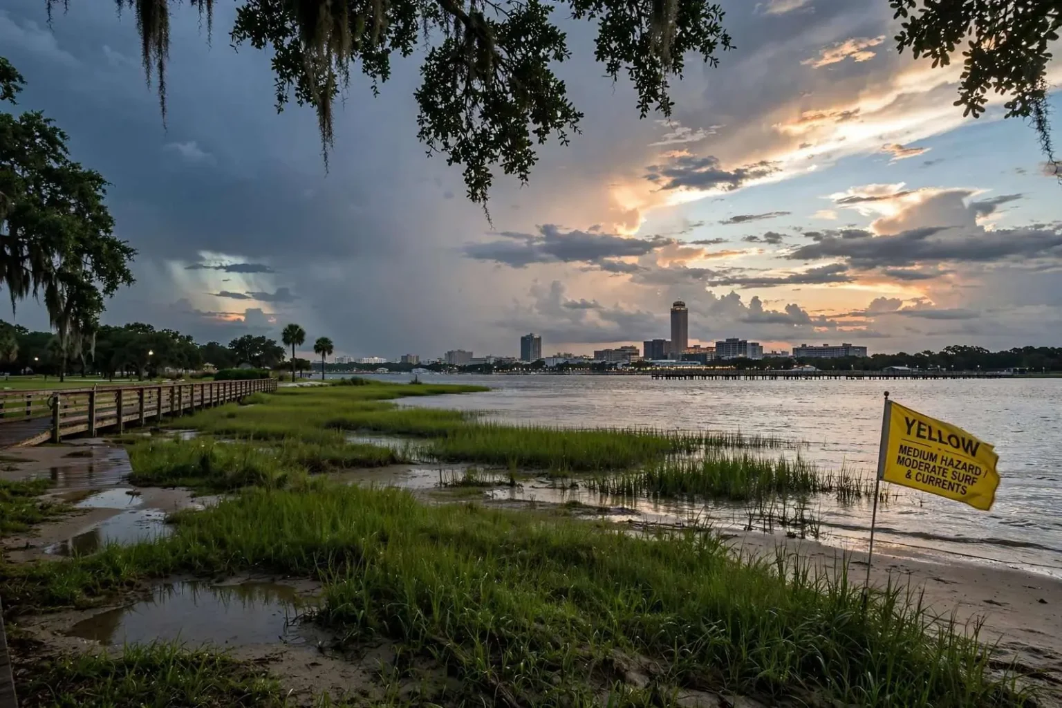
MOBILE, Ala. — Scattered thunderstorms remain possible through early Monday evening, and a few could still produce gusty winds, frequent lightning and heavy downpours before activity gradually fades.
Tuesday looks a little quieter. Daily afternoon storm chances continue through the week, with more widespread rain likely Wednesday through the weekend.
Tonight: Storms Gradually Fade
Scattered showers and thunderstorms will continue into the evening, particularly during the first few hours after sunset. A few stronger storms may bring brief strong wind gusts and heavy rain, but coverage should decrease steadily later tonight.
Skies become partly cloudy overnight, and warm, humid conditions continue. Lows will generally settle into the middle to upper 70s.
The fade after sunset is the normal behavior of air-mass thunderstorms in late summer. These storms are driven by daytime heating: the sun warms the surface, warm air rises, and moisture condenses as it climbs. Remove the heating and the engine loses its fuel. What lingers past dark is typically a decaying cluster running on outflow rather than fresh convection.
Tuesday: More Sunshine, Fewer Storms
Tuesday should feature more sunshine and somewhat lower storm coverage. Most locations will stay dry for much of the day, though an isolated afternoon or early evening thunderstorm remains possible.
Highs will generally reach the upper 80s to around 90 degrees, with humid conditions continuing.
Note the phrasing on temperature. Upper 80s to around 90 does not sound extreme, and by the raw number it is not. The relevant figure on the Gulf Coast in September is the heat index, which combines temperature with humidity to estimate what the body actually experiences. At the dew points typical here this time of year, a 90-degree afternoon can produce a heat index well above 100.
Rip Currents at the Beach
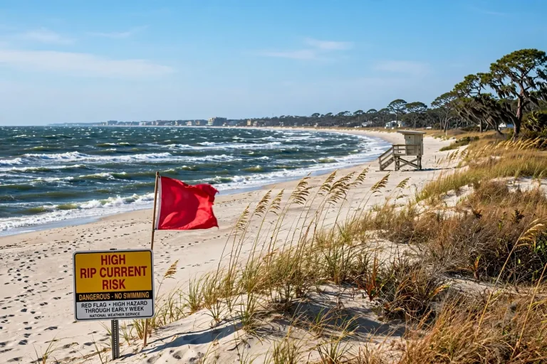
Along the Alabama and northwest Florida beaches, the rip current risk increases to Moderate on Tuesday and remains Moderate Wednesday.
Check beach flags before entering the water, and swim near a lifeguard whenever possible.
A moderate risk designation is not a low one. Rip currents are the leading cause of surf-zone fatalities on this coast, and they are responsible for the large majority of lifeguard rescues. They form where water pushed shoreward by breaking waves finds a channel to return seaward, producing a narrow, fast-moving current that carries a swimmer away from the beach.
The critical thing to understand is that a rip current does not pull a swimmer under. It carries them out. Drownings happen when a swimmer tries to swim directly back toward the beach against the current, exhausts themselves and cannot stay afloat. The correct response is to stop fighting it, float or tread water to conserve energy, and swim parallel to the shore until out of the channel — rips are typically narrow — then angle back in.
Alabama’s beach flag system is worth knowing before you need it: green for low hazard, yellow for medium hazard with moderate surf or currents, red for high hazard, double red for water closed to the public, and purple for dangerous marine life. Flag violations carry fines in the beach municipalities.
Wednesday Through Friday: Storm Coverage Increases
Rain chances begin increasing again Wednesday, followed by a more active pattern Thursday and Friday. Expect a mixture of sunshine and scattered to numerous showers and thunderstorms, particularly during the afternoon and evening.
Not everyone will see rain each day. Storms that do develop could bring localized heavy downpours, frequent lightning and gusty winds. Temperatures should generally remain in the upper 80s and lower 90s.
The distinction between “scattered” and “numerous” is meaningful rather than stylistic. Scattered generally implies coverage in the range of about 30 to 50 percent of the area; numerous implies 60 to 70 percent. In practical terms, a scattered day means most locations stay dry and a few get hit; a numerous day means most locations see rain at some point.
Lightning deserves a specific note in this pattern. Alabama and Florida sit in the most lightning-prone region of the United States, and late-summer air-mass storms are prolific producers. The guidance has not changed: when thunder is audible, the storm is close enough to strike, and outdoor activity should stop until 30 minutes after the last thunder is heard.
Weekend: The Familiar Late-Summer Pattern
Daily showers and thunderstorms remain possible into Saturday and Sunday. There will still be plenty of dry time between storms, but outdoor plans may occasionally need to work around passing afternoon rain.
Temperatures remain seasonably hot and humid, with highs generally near 90 degrees and overnight lows in the 70s.
For anyone planning weekend events — and there are several on the local calendar — the operative point is timing rather than cancellation. Late-summer convection is heavily weighted toward the afternoon and early evening. Morning activities are usually safe; mid-afternoon activities are the ones that need a contingency.
Tropical Update: The Atlantic Remains Very Quiet
Despite sitting near the climatological peak of Atlantic hurricane season, the tropics remain remarkably quiet. The National Hurricane Center is not currently highlighting any areas for tropical development across the Atlantic, Caribbean or Gulf over the next several days.
There are no tropical threats to the Gulf Coast at this time. Hurricane season continues through Nov. 30.
Some context on why that is notable: the statistical peak of the Atlantic season falls in the second week of September, which is to say right now. A completely blank map at this point in the calendar is unusual.
It is also not a reason to stop paying attention. Basins can go from empty to active in under a week, and the Gulf in particular is capable of producing a system that develops close to shore with a short lead time. A quiet week in September says nothing about the following one, and the remaining two and a half months of the season are more than enough time for the picture to change.
The practical takeaway for the rest of this week is unglamorous: hot, humid, storms most afternoons, and nothing tropical to watch.
Reading a Forecast Like This One
Late-summer forecasts on the Gulf Coast frustrate people because they rarely produce a clean answer, and the reason is meteorological rather than a failure of the forecast.
The dominant summer regime here is air-mass convection: a warm, humid, weakly sheared environment in which thunderstorms develop where local forcing happens to trigger them — a sea breeze boundary, an outflow boundary from an earlier storm, a subtle terrain effect. Those triggers operate at scales far smaller than any forecast model resolves reliably.
The consequence is that a forecaster can predict with high confidence that storms will develop somewhere in the area during the afternoon, and with very low confidence whether one will develop over a particular neighborhood. That is what a probability of precipitation actually expresses: the chance that a given point in the forecast area sees measurable rain, not the intensity or duration of what falls.
Practical translation: a 40 percent afternoon storm chance in September means make outdoor plans and have a way to get under cover for 30 minutes.
Lightning Is the Underrated Hazard
Air-mass thunderstorms in this region rarely produce tornadoes or damaging straight-line winds on the scale of a spring severe weather event. They produce a great deal of lightning.
Alabama and Florida sit in the most lightning-active corridor of the United States, and lightning fatalities nationally are concentrated in exactly the activities that fill a Gulf Coast summer: fishing, boating, beach recreation, yard work and outdoor sports.
The guidance is simple and widely ignored:
- When thunder roars, go indoors. If you can hear thunder, you are within striking distance. There is no safe distance outdoors.
- Substantial shelter means a fully enclosed building or a hard-topped vehicle. A picnic pavilion, a dugout, a beach umbrella and a golf cart are not shelter.
- Wait 30 minutes after the last thunder. A significant share of strikes occur after the rain has stopped and people have gone back outside.
- Water is the worst place to be. Get off boats, out of the surf and out of pools at the first thunder.
Heat Index and What It Actually Measures
Highs near 90 with high humidity produce heat index values well above the air temperature, and the heat index is the number that matters physiologically.
The body sheds heat primarily by evaporating sweat. Evaporation depends on the moisture gradient between skin and air. When dew points climb into the mid-70s — routine here in September — that gradient narrows and the cooling mechanism becomes progressively less effective. At sufficiently high humidity, sweating produces little cooling at all, and core temperature rises regardless of how much a person is perspiring.
That is why a 90-degree day in Mobile is a materially different physiological challenge than a 90-degree day in a dry climate, and why heat guidance here emphasizes shade, scheduled breaks and fluid intake rather than simply drinking when thirsty.
Staying Aware Through Hurricane Season
A quiet tropical map is a good week, not a season. With two and a half months remaining, the standard preparedness guidance stands: know your evacuation zone, keep a supply kit stocked, maintain a written family communication plan, and review insurance coverage — particularly flood coverage, which is separate from standard homeowners policies and carries a waiting period before it takes effect.
The Gulf’s particular hazard is short lead time. A system that develops close to shore can go from a disturbance to a landfalling storm in a few days, which is not enough time to buy plywood, arrange lodging inland and secure a boat. Preparation done in a quiet week is what makes a busy one manageable.