Two Great Whites and a Tiger Shark Tracked in Waters Off Mobile Bay
Ocearch tracking shows two great white sharks, Cabot and Edithe, plus a tiger shark pinging in Gulf waters south of Mobile Bay.
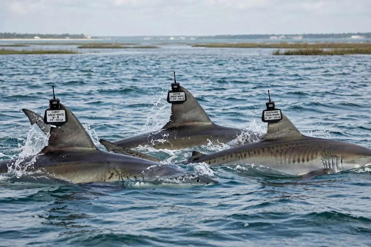
Three tagged sharks surface near Mobile Bay
Three tagged sharks, including two great whites, have been pinging in the Gulf of Mexico within range of the central Gulf Coast, according to tracking data from the research group Ocearch. The appearances put the region’s beachgoers and fishing community on notice that some of the ocean’s most famous predators are passing through waters not far from Alabama’s coastline, even if they remain well offshore and pose little practical concern for swimmers on the beaches of Gulf Shores and Orange Beach.
The sharks being followed include Cabot, a male great white measuring 9 feet 8 inches and weighing 533 pounds, which recently registered south of Mobile Bay. So did Edithe, a female great white at 11 feet 8 inches and 1,185 pounds. Nearby in the same stretch of water was SouthJaw, a male tiger shark measuring 8 feet 5 inches and weighing about 200 pounds. The trio represents two of the species most associated with the Gulf’s open waters, and the coincidence of all three pinging in the same area at the same time is exactly the kind of data point that makes the tracking map a favorite of shark watchers.
Each of the sharks carries a name chosen by the researchers, sponsors or followers who support the expeditions that tag them, a convention Ocearch adopted to make the animals memorable to the public. Cabot takes his name from the explorer whose transatlantic voyages echo the shark’s own long-range movements, and the naming practice has turned individual sharks into ambassadors for their species, with thousands of people following their travels online from season to season.
How the tracking works
Ocearch fits sharks with satellite tags mounted to the dorsal fin. Each time the fin breaks the surface long enough, the tag transmits a location, which appears on the group’s public tracking map. The method, known as SPOT tagging, has been refined over dozens of research expeditions and allows scientists to follow individual sharks for years, building movement histories that were impossible to assemble in the era when sharks could only be studied when caught.
That means a “ping” marks where a shark surfaced, not a continuous path, and gaps of days or weeks between reports are routine. A great white that travels deep offshore, or one that spends most of its time with its dorsal fin below the surface, may go silent for long stretches before surfacing long enough for the tag to transmit. Researchers caution against reading a straight line between pings, since the animal may have traveled hundreds of miles in a direction the map never shows.
The public-facing nature of the map has changed how people think about sharks along the coast. Fishermen report sightings with more context, beach communities follow the animals in near real time, and scientists gain a steady stream of public interest that supports their expeditions. The same transparency also requires constant explanation, because a ping within a few dozen miles of shore can prompt alarm even though the animal is far from bathing areas and great whites rarely come close to the surf zone.
Seasonal visitors to the northern Gulf
Great whites are seasonal visitors to the northern Gulf rather than permanent residents, and researchers have used tagging data in recent years to document how far into the Gulf the species ranges during cooler months. The picture that has emerged shows white sharks moving widely through the Gulf’s open waters in winter and spring, some ranging as far as the Texas coast and the waters off Mexico, before heading back toward the Atlantic and the cooler waters of the northeast.
Tiger sharks, by contrast, are genuine Gulf residents, common in warm waters year-round and well known to anglers and researchers along the Florida panhandle and Alabama coast. SouthJaw’s presence alongside the two white sharks illustrates the overlap: in the cooler months, the Gulf holds both its permanent large-shark population and a rotating cast of seasonal visitors, all moving through the same productive open waters between the shelf and the deep.
For researchers, every ping adds to a data set that informs protections and answers basic questions about reproduction, feeding grounds and migration corridors. For everyone else, the appearances of Cabot, Edithe and SouthJaw are a reminder of how much large marine life moves through the Gulf within reach of the Alabama coast, mostly unseen, and now increasingly visible through the fins that surface long enough to say where they are.
What the tracking map shows and does not
The Ocearch tracking map that carries these pings has become one of the most-followed tools in marine science communication, displaying each tagged animal’s last reported position with a timestamp so viewers can see both the location and how fresh it is. Freshness matters: a position from two days ago tells a very different story than one from two hours ago, and the map’s users quickly learn to check the date before drawing conclusions about where a shark is now. The map also archives each animal’s track over time, letting researchers and the public retrace journeys that span years and thousands of miles.
For the central Gulf Coast, the significance of these pings is largely educational. The waters south of Mobile Bay sit near the edge of the continental shelf, where the shallow bottom drops away into deep water, and that transition zone concentrates the fish, turtles and marine mammals that large sharks prey on. Sharks transiting the Gulf frequently follow these routes, which is why tagged animals so often ping in the broad band of offshore water south of the barrier islands rather than inside the bay itself.
The science behind the tags
Tagging a great white or tiger shark is an involved operation that Ocearch has refined into a signature method. The team uses a custom lift platform to briefly raise the shark out of the water, allowing researchers to take measurements and samples, attach the dorsal-fin tag and release the animal within minutes. The procedures are conducted under permits and with veterinary oversight, and the data collected in those few minutes — length, weight, sex, blood work and more — becomes the baseline that the satellite record builds on.
Each shark’s tag is expected to transmit for years, and the accumulated tracks have already reshaped scientific understanding of where these animals go. Great whites once thought of as creatures of California, South Africa or the New England coast turned out to make regular use of the Gulf of Mexico, and the northern Gulf’s winter visitors are now a documented part of the species’ range. Tiger sharks tracked from Gulf waters have shown similarly wide movements, often shuttling between coastal shallows and deep offshore waters with the seasons.
Sharing the water safely
None of the recent pings suggests any change in the risk picture for people using Alabama’s beaches. The sharks registered offshore, far from the swimming beaches of Gulf Shores and Orange Beach, and their presence in the region reflects normal seasonal movement rather than anything unusual. Marine scientists routinely note that the Gulf’s shark populations have shared these waters with swimmers for as long as people have visited them, and that basic precautions — avoiding dawn and dusk swims, staying in groups, keeping clear of fishing activity — account for most of the practical safety advice anyone needs.
The bigger story from the research community’s perspective is what the tags reveal about the health of the Gulf ecosystem. Large sharks are apex predators, and their movements track the abundance of the prey and the conditions of the water they pass through. When three tagged sharks, two of them great whites, ping within range of the central Gulf Coast in the same stretch of time, it documents the Gulf functioning as the productive marine environment it has always been — and it hands researchers another season of data on animals that are only beginning to give up their secrets.
Reading the pings responsibly
Marine researchers emphasize a few consistent points whenever tagged sharks surface near a populated stretch of coast. A ping is a single data point, a snapshot of one moment when a dorsal fin cleared the surface long enough for the satellite link to fire. Between pings, an animal like Cabot — a 533-pound great white capable of covering remarkable distances — may swim far outside the Gulf or circle back to the same spot, and no map can say which. That uncertainty is built into every tracking display, and it is why researchers ask the public to treat the positions as research data rather than as a live warning system.
The tracking program also depends on conditions that have nothing to do with the shark. Satellite tags transmit when the antenna is above water, so rough seas, the angle of the fin and the duration of a surface interval all affect whether a ping registers. A quiet week on the map does not mean a shark has left the region, just as a cluster of pings does not mean an animal is lingering. The pattern that emerges over months and seasons is what carries the scientific value, not any single mark on the map.
Why the Gulf matters to these species
The Gulf of Mexico serves several roles for large sharks. For great whites, it functions primarily as a winter range — warm, open water where the animals roam far from the coastal waters where they feed during cooler parts of their Atlantic range. For tiger sharks, the Gulf is home territory, with the species common along the shelf from the Florida Keys around to Texas waters. The waters south of Mobile Bay, where the recent pings clustered, sit over the shelf break where deep and shallow waters meet, an area long known to fishermen as productive ground for the fish that sharks feed on.
Research expeditions have tagged hundreds of sharks in these waters over recent years, and every new animal adds to a picture that was sketched almost entirely from commercial catch records before satellite tagging matured. The data has documented nursery areas, migration corridors and the surprising speed with which these animals move between them. It has also shown how individual sharks develop recognizable patterns — returning to the same regions in the same seasons year after year — which is precisely the kind of long-term behavior that only multi-year tracking can reveal.
Following along from shore
For residents of the Alabama coast, the practical takeaway from the latest pings is mostly a matter of perspective. The Gulf that stretches south of Mobile Bay supports a full cast of large marine life, from the great whites passing through in winter to the tiger sharks that patrol warm waters all year, and the overwhelming majority of it never comes near a swimmer. The beaches of Gulf Shores and Orange Beach operate under their own safety systems — flags, lifeguards and posted advisories — and those systems reflect the conditions that actually matter to beachgoers, not the movements of tagged animals offshore.
Still, the sight of three familiar names pinging within range of the central Gulf Coast gives the public a rare window into an ecosystem that usually stays out of view. Cabot, Edithe and SouthJaw will keep surfacing on the tracking map as they move, and each ping will add another line to the growing record of how the Gulf’s largest predators use these waters. For the researchers who tagged them, that record is the point; for everyone following along from shore, it is a reminder of how much life moves through the waters just beyond the sand.