Why the Chickasaw Tornado Came With No Warning: NWS Explains
The NWS Mobile explains why the EF-0 Chickasaw tornado triggered no warning: radar gaps, low wind shear, and avoiding over-warning the public.
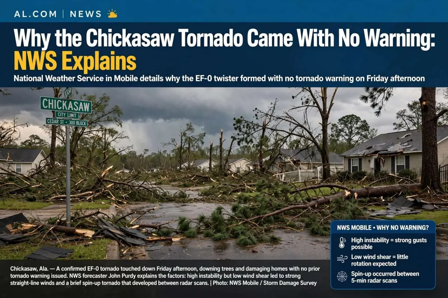
When a confirmed EF-0 tornado touched down in Chickasaw on a Friday afternoon, some residents wondered why the National Weather Service office in Mobile never issued a tornado warning for the storm. The absence of sirens and phone alerts in the minutes before the twister arrived was enough to make people ask how a tornado could reach a neighborhood with no notice at all. Lead forecaster John Purdy said forecasters scrutinize the pre-storm environment before severe weather arrives, and that day the key parameters — instability and wind shear — did not favor tornadic development. The primary threat appeared to be straight-line winds, with instability running high but wind shear low. In other words, the atmosphere that afternoon looked far more likely to produce damaging wind gusts than rotating storms, and the forecast reflected that reading.
Purdy’s explanation gets to the heart of how modern severe weather forecasting works. Before a storm system ever arrives, meteorologists at the Mobile forecast office examine a checklist of atmospheric ingredients. Instability measures how readily air near the ground will rise once it is heated or lifted — the fuel for thunderstorms of any kind. Wind shear describes how wind speed and direction change with height above the ground, and it is the ingredient that allows a thunderstorm’s updraft to tilt and rotate. When instability is high but shear is low, storms can turn strong and gusty, but they rarely organize into the supercells that produce long-track tornadoes. That combination steered forecasters toward a straight-line wind threat, which calls for a severe thunderstorm warning rather than a tornado warning.
The distinction matters for residents across the Gulf Coast. A severe thunderstorm warning covers winds of 58 mph or greater and hail of one inch or larger, and those events are far more common in south Alabama than tornadoes. Straight-line winds from a collapsing thunderstorm can snap tree limbs, peel away shingles and shove power lines onto roads — damage that is easy to mistake for a tornado after the fact. On the day of the Chickasaw storm, the environment pointed squarely in that direction, and the warnings that were issued reflected a wind threat rather than a rotational one.
Understanding the EF-0 Rating
The tornado that did touch down in Chickasaw was later confirmed as an EF-0, the weakest category on the Enhanced Fujita scale used to rate tornadoes in the United States. EF-0 storms produce estimated wind speeds in the range of 65 to 85 mph and typically leave behind damage such as missing shingles, damaged gutters, broken tree limbs and shallow-rooted trees pushed over. Surveys by National Weather Service teams after such events involve examining the wreckage on the ground, because the rating is based on damage indicators rather than on radar measurements. Many small tornadoes along the Gulf Coast fall into this lowest category, and most last only a minute or two along the ground.
That is not to say an EF-0 is harmless. Mobile County’s dense stands of mature oaks and pines mean that even modest winds can bring large limbs down onto roofs, vehicles and power lines, and outages routinely follow storms that would barely register in other parts of the country. A weak tornado crossing a wooded subdivision can still cause tens of thousands of dollars in damage and put people at risk who are outdoors or driving. The confirmation of the Chickasaw tornado came after crews reviewed the damage pattern, which showed the tight, convergent debris signature typical of a small rotating column of air rather than the broader, straight-line swath of a downdraft.
The National Weather Service office in Mobile is one of more than 120 local forecast offices nationwide, responsible for forecasts and warnings across southwest Alabama and northwest Florida, including the population centers of Mobile, Baldwin, Escambia and Santa Rosa counties. Its meteorologists staff the office around the clock, monitoring radar, satellite and surface observations, and their warning decisions hinge on the environment they can diagnose before storms form. On the afternoon of the Chickasaw tornado, that diagnosis pointed away from tornadoes — and the storm still managed to surprise everyone.
The Spin-Up Problem
Purdy said quick spin-up tornadoes are one of the Gulf Coast’s toughest forecasting challenges. These weak, short-lived twisters often occur between radar scans, which run every five minutes, leaving forecasters no time to warn before they dissipate. By the time a warning could be issued, he said, the tornado is often already gone. The problem is not that the radar misses the storm entirely — it is that the tornado’s entire life can fit inside the gap between two sweeps of the antenna.
The physics behind spin-up tornadoes helps explain why they are so hard to catch. Along the Gulf Coast, severe weather most often arrives in long lines of storms called squall lines, which race ahead of cold fronts in the fall, winter and spring, and in the outer rainbands of landfalling tropical systems. Embedded in those lines are small circulations — pockets of spinning air near the ground — that can be stretched and tightened into a brief tornado when a storm’s strong winds converge on them. Unlike the giant rotating supercells of the Great Plains, these storms show little or no sustained rotation on radar until the tornado is already forming, and they frequently drop a funnel, do their damage and lift again in less time than it takes a radar beam to complete a single rotation and return for another look.
Radar adds another complication. The NEXRAD Doppler radars that serve the region, including the unit that covers the Mobile area, send out a beam that grows higher above the ground the farther it travels from the antenna. Chickasaw sits within close range of the radar, which is a benefit, but even at moderate distances the beam can overshoot the lowest few thousand feet of the atmosphere where spin-up tornadoes live. A circulation that a forecaster might catch at closer range can be invisible or ambiguous at the beam heights available farther out, leaving meteorologists working from indirect clues such as storm shape, speed and the strength of the line’s leading edge.
Timing compounds everything. A radar volume scan that samples the atmosphere in layers takes roughly four to six minutes to complete, and a warning has to be drafted, issued and broadcast after a forecaster sees something convincing. Add the minute or two that a typical warning takes to reach phones and televisions through the alert system, and the total lag between detection and public notification can approach the entire lifespan of a spin-up tornado. In the case of the Chickasaw storm, there simply was no radar signature worth acting on until the tornado was on the ground, and by the time anything could have been issued, the event was over.
This is why Gulf Coast residents sometimes experience a damaging storm with no warning at all, even on days when the weather service is fully staffed and watching. The tornadoes that dominate warnings — the ones that track for miles and show clear rotation for tens of minutes before touching down — are a different breed from the spin-ups that dot squall lines. Forecasters in Mobile and along the coast handle both, but the small, fast ones remain the stubborn minority that no amount of technology has fully solved.
The Deliberate Choice Not to Over-Warn
There is also a deliberate effort not to over-warn. Purdy noted that warning on every spin-up could mean ten tornado warnings on a single severe weather day — and a public that stops taking them seriously. Balancing alerts for minor spin-ups against making sure people respond to strong, life-threatening tornadoes is a delicate task, he said. The concern is well documented in emergency management circles: when sirens sound repeatedly for storms that cause little damage, residents begin tuning out, and the warning that actually matters for a large tornado gets treated as background noise.
Warning fatigue is not a hypothetical problem along the Gulf Coast, where severe weather seasons can deliver round after round of squall lines in a single winter. Emergency managers in Mobile and Baldwin counties spend considerable effort encouraging residents to treat every warning as actionable, and forecasters know that credibility is part of that equation. Each warning carries a cost in public attention, so the decision to issue one weighs the strength of the evidence against the need to preserve the alert system’s meaning. A marginal blip on radar that might be a brief spin-up competes with the certainty that another storm in the same line will justify a warning on its own.
The tradeoff also shapes how warnings are written. Modern practice favors storm-based polygons and specific language about the threat rather than county-wide blanket alerts, so residents know whether their neighborhood is actually in the path. The same philosophy drives the reluctance to issue tornado warnings for circulations that do not meet the threshold. When a warning does go out for the Gulf Coast, the intent is that people recognize it as a signal worth acting on immediately — moving to an interior room on the lowest floor, away from windows — rather than assuming it is another minor event.
What Residents Can Take From the Chickasaw Storm
The Chickasaw tornado offers a practical lesson for households across south Alabama, because it demonstrates that warning lead time is never guaranteed for small, fast-moving storms. Preparedness starts with having more than one way to receive severe weather information, whether that means a NOAA Weather Radio, wireless emergency alerts on a phone, or local media coverage, so that a single missed alert does not leave a family unaware. It continues with knowing where to shelter before a storm ever forms, since the minutes spent deciding during an event are often the difference between close call and injury.
It also helps to understand what different alerts mean. A severe thunderstorm warning is not a tornado warning, but straight-line winds can reach well over 60 mph and deserve the same instinct to get indoors and away from windows. Watching storm motion — noting when a line of storms is approaching from the southwest and roughly when it will arrive — gives residents a personal margin of awareness that no alert system can replace. On a day when the primary threat is wind, that background awareness fills the gap left by the absence of a tornado warning.
For the people of Chickasaw, the storm ended with a confirmed tornado and no advance alert, a combination that will happen again somewhere along the Gulf Coast regardless of how good forecasting becomes. The National Weather Service’s explanation was not a defense of a missed threat but a window into the mechanics of a forecasting challenge that is genuinely difficult: an atmosphere tilted toward wind rather than rotation, a tornado whose life fit inside a radar gap, and an alert philosophy designed to keep every warning meaningful. Residents who understand those mechanics are better positioned to respond to the next storm, warned or not.