

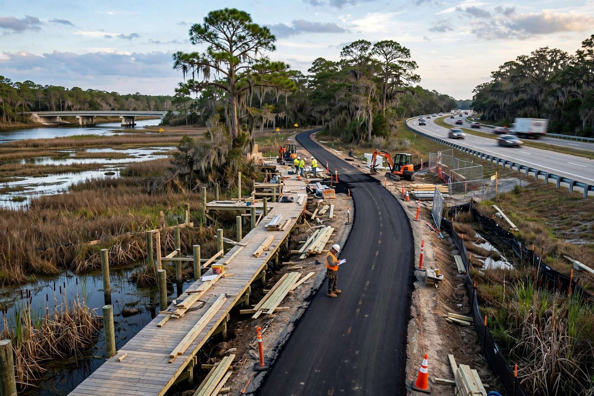
BALDWIN COUNTY, Ala. — Walkers and cyclists on the Eastern Shore will soon have nearly two more miles of paved path, as Baldwin County’s extension of the Eastern Shore Trail east of Fish River heads toward a November finish.
County officials said the new segment is about 80% complete. Once it opens, it will add 1.84 miles to a trail system that now spans about 23 miles, bringing the total to roughly 24.8 miles.
The extension begins at the Fish River bridge on U.S. 98 and runs east to Pleasant View Lane, where it connects with the rest of the trail system. It is being built as an 8-foot-wide asphalt path inside the existing U.S. 98 right of way, alongside the highway.
How the project is paid for
The project is funded primarily through a $2 million Transportation Alternatives Program grant, according to Taylor Bufkin, public information and communications specialist for the Baldwin County Commission.
“The $2 million TAP grant primarily funds construction of the new 1.84-mile trail segment, including the paved path, boardwalk structures, grading and site work,” Bufkin said. “Engineering, environmental review and inspection services are funded separately through the county’s roadway and infrastructure programs.”
The Transportation Alternatives Program is a federal funding stream, administered in Alabama through the Alabama Department of Transportation, that pays for projects such as sidewalks, bike lanes, multi-use trails and safe routes to school. Local governments compete for the money and typically must cover a share of the overall project cost. When the county announced the start of work in February, it credited former U.S. Rep. Jerry Carl, who represented Alabama’s 1st Congressional District, with championing the federal funding.
The county selected McElhenney Construction for the work. When construction began earlier this year, the county had targeted completion for summer 2026; officials now expect the segment to be finished by November.
Closing a gap along U.S. 98
Bufkin said the location was chosen because it continues the trail eastward from the Fish River bridge.
“It closes a key gap in the network, improves safety along U.S. 98 and advances long-term connectivity toward Magnolia Springs,” she said.
Safety is a central goal. U.S. 98 is a busy highway through central and south Baldwin County, carrying commuters, delivery trucks and beach traffic. A separated path within the right of way gives people on foot or on bicycles a place to travel without sharing the road’s shoulder with fast-moving vehicles.
Because the path is built within the existing right of way, the county did not need to buy additional property for the project, and the footprint stays close to the existing roadway corridor.
Next stop: Magnolia Springs and Foley
The Pleasant View Lane segment is part of a broader push to carry the Eastern Shore Trail beyond its historic route and into south Baldwin County.
“This extension moves the Eastern Shore Trail one step closer to Magnolia Springs and ultimately Foley. As the trail connects with Foley’s larger sidewalk and trail network, multiple opportunities will open for regional multimodal connectivity,” Bufkin said.
The county has already lined up money for the next phase.
“The county has been approved for another TAP Grant to extend the trail from Pleasant View Lane to Magnolia Springs Highway,” Bufkin said. “Through the 30 Cubed partnership with Magnolia Springs, a multi-use path is also planned along Magnolia Springs Highway from U.S. 98 to Magnolia River.”
The county expects the trail to continue growing southward from there, adding connections across the Eastern Shore and into central Baldwin County to support both recreation and alternative transportation.
Upcoming phases at a glance
- Now under construction: Fish River bridge to Pleasant View Lane, 1.84 miles, expected to finish by November
- Next, with TAP funding approved: Pleasant View Lane to Magnolia Springs Highway
- Planned with Magnolia Springs: Multi-use path along Magnolia Springs Highway from U.S. 98 to the Magnolia River
- Long-term goal: Connection to Foley’s sidewalk and trail network
A trail with a long history
The Eastern Shore Trail grew out of the work of the Baldwin County Trailblazers, a group founded by Teko Wiseman, who envisioned a safe, scenic route linking historic Mobile with the communities along the eastern shore of Mobile Bay. A historical marker along the route describes the trail as running from U.S. 98 at Gator Alley in Daphne south to Weeks Bay, largely following Scenic Highway 98 through Spanish Fort, Daphne, Montrose, Fairhope, Point Clear and Barnwell. A connector along the Causeway links the trail to Battleship Memorial Park.
Over the years, the trail has become one of the region’s most popular places to walk, run and ride, passing bayfront views, shaded neighborhoods and the downtowns of several Eastern Shore cities. Motorized vehicles and golf carts are not permitted on the trail.
Extending the path east from Fish River marks a shift from the bayfront corridor toward the fast-growing interior of south Baldwin County, where new neighborhoods have filled in along U.S. 98 and the roads leading to Magnolia Springs and Foley.
Free and open to all
Once the new segment opens, residents and visitors will be able to reach it from several entrance points.
“The trail is free and accessible at multiple locations along its route,” Bufkin said. “We expect it to increase recreational access, provide a safer option for walking and biking and improve multimodal connectivity between Eastern Shore communities.”
Why trails like this matter
Connected trail networks serve several purposes at once. They give residents a place to exercise close to home, offer a safer route for people who walk or bike to work, school or errands, and draw visitors who come specifically to ride or run scenic routes. Communities across Baldwin County, from Gulf Shores and Orange Beach to Fairhope and Foley, have invested heavily in sidewalks, bike lanes and trails in recent years as the county’s population has grown.
For Baldwin County, each new segment of the Eastern Shore Trail also brings the long-held goal of a continuous path linking the bay communities with south Baldwin a little closer to reality.