Foley police drone program will send Skydio drones to emergency calls first
The Foley City Council approved a police drone program with Skydio that will fly drones to certain emergency calls and stream live video to dispatchers and officers before they arrive.
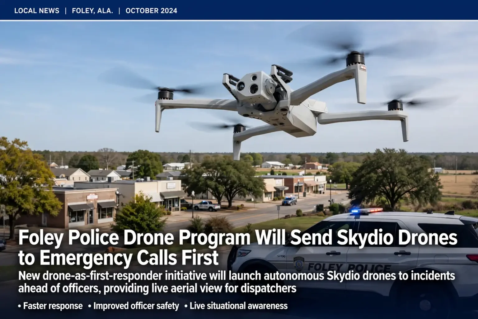
FOLEY, Ala. — The Foley Police Department is preparing to send drones to emergency calls ahead of its officers after the Foley City Council approved a new technology initiative that will put an aerial “first responder” over incident scenes within moments of a call for help. The Foley police drone program is designed to give dispatchers and officers a live look at an emergency before ground units arrive.
The program is being developed in partnership with Skydio, a U.S.-based drone manufacturer, and will be built into the department’s existing emergency response system. According to a news release from the police department, the goal is to give officers and dispatchers a view of an incident within seconds of an emergency call.
How the drone program will work
Under the plan described by the department, the drones will be housed at a station within the city. When certain types of emergency calls come in, a Skydio drone will launch from that station and fly autonomously to the GPS coordinates of the incident.
Once it arrives, the drone will stream live video to dispatchers and to the officers who are on their way. That early look is intended to show conditions at the scene before the first patrol car pulls up, giving responders information they would otherwise not have until they arrived.
In a typical emergency call, a dispatcher gathers the caller’s location and the nature of the problem, then assigns police, fire or medical units through the dispatch system. Foley’s plan adds a step to that process for qualifying calls: as soon as the incident location is known, the drone can be sent on its way while officers are still being assigned and en route. Because the aircraft flies directly to the coordinates rather than following roads, it is not slowed by traffic, stoplights or detours.
The department has not said exactly which types of calls will trigger a drone launch, describing them only as “certain emergency calls.” Police officials said they plan to share more details as the program develops.
Goals: officer safety, faster response and better decisions
Foley police said the technology is intended to accomplish several things at once: improve officer safety, reduce response times and help emergency personnel determine what resources an incident actually needs.
- Situational awareness: Live video could give officers critical information about a scene before they reach it, helping them prepare for potentially volatile situations.
- De-escalation: With a clearer picture of what is happening, officers may be able to identify opportunities to calm a situation rather than walking into it without context.
- Speed: The department expects that in some situations the drones will arrive faster than officers on the ground, allowing police to assess an emergency more quickly.
- Staffing decisions: Aerial video could help police and fire supervisors make informed decisions about the type and number of personnel to send.
- Missing person searches: The drones could support active searches by providing an aerial view of the search area.
- Transparency: The department has committed to sharing updates with the community as the program is developed.
Each of those benefits builds on the same basic idea: the sooner responders understand what they are dealing with, the better they can match their response to the situation. A call that sounds serious might turn out to be minor, freeing up officers for other calls, while a call that sounds routine might reveal a more dangerous situation that calls for additional help.
The department noted that the benefits extend to fire supervisors as well as police. In practice, a live view of that kind could help a fire commander judge the size of a fire, the direction smoke is moving or whether people appear to be trapped, and then decide how many engines and crews to send. At a serious traffic crash, an overhead view could show how many vehicles are involved and whether additional ambulances will be needed, information that can shape the response in the critical first minutes.
The search-and-rescue role could prove especially valuable. When a child wanders away from home or an older adult with memory loss goes missing, searchers on foot can cover only so much ground, and wooded areas, fields and waterways can be difficult to scan from the road. An aerial view can help direct searchers where they are most needed.
Department stresses: no general surveillance
Aware that drones in the hands of police can raise privacy concerns, the department was direct about how the aircraft will and will not be used. Officials emphasized that the drones will not be used for general surveillance.
“Our program is strictly designed as an emergency response tool, solely utilized to bring real-time situational awareness and visual insight to active emergency scenes within minutes,” the department said in the release.
That framing ties every drone flight to an active emergency call, rather than to routine patrol or monitoring of neighborhoods. The department also pledged to keep residents informed as the program moves forward.
“We are eager to bring this program to the City of Foley,” the department said. “As we move forward with this project, we remain committed to transparency and look forward to sharing further updates with our community as development progresses.”
Residents interested in how the program will operate day to day may want to watch for future department announcements on questions such as how long video is kept, who can view it and how flights are logged. The department has said it will share updates as the program takes shape.
What ‘drone as first responder’ means
The approach Foley is adopting is commonly known in public safety circles as “drone as first responder,” or DFR. Rather than having officers carry a drone in a patrol car and launch it after they arrive, a DFR program keeps drones ready at fixed locations so they can be dispatched directly to a call, often reaching the scene before any ground unit.
Police departments in several parts of the country have adopted DFR programs over the past several years, and the model has drawn growing interest from cities looking for ways to cover more ground with limited staffing. The core features are similar from place to place: a drone that can launch quickly from a dock or station, fly to a location sent by dispatch and relay live video to people who need it.
Drone flights in the United States are regulated by the Federal Aviation Administration, which sets rules for how and where unmanned aircraft can operate. Programs in which drones fly to calls without a pilot standing next to them generally require operating approvals beyond those needed for basic, within-sight drone flights. The Foley department has not released details about the specific approvals, flight procedures or launch station locations for its program.
About Skydio
Skydio, the department’s partner on the program, is an American company known for drones that use onboard cameras and software to navigate on their own and avoid obstacles. Its aircraft are used by public safety agencies, utilities and the military. The company’s emphasis on autonomous flight fits the way Foley’s program is designed to work, with the drone flying itself to the GPS location of an emergency call while dispatchers and officers watch the live feed.
The department did not release the cost of the program, the number of drones it expects to deploy or a date when flights will begin.
Keeping pace with a growing city
Police officials said the initiative comes as Foley continues to grow. The south Baldwin County city has been among the fastest-growing communities in Alabama in recent years, with new neighborhoods, shopping and tourism attractions drawing residents and visitors alike. Baldwin County as a whole has been the fastest-growing county in Alabama, and Foley, home to attractions such as OWA Parks & Resort and a busy outlet shopping center, sits along the main routes that carry visitors to Gulf Shores and Orange Beach. That growth brings more traffic, more calls for service and more territory for officers to cover.
The department said it intends to use technology to strengthen public safety while keeping residents informed, and that it will continue working to provide the people and technology needed to protect residents and their families. Drones are not intended to replace officers on the street; rather, the department describes them as a tool that gives those officers better information, faster.
What happens next
With the City Council’s approval in place, the department is now preparing to deploy the program. Police officials have not announced a launch date, but they have said they will provide updates to the community as development progresses.
Residents who have questions about the program, including how video is handled and which calls will receive a drone response, can watch for future announcements from the Foley Police Department and the City of Foley, and can raise questions during public comment at City Council meetings. As with any emergency, residents should continue to call 911 when they need police, fire or medical help; a drone response, when the program is running, will be part of how the city answers that call, not a substitute for it.