University of South Alabama Mobile
Mobile Meteorologist Alan Sealls Looks Back at Katrina as Hurricane Season Heats Up
Mobile meteorologist Alan Sealls reflects on Hurricane Katrina's 14th anniversary, his hiatus from television, and why Gulf Coast residents should stay prepared as hurricane season nears its peak.
MOBILE – As forecasters keep a wary eye on a new tropical system churning toward South Florida, longtime Mobile-based broadcast meteorologist Alan Sealls says the current hurricane season is a reminder of how quickly a quiet stretch of summer can turn dangerous.
The season had been relatively calm until the past week, when attention turned to a strengthening storm approaching the Florida coast. Sealls cautions that recent history offers no guarantees about what comes next. Last month it was Hurricane Barry causing concern to the west. Fourteen years ago this week, it was Hurricane Katrina, a storm Sealls covered on television as it devastated the Gulf Coast.
The rhythm of the season – long lulls punctuated by sudden, urgent stretches – is one of the oldest lessons of Gulf Coast meteorology, and one that Sealls has spent a career impressing on South Alabama viewers. Quiet Augusts and Septembers have a way of ending abruptly, and the storms that arrive after a calm stretch often catch residents who had let their guard down.
The lesson of Katrina
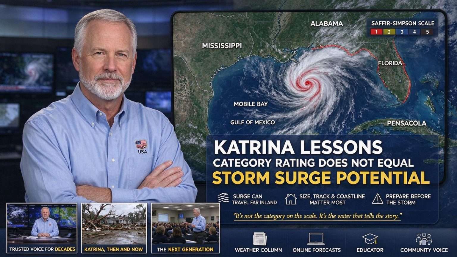
Katrina remains one of the starkest illustrations of a fact meteorologists repeat every season: a hurricane’s category rating does not necessarily predict its storm surge. Katrina proved catastrophic in that regard, killing more than 1,800 people, the majority in New Orleans after levees and floodwalls failed or were breached.
The storm’s category rating described its winds, not its reach. As Katrina spun through the Gulf of Mexico, its enormous wind field drove a dome of water ahead of it that overwhelmed defenses far inland from where the eye came ashore. The Mississippi coast recorded storm surge heights never seen before, with widespread destruction, and surge from the storm also pushed into Mobile Bay and the Florida Panhandle, leaving lasting damage far from where the storm made landfall.
For residents of Mobile and Baldwin counties, the memory is specific: flooded streets along the bay, damage to the Causeway communities, and the realization that a storm making landfall to the west could push water into their neighborhoods just as surely as one striking the Alabama coast directly. Katrina demonstrated that the geography of a hurricane’s damage is shaped by its size, its track and the shape of the coastline – not by the number on its rating.
Beyond the surge, Katrina brought destructive winds and spawned tornadoes across a broad swath of the Southeast, compounding losses and reshaping communities for years afterward. For meteorologists like Sealls who tracked the storm in real time, it remains one of the defining events of their careers.
A career built on South Alabama weather
Sealls, who has spent decades forecasting weather for South Alabama television audiences, is currently on a professional hiatus from local TV broadcasting. He said he hopes to return to the air within a matter of months, though the timing isn’t entirely in his hands.
In the meantime, he continues to live in Mobile and teaches a weather broadcasting course each spring at the University of South Alabama. The class passes along to students what Sealls learned over decades in front of the camera: how to read the atmosphere, and how to explain it to an audience that may be making decisions about their family’s safety based on what a forecaster says.
Teaching in the same city where he spent his broadcasting career gives the course a local flavor that textbooks cannot. South Alabama’s weather – hurricane seasons, severe thunderstorm outbreaks, flooding rains and the occasional winter ice event – offers students a living laboratory, and Sealls draws on the region’s own storms when he walks them through the craft of communicating forecasts.
A return to his roots
The break has also given him time to revisit an old passion for storytelling in print. Sealls launched a new biweekly weather column, describing it as something of a return to his roots.
Long before his television career, he delivered newspapers on foot for years as a paperboy, covering a 40-house route rain or shine, through winter mornings in the teens and summer afternoons pushing 100 degrees. He said the experience taught him early lessons about people, responsibility and how weather touches nearly every part of daily life, lessons that eventually steered him toward a career studying the atmosphere.
The arc from paper route to weather column is a fitting one. Both jobs put weather at the center of daily routine – the paperboy feels it directly, and the columnist explains it – and both depend on showing up day after day. The column lets Sealls explore weather questions at more length than a television broadcast allows, taking readers inside the reasoning that produces a forecast.
Sealls also keeps an active presence online between broadcasts. His YouTube channel, Alan Sealls Weather, recently featured a retrospective look back at Katrina, and his Facebook page of the same name remains a gathering spot for weather enthusiasts around the region who share storm photos and ask questions about how the atmosphere behaves.
He also continues to visit area schools and community organizations to talk about weather and forecasting. Those visits have long been a fixture of his public work, introducing students across Mobile and Baldwin counties to the science behind the forecasts they see on television and encouraging an interest in the atmospheric sciences among a new generation growing up in one of the nation’s most hurricane-prone regions.
The season and its peak
With the Atlantic hurricane season approaching its statistical peak, Sealls said residents should expect more storms to develop, though exactly how many, and where they might go, remains impossible to predict this far out.
The peak weeks of the season fall in late summer and early fall, when sea surface temperatures across the tropical Atlantic and Gulf of Mexico reach their warmest and wind patterns most readily allow storms to organize and strengthen. History shows that the most active stretch of the season can produce storms in quick succession, turning a quiet map into a busy one in a matter of days – exactly the pattern Sealls warns against underestimating.
The storms already seen this season support the point. Barry brought concern to communities to the west, and the system then churning toward South Florida arrived only weeks later. Neither followed the other’s path, and neither determined what would come next – a reminder that each system must be watched on its own terms.
Sealls urged coastal residents not to panic over every cluster of clouds that shows up on social media, but to stay prepared for the real possibility of a tropical storm or hurricane affecting the area before the season winds down.
Preparedness over panic
The distinction he draws is one that Gulf Coast emergency managers echo every June: panic accomplishes nothing, and most tropical waves that appear on satellite imagery never become anything at all. Preparation, by contrast, is something residents can complete well before any storm has a name – supplies, a plan for pets and family members with medical needs, and a decision about whether to ride out a storm at home or leave.
Modern forecasting gives the Gulf Coast days of warning that earlier generations never had, but forecasters are candid about the limits: a storm’s intensity, in particular, is far harder to predict days in advance than its track. That uncertainty is precisely why preparedness has to be in place before watches and warnings appear.
Readiness, he said, is simply part of living along the Gulf Coast. From the barrier islands of the Florida Panhandle to the shores of Mobile Bay, the men and women who have spent decades forecasting these waters share a common message, and Sealls – teacher, columnist and broadcaster alike – has spent a career making sure South Alabama hears it before the next storm, not after.
Weather on the Gulf Coast airwaves
South Alabama’s television market has long demanded a particular kind of meteorologist: someone who can walk viewers through a routine week of heat and thunderstorms, then pivot overnight to tracking a hurricane in the Gulf. Sealls built his reputation on exactly that range, becoming a familiar and trusted presence for viewers from Mobile to Pensacola and across the wiregrass.
The trust matters most when a storm is approaching. In the days before landfall, forecasts change as new data arrives, and a viewer’s ability to follow those changes – to understand why a track shifted or why an evacuation zone opened – depends on a broadcaster who explains rather than simply announces. Colleagues and viewers alike have credited Sealls with that clarity, an approach he now passes along to students in his USA classroom.
His hiatus comes as Gulf Coast broadcasting itself is changing, with audiences increasingly scattered across streaming platforms, social media and traditional television. The YouTube channel and Facebook page he maintains are part of that shift, meeting weather followers where they already are while preserving the local expertise that a national weather app cannot provide.
For now, the rhythm of his work continues in print and online, with the biweekly column and the classroom in the spring. When he returns to local air, he will do so with an audience that has followed him across formats – and, if history holds, with a hurricane season that will sooner or later test every lesson he has spent a career teaching.