Rough Surf From Bertha Puts Dauphin Island’s Erosion Fight Back in the Spotlight
<p>Tropical Storm Bertha's rough surf tested Dauphin Island's flood preparations and reopened conversations about the barrier island's ongoing erosion fight, even as some visitors and a lone surfer took advantage of the waves.</p>
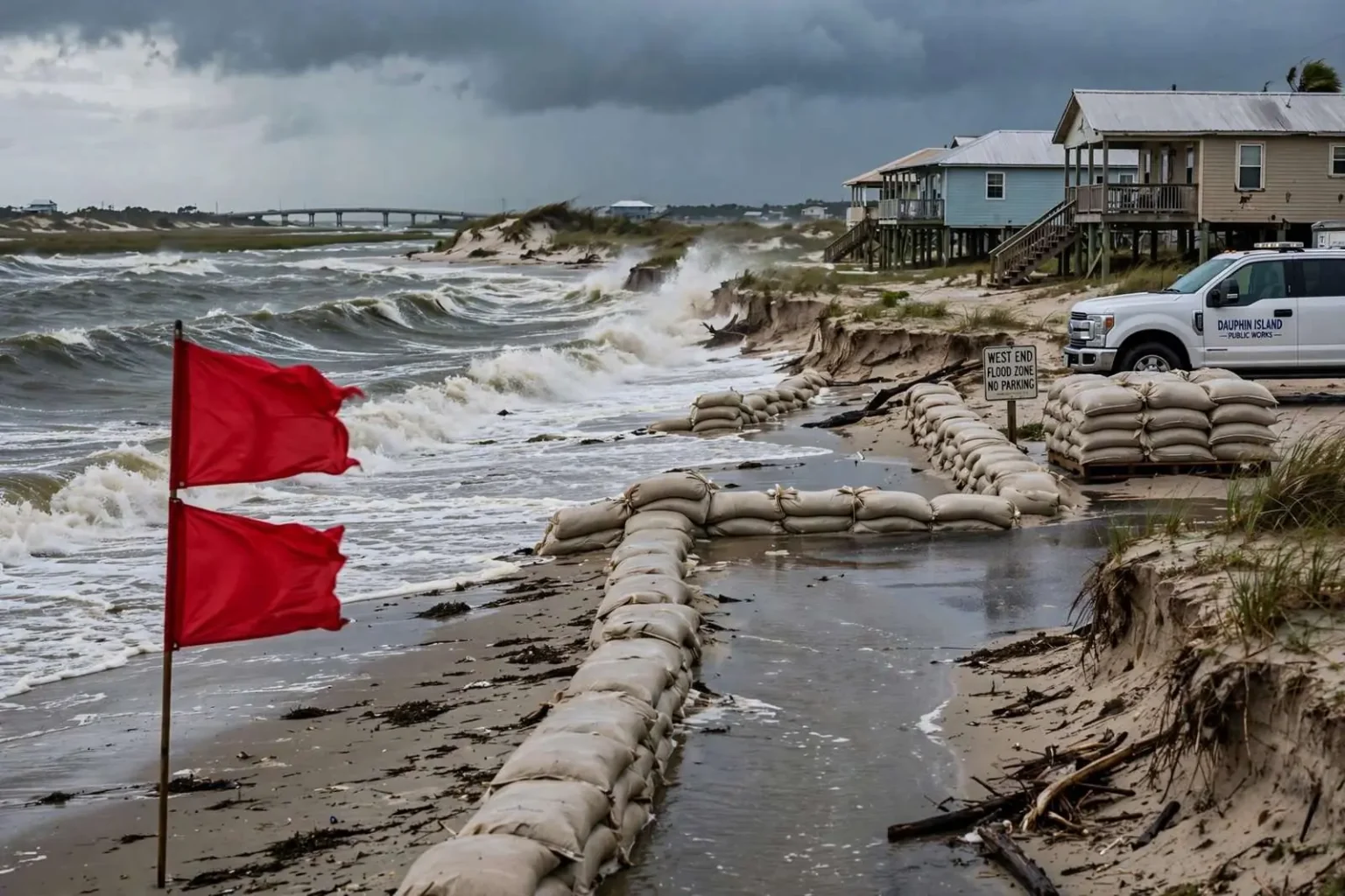
As Tropical Storm Bertha churned through the Gulf of Mexico, Dauphin Island found itself doing what it always does when a tropical system approaches: bracing for impact while some beachgoers lingered just long enough to watch the waves roll in. Town leaders raised double red flags Tuesday, closing the water to swimmers, even as the island’s low-lying geography and long-running erosion battle made this storm feel familiar.
Dauphin Island Mayor Jeff Collier said the town moved early to prepare residents and visitors for possible saltwater flooding and worsening rip currents. Officials asked people to move vehicles out of flood-prone areas on the island’s West End before nightfall and offered sandbags through the town’s Public Works Department for anyone who needed them. Offsite parking areas at Green Park and near Dauphin Island Elementary School gave residents and vacationers somewhere to relocate cars away from the water.
The preparations followed a rhythm the town has rehearsed many times over the years, but they were a reminder of how little buffer a barrier island has between ordinary weather and genuine hazard. A tropical storm that might barely ruffle windows in Mobile or Fairhope can put streets underwater on Dauphin Island, simply because of where the town sits.
Alabama’s only barrier island
Collier said the island’s position as Alabama’s only barrier island means it typically absorbs the first and hardest hits from any tropical system headed toward the mainland. “We’re the ones that’s going to get the most impacts probably the quickest part of the impacts,” he said, noting that storm surge, waves and rip currents are all “accentuated” on a barrier island.
The geography explains why. Dauphin Island sits at the mouth of Mobile Bay, a slim strip of sand and marsh separating the bay’s open waters from the Gulf of Mexico. A bridge across the bay connects the town to the mainland, so when conditions deteriorate, the island’s year-round residents and summer visitors watch the Gulf do its work from the front row.
Because much of Dauphin Island sits at such a low elevation, even modest rises in water can produce saltwater flooding in vulnerable spots, particularly along the West End. That western third of the town is a chain of low beachfront lots and quiet streets where standing water after a storm is less an exception than an expectation, and where residents have learned to park high, sandbag doorways and wait out the surge.
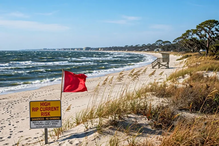
The flag system that closed the beach this week is the same one used along the Gulf Coast: a single red flag means strong surf and hazards for swimmers, and double red flags mean the water is closed outright. Rip currents — narrow channels of fast-moving water that pull swimmers away from shore — intensify as waves from a distant storm arrive, and they are consistently among the deadliest hazards on the northern Gulf Coast, claiming swimmers who underestimate them even on sunny days.
The same surf, a longer problem
The same surf that worried town officials also highlighted a longer-running challenge for the island: erosion. Barrier islands naturally shift as wind, waves and tides move sand along the shoreline, and tropical systems speed up that process, stripping sand from beaches and dunes while adding to flooding risk in low areas.
On Dauphin Island, that natural movement has been amplified over decades by hurricanes that have repeatedly chewed away at the island’s width. The island has thinned and breached in past storms, cut channels through neighborhoods, and left some West End property that once sat behind wide beaches exposed directly to the Gulf. Every strong storm rewrites a bit of the map, and every rewrite makes the next flood easier.
Collier said the town has already completed a restoration project on the island’s East End and is preparing a similar effort for the West End, with construction expected to begin once permitting and funding are in place. Beach restoration of this kind involves dredging sand from approved offshore sources and pumping it onto the shoreline, rebuilding beaches and dunes that storms have carried away.
Such projects are neither cheap nor simple. They require environmental permits, engineering studies, agreements with state and federal agencies, and a funding plan that often combines local money with state and federal contributions. The dunes the projects rebuild are not cosmetic; a healthy dune line absorbs wave energy, holds back surge and gives the island itself something to stand on as storms pass.
Life on the front line of hurricane season
For the people who live on Dauphin Island year-round, the drill is second nature by now. A storm enters the Gulf, and the questions arrive in a familiar order: Will the water rise? Which streets will flood? Should the cars move to higher ground tonight? The town’s small public works crew and its volunteer-driven culture carry much of the load, moving sandbags, checking on neighbors and clearing debris after the water falls.
Visitors add a layer of complexity. In summer, the island’s population swells daily with beachgoers, anglers and families staying in rental homes, many of whom have never watched water climb a street before. That is why town officials lean so heavily on early warnings, social media notices and the flag system — the fastest ways to reach an audience that changes every week.
Bertha’s approach, with its rough surf and mounting rip current risk, was exactly the kind of event where the flag decision matters most. Even when a storm stays well offshore, its waves arrive first, and swimmers who see blue skies over the beach can be caught by dangerous water they cannot see forming beneath them. Double red flags take the choice out of visitors’ hands, and police and fire personnel can enforce the closure.
Moving vehicles before nightfall, as officials asked, is a practical step with a straightforward logic: saltwater flooding is hard on engines, and cars left in low spots can block drainage and emergency routes. Offsite parking at Green Park and near the elementary school on higher ground keeps vehicles dry and streets clear for any response crews that need to pass.
What beach restoration can and cannot do
The East End restoration the town completed is part of a broader strategy that Gulf Coast communities have adopted over the past two decades: rather than rebuild the same damaged property after every storm, invest in projects that reduce the damage in the first place. Restored beaches and dunes act as the island’s first line of defense, taking the brunt of wave energy before it reaches homes and roads.
The planned West End project targets the part of the island where that need is greatest. The West End’s low elevation means that a beach and dune system in good condition can make the difference between a wet yard and a flooded house. Sand placed on the shoreline will inevitably move — no restoration stops the natural drift of a barrier island — but it buys time and protection while the town pursues longer-term solutions.
Funding for such work on Dauphin Island has historically come through a patchwork of sources, including federal disaster recovery programs, state coastal funds and the town’s own budget. Officials have spent years making the case that protecting the island protects more than the island: it shelters the mouth of Mobile Bay, the port and industry upstream, and the mainland shoreline from the full force of Gulf storms.
Scientists who study barrier islands describe them as systems that are supposed to move — rolling landward over time as waves and currents redistribute sand. The hard question for a town built on one is how to live with that movement: armor the shoreline, nourish it with sand, elevate the homes, or some combination. Dauphin Island, with its modest tax base and outsized exposure, has become a case study in that dilemma for the entire northern Gulf Coast.
Why the island matters to the whole coast
It is easy, from the mainland, to think of Dauphin Island as a quiet beach town at the end of the causeway. In practical terms it is also a breakwater for Mobile Bay. The island blunts waves and surge before they reach the bay’s open water, where the Port of Mobile, shipbuilding, commercial fishing and ferry operations all depend on relatively sheltered conditions. Weakening the island weakens that natural shield, which is why engineers, planners and state officials pay close attention to its condition even if they never set foot on its beaches.
The island also carries ecological weight that extends well beyond its size. Its beaches and dunes are nesting grounds for sea turtles and shorebirds, its marshes and seagrass beds shelter juvenile fish, and the waters around it are among the most productive fishing grounds on the Gulf Coast. The Estuarium at the Dauphin Island Sea Lab draws students and visitors year-round, and Fort Gaines on the island’s eastern tip anchors the Civil War history of the Battle of Mobile Bay. Protecting the island’s shoreline protects the tourism, research and heritage economy built around all of it.
The familiar rhythm of watch and wait
By the time Bertha’s surf began arriving, the town had already done the things it knows how to do: flags up, sandbags out, parking lots designated, residents reminded. What remains during any tropical event is the waiting — watching the forecast cone, measuring the water in the streets, and hoping the worst of the surge passes at low tide rather than high.
Collier’s message to residents and visitors throughout the event was consistent with the town’s long practice: take the water seriously, move early, and don’t test the surf under double red flags. The island’s history has taught its people that storms do not need to make landfall here to cause damage here, and that the cleanup — hauling debris, pushing sand off roads, checking on the West End — often begins while the rest of the coast is still watching the radar.
For now, the erosion fight that Bertha pushed back into the spotlight continues the way it always does on Dauphin Island: one project, one storm and one season at a time. The East End beach is rebuilt, the West End work is being readied, and residents of Alabama’s only barrier island keep doing what they have always done — living their lives a few feet above the Gulf, with their eyes on the horizon and their sandbags close at hand.
When the next system spins up in the tropics, the same script will follow: flags go up, cars move to Green Park and the school lot, the Public Works Department hands out sandbags, and the island braces. And when the water recedes, the measure of every storm will be the same one the town always takes — how much sand is left on the beach, and how much work it will take to put it back.