BP Settlement Money Offers Rare Shot at Saving Mobile Bay’s Last Wild Marshes
Coastal advocates say BP oil spill settlement funds may be Alabama's only realistic chance to permanently protect remaining Mobile Bay marshland.
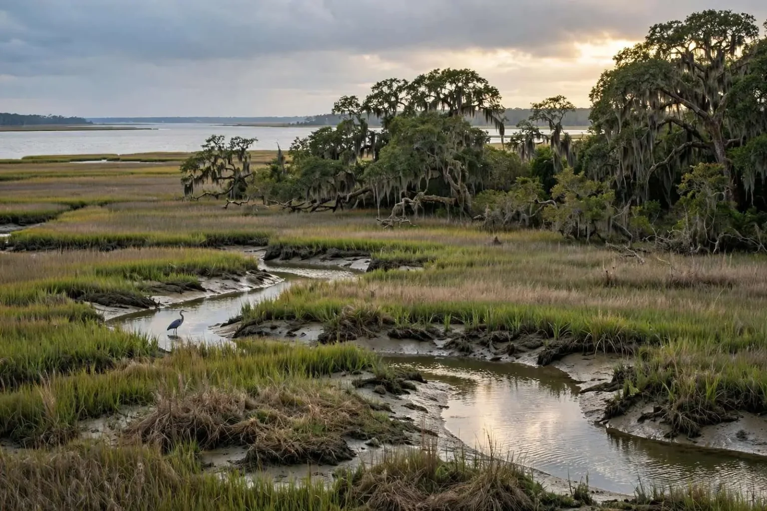
Environmental advocates along the Alabama coast say the state faces a narrow, possibly once-in-a-generation opportunity to permanently protect what remains of Mobile Bay’s undeveloped marshes, maritime forests and undisturbed shoreline, using a portion of the billions of dollars in fines and settlement money tied to the BP oil spill.
The argument centers on a simple reality: Alabama has never had the budget to buy up and preserve large stretches of coastal wetland on its own. The BP spill, for all the damage it caused across the Gulf, produced an unusual financial windfall for the state through legal settlements and federal penalties. Advocates argue that directing even a modest share of those funds toward land conservation could secure a lasting benefit for the region long after the spill itself fades from memory.
The window is what gives the argument its urgency. Settlement money arrives on a schedule, and once it is committed to roads, buildings or operating expenses, it cannot be redirected. Land, by contrast, is a permanent purchase — an acre of marsh or maritime forest protected this decade is protected indefinitely, with no maintenance contract beyond stewardship. Conservation groups say that asymmetry is exactly why acquisition should jump the line ahead of spending that can be funded through ordinary budgets later.
The push comes as officials in both counties continue deciding how to allocate their share of BP-related settlement dollars among competing priorities, from infrastructure and economic development to environmental restoration. Conservation groups argue that land acquisition and protection should rank among the top uses of that money, given how rare it is for the state to have this level of funding available for coastal preservation at all.
What the marshes do
The marshes at the center of the debate do more than provide scenic value. They function as nurseries for much of the seafood that defines the Gulf Coast economy and dinner table, including shrimp, crabs and speckled trout. Marine biologists have long pointed to healthy marsh systems as essential to sustaining those populations in estuaries like Mobile Bay.
The connection is direct and physical. Juvenile shrimp, blue crabs and many of the fish that support both commercial and recreational fishing spend their earliest stages hiding in the grasses and tidal creeks of coastal marsh, where shallow water and dense vegetation offer protection from predators and a rich supply of food. When marsh acreage shrinks, the nursery shrinks with it, and the effect shows up years later in the harvests that dock workers unload and restaurants serve. For a region whose identity and economy are tied to seafood, marsh protection is fishery policy by another name.
Marshes also perform quieter services that are easy to overlook until they are gone. They absorb storm surge coming up the bay, filter runoff before it reaches open water, and buffer the shoreline against erosion. Mobile Bay’s communities have learned in recent decades how much a healthy fringe of wetland matters when a hurricane pushes water northward — the marsh is infrastructure, even if it never appears in a capital budget.
The skeptic’s argument — and the sea level answer
Some skeptics argue the marshes are already effectively protected simply because they’re too wet and unstable to build on. Coastal researchers counter that this overlooks a more pressing threat: rising sea levels.
Estimates cited by coastal scientists suggest seas have already risen roughly eight inches over the last century, with projections of another two to six feet over the next hundred years. Evidence of Alabama’s historically shifting coastline is visible well inland, including fossilized marine life found near the Alabama River and remnants of an ancient cypress forest submerged roughly a dozen miles offshore in the Gulf.
Those inland relics are the region’s own proof that shorelines move. Marine fossils far up the Alabama River record a time when the sea reached where no sea is now, and the drowned cypress forest off the coast shows the opposite — forest land that the Gulf later claimed. The coastline has never been fixed; what is new is the speed of the change and the presence of fixed development in its path.
Even a modest one-foot rise in sea level over the coming decades could be enough to submerge much of Alabama’s existing marshland, according to researchers who study the coast. A marsh that stops draining at low tide, they note, is a marsh on its way to dying off.
That detail — drainage at low tide — is the operational heart of the science. Marsh grasses tolerate flooding, but they need regular exposure to air to survive; when water levels rise past the point where the marsh dries twice a day, the vegetation drowns and the system collapses into open water. Healthy marshes naturally migrate landward as seas rise, colonizing the higher ground behind them. That is why the undeveloped uplands adjacent to today’s marshes, which look like ordinary woods to a passerby, are in fact the marsh’s future.
The development squeeze
That makes preserving the higher, drier ground behind today’s marshes just as important as protecting the wetlands themselves, since marsh ecosystems need somewhere to retreat as water levels climb. Advocates warn that without intervention, continued residential and commercial development in Mobile and Baldwin counties will keep closing the gap between existing urban areas and the coastline, right up to the boundary the U.S. Army Corps of Engineers uses to distinguish protected wetlands from buildable uplands.
Once that adjacent high ground is developed, they say, there will be nowhere left for retreating marsh ecosystems to go.
The regulatory line compounds the problem. Wetlands inside the Corps’ jurisdiction cannot simply be filled, but the dry ground just outside it carries no such protection, and that is precisely the ground the marsh will need as the bay rises. Every subdivision, shopping center and industrial site built on that fringe converts the marsh’s escape route into permanent development, a decision that cannot be undone when the water arrives.
Baldwin and Mobile counties have grown steadily along their waterfronts, and the pressure points are easy to name: the eastern shore of the bay, the Causeway corridor, the western shore communities and the tidal creeks that thread through them. Each parcel sold and built on the marsh margin is a piece of the conservation question answered by default. Advocates argue the state should answer it deliberately instead — with settlement money, while it is still available.
A question of priorities
The allocation debate is the practical arena where all of this gets decided. BP-related dollars flowing to Alabama pass through decisions made by state and county officials, and the menu of eligible uses is broad: roads and public buildings, economic development projects, tourism promotion, environmental restoration and land conservation all compete for the same pool.
Each option has its constituency, and the arguments are familiar. Infrastructure advocates point to real needs on coastal highways and bridges; economic development backers argue for investments that create jobs; restoration supporters counter that the money exists only because the Gulf’s natural systems were damaged, and that the most fitting memorial is to repair and protect what remains. Conservation groups have tried to distinguish land acquisition from the broader restoration category by emphasizing its permanence — restoration projects require ongoing management, while a protected parcel is secured outright.
There is also a valuation argument: waterfront property does not get cheaper. Parcels of undeveloped shoreline and marsh-adjacent upland in Mobile and Baldwin counties appreciate as the population grows, and every year of delay raises the price of the same acreage. Money that sits uncommitted loses purchasing power even while its balance is intact. Advocates describe the situation as a market that is closing — the funds are finite, the land is finite, and only the demand for both keeps rising.
What protection would look like
Permanent protection can take several forms, from outright public acquisition to conservation easements that keep land in private hands while permanently restricting development. The scale of the BP windfall makes a meaningful program conceivable: contiguous tracts that preserve whole wetland systems rather than isolated fragments, connected to public access points where appropriate, and managed for the nursery functions that make marsh valuable in the first place.
For the communities around the bay, the benefits would compound. Protected marshes sustain the seafood harvests that support docks, processors and restaurants across the region. They blunt storm surge for the homes behind them. They keep the scenery — the herons, the grass flats, the quiet shorelines — that draws visitors and supports coastal tourism. And they preserve the flexibility that rising water will demand: room for the coast to be a coast in a century when the waterline is higher.
The advocates’ case ultimately rests on a comparison of risks. Spend the money on conventional projects, and Alabama gets things it might have bought anyway. Spend part of it on the marshes, maritime forests and undisturbed shorelines while they remain on the market, and the state gets something it will never have the chance to buy again — a permanently wild edge to Mobile Bay, and the working ecosystems that come with it, protected before the rising tide and the bulldozer could take the choice away.