Back-to-School Forecast: Morning Showers, Afternoon Storms and a Heat Index Near 107 Along the Gulf Coast
Scattered storms linger through Monday before hotter, drier weather builds across the Gulf Coast. Heat index values reach 100 to 107 Monday and could hit 110 by late week. No tropical threats are expected near home.
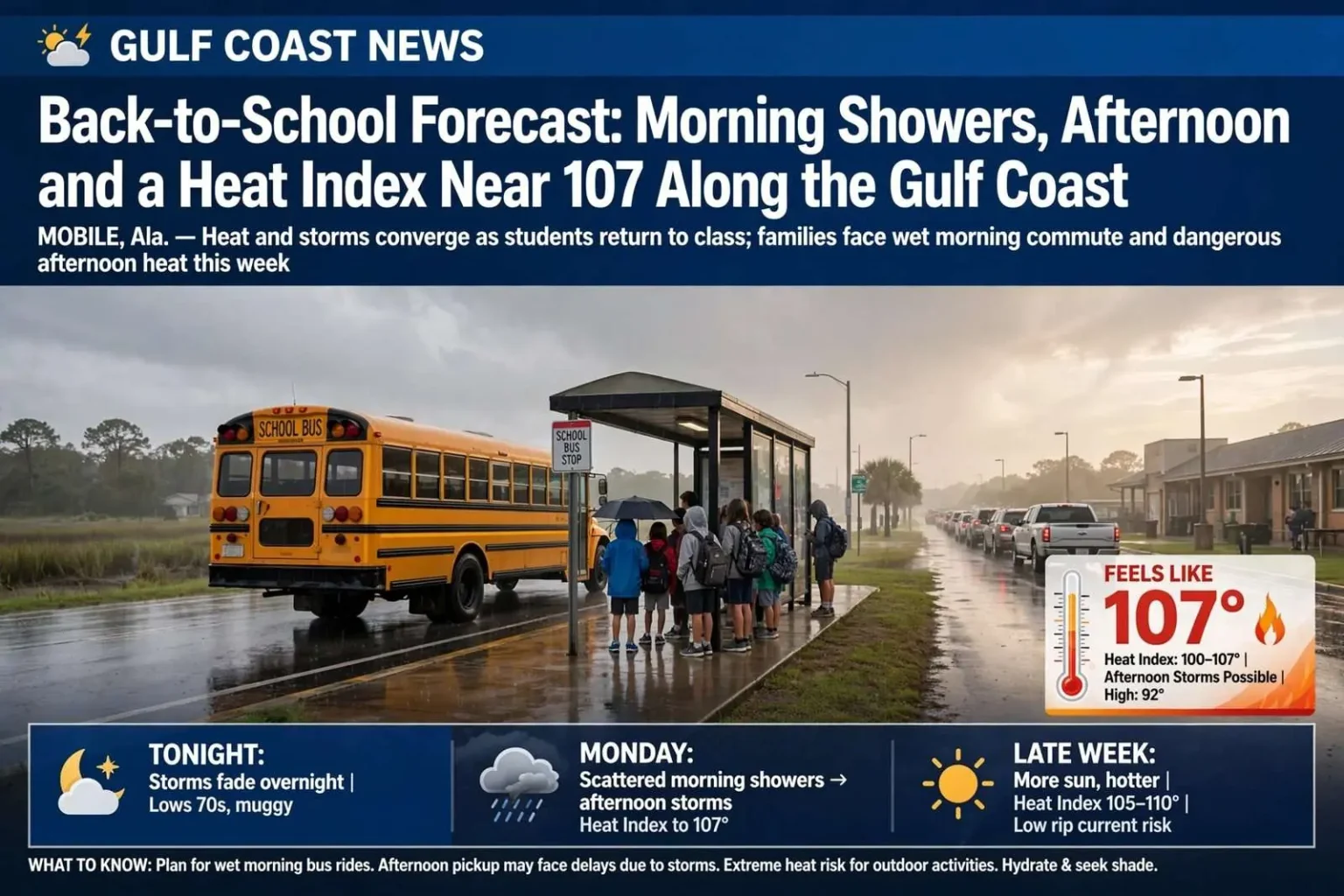
MOBILE, Ala. — A textbook August pattern holds across the Gulf Coast this week: hot, humid, and prone to scattered thunderstorms that fire in the afternoon and fade after sunset. Storm coverage should thin out by midweek — but only because the heat is taking over. With students across the region heading back to class, families will want to plan around two different problems on the same day: a wet morning bus ride and a dangerously hot afternoon pickup line.
The setup is the one coastal residents know by heart. By August, water temperatures in the Gulf and Mobile Bay run warm enough that any afternoon sea breeze collision can set off a storm, and the air mass overhead holds more than enough moisture to feed heavy rain. Forecasters describe the coming week as typical in every respect except the calendar: the first days of school mean the familiar pop-up storms now land on top of bus routes, car lines, practices and recess schedules.
Tonight: Evening Storms Gradually Fade
Scattered showers and thunderstorms continue across parts of the area early this evening before weakening and becoming less widespread after sunset. A few stronger cells could briefly produce heavy rain, frequent lightning and gusty winds. Most communities turn quiet overnight under partly cloudy skies and muggy conditions. Lows generally settle into the mid 70s inland and upper 70s near the coast.
The evening fade is a signature of the summer regime along the northern Gulf Coast. Once the sun drops, the sea breeze that helps trigger afternoon storms loses its contrast, and cells that survived into the evening typically lose organization within an hour or two of sunset. Overnight, humidity stays high enough that it rarely feels genuinely cool, even in the hours before dawn — a point worth remembering for families laying out clothes and packing backpacks the night before the first day.
Monday: Back to School With Scattered Storms
Several districts across the Gulf Coast return to class Monday. The morning bus ride will be warm and muggy with temperatures mainly in the 70s, and a few showers may develop near the coast during the morning — enough that some students could catch a brief shower on the way in.
Another round of scattered showers and thunderstorms is possible as the day goes on, with activity drifting inland through the afternoon. Many locations will stay dry or see stretches of sunshine between storms. Where thunderstorms do develop, expect brief downpours, frequent lightning and gusty winds, which means some afternoon pickup lines, bus routes and after-school activities could be interrupted.
Afternoon highs generally reach the lower 90s, with heat index values climbing into the 100 to 107 degree range. That spread between the actual temperature and what the body experiences is the defining feature of Gulf Coast August afternoons, and it is the reason school officials treat outdoor activities with caution even when it is not raining. On a day when the thermometer reads 92 but the heat index pushes toward 107, a student standing in an uncovered pickup line or on a practice field is dealing with conditions that stress the body far faster than the air temperature alone would suggest.
Parents should also build in flexibility for the afternoon drive. Slow-moving summer storms routinely drop enough rain in under an hour to flood low-lying stretches of road, and lightning within a few miles of a school field will send bands, teams and car-line staff indoors. A storm that interrupts dismissal does not necessarily mean severe weather is striking the school itself — it often means the storm is close enough that waiting it out is the only sensible move.
Tuesday Into Wednesday: Fewer Storms
Storm coverage should gradually decrease Tuesday and especially Wednesday — good news for additional districts starting classes around midweek, with more sunshine and fewer thunderstorms expected Wednesday. An isolated afternoon thunderstorm remains possible, but most communities should stay dry for longer stretches.
Temperatures hold in the lower to middle 90s, with muggy overnight lows in the 70s. Heat index values continue reaching the lower to middle 100s.
The thinning of storm coverage happens because the disturbances that have been prowling the Gulf and helping organize daily clusters of storms move on, leaving a drier and slightly more stable air mass overhead. It is a trade-off familiar to anyone who has lived through a coastal summer: less rain means fewer downpours and lightning delays, but it also means more uninterrupted sun, which pushes the heat index up and keeps overnight temperatures from falling as far.
For students at afternoon practices, recess and other outdoor activities, the heat becomes the more meaningful concern once the rain backs off — rain at least provides some cooling; a clear afternoon does not. Coaches and band directors across the region build in water breaks, shade rotation and shortened outdoor sessions during stretches like this, and parents sending students to August practices should assume that hydration starts well before the student leaves the house, not when the whistle blows.
Late Week: Hotter Weather Builds
More sunshine and fewer thunderstorms are expected Thursday through Saturday. With less rain around to break the heat, afternoon temperatures climb into the mid and upper 90s inland, while coastal communities stay slightly cooler thanks to the water.
The combination of heat and humidity could push heat index values into the 105 to 110 degree range late in the week and into next weekend.
That is the kind of heat where heat illness can develop quickly, particularly for younger children, older adults, outdoor workers and anyone exercising outside. Health officials generally advise shifting outdoor activity to the morning hours, drinking water steadily rather than waiting for thirst, and knowing the warning signs of heat exhaustion — heavy sweating, weakness, dizziness, nausea and headache — which, if ignored, can progress to heat stroke, a medical emergency. Vehicles are a special danger: a car interior can reach lethal temperatures in minutes, and children or pets should never be left inside one, even briefly, even with the windows cracked.
The late-week pattern also has practical consequences beyond school schedules. Utility demand typically peaks during stretches like this as air conditioners run continuously, and road crews, landscapers, roofers and construction workers across Mobile and Baldwin counties will be working through the worst of it. Employers are generally advised to schedule the heaviest labor for early morning, provide shade and water, and rotate workers through breaks.
Beach Forecast: Lower Rip Current Risk
Beach conditions should remain relatively manageable through the middle of the week, with a low risk of rip currents expected through Wednesday.
Even with generally calm surf, thunderstorms can create dangerous conditions near the water in a matter of minutes. If you hear thunder, leave the beach and move indoors.
The low rip current risk is welcome news for beachgoers along the Alabama and Florida panhandle coast, but forecasters stress that the risk rating describes the average day, not a guarantee at any particular moment. Rip currents can form near jetties, piers and sandbars even when the surf looks gentle, and they remain the leading weather-related killer at Gulf beaches. Swimmers caught in one should not fight it directly; swimming parallel to shore until free of the current, then angling back to the beach, is the recommended escape. And an afternoon storm offshore or over the water can put lightning on the beach while the sky directly overhead still looks blue.
Tropics: Activity Well East of Home
The National Hurricane Center is monitoring several areas across the Atlantic, including tropical waves and areas of low pressure well east of the United States. Some gradual tropical development is possible over the open Atlantic later this week, but there is no immediate tropical threat to the Gulf Coast or the contiguous United States over the next several days.
That picture is typical for the start of what forecasters watch closely as the approach to the statistical peak of hurricane season. August marks the point where tropical waves rolling off the west coast of Africa begin to arrive in the main development region of the central and eastern Atlantic with enough organization and warm water beneath them to strengthen. Systems that form there generally take a week or more to cross the basin — which is why an area of interest east of the islands warrants attention now but poses no threat to the Gulf this week. The National Hurricane Center issues updates on these disturbances regularly, and residents along the northern Gulf Coast are accustomed to the routine: watch the long-range systems, keep supplies current, and let the five-day forecast cone do the worrying when and if a storm actually enters it.
For now, the local forecast holds no tropical complications. The rain and storms in this week’s pattern are strictly the ordinary afternoon variety.
What the Week Means for the First Days of School
Put together, the week asks families to manage two hazards on opposite ends of the clock. The morning hours carry the higher chance of rain, particularly near the coast, where a brief shower on the walk to the bus stop or the drive to school is possible Monday. The afternoon and early evening carry the heat, with heat index values climbing past 100 every day and pushing toward 110 by the weekend.
That combination is why school districts around the region treat the opening weeks of the year with weather plans already in hand. Dismissal may be held briefly if lightning is near a campus. Outdoor recess and practices get shortened or moved indoors as heat indices climb. Athletic programs across Alabama and the broader Gulf Coast follow heat guidelines that scale activity to the heat index, adding rest and hydration breaks as the number rises.
For parents, the practical checklist is short. Send students with water, especially those with after-school activities. Plan for a wet morning drive Monday, even if the rain never materializes at your house. Expect the hottest conditions of the week late in the week, and shift any family outdoor plans — yard work, practices, beach trips — toward the morning. And keep an eye on the sky during afternoon pickup: a storm that appears over the bay can reach a school campus in minutes in a summer regime where cells move with the steering flow and build fast.
The forecast itself is unremarkable for August on the Gulf Coast — hot, humid, dotted with storms that thin out as the week goes on. The only unusual element is the calendar. The same weather that in June would pass unnoticed now collides with the first days of school, and a week that would otherwise be routine becomes one that families, teachers and coaches have to actively manage. The good news embedded in the forecast: no tropical threats close to home, a low rip current risk through the middle of the week, and progressively fewer storms by Wednesday and Thursday. The catch: what the pattern removes in rain, it returns as heat.