
Heat Advisory Wednesday as Gulf Coast Heat Index Values Stay in Dangerous Range
An Extreme Heat Warning remains in effect for Gulf Coast areas with a Heat Advisory elsewhere, as heat index values near 107 degrees persist into Wednesday before slight relief arrives this weekend.
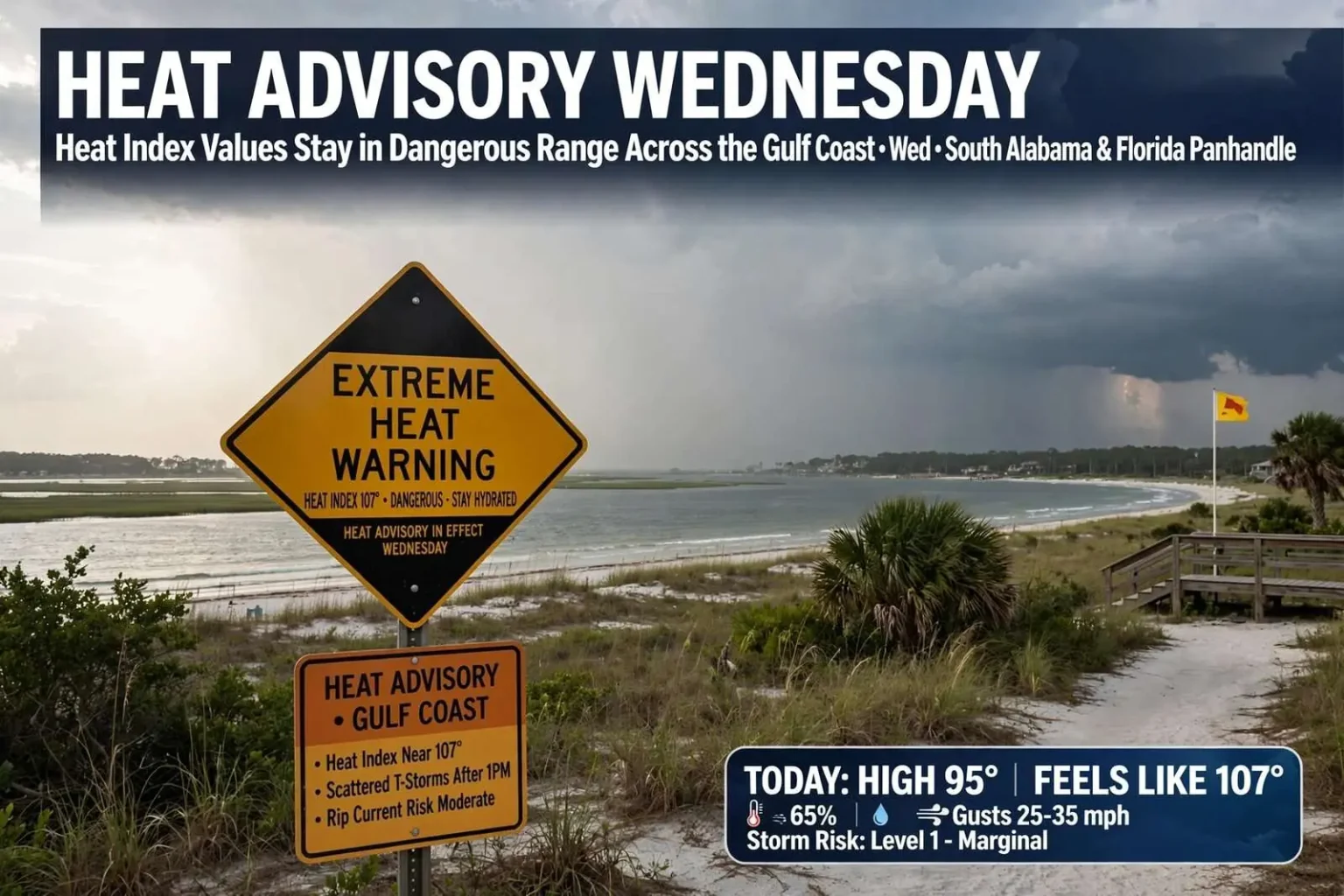
Extreme heat remained the top weather concern across the Gulf Coast this week, with an Extreme Heat Warning in effect for coastal areas and a Heat Advisory covering the rest of the region as heat index values climbed to dangerous levels. Forecasters also noted a level 1, or marginal, risk of severe weather across the entire area, with damaging wind gusts identified as the primary threat. Scattered afternoon thunderstorms remained possible alongside the heat. Officials urged anyone heading outdoors to take frequent breaks in air conditioning, drink plenty of water and watch for signs of heat illness such as dizziness, nausea or excessive sweating.
The combination of extreme heat and scattered storms is a familiar summer pattern for south Alabama, but this week’s setup pushed conditions toward the top of the range. An Extreme Heat Warning represents the National Weather Service’s most urgent heat alert, reserved for situations where heat indices pose a genuine danger to health, while the accompanying Heat Advisory signals conditions serious enough to warrant caution across inland communities. Together, the two alerts covered essentially the entire forecast area from the Mississippi line to the Florida border and out across the coastal waters.
Extreme Heat Warning for Coastal Areas
Storms moved through the region, bringing heavy rain, frequent lightning and gusty winds. Overnight temperatures offered little relief, with lows only around 77 degrees inland and warmer readings closer to the coast. Warm, humid nights prevent the body from recovering after a long day in the heat, which is one reason extended hot stretches strain emergency rooms and heat-sensitive residents far more than single hot days. Mobile’s subtropical climate, buffered by the waters of Mobile Bay and the Gulf of Mexico, keeps overnight temperatures elevated even when afternoon storms arrive.
Wednesday is expected to bring another very hot day, with highs in the mid-90s and heat index values again reaching dangerous levels near 107 degrees. Rain chances increase to around 50 percent, with scattered afternoon showers and thunderstorms possible after 1 p.m. Any storms that develop could produce brief heavy rain and gusty winds. Overnight lows are expected to drop to around 76 degrees. A heat index near 107 means the combination of temperature and humidity will make it feel more than ten degrees hotter than the thermometer reads, a level at which heat exhaustion becomes a real risk for anyone working or exercising outdoors without frequent rest.
Forecasters stressed that the marginal severe weather risk should not distract from the heat. A level 1 risk is the lowest rung on the Storm Prediction Center’s five-point scale, but even marginal setups can produce damaging wind gusts when afternoon storms collapse or organize along the sea breeze. Residents spending the day outside should plan for both threats at once — shade and water for the heat, and a sturdy shelter plan for the afternoon storm window.
Why Heat Index Matters on the Gulf Coast
The heat index combines air temperature with relative humidity to estimate how hot conditions actually feel to the human body. High humidity slows the evaporation of sweat, the body’s primary cooling mechanism, so a humid 95-degree afternoon can stress the body as severely as a dry 105-degree one. Along the upper Gulf Coast, moisture streaming north from the Gulf of Mexico routinely pushes dew points into the mid-70s, making the region one of the most heat-stressed corners of the country during the summer months.
Health officials note that young children, older adults, outdoor workers, and athletes are the groups most vulnerable when heat indices climb past 105 degrees. The standard advice — frequent breaks in air conditioning, plenty of water, and attention to early symptoms such as dizziness, nausea or excessive sweating — becomes critical during stretches like this week’s. Residents without reliable air conditioning are encouraged to spend the hottest afternoon hours in public spaces such as libraries, malls, or community centers.
Pattern Continues Into the Weekend
From Thursday through Friday, the weather pattern is expected to return to a more typical mid-August setup, with scattered afternoon thunderstorms expected each day. Highs will remain in the mid-90s, and heat index values are forecast to stay in the upper 90s to low 100s. The sea breeze will continue to be the main trigger for storm development, which forecasters say makes it difficult to pinpoint exactly where individual storms will form. Most storm activity is expected to occur between noon and 9 p.m.
The sea breeze is the defining feature of Gulf Coast summer weather. As the land heats faster than the water during the morning, a cool flow of marine air pushes inland from Mobile Bay and the Gulf, and the boundary where it meets the hot inland air becomes a focusing line for afternoon thunderstorms. Those storms typically drift back toward the coast during the evening, which is why the midday-to-evening window carries the greatest storm risk. Because the boundary’s exact position shifts day to day, forecasters can identify the general risk but not the specific neighborhoods that will see a downpour.
Some relief is on the way by the weekend. The upper-level ridge responsible for the extended stretch of extreme heat is expected to begin weakening late in the week, which should help push temperatures down a few degrees. Highs are forecast to settle into the low to mid-90s by Saturday and Sunday, with Saturday looking slightly wetter than Sunday as scattered afternoon storms remain possible. Conditions will still be hot and humid, but forecasters say the shift will provide some relief from the relentless heat of the past several days.
An upper-level ridge acts like a lid on the atmosphere, sinking air and suppressing cloud cover while allowing surface heat to build day after day. When such a ridge weakens or shifts, the capping effect eases, storms can fire more freely, and temperatures moderate. For residents who have endured days of heat indices near or above 105 degrees, even a few degrees of improvement meaningfully lowers the strain — though August on the Gulf Coast never truly cools off, and forecasters caution that the pattern could rebuild.
Beach and Rip Current Conditions
A moderate rip current risk is in effect for all area beaches in Alabama and Florida through Wednesday. Surf heights are expected to remain around 1 to 2 feet, potentially reaching 3 feet Tuesday and Wednesday afternoons as winds increase. Beachgoers are reminded to always check beach warning flags and to swim near a lifeguard whenever possible, particularly given the combination of dangerous heat and elevated rip current risk affecting the coast this week.
Rip currents are narrow channels of fast-moving water that pull swimmers away from shore, and they are the leading weather-related killer at Gulf Coast beaches. The beaches along Alabama’s island communities of Gulf Shores and Orange Beach and Florida’s Panhandle draw enormous crowds in summer, and warning flags posted at public beach access points give visitors a daily read on the risk. A moderate risk means rip currents are likely for swimmers who enter the surf, especially near jetties, piers, and sandbars where currents tend to concentrate.
Safety experts recommend that anyone caught in a rip current stay calm, float, and swim parallel to shore until free of the current rather than fighting it head-on. Visitors heading to the beach during this week’s heat should also remember that the same oppressive conditions inland apply on the sand, where shade is scarce and reflected heat from the beach surface pushes effective temperatures even higher. Water, hats, and frequent breaks in the shade or in air conditioning remain the best defenses.
What the Alerts Mean for South Alabama Residents
For most residents, the practical effect of this week’s alerts comes down to scheduling. Lawn work, construction, and outdoor exercise are best moved to the early morning hours before heat indices climb, and afternoon plans should include an indoor backup in case storms develop. Employers across the region are urged to follow standard heat protocols for outdoor crews, including rotating workers through shaded breaks and providing water throughout the shift. Vehicle owners should also remember that cars heat rapidly in direct sun, and that children and pets should never be left inside, even briefly.
The alerts also matter for the region’s agricultural and fishing communities. Livestock handlers watch heat indices closely during stretches like this one, and commercial and recreational fishermen on Mobile Bay and the Gulf face a double consideration — extreme heat on open water and the possibility of sudden storms during the afternoon window. Farmers along the delta and in the rural stretches of Mobile and Baldwin counties typically shift heavy work to dawn during heat advisories.
School calendars add another layer of attention. August marks the return of classes across south Alabama, and high school band practices, football workouts, and cross-country training all run during the very weeks when heat indices peak. State athletic guidelines require heat monitoring and mandated rest and hydration periods during such conditions, and coaches across the region adjust outdoor practice times whenever advisories are in effect.
Staying Weather-Aware Through the Stretch
Residents across South Alabama and the broader Gulf Coast are encouraged to stay alert to changing conditions as forecasters continue to monitor both the extreme heat and the potential for storm activity in the days ahead. The National Weather Service office that serves the region issues updated forecasts, watches, and warnings throughout the day, and local media and emergency management agencies pass those updates along through television, radio, and social channels.
Weather radios remain one of the most reliable tools for receiving warnings, particularly overnight when damaging winds can accompany collapsing storms while most residents sleep. Mobile alerts and local apps provide similar coverage for those who prefer phones. Because the sea breeze drives storm formation, conditions can shift quickly within a single county — a sunny morning in downtown Mobile can give way to a heavy afternoon downpour across the bay in Daphne or Spanish Fort — so residents are advised to check the forecast before heading out rather than relying on the morning’s outlook.
The week’s pattern — dangerous heat, scattered afternoon storms, warm nights, and a slow moderation toward the weekend — is a reminder of how dominant summer weather remains along the upper Gulf Coast. Forecasters expect the immediate danger to ease as the upper ridge weakens, but the underlying August pattern will stay in place, and residents should treat heat safety as a daily routine until the season finally turns toward fall.
The Bottom Line for the Days Ahead
Wednesday stands as the peak of this stretch, with mid-90s temperatures, heat indices near 107 degrees, and a 50 percent chance of afternoon storms after 1 p.m. Thursday and Friday return to a typical mid-August rhythm of scattered sea-breeze storms and upper-90s to low-100s heat indices, and the weekend brings slightly cooler highs in the low to mid-90s with Saturday the wetter of the two days. Through it all, the moderate rip current risk along Alabama and Florida beaches through Wednesday adds a coastal dimension to the heat story.
The guidance from officials remains unchanged and straightforward: take frequent breaks in air conditioning, drink plenty of water, and watch for signs of heat illness such as dizziness, nausea or excessive sweating. Check beach warning flags before entering the surf, swim near a lifeguard where possible, and keep an eye on the sky between noon and 9 p.m., when storms are most likely to develop. A few degrees of relief are in sight by the weekend — but the Gulf Coast summer, as always, will have the final word.