
A Return to Typical Gulf Coast Summer Weather: Pop-up Storms and Near-90 Heat
The Gulf Coast returns to a typical summer pattern with pop-up storms and near-90 heat, while the Alabama Deep Sea Fishing Rodeo wraps up on Dauphin Island.
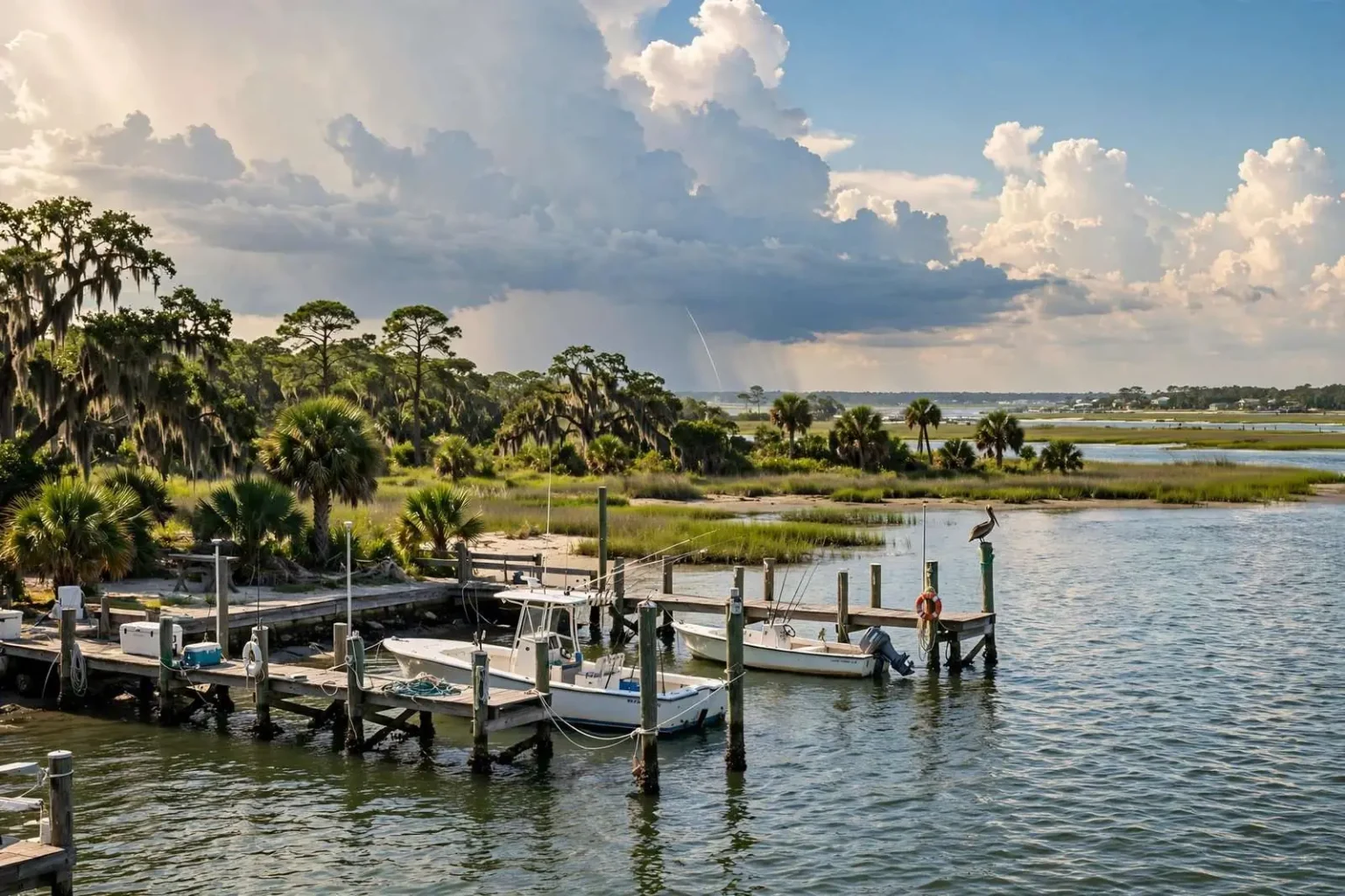
The Gulf Coast is settling back into a typical summer weather pattern, and that means the forecast for the coming week reads like a broken record: partly cloudy, humid, and hot, with a high near 90 and the daily rhythm of pop-up showers and thunderstorms. Showers and a few thunderstorms will develop along the coast in the morning and push inland with the sea breeze, with about a 30 percent chance of rain reaching any given spot. The storms will fade overnight, then return each afternoon through the week, keeping lawns green and the afternoon commute occasionally soggy.
This is the classic Gulf Coast summer setup that residents of Mobile, Baldwin County, and the rest of the northern Gulf shoreline know by heart. The pattern is driven by the sea breeze — the daily wind that forms as the land heats faster than the water. As the morning sun warms the coastal plain, cooler marine air slides inland to replace the rising warm air, and the boundary where the two air masses meet acts as a trigger for shower and storm development. The result is a forecast that repeats itself: storms near the coast late morning, drifting over inland neighborhoods by mid-afternoon, dissolving after sunset, and starting over the next day.
Temperatures hold to the summer script
Temperatures stay seasonable throughout the period, with highs running a degree or so on either side of 90 and lows in the mid 70s. That is not extreme heat by Gulf Coast standards — the region’s worst summer stretches push well into the mid and upper 90s — but the humidity makes it feel hotter than the thermometer shows, particularly in the afternoon hours. Anyone working outdoors should plan around the pattern: outdoor exertion is best completed in the morning before the heat and storm activity build, and the standard summer precautions about hydration and shade apply all week.
The overnight lows in the mid 70s offer little relief, especially with the moisture in the air. Air conditioning works overtime in July and August across south Alabama, and the region’s summer electricity demand peaks with the pattern. The consolation is consistency — a forecast like this one requires little adjustment from day to day, and residents can plan a full week of activities with reasonable confidence about what each afternoon will bring.
A good week for the rodeo
Meanwhile, the Alabama Deep Sea Fishing Rodeo wraps up Sunday on Dauphin Island, and the weather picture for the event looks cooperative. Anglers may need to dodge a thunderstorm or two over the coastal waters — isolated storms are part of any Gulf summer day — but marine conditions are expected to be mostly quiet, with 1-foot seas and a light east breeze. For small boats running out of Dauphin Island’s docks, those are about as friendly as Gulf conditions get in late July, when summer squalls can otherwise keep even experienced captains tied up.
The rodeo is one of the country’s oldest and largest saltwater fishing tournaments, and it transforms Dauphin Island each year into a hub of weigh-ins, vendors, and crowds. The island, a barrier island at the mouth of Mobile Bay reachable by bridge from the mainland, hosts the event at its festival grounds, with anglers bringing in red snapper, king mackerel, grouper, and dozens of other species for weighing and judging. Calm seas through the final day mean the leaderboard should get its full share of additions before the scales close.
For beachgoers and boaters elsewhere along the coast, the same marine forecast applies: light winds and gentle seas, with the main caution being the scattered afternoon thunderstorms that can build quickly over the water. Boaters should keep an eye to the sky and be ready to move — a storm that looks distant at lunchtime can be overhead by mid-afternoon in a typical summer pattern like this one.
Understanding the 30 percent chance
The 30 percent rain chance that headlines the daily forecast deserves a plain-language explanation, because it is one of the most misunderstood numbers in weather. It does not mean it will rain for 30 percent of the day, nor that 30 percent of the area will definitely get wet. It means that for any given spot in the forecast area — your backyard, your office parking lot, your kid’s ballfield — there is about a three-in-ten chance of measurable rain during the period. Put the other way, there is a strong chance any particular location stays dry, even though somewhere in the region almost certainly will not.
Scattered coverage is the norm for sea breeze storms. Because the sea breeze boundary is irregular, storms pop up along it in clusters rather than as a wall of rain. One neighborhood gets a quick downpour and a gusty hour while the next community over never sees a drop. That is why summer forecasts lean on the phrase “scattered afternoon showers and thunderstorms” rather than calling for rain everywhere — and why a washed-out lawn plan one afternoon says nothing about the next.
When storms do form, they bring the Gulf Coast summer staples: brief heavy rain, frequent lightning, and gusty outflow winds. Lightning is the main hazard, and the standard safety rule — when thunder roars, go indoors — applies to anyone caught outside, whether on a ballfield, a golf course, or the beach. Most of these storms are gone within an hour, leaving behind steamy streets and, often, a vivid sunset.
The week ahead
The repetition is the story for the next seven days: showers and storms fade overnight, skies clear briefly, and the cycle restarts each morning along the coast. No organized storm systems are in the picture, and no significant cool-down is expected — highs will hold a degree or so either side of 90 with muggy mid-70s nights. In other words, textbook July along the northern Gulf Coast, the kind of pattern that fills retention ponds, keeps the grass growing fast, and makes the beach the best place to be by mid-afternoon.
Residents with flexible schedules can use the pattern to their advantage. Mornings are the driest, most comfortable window for yard work, jogging, and outdoor projects. Pools and beaches are best enjoyed after the morning storm window closes and before the afternoon storms organize. And anyone planning an outdoor event for the weekend should keep a covered backup option handy — with a daily 30 percent rain chance, the odds eventually catch up with everyone.
For the anglers on Dauphin Island
Back at the Alabama Deep Sea Fishing Rodeo, the forecast sets up a fitting close to the tournament weekend. Light east winds and 1-foot seas make for easy runs to the fishing grounds and comfortable rides home, while the scattered afternoon storms are manageable for boats paying attention to the radar. Weigh station crowds on the island should enjoy typical summer beach weather — hot, humid, and punctuated by the occasional shower that is gone as quickly as it arrived.
The quiet pattern is a benefit for the event’s final Sunday, when the biggest fish of the tournament often hit the scales in the last hours of competition. Between the calm seas offshore and the familiar summer rhythm on shore, the Gulf Coast is delivering exactly the weather its residents expect in late July — and exactly what the rodeo needs to finish strong.
The sea breeze, explained
The engine behind the whole week’s forecast is the sea breeze circulation, and it is worth understanding because it shapes daily life along the entire northern Gulf Coast from Pensacola Bay to Mobile Bay and westward. The mechanics are simple. Sunlight warms land faster than water, so by late morning the air over the coastal plain is rising while the air over the Gulf stays relatively cool. Cooler, denser marine air then flows inland to replace the rising air, arriving at the shore as a welcome breeze by late morning and pushing inland through the afternoon — usually reaching the Mobile area hours after it first crosses the beach.
The leading edge of that marine air is called the sea breeze front, and it acts like a shallow wedge that lifts the hot inland air ahead of it. Where the lifting is strong enough and moisture is plentiful — and in July it always is — clouds build along the front and showers and thunderstorms form. The storms then ride the circulation inland, which is why coastal communities often clear out by mid-afternoon just as inland spots like Citronelle, Bay Minette, and the neighborhoods north of the city get their rain. By evening, the circulation breaks down, the storms die, and the overnight clearing sets up the next day’s repeat performance.
Locals track this cycle instinctively. It explains why a morning on the beach is usually dry even when the forecast mentions storms, why inland ballfields see more rainouts than coastal ones, and why the drive home from work in August can be a windshield-wiper workout on one side of the bay and a dust-dry road on the other.
Summer heat and the humidity premium
The high near 90 that the forecast carries all week sits at the modest end of the Gulf Coast summer spectrum, but the humidity adds a significant premium to how it feels. Dew points in the 70s — standard for the region in late July — make the air feel several degrees hotter than the temperature suggests and slow the body’s ability to cool itself through sweat evaporation. Heat indices can climb into the mid and upper 90s even when the actual high stays around 90, which is why outdoor work schedules in the region shift early and why hydration matters on days that sound merely warm.
The pattern also has its benefits. The daily storms keep the region’s famous greenery alive through the hottest months, refill the soils after dry spells, and moderate temperatures in the immediate aftermath of each downpour. The mid-70s overnight lows, while not crisp, are enough for a comfortable evening on the porch once the sun goes down — a Gulf Coast ritual that the week’s forecast will support night after night.
Planning around the pattern
For residents, the week’s takeaway is convenience: a forecast this repetitive requires almost no monitoring. Mornings are for outdoor plans, afternoons carry a one-in-three chance of interruption, and evenings dry out. Boaters heading out of Bayou La Batre, Dauphin Island, or the causeway should still check the radar before and during any trip, because scattered summer storms can build over the water quickly — but with 1-foot seas and a light east breeze in place, the marine environment itself is about as benign as the Gulf gets in the height of summer. The Alabama Deep Sea Fishing Rodeo’s final day on Dauphin Island gets the best of it, and the rest of the coast gets another week of the summer rhythm it knows by heart.