

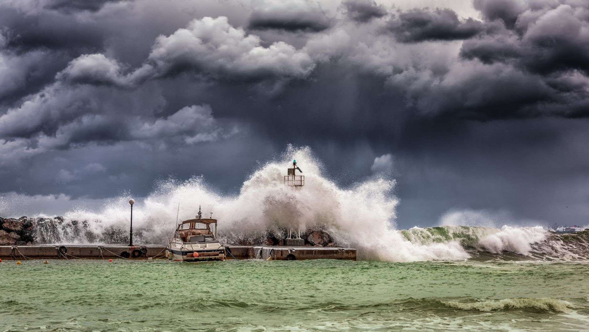
MOBILE, Ala. — The calendar turned this week to a date that carries unusual weight along the northern Gulf Coast. September 16 is the anniversary of two hurricane landfalls that reshaped coastal Alabama and the western Florida Panhandle: Hurricane Ivan, which came ashore at Gulf Shores 22 years ago, and Hurricane Sally, which followed the same approach six years ago and struck almost the identical stretch of shoreline.
Two storms, sixteen years apart, arriving on the same day at very nearly the same place. For residents of Baldwin and Mobile counties, the coincidence is more than a curiosity. It is a reminder that mid-September sits squarely inside the most dangerous weeks of the Atlantic hurricane season, and that the barrier islands and bayous of south Alabama occupy a corner of the Gulf where storms have a long history of turning inland.
Hurricane Ivan: the benchmark storm
Hurricane Ivan made landfall at Gulf Shores as a Category 3 hurricane, carrying maximum sustained winds of 120 mph and pushing a storm surge that remains the standard against which coastal Alabama measures every subsequent storm. Fifteen fatalities were reported across the region in connection with the landfall: 14 in Florida and one in Mississippi. Notably, no deaths occurred in Alabama, the state that absorbed the eyewall.
The damage total reached $18.82 billion, and Ivan entered the record books as the strongest hurricane to strike Alabama since Hurricane Frederic in 1979 — a 25-year gap that had, in the intervening decades, allowed a great deal of new construction to rise along a coastline that had not been tested by a major hurricane in a generation.
That point deserves emphasis, because it explains much of what happened. Between Frederic and Ivan, Baldwin County transformed. Gulf Shores and Orange Beach grew from modest beach towns into high-rise condominium destinations. Subdivisions filled in behind the dune line. The permanent population of Baldwin County climbed steadily, and the seasonal population climbed faster. When Ivan arrived, it met a coast with far more in its path than Frederic had found.
What Ivan did to the built environment
Ivan’s signature was surge and structural failure. The storm’s approach angle drove water into the shallow, gently sloping shelf off Alabama, and the surge did what surge does on a developed barrier island: it undercut foundations, stripped dunes, cut new passes through the beach, and pushed sand and debris inland across roadways. Beach Boulevard and the connecting routes through Gulf Shores and Orange Beach were left impassable in stretches, and rebuilding the dune system became a years-long public works project in its own right.
Inland, the wind field did separate damage. Ivan remained a strong hurricane well after crossing the shoreline, and hurricane-force gusts reached far up into Baldwin and Escambia counties, snapping pines, pulling down transmission lines and leaving large portions of the region without power for extended periods. Pecan groves and timber stands — a meaningful part of the rural economy in Baldwin County and the counties to the north — suffered losses that took many seasons to recover.
One of the most widely photographed consequences of Ivan occurred just across the state line, where the Interstate 10 bridge over Escambia Bay near Pensacola lost multiple spans to the combination of surge and wave action. The severing of a primary east–west interstate link complicated the recovery for months and became the visual shorthand for the storm’s power.
Ivan also proved remarkably durable as a weather system. After moving inland and weakening, its remnant circulation tracked northeast, swung out over the Atlantic, looped south, crossed Florida, re-entered the Gulf of Mexico and made a second landfall along the Louisiana coast. Few storms in the modern record have taken such a path, and it remains one of the more unusual tracks in Atlantic hurricane history.
Hurricane Sally: the slow storm
Sixteen years later to the day, Hurricane Sally made landfall at Gulf Shores as a high-end Category 2 hurricane with sustained winds of 110 mph — just under the 111 mph threshold that would have made it a major hurricane.
The wind speed, however, was not the story. Sally’s defining characteristic was its pace. At times the storm crawled forward at roughly 2 mph — slower than a person walking — which meant that communities in southern Baldwin County were held inside hurricane-force winds not for an hour or two but for hours on end. A storm that moves quickly delivers a violent but comparatively brief assault. A storm that stalls delivers something different: sustained, grinding pressure on structures, trees and infrastructure that were built to withstand a peak gust, not a prolonged siege.
Four direct fatalities were attributed to Sally, and the storm caused $7.3 billion in damage.
Why slow storms behave differently
Sally’s forward speed compounded every other hazard it carried. Storm surge, which depends heavily on how long the wind pushes water toward the shore, had extended time to build and to hold. Rainfall, which accumulates as a direct function of how long a rain band sits over a given point, piled up dramatically across coastal Alabama and the western Florida Panhandle. Rivers and creeks that drain the coastal plain — systems that ordinarily handle heavy rain without trouble — rose into flood as runoff arrived faster than it could be carried to the bays.
The combination produced the flooding that many residents remember more vividly than the wind: water standing in neighborhoods well inland of the beach, roads cut off by rising creeks, and marinas and waterfront properties battered by surge that did not recede on the usual schedule.
Sally was also responsible for one of the more dramatic infrastructure failures of the 2020 season. Construction barges moored near the Pensacola Bay Bridge broke loose in the storm and struck the structure, damaging spans badly enough to close the crossing for months. As with Ivan and the Escambia Bay bridge, the loss of a major connection reshaped daily life for commuters across the Florida–Alabama line long after the wind had gone.
Two storms, one lesson about mid-September
That both storms arrived on September 16 is a coincidence of dates, but it is not a coincidence of timing. The Atlantic hurricane season runs from June 1 through November 30, and climatologically the season reaches its statistical peak in the second week of September. The Gulf is at or near its warmest, wind shear across the basin is typically at a seasonal minimum, and the atmospheric pattern favors tropical waves that can organize as they move west. Mid-September is, in short, when the northern Gulf Coast has historically been most exposed.
Alabama’s coastline is short — roughly 60 miles of shoreline fronting the Gulf — but its geography concentrates risk. Mobile Bay funnels surge northward toward the Port of Mobile and the low-lying communities around its edges. The barrier island system at Gulf Shores, Orange Beach and Dauphin Island absorbs the first blow. Behind them, a network of bayous, rivers and wetlands carries water inland rather than blocking it.
What changed after Ivan and Sally
Both storms left a legacy in policy as well as in memory. Ivan, in particular, drove significant revisions in how coastal Alabama builds. Elevation requirements for structures in flood-prone zones, wind-resistant construction standards, roof attachment and opening protection requirements, and the fortified building programs that insurers now incentivize all gained traction in the years following 2004. Newer construction along the Alabama coast is, as a rule, substantially more resistant to both wind and surge than what stood when Ivan arrived.
Sally tested some of that work and exposed a different vulnerability: rainfall and freshwater flooding, which building codes address far less directly than wind. Drainage capacity, stormwater management in rapidly developing areas, and the question of where new subdivisions are permitted relative to floodplains have all received more attention along the coast since 2020.
Evacuation planning has also matured. Coastal Alabama’s evacuation zones, contraflow arrangements on the main northbound routes, and the coordination between the Alabama Emergency Management Agency, county EMA offices in Baldwin and Mobile counties, and municipal governments have been refined through repeated real-world use.
Practical preparedness, in the middle of a season
Emergency managers along the Gulf Coast use anniversaries like this one as a prompt rather than a commemoration. With the peak of the season just passed and weeks of active season still ahead, the standing recommendations are straightforward:
- Know your evacuation zone. Zones are assigned by surge vulnerability, not by distance from the beach. County EMA offices publish current maps, and a property’s zone can change as modeling improves.
- Prepare for the aftermath, not just the storm. Extended power outages are the most common shared experience after a landfall. A week of water, non-perishable food, medications, batteries and cash remains the standard baseline.
- Understand your insurance before you need it. Standard homeowners policies do not cover flood. Flood insurance through the National Flood Insurance Program typically carries a 30-day waiting period, which means it cannot be purchased once a storm is in the Gulf. Wind and hail deductibles on coastal policies are often expressed as a percentage of the insured value rather than a flat dollar amount.
- Document your property in advance. Photographs and video of rooms, contents and serial numbers, stored somewhere that survives the loss of the house, make claims dramatically easier.
- Plan for pets and for people with medical needs. Not every shelter accepts animals, and residents who depend on powered medical equipment should register in advance with their county EMA where such programs exist.
- Watch the forecast, not the forecast track line. The center line of a forecast cone is the least useful part of it. Hazards — surge, wind, rain, tornadoes — extend well beyond the center, and a storm does not need to make a direct hit to cause serious damage.
Memory as infrastructure
There is a particular value in these anniversaries that goes beyond the retelling. Coastal populations turn over. People move to Baldwin and Mobile counties from places that have never seen a hurricane, buy property behind a dune line that looks permanent, and form their sense of risk from a few quiet seasons. Ivan arrived after 25 years without a major hurricane in Alabama. A generation of residents had no personal frame of reference for what a Category 3 landfall meant.
Institutional memory is part of coastal infrastructure. Building codes encode it. Evacuation zones encode it. So, in a less formal way, do the stories that get retold every September by people who were here — the sound of the wind through the long hours of Sally’s crawl, the sand drifted like snow across the roads after Ivan, the weeks without power, the neighbors with chainsaws.
Twenty-two years and six years. Same date, same stretch of shoreline, two very different storms. The first taught coastal Alabama what wind and surge could do to a coastline that had grown comfortable. The second taught it what water can do when a storm refuses to leave. Both lessons remain relevant, and the season is not over.