

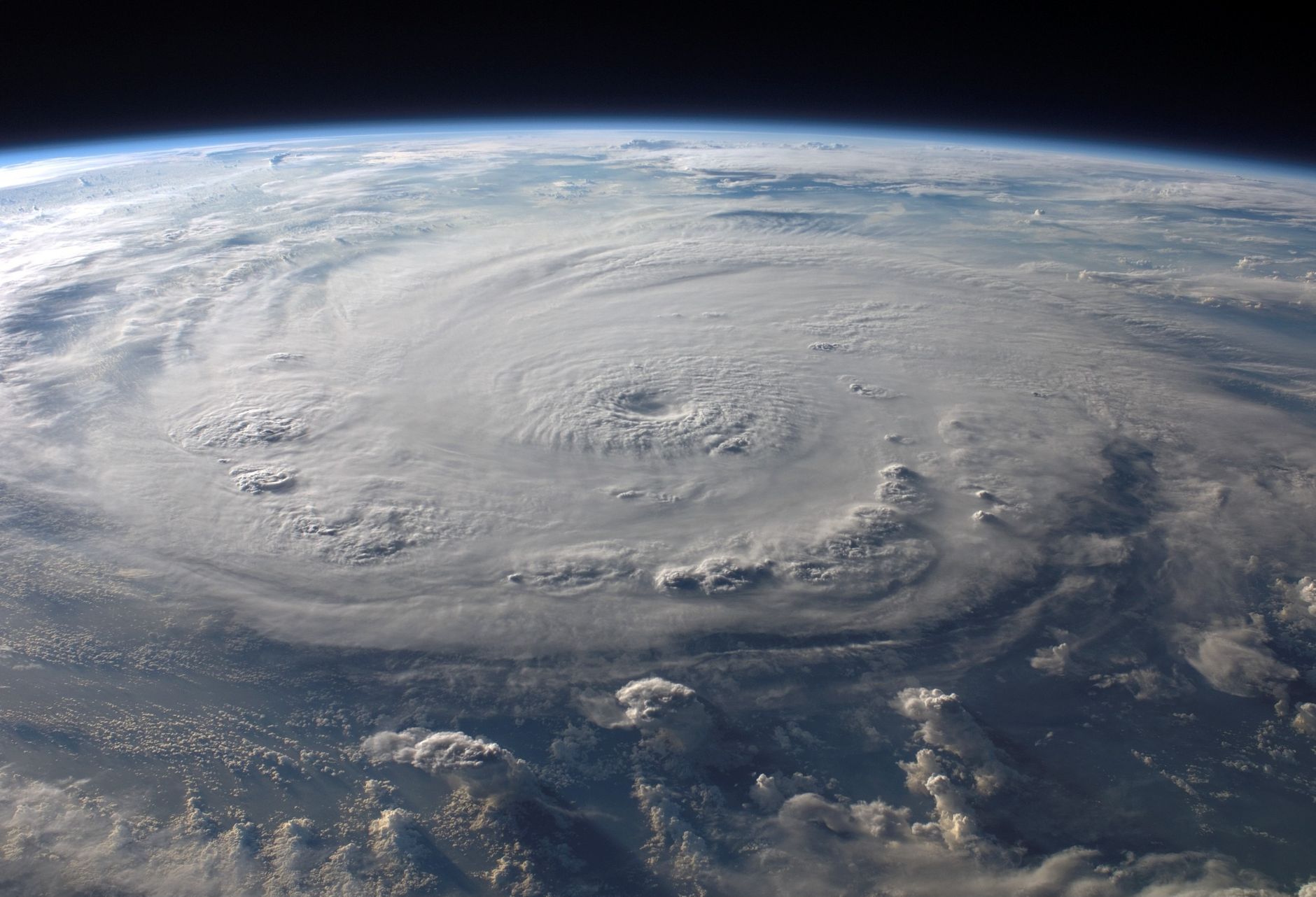
MOBILE, Ala. — The 2026 Atlantic hurricane season has reached a milestone nobody on the Gulf Coast expected to see. As of Sept. 21, the Atlantic basin still had not produced a single hurricane, making this the longest wait for a season’s first hurricane in the satellite era. For residents of Mobile and Baldwin counties, a historically quiet hurricane season may feel like a reprieve, but forecasters and history alike carry the same message: the season is not over, and quiet years have a way of delivering one storm that matters.
The Atlantic hurricane season officially runs from June 1 through Nov. 30. That leaves more than two months on the calendar, including October, a month that has repeatedly brought damaging storms to the northern Gulf. The absence of hurricanes so far says nothing certain about what the final weeks may hold.
A Record Nobody Wanted to Watch
Meteorologists generally mark the satellite era as beginning in the mid-1960s, when routine satellite imagery made it possible to spot and track every tropical system over the open ocean. Before then, storms that never touched land or crossed a shipping lane could go unrecorded. That is why the current record is framed around the satellite era: since forecasters gained the ability to see the entire basin, no season has gone this long without its first hurricane.
That does not mean 2026 has been empty. Tropical storms have formed, and some have touched the region. Early in September, the remnants of Tropical Storm Arthur swept through Mobile, leaving crews to clear downed trees and flooded roads. Systems like that are a reminder that a storm does not need hurricane-force winds to cause problems along the coast. Heavy rain, localized flooding, rip currents and isolated tornadoes all come with tropical systems of any strength.
The climatological peak of hurricane season falls around Sept. 10, and activity typically remains elevated into October before tapering off in November. A season that has been slow through the peak can still turn active late, particularly in the Gulf and western Caribbean, where warm water lingers well into autumn.
What the Quietest Seasons Teach
Some of the quietest Atlantic hurricane seasons on record include 1907, 1914, 1983 and 1997. The earliest two predate satellites and even routine aircraft reconnaissance, so their records are less complete than modern ones, but they remain on the list of seasons with remarkably little recorded activity. The more recent examples carry lessons that apply directly to this year.
The 1997 season is the most relevant for coastal Alabama. That year, a powerful El Niño helped suppress overall Atlantic activity. El Niño, the periodic warming of the eastern tropical Pacific, tends to increase wind shear over the Atlantic, and strong shear tears developing storms apart before they can organize. The result in 1997 was a season with limited activity overall.
Yet Hurricane Danny still struck the northern Gulf Coast that summer and moved into Mobile Bay. Danny was not a powerful storm by wind speed, but it moved slowly, and a slow-moving storm can be a dangerous one. Danny brought tremendous rainfall to southern Alabama, and residents who remember it tend to talk about the water rather than the wind. It remains one of the clearest local examples of how a quiet season can still produce an impactful storm.
The 1983 season offers a similar lesson from farther west. It was one of the least active seasons of the modern era, but it included Hurricane Alicia, which struck the upper Texas coast near Galveston and Houston as a major hurricane that August. A season can be quiet in total and still deliver a landfall that defines it for the communities in its path.
Perhaps the most famous example is 1992. That season got off to a very slow start, with its first named storm not forming until August. That storm was Andrew, which devastated South Florida as a Category 5 hurricane before striking Louisiana. Emergency managers have repeated the lesson ever since: it only takes one.
Why Late-Season Storms Matter on the Gulf Coast
For the stretch of coast from Mississippi through the Florida Panhandle, the second half of hurricane season has a long and painful record. Hurricane Ivan made landfall near Gulf Shores on Sept. 16, 2004, and Hurricane Sally came ashore in the same area on Sept. 16, 2020, stalling and dropping torrential rain on Baldwin County and Pensacola. Both dates fall after the statistical peak of the season.
October has been no kinder. Hurricane Opal struck near Pensacola Beach in October 1995. Hurricane Michael slammed into the Florida Panhandle near Mexico Beach in October 2018 as a Category 5 storm. Hurricane Zeta moved through the region in late October 2020, cutting power to large numbers of homes and businesses across coastal Alabama during an already exhausting season. Even November has produced landfalls on the northern Gulf, including Hurricane Kate on the Florida Panhandle in 1985.
Late-season storms often form closer to home. Instead of long tracks across the open Atlantic that give residents a week or more of warning, autumn systems frequently develop in the Gulf or western Caribbean, where they can organize quickly and reach the coast in just a few days. That compressed timeline makes advance preparation especially valuable.
How Forecasters Watch the Tropics
The National Hurricane Center in Miami issues its Tropical Weather Outlook several times a day throughout the season. The outlook highlights areas of disturbed weather and assigns each one a probability of development over the next two days and the next seven days. Those percentages are one of the best early signals of whether a system deserves attention.
Once a system is expected to bring tropical-storm or hurricane conditions to land, the hurricane center can begin issuing advisories even before a storm fully forms. Watches mean hurricane or tropical-storm conditions are possible within a specified area, typically about 48 hours out for hurricanes. Warnings mean those conditions are expected, typically within about 36 hours. Locally, the National Weather Service office in Mobile translates those forecasts into specific impacts for Mobile, Baldwin and surrounding counties, including rainfall, storm surge and wind.
Forecasters also stress that the category of a hurricane describes only its peak sustained winds. It does not capture rainfall or storm surge, which historically cause a large share of hurricane deaths and damage. Danny in 1997 and Sally in 2020 both showed coastal Alabama how much damage slow-moving rain can do.
Many ingredients shape how active a season becomes. Warm ocean water fuels storms, while strong upper-level winds, dry air and plumes of dust drifting off the Sahara can choke them off. The state of the Pacific matters too: El Niño conditions tend to suppress Atlantic hurricanes, while La Niña conditions tend to favor them. None of these factors switches off entirely in the fall, and a single favorable window of a week or two is enough for a storm to form and strengthen.
That is also why seasonal outlooks, which describe the expected number of storms for a whole season, cannot say where or when any individual storm will strike. A below-average season on paper still leaves room for one landfall on the Gulf Coast, and for the families in its path, that single storm is the only number that matters.
What Residents Should Do Now
A quiet stretch is the easiest time to prepare, because stores are stocked, contractors are available and there is no pressure of an approaching storm. Emergency management agencies recommend a few basic steps:
- Know your zone. Find out whether your home is in a hurricane evacuation zone and learn your route out. Mobile County and Baldwin County emergency management agencies publish evacuation information.
- Build or refresh a kit. Include at least a gallon of water per person per day for several days, nonperishable food, medications, flashlights, batteries, a first-aid kit and a battery-powered or hand-crank weather radio.
- Check your insurance. Standard homeowners policies generally do not cover flood damage. Flood policies through the National Flood Insurance Program typically carry a 30-day waiting period, so buying coverage after a storm appears is usually too late.
- Protect documents. Keep copies of insurance policies, identification and important records in a waterproof container or stored digitally.
- Plan for pets and vulnerable family members. Know which shelters accept pets and how you will help elderly relatives or neighbors if an evacuation is ordered.
- Use generators safely. Never run a generator indoors or in a garage, where carbon monoxide can build up to deadly levels.
Residents should also sign up for local emergency alerts and follow the National Weather Service in Mobile and the National Hurricane Center for official information rather than relying on social media posts or long-range model runs shared without context.
Staying Ready Through Nov. 30
The historic lack of hurricanes in 2026 is a genuine curiosity for weather watchers, and it will be studied long after the season ends. But on the Gulf Coast, history keeps pointing in the same direction. The quietest seasons on record still produced storms that people remember decades later, and some of the region’s most destructive hurricanes arrived in September and October.
Viewed in historical perspective, this unusual season is a reminder rather than a guarantee. Until the calendar reaches Nov. 30, Gulf Coast residents have every reason to keep their plans current, their supplies stocked and an eye on the tropics.