

FAIRHOPE, Ala. — The rebuilding of Magnolia Beach is finished, closing out a shoreline project that city officials had discussed for the better part of two decades and that took roughly three months of construction to complete once crews finally went to work.
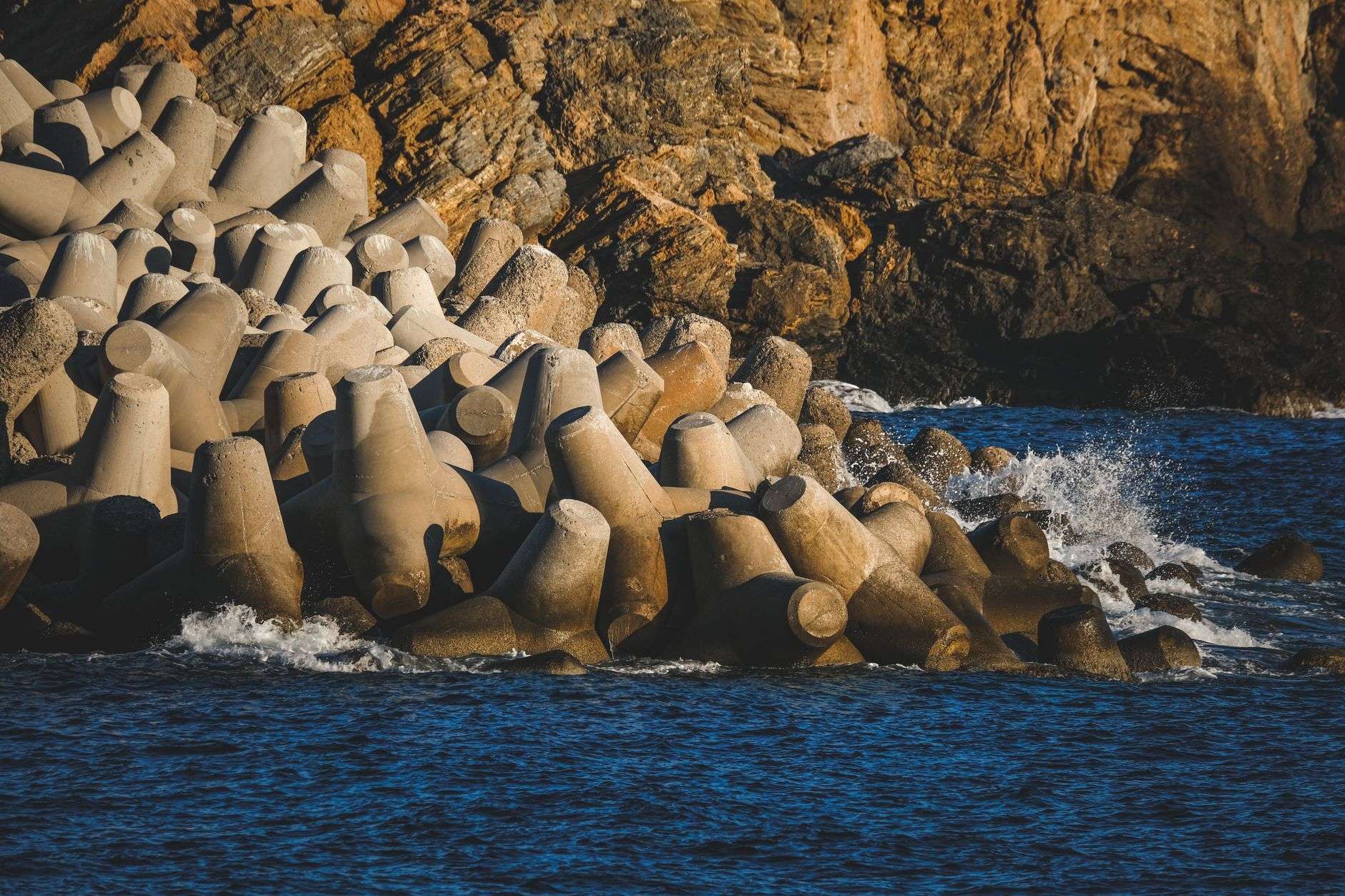
The centerpiece of the job was a set of three breakwater structures built offshore beginning in June. They are designed to take the energy out of waves before the waves reach land, which allows sand to settle and stay put instead of washing back into Mobile Bay. The result, according to the city, is a beach where for years there had been an eroding bluff.
Fairhope City Engineer Richard Johnson said the finished product is better than the drawings suggested it would be.
“Better than I expected. We kind of knew what the vision looked like but when you see it in reality, trying to understand where the shoreline was and now where it is, that you really have a proper beach. It has exceeded expectations,” Johnson said.
Johnson also noted how long the idea had been sitting on the shelf.
“We kind of jokingly when we had the walk through the other day with the design engineers that we only talked about it for about fifteen years. We actually did something about it,” Johnson recalled.
A Shoreline That Had Been Losing Ground
Before the work, Magnolia Beach had been giving up ground steadily, and the losses accelerated during strong winter storms. Water had cut so far back into the bluff that trees along the shoreline were in danger of toppling into the bay. Those same trees now stand roughly 40 yards back from the water’s edge, a measure of how much beach the project put back.
Monica Coward, who had not been to the site in some time, said the difference was obvious the moment she walked down.
“I saw the sprinklers first and I thought, Oh gosh. They’ve planted something here and then, when I got down here walking with her, I saw all the new grass. Then I saw the beach. I had not been…like I say, I had not been here in a while. The beach is gorgeous,” Coward said.
Why Bluffs Erode On The Eastern Shore
The eastern side of Mobile Bay is not a flat coastal plain running gently into the water. From Spanish Fort south through Daphne, Montrose, Fairhope and Point Clear, much of the shoreline is a low bluff of sand, silt and clay that stands above a narrow strip of beach. That geography is part of what makes the Eastern Shore distinctive — the Ecor Rouge bluff a short distance north of downtown Fairhope has been a landmark for mariners since the era of Spanish exploration, and a historical marker there identifies it as the highest coastline point between Maine and Mexico.
Bluff shorelines erode differently than dune shorelines. The damage generally begins at the bottom. Waves striking the base of the bluff carry away the sand and sediment that hold up everything above it. Once that support is gone, the face of the bluff has nothing underneath it, and gravity does the rest: the unsupported material slumps, slides or calves off in blocks, and the top edge of the bluff retreats inland. Trees that were once well back from the water end up perched on the lip, then leaning, then down.
Two other factors make it worse. Rainfall running across the top of a bluff and groundwater seeping out of its face both loosen sediment and add weight, which increases the odds of a slide. And on a body of water shaped like Mobile Bay, wind direction matters enormously. Winter frontal systems that push sustained winds down the long axis of the bay give waves a great deal of open water to build across before they arrive on the eastern shoreline. That is why bluff loss on this side of the bay tends to show up in bursts after cold-season storms rather than as a slow, even trickle.
Breakwaters address the problem at its root by intercepting wave energy offshore. With smaller waves reaching the shoreline, sand that would otherwise be pulled away is more likely to accumulate behind the structures, widening the beach and putting distance between the water and the toe of the bluff.
Where The Money Came From
The project was funded entirely through a grant under the Gulf of Mexico Energy Security Act, the federal law that routes a share of offshore oil and gas money back to the four Gulf states.
Congress passed the act in 2006. Under it, 37.5 percent of qualified revenue from federal offshore leases in specified areas of the Gulf is shared among Alabama, Louisiana, Mississippi and Texas and their coastal political subdivisions, with another 12.5 percent directed to the Land and Water Conservation Fund. The revenue comes from lease bonuses, rents and royalties paid by energy companies operating on the outer continental shelf — money that would otherwise stay entirely with the federal treasury.
The program has two phases. Phase I, in place since 2007, covered a limited set of lease areas. Phase II took effect in fiscal 2017 and substantially expanded the geography that generates shareable revenue, while also capping how much the states can collectively receive in a given year. The U.S. Department of the Interior’s Office of Natural Resources Revenue calculates and disburses the money annually. In fiscal 2024, GOMESA disbursements to the four states and their coastal counties and parishes totaled roughly $353.6 million.
Federal law limits what the money can be spent on. Eligible uses include coastal protection and conservation, coastal restoration, hurricane protection, mitigation of damage to fish, wildlife or natural resources, onshore infrastructure projects that address the effects of offshore energy activity, and implementation of federally approved coastal and marine conservation management plans. A small percentage may go to administrative costs. Beach and shoreline stabilization work of the kind done at Magnolia Beach sits squarely inside those categories.
In Alabama, the state’s share is administered by the Alabama Department of Conservation and Natural Resources with approval from the governor’s office. Cities, counties and other public entities submit project suggestions, and awards are announced in batches.
A Steady Pipeline Of Coastal Grants
Those announcements have become a recurring feature of local government budgets in Mobile and Baldwin counties. South Alabama News reported on Aug. 21 that Gov. Kay Ivey announced more than $52 million in GOMESA grants for 21 coastal Alabama projects — a list that included Mobile’s Brookley by the Bay waterfront park, a new recreation pier for Daphne’s Bayfront Park and a third phase of Fairhope’s Flying Creek Nature Preserve. The governor’s office said at the time that more than $310 million in GOMESA-funded projects had been announced during her tenure.
For a city the size of Fairhope, that funding stream is the difference between studying a shoreline problem and fixing one. Marine construction is expensive, and rock breakwaters in particular require barges, heavy stone and permitting from state and federal regulators. Johnson’s remark about fifteen years of conversation is a reasonably common story on the Gulf Coast: the engineering for shoreline stabilization is well understood, but the money rarely lines up with the need.
What ‘Engineered Beach’ Status Actually Buys
One of the quieter but more consequential outcomes of the work is a change in classification. Magnolia Beach is now categorized as an engineered beach. If a storm tears it up, the city will be eligible for public funding to repair it.
That distinction comes out of federal disaster policy, and it matters more than it sounds. Under long-standing Federal Emergency Management Agency guidance, sand lost from an unimproved natural beach is generally not eligible for federal public assistance, because a natural beach was never built to a design and has no design to restore. An engineered beach is treated differently. To qualify, a beach must have been constructed by placing imported sand of an appropriate grain size to a designed elevation, width and slope, and the owner must have an established maintenance program that periodically renourishes the beach to preserve that design.
That is why monitoring is not optional. To keep the designation, Fairhope has to document what it built and then keep documenting what happens to it. In practice, that means periodic surveys of beach profiles — cross-sections measured from a fixed landward point out into the water, often to the nearshore depth where sand stops moving significantly. Those profiles establish a baseline, track routine seasonal change, and, critically, allow the city to show after a hurricane exactly how much sand a specific storm took and how that loss compares to the design template.
Without that record, a city asking for storm repair money is essentially asking a federal reviewer to take its word for it. With the record, the claim becomes an arithmetic problem. The monitoring requirement is, in effect, the price of admission to a repair program that could be worth far more than the surveys cost.
The Fairhope City Council was scheduled to vote at Monday night’s meeting on hiring a firm to perform that monitoring.
Part Of A Larger Pier Street Overhaul
The beach restoration finishes several months of work at the Pier Street site, where the city also built new restrooms, installed a lift station and relocated stormwater drainage.
The drainage piece is more than housekeeping. Stormwater outfalls that discharge directly onto or across a beach can cut channels through new sand, undermine structures and carry sediment and pollutants into the bay. Moving and reconfiguring that drainage protects the investment in the sand itself and reduces the chance that the first heavy rain undoes part of the work.
Why It Matters Locally
Public shoreline access on the Eastern Shore is limited, and most of Mobile Bay’s eastern edge is privately held. Fairhope’s waterfront park system, anchored by the municipal pier at the foot of Fairhope Avenue and extending along the bluff and beach to the north and south, is one of the few places where the general public can reach the water without a boat or a friend who owns property. Losing beach there is not just an engineering problem; it reduces the amount of shoreline available to residents and visitors.
There is also a defensive argument. Every foot of beach between the waterline and the bluff is a foot of buffer during a storm surge event. Restored beaches are consumable by design — they are meant to absorb energy and give up material so that what sits behind them does not. That is precisely why the federal repair-eligibility question is central to the project’s long-term value.
What Happens Next
With construction complete, the city’s attention shifts from building to maintaining. Assuming the council moves forward with a monitoring contract, the near-term work will involve establishing survey control, collecting the first post-construction profiles and setting a schedule for repeat surveys.
The breakwaters themselves will also need periodic inspection. Rock structures settle, individual stones shift, and storms can rearrange armor units. Catching that early is far cheaper than rebuilding later.
For beachgoers, the practical change is already visible: new grass, irrigation to establish it, and a strip of sand where a retreating bluff used to be.