Fairhope Wins Federal Grant to Connect Rock Creek Subdivision With New Multi-Use Path
A $400,000 federal grant will fund a new two-mile path linking Fairhope's Rock Creek subdivision to the Eastern Shore Trail network.
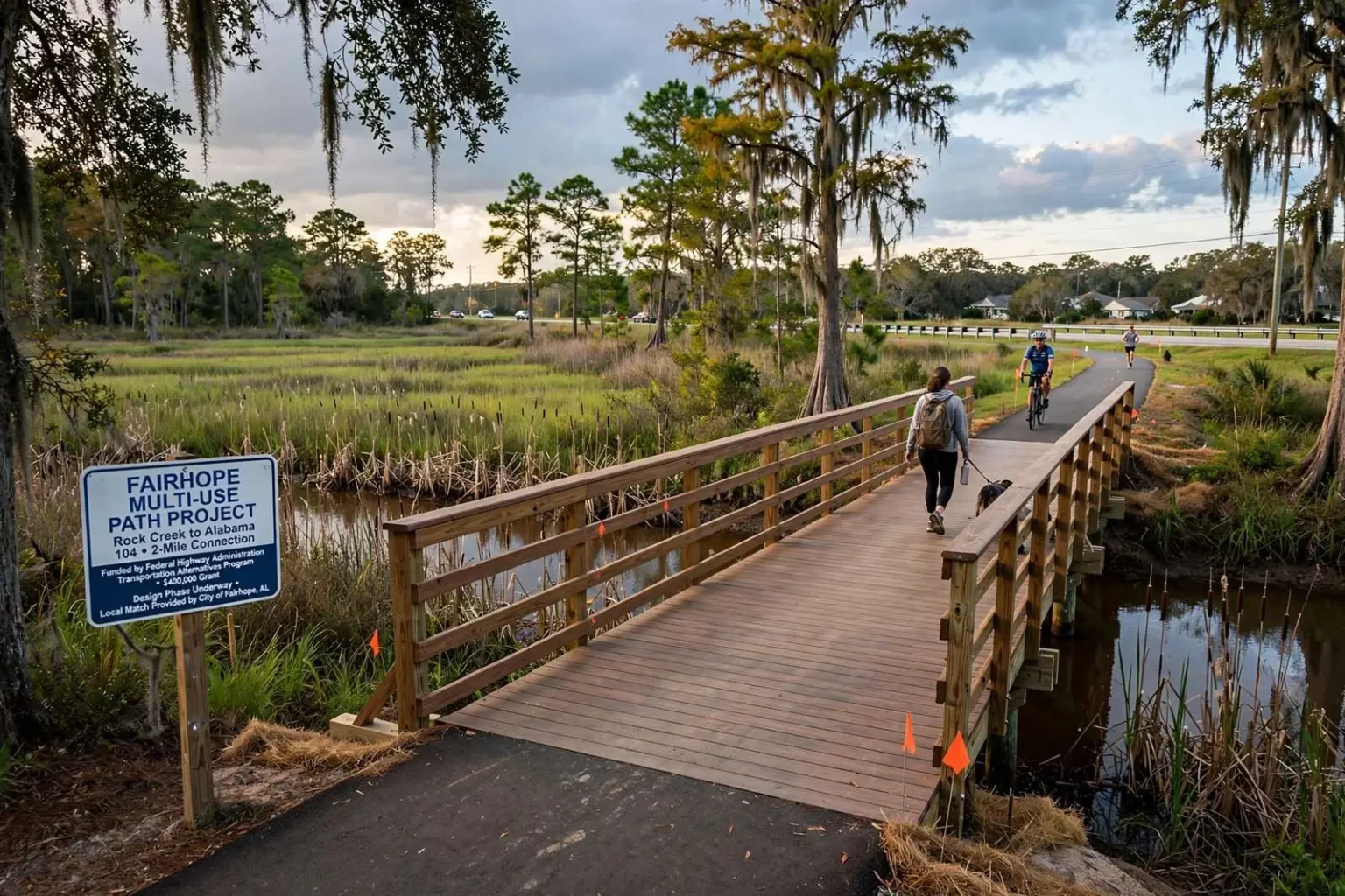
FAIRHOPE, Alabama — Fairhope’s growing network of sidewalks and multi-use trails is about to extend further up U.S. 98, after the city secured a $400,000 federal grant to build a two-mile path connecting the Rock Creek subdivision area to Alabama 104.
The funding comes through the Federal Highway Administration’s Transportation Alternatives Program, which is administered locally by the Alabama Department of Transportation. The program is one of the primary federal funding sources for sidewalks, trails, bike routes and other projects that expand transportation options beyond the automobile, and it has become an essential tool for Gulf Coast communities looking to extend their pedestrian networks without shouldering the full cost. Baldwin County cities have used it repeatedly in recent years to piece together segments of the Eastern Shore Trail and similar routes, one award at a time.
The stretch of U.S. 98 targeted by the project is among the busiest corridors on the Eastern Shore, carrying commuter traffic between Interstate 10 and central Fairhope and serving as the front door for several large residential neighborhoods. Until now, that traffic has shared the road with little in the way of dedicated space for walkers and cyclists, a gap the city has been working to close as its trail network has grown segment by segment.
Second try was the charm
Fairhope’s first attempt at the grant in 2013 was turned down, but after the City Council voted in March to resubmit the application, the second try succeeded. The council gave final approval this week, authorizing Mayor Tim Kant to sign off on the agreement with the state highway department. With the contract executed, design work can move from concept to production, and city staff can begin coordinating with ALDOT on the engineering and environmental reviews required before any construction contract can be let.
Grant-writing consultant Stacy McKean told city officials that some preliminary work on the project is already underway. That early start matters, because federally assisted projects of this type pass through multiple review stages — preliminary design, environmental documentation, utility coordination and final plan approval — and a head start on the paperwork shortens the time residents spend waiting for crews to arrive.
City picks up part of the cost
As a condition of the award, Fairhope agreed to cover 20 percent of the total project cost, along with engineering, design and inspection fees, adding up to roughly $100,000 in local funding. The split is typical for Transportation Alternatives awards, in which the federal government supplies the majority share and the sponsoring city or county commits a local match. In Fairhope’s case, the local obligation reaches beyond the raw construction percentage because the city also absorbs the professional services that turn a trail concept into a buildable set of plans.
City officials have framed the investment as a modest price for a corridor the city would otherwise have to build entirely on its own. Matching-grant programs exist precisely so that mid-sized municipalities like Fairhope can stretch limited budgets on projects that improve safety and quality of life without adding vehicle capacity to crowded roads, and the council’s decision to resubmit the application reflected a judgment that the payoff justified the wait.
The award also reflects a shift in how state and federal agencies view these corridors. What was once treated as an amenity is increasingly recognized as basic transportation infrastructure, serving residents who cannot drive, families working to cut their transportation costs and visitors drawn to the bayfront communities. Baldwin County’s coastal municipalities have been among the state’s most consistent applicants for these funds, and Fairhope’s success on the second attempt keeps pace with the trail-building efforts of its Eastern Shore neighbors.
An 8-foot path with a boardwalk and bridge
The new route will be an 8-foot-wide asphalt multi-use path stretching just over two miles, beginning at Rock Creek Parkway and running south along U.S. 98 until it reaches Alabama 104. An eight-foot width is the accepted standard for a shared-use path because it comfortably accommodates cyclists traveling in both directions alongside pedestrians, runners and strollers — a design choice that mirrors the sections of the Eastern Shore Trail that have proven most popular with users.
The path’s design includes a 150-foot boardwalk and an 80-foot pedestrian bridge crossing Fly Creek, just north of the entrance to the Woodlands neighborhood. The creek crossings are the most technically demanding pieces of the project, and they are also expected to become its most scenic stretches, carrying trail users over the wooded wetland edges that drain toward Mobile Bay. Structures of this kind require their own permitting and engineering review, which is a large part of why design and inspection fees figure so prominently in the city’s local cost share.
From the Alabama 104 end, the path will tie into the roughly 30-mile Eastern Shore Trail system along Scenic 98 and North Section Street near the Fairhope Flower Clock. The trail system links the bayfront communities of Daphne, Montrose, Fairhope and Point Clear, and it has been assembled over two decades through exactly this kind of incremental project, with each new grant-funded connection extending the reach of the network.
For Fairhope, the Rock Creek segment closes one of the more conspicuous gaps on the city’s northern side. The Flower Clock junction is a familiar landmark for local cyclists, and from it riders can follow the bayfront path to the Fairhope Municipal Pier and the shops of downtown, or push south along Scenic 98 toward Point Clear as the trail continues its run along the bay.
A new route for hundreds of homes
The project stands to benefit residents of the roughly 600-lot Rock Creek subdivision as well as nearly 100 homes in the neighboring Woodlands community, giving both areas a car-free connection into downtown Fairhope and the wider Eastern Shore trail network. For families in those neighborhoods, the path means a child could ride a bicycle to school, a park or the ball fields without pedaling along the shoulder of a federal highway, and an evening walk could begin at the front door instead of at the edge of a busy road.
City officials have also pointed to a more everyday benefit: the path would give residents a practical option for short trips that today require a car, whether a run to a nearby store, a visit to a neighbor or a commute to a job along the corridor. Transportation planners refer to these as first- and last-mile connections, and they are often the difference between a trail that people use on weekends and one that becomes woven into daily life.
Safety is the other half of the argument. Multi-use paths separate pedestrians and cyclists from motor traffic entirely, and corridors like U.S. 98 — with its mix of commuters, delivery trucks and school-run traffic — are exactly the environments where that separation matters most. National safety research has consistently found that dedicated paths reduce conflicts between vehicles and vulnerable road users, a point city officials have emphasized in past discussions of Fairhope’s sidewalk program.
Timing for construction will depend on how quickly the design and permitting phases move through state review. Projects of this scale on the Eastern Shore have typically required a year or more from award to groundbreaking once utility conflicts, environmental permits and right-of-way questions are resolved, and city officials have not tied the Rock Creek path to a specific opening date.
There is an economic dimension as well. Fairhope’s reputation as a walkable, bikeable bayfront town is part of its draw for tourists and prospective residents alike, and every extension of the trail network reinforces that identity. Businesses near the trail’s existing segments benefit from the steady stream of riders and walkers, and the Rock Creek extension extends that traffic toward a part of the city that has watched much of the growth pass it by.
The project also arrives as Fairhope continues to confront the growing pains that come with rapid residential development. New subdivisions north of the city center have added traffic faster than the road network has expanded, and officials have repeatedly looked for ways to give residents alternatives to driving for short trips. A trail that connects two large neighborhoods directly to the existing network is the kind of improvement that can take real numbers of car trips off the road each day.
City leaders have described the Eastern Shore Trail as one of the region’s signature quality-of-life assets, and each new segment has historically made the whole system more useful. A rider in Daphne can now imagine a continuous ride into the Rock Creek area; a walker in Fairhope can reach the northern neighborhoods without ever touching the shoulder of U.S. 98. Those connections, planners say, are what turn a collection of local paths into a genuine regional network.
What is certain is that the grant converts a long-discussed connection into a funded project with a signed agreement behind it. For the residents of Rock Creek and the Woodlands, the approval means the day is coming when the trip to downtown Fairhope no longer begins at the edge of a highway, but on a path of its own.